Hill Country State Natural Area
🏆 Researched by State Park Experts — Based on Texas Parks & Wildlife Department data and verified visitor experiences across 5,369 acres of untouched Hill Country terrain
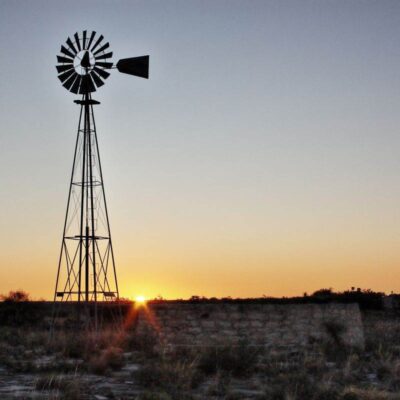
The first thing you notice at Hill Country State Natural Area is the silence. Not the absence of sound—the Hill Country is alive with birdsong, wind through juniper groves, and the distant trickle of spring-fed creeks—but the absence of engines, generators, and the mechanical hum that follows most of us everywhere. Standing on West Peak at sunset, watching the limestone hills roll toward the horizon in deepening shades of gold and purple, you understand why ranch owner Louise Merrick donated this land with a single condition: that it be “kept far removed and untouched by modern civilization.”
Spanning 5,369 acres of rugged Bandera County terrain roughly 45 miles northwest of San Antonio, Hill Country State Natural Area is the antithesis of a manicured state park. There are no paved roads past the headquarters. No park store, no cell service to speak of, no electric hookups. What you get instead is over 40 miles of multi-use trails threading through eroded limestone mesas, oak-juniper woodlands, creek-carved canyons, and open grasslands—terrain that looks much as it did when Spanish colonists first claimed it in a land grant centuries ago. About 40% of visitors bring horses, making this one of the premier equestrian destinations in the American Southwest.
Whether you arrive on two feet, two wheels, or four hooves, Hill Country State Natural Area rewards those who come prepared to disconnect. This is backcountry Texas at its most honest—primitive, demanding, and unforgettable.
Geology & Natural Landscape
Hill Country State Natural Area sits within the Balcones Fault Zone, a geological boundary that separates the flat coastal plains of eastern Texas from the elevated limestone plateaus of the Edwards Plateau. The local Woodard Cave Fault runs directly through the property, exposing layers of Cretaceous-era limestone that tell a 100-million-year story of ancient seabeds now thrust upward into rugged hills. Elevations range from approximately 1,280 feet along the creek bottoms to just over 2,000 feet on the highest ridges—a 720-foot elevation change that creates surprisingly varied microclimates within a relatively compact area.
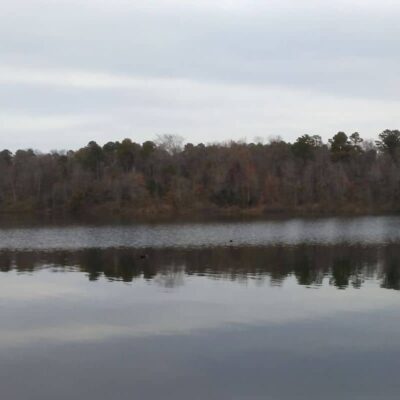
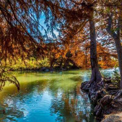
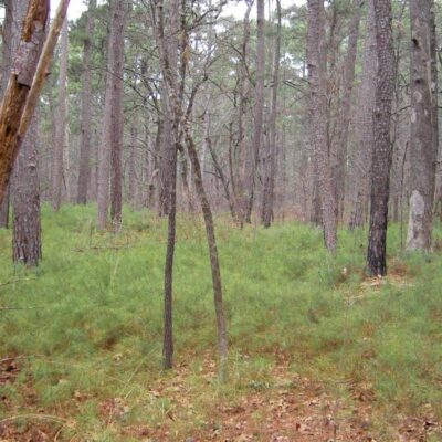
The terrain is dominated by three distinct landscape types. The ridge tops and mesas feature exposed bedrock with thin, rocky soils supporting Ashe juniper and various oaks. The canyon slopes are steeper and more heavily wooded, providing critical habitat for endangered songbirds. The bottomlands along Bandera Creek and its tributaries are relatively flat with deeper soils, supporting taller hardwoods and the park’s most reliable water sources. Seasonal springs bubble up where fault lines intersect permeable limestone layers—some flowing year-round, others only after significant rainfall.
Top Trails & Hiking Guide
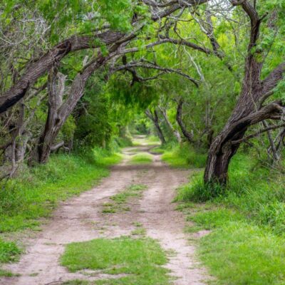
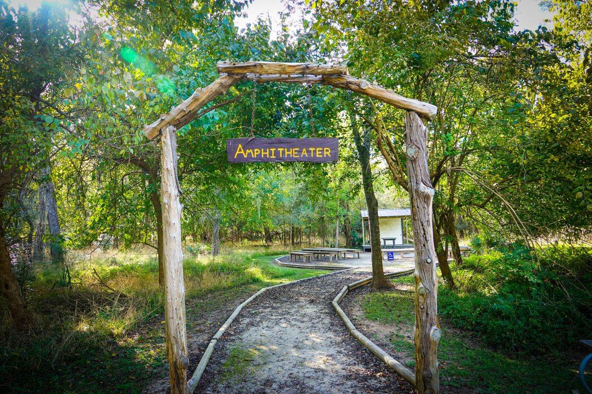
With over 40 miles of trails, Hill Country State Natural Area offers everything from gentle creekside strolls to lung-burning ridge climbs. All trails are multi-use and shared between hikers, mountain bikers, and horseback riders—yield to horses, always. The trail system is well-marked with color-coded blazes, but carry a paper map from headquarters because GPS reception is spotty at best in the deeper canyons.
| Trail Name | Distance | Difficulty | Highlights |
|---|---|---|---|
| Heritage Loop | 1.1 mi | Easy | Ranch remnants, wildflowers in spring, gentle terrain near HQ |
| Merrick Mile Trail | 1.0 mi | Easy-Moderate | Scenic loop near headquarters, good for orientation hike |
| Wilderness Trail | 3.1 mi | Moderate | Heart of the natural area, creek crossings, diverse vegetation |
| Hermits Trail | 1.9 mi | Moderate | Canyon passage, sun-to-shade transitions, backcountry campsite access |
| West Peak Overlook | 2.5 mi | Strenuous | Best panoramic views, steep rocky climb, staff favorite |
| Comanche Bluff Trail | 4.2 mi | Strenuous | Remote ridgeline, limestone bluffs, rarely crowded |
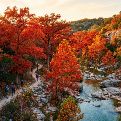
The West Peak Overlook is the trail that defines this park. The final half-mile is a relentless rocky scramble, but the summit delivers a 360-degree panorama across miles of unbroken Hill Country—no power lines, no rooftops, nothing but limestone ridges fading into blue haze. Arrive before 8 a.m. or after 5 p.m. to avoid summer heat and catch the best light. In spring, the Heritage Loop explodes with bluebonnets, Indian paintbrush, and prickly pear cactus blooms that turn the trail into a wildflower corridor.
📸 Photography Guide: Hill Country SNA
• Golden Hour at West Peak: Face west for sunset shots across layered limestone ridges. Bring a wide-angle lens (16-35mm) and a tripod—the wind up top is constant.
• Wildflower Season (March-May): Heritage Loop and the meadows near Twin Peaks are prime. Get low with a macro lens for bluebonnet close-ups at f/2.8.
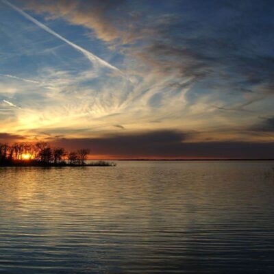
• Star Photography: Zero light pollution makes this a Bortle Class 2-3 sky. Set up at any open meadow—the Milky Way core is visible from March through October. ISO 3200, 20-second exposure, f/2.8 wide-angle.
• Wildlife: Golden-cheeked warblers are most active at dawn along canyon trails. Use a 400mm+ telephoto and stay on-trail to avoid disturbing nesting areas.
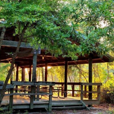
Camping: Primitive & Backcountry
Camping at Hill Country State Natural Area is deliberately primitive—and that’s the entire point. Forget about electric hookups or hot showers. The campgrounds here are designed for people who want to feel the ground under their sleeping bags, cook over a campfire (when burn bans allow), and fall asleep to coyote songs echoing off limestone canyon walls. The trade-off for these Spartan amenities is something increasingly rare: genuine solitude in a landscape that hasn’t been sanitized for mass consumption.
| Site Type | Sites | Amenities | Price |
|---|---|---|---|
| Walk-in Tent Sites | ~15 | Vault toilets, fire rings, no water | $8/night |
| Backcountry Sites | ~10 | Minimal—vault toilet nearby, BYOW | $8/night |
| Equestrian Sites | ~12 | Horse pens, hitching posts, vault toilets | $12/night |
| Group Lodge | 1 | Historic ranch house, group use only | Varies (call 512-389-8900) |
A critical note: bring all your own water. There is no potable water at individual campsites. The headquarters has water available, but backcountry sites require you to pack in everything. Plan on at least one gallon per person per day—more during Texas summers when temperatures routinely exceed 100°F. Campfires are only permitted in designated fire rings, and burn bans are implemented frequently during dry spells. Always check current fire conditions before your trip by calling the park at 830-796-4413.
Horseback Riding: The Equestrian Capital
Hill Country State Natural Area is arguably the best equestrian destination in the Texas state park system. The 40+ miles of multi-use trails traverse terrain that challenges both horse and rider—rocky creek crossings, steep switchbacks through juniper thickets, and open ridgeline stretches where you can let your mount cover ground. The park estimates that roughly 40% of all visitors arrive with horses in tow, creating a community of riders who return season after season.
The day-use equestrian area near park headquarters includes water troughs, hitching posts, and a flush toilet. An equestrian arena is available by reservation—contact the park directly to schedule. For overnight stays, equestrian campsites provide horse pens adjacent to your camp. All horses must have a current negative Coggins test (within 12 months)—no exceptions, and rangers do check. Note that horse washing is periodically restricted during water conservation periods.
The best riding seasons are spring (March-May) when wildflowers carpet the meadows and temperatures are manageable, and fall (October-November) when the oaks turn amber and the summer crowds have departed. Summer riding is possible but should be restricted to early morning hours—heat exhaustion affects horses faster than most riders realize.
Mountain Biking
Mountain bikers have access to the full 40+ mile trail network, and the terrain delivers a raw, technical experience that polished bike parks can’t replicate. Exposed limestone ledges, loose gravel descents, and root-choked creek crossings demand constant attention. This isn’t a flow trail—it’s backcountry riding where a mechanical failure means a long walk out.
The Wilderness Trail to Comanche Bluff loop is the crown jewel for experienced riders: roughly 12 miles of continuous singletrack with 1,500+ feet of cumulative climbing, technical rock gardens, and a ridgeline section with views that will make you stop pedaling just to stare. Bring plenty of water—there are no refill stations on trail—and a basic repair kit. Cell service for emergency calls is unreliable in the canyons.
Wildlife & Birding
Hill Country State Natural Area is a critical habitat for two federally endangered bird species that make this park internationally significant for conservation. The golden-cheeked warbler breeds exclusively in the mature Ashe juniper and oak woodlands of central Texas—nowhere else on Earth. These striking yellow-and-black songbirds arrive from their Central American wintering grounds in March and stay through August, using the shredded bark of mature juniper trees to construct their nests. The canyon slopes at Hill Country SNA support some of the best remaining habitat for this species.
The black-capped vireo, also endangered, prefers the scrubby, early-succession oak thickets found on the park’s disturbed slopes and edges. These tiny, energetic birds arrive from Mexico between mid-March and mid-April to breed. Both species face threats from brown-headed cowbird nest parasitism—the cowbirds lay their eggs in warbler and vireo nests, and the host parents raise the cowbird chicks at the expense of their own. Active conservation management including cowbird trapping programs helps protect both species on the property.
| Species | Best Months | Where to Look | Tips |
|---|---|---|---|
| 🐦 Golden-cheeked Warbler | Mar-Aug | Canyon slopes, juniper-oak woodlands | Listen for buzzy songs at dawn; stay on trail near nesting areas |
| 🐦 Black-capped Vireo | Mid-Mar to Sep | Scrubby oak thickets, open edges | Extremely active and vocal; binoculars essential |
| 🦌 White-tailed Deer | Year-round | Meadows, creek bottoms at dusk | Most active at dawn and dusk; rutting season Oct-Nov |
| 🦃 Wild Turkey | Year-round | Open grasslands, oak flats | Often seen in groups near Heritage Loop |
| 🦎 Texas Spiny Lizard | Apr-Oct | On rocks, exposed limestone | Common basking on sunny trail-side boulders |
| 🦔 Nine-banded Armadillo | Year-round | Creek bottoms, soft soil areas | Most active at night; listen for rustling in leaf litter |
Over 160 bird species have been documented in the natural area. Beyond the endangered species, look for painted buntings (summer), vermilion flycatchers, canyon wrens echoing their cascading songs off limestone walls, and red-tailed hawks circling the thermals above the ridgelines. Bring binoculars—this isn’t optional here.
History: From Spanish Land Grant to Conservation Legacy
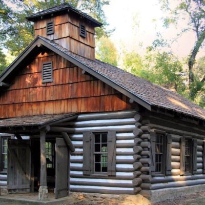
The land that became Hill Country State Natural Area was originally part of a Spanish colonial land grant, later becoming the Bar-O Ranch that operated for generations in the rugged limestone hills southwest of Bandera. The ranch changed hands multiple times but remained largely undeveloped—the terrain was simply too rough for intensive agriculture, a geological stubbornness that ultimately preserved its wildness.
The park owes its existence to Louise Merrick, the ranch’s final private owner, who donated parcels of land to the State of Texas between 1976 and 1982. Her donation came with a profound stipulation that still guides management today: the land must be “kept far removed and untouched by modern civilization, where everything is preserved intact, yet put to a useful purpose.” The 5,369-acre natural area officially opened to the public in 1984 under the designation “State Natural Area”—a classification that prioritizes ecological preservation over recreational development, explaining why facilities remain deliberately primitive.
Remnants of the Bar-O Ranch are scattered throughout the property: old fence lines reclaimed by cedar, stone foundations softened by decades of weather, and the ranch house itself—now available as a group rental lodge. The Heritage Loop trail passes several of these ranch artifacts, offering a tangible connection to the property’s ranching past.
Seasonal Guide
| Season | Weather | Crowds | Best For |
|---|---|---|---|
| 🌸 Spring (Mar-May) | 65-85°F, occasional storms | Moderate-High | Wildflowers, birding (warbler season), ideal riding temps |
| ☀️ Summer (Jun-Aug) | 90-105°F, intense sun | Low-Moderate | Stargazing, early morning hikes, solitude |
| 🍂 Fall (Sep-Nov) | 65-85°F, clear skies | Moderate | Horseback riding, mountain biking, fall foliage |
| ❄️ Winter (Dec-Feb) | 35-60°F, occasional frost | Low | Solitude, clear views, cool hiking weather |
Spring is the marquee season: wildflowers blanket the meadows, endangered warblers return to the canyons, and temperatures are perfect for long trail days. But it’s also the busiest time—equestrian sites fill up weekends in April and May. Fall is the insider’s choice: the oaks turn golden, the summer heat breaks, and you’ll have many trails to yourself. Summer demands extreme caution—heat exhaustion is a real risk on exposed ridgelines, and there’s no reliable shade on the upper trails. Start any summer activity by 7 a.m. or wait until 5 p.m. Winter offers superb hiking weather but pack layers; mornings can dip below freezing with frost on the limestone.
Sample Itineraries
Day Trip (6 Hours)
Arrive at gate opening (8 a.m.). Pick up a trail map at headquarters—reception will orient you to current conditions and any closures. Start with the Heritage Loop (1.1 mi, ~45 min) to warm up and see the ranch remnants. Then tackle the West Peak Overlook (2.5 mi, ~2.5 hours with summit time)—bring at least 2 liters of water. After descending, take the Merrick Mile for a cool-down loop. Total: ~5 miles, 4-5 hours of trail time. Pack lunch—eat at one of the backcountry clearings with a view. No food available at the park.
Weekend Backpacking Trip
Day 1: Arrive by noon, set up at a backcountry campsite accessed via Hermits Trail (1.9 mi in). Spend the afternoon exploring the Wilderness Trail corridor. At dusk, return to camp and set up for stargazing—the Milky Way visibility here is extraordinary. Day 2: Rise at dawn for the full Comanche Bluff–West Peak loop (~8-10 miles depending on route). Break camp by noon and hike out. Total weekend: 12-14 miles across some of the most scenic terrain in Texas. Pack all water (3-4 gallons per person for 2 days), all food, and carry out all trash—Leave No Trace is strictly enforced.
Visitor Information & Planning
| Detail | Information |
|---|---|
| Address | 10600 Bandera Creek Rd., Bandera, TX 78003 |
| Phone | 830-796-4413 |
| Hours | 8 AM – 10 PM daily, year-round |
| Entry Fee | $6/person (age 13+); children 12 and under free |
| Camping | $8-12/night depending on site type |
| Reservations | texasstateparks.org or call 512-389-8900 |
| Pets | Allowed on leash (max 6 ft); not in Group Lodge |
| Cell Service | Extremely limited—plan accordingly |
Budget Planning
| Expense | Day Trip | Weekend | Notes |
|---|---|---|---|
| Entry Fee | $6 | $12 | Per person, per day |
| Camping | — | $16 | $8/night × 2 nights |
| Gas (from San Antonio) | ~$15 | ~$15 | ~90 mi round trip |
| Food & Water | $10 | $30 | Pack everything—no store! |
| Total per Person | ~$31 | ~$73 | Budget-friendly wilderness |
Safety & Hazards
| Hazard | Risk Level | Prevention |
|---|---|---|
| 🌡️ Heat Exhaustion | High (Summer) | 1 gallon water/person/day minimum; start early; rest in shade |
| 🐍 Rattlesnakes | Moderate | Watch step on rocky trails; don’t reach into crevices; give wide berth |
| 🌵 Cactus & Thorns | Moderate | Wear boots and long pants on brushy trails; carry tweezers |
| 📵 No Cell Service | Moderate | File a trip plan; bring paper map; tell someone your itinerary |
| 🔥 Wildfire/Burn Bans | Seasonal | Check current burn ban status before lighting any fire |
| 🌊 Flash Floods | Low-Moderate | Avoid creek bottoms during storms; water rises fast in limestone canyons |
The most underestimated danger here is dehydration. With no potable water on trails, no park store, and summer temperatures exceeding 100°F, running out of water in this terrain is a genuine emergency. Carry more than you think you need, and plan your route around your water supply—not the other way around.
Nearby Attractions
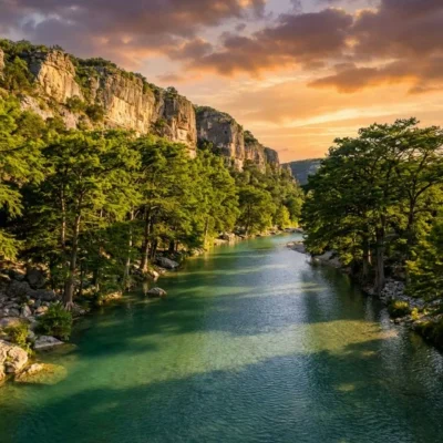
Hill Country State Natural Area sits in one of Texas’s most scenic regions. The town of Bandera (10 miles northeast) bills itself as the “Cowboy Capital of the World” and offers dude ranches, western shops, and restaurants. Lost Maples State Natural Area (35 miles west) is famous for its rare bigtooth maple trees that blaze crimson in November—one of the best fall foliage displays in Texas. Garner State Park (45 miles southwest) offers swimming in the crystal-clear Frio River and a more developed camping experience. For a full Hill Country road trip, combine all three parks over a long weekend.
Frequently Asked Questions
Is Hill Country State Natural Area free to enter?
No—the day-use entry fee is $6 per person for visitors age 13 and older. Children 12 and under enter free. If you have a Texas State Parks Pass ($70/year), entry is included and the pass pays for itself after about 12 visits. Camping fees ($8-12/night depending on site type) are separate from the entry fee.
Can I bring my horse to Hill Country State Natural Area?
Yes—Hill Country SNA is one of the most popular equestrian destinations in Texas. About 40% of visitors bring their own horses. All equines must have a current negative Coggins test (within the past 12 months), which rangers verify at check-in. The park has equestrian day-use areas with water troughs and hitching posts, overnight equestrian campsites with horse pens, and a reservable arena.
Is there water available at the campgrounds?
Potable water is available at the park headquarters, but not at individual campsites. You must carry all water to your campsite. This is especially critical for backcountry sites, which can be 1-2 miles from headquarters. Plan for a minimum of one gallon per person per day, more in summer heat or if you’re bringing horses.
What’s the best time to see wildflowers?
Peak wildflower season typically runs from late March through May, depending on winter rainfall. Bluebonnets, Indian paintbrush, prickly pear cactus blooms, and dozens of other species blanket the meadows. The Heritage Loop and the open grasslands near the Twin Peaks area tend to have the densest displays. A wet winter usually means a spectacular spring bloom.
Can I mountain bike at Hill Country SNA?
Yes—all 40+ miles of trails are open to mountain bikers. The terrain is technical, with exposed limestone, loose rock, and steep grades. Helmets are strongly recommended. Bikers must yield to both hikers and horses on shared trails. The Wilderness Trail to Comanche Bluff loop offers the most challenging and rewarding ride in the park.
Are campfires allowed?
Campfires are permitted only in designated fire rings at established campsites—but burn bans are frequently implemented during dry periods, especially in summer and early fall. When a burn ban is in effect, wood and charcoal fires are prohibited, though containerized fuel stoves (propane) are allowed for cooking. Always check the current burn ban status by calling the park at 830-796-4413 before your trip.
Is there cell phone service in the park?
Cell service is extremely limited throughout the natural area. You may get weak signal near the entrance or on high ridgelines, but don’t count on it. Download offline maps before arrival, bring a paper trail map from headquarters, and tell someone outside the park your planned itinerary and expected return time. Consider carrying a personal locator beacon (PLB) or satellite communicator for backcountry trips.
How far is Hill Country SNA from San Antonio?
Hill Country State Natural Area is approximately 45 miles northwest of San Antonio, about a 75-minute drive via TX-16 North through the town of Bandera. The last few miles are on rural roads—follow signs carefully as GPS can be unreliable in this area. The address is 10600 Bandera Creek Rd., Bandera, TX 78003.
🏕️ Ready to Experience Hill Country State Natural Area?
Pack your water, download your maps offline, and prepare for one of the most authentically wild landscapes in the Texas state park system. Whether you’re riding on horseback through juniper canyons, summiting West Peak at golden hour, or falling asleep under a Bortle 2 sky, Hill Country SNA delivers wilderness that doesn’t compromise.
Do I need a reservation to visit Texas state parks?
Day-use reservations are now mandatory at popular parks including Enchanted Rock, Garner, Pedernales Falls, and Palo Duro Canyon. Make reservations through the Texas Parks & Wildlife reservation system before visiting.
How much is a Texas State Parks Pass?
The Texas State Parks Pass costs $70 per year and provides free entry for the pass holder and all vehicle occupants at all Texas state parks. It is one of the best-value annual passes in the country.
What are the best state parks near Austin, Texas?
Popular state parks near Austin include Enchanted Rock (1.5 hours), Pedernales Falls (45 minutes), McKinney Falls (15 minutes), and Inks Lake (1.5 hours). All require advance day-use reservations on weekends.
Can I swim at Texas state parks?
Yes, many Texas state parks offer excellent swimming. Popular swimming spots include the spring-fed Frio River at Garner SP, Pedernales Falls, and Hamilton Pool Preserve. Some parks have designated swimming areas with no lifeguards.
Explore More Texas State Parks
Hill Country State Natural Area is one of many outstanding state parks in Texas. Discover more parks in our Best State Parks in Texas guide, or use our Park Finder to search by activity, location, or features.