🏆 Researched by State Park Experts — Based on California State Parks data, Bureau of Reclamation records, and verified angler reports across 27,000 acres of Central California reservoir country
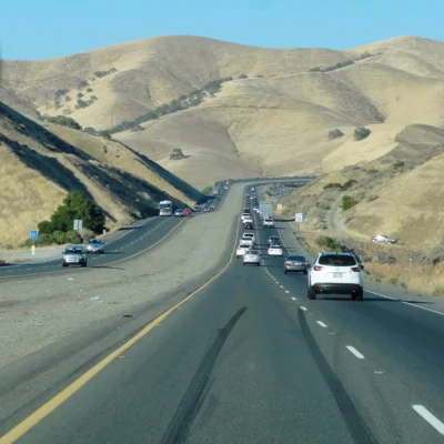
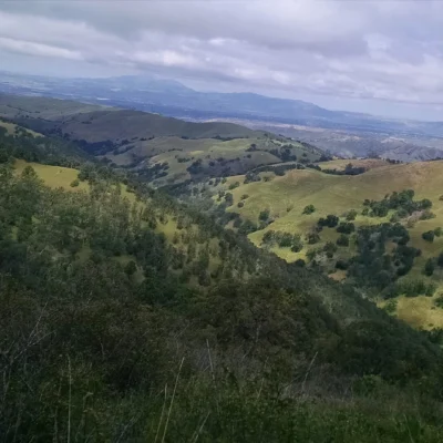
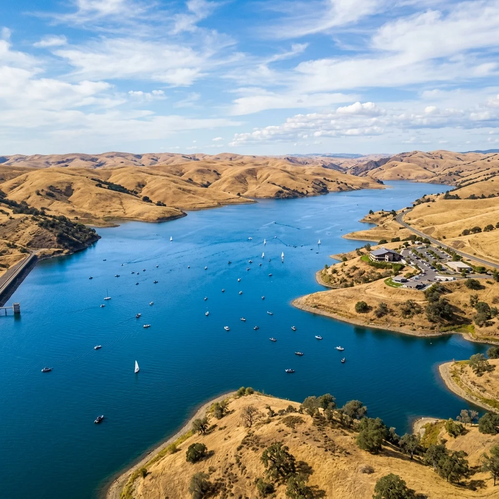
The wind hits you before you see the water. Cresting the golden hills along Pacheco Pass, the San Joaquin Valley unfolds below in a panorama of tawny grasslands—and then the reservoirs appear, twin mirrors of impossible blue set into the arid landscape like something that shouldn’t exist. And in geological terms, they shouldn’t. San Luis Reservoir State Recreation Area is built around the largest off-stream reservoir in the United States, an engineering marvel that stores water pumped uphill from the Sacramento-San Joaquin Delta and holds it here, in the dry heart of California’s agricultural belt, until the state’s farms, cities, and ecosystems need it downstream.
But don’t let the infrastructure pedigree fool you—this isn’t a concrete-lined canal zone. The 27,000-acre recreation area encompasses three distinct water bodies: the massive San Luis Reservoir itself, the smaller but legendarily productive O’Neill Forebay, and the serene Los Banos Creek Reservoir tucked into oak-studded foothills. Together, they create a recreational playground that draws bass anglers chasing world-record striped bass, windsurfers harnessing the notorious Pacheco Pass winds, campers seeking open-sky solitude, and birders tracking bald eagles and tule elk against a backdrop that feels more like the California of the 1800s than the 2020s.
Five world-record or former world-record striped bass have been pulled from O’Neill Forebay. That single statistic tells you everything about the caliber of fishing here—and why this under-the-radar SRA deserves far more attention than it typically receives.
The Three Lakes: Understanding the Landscape
San Luis Reservoir State Recreation Area isn’t a single lake with a campground—it’s a complex of three distinct water bodies, each with its own character, regulations, and recreational strengths. Understanding which lake suits your plans is the key to a great visit.
San Luis Reservoir is the main event: California’s fifth-largest reservoir at over 2 million acre-feet capacity, impounded behind the 382-foot-high B.F. Sisk Dam. The reservoir’s open expanse makes it a magnet for boaters and windsurfers, but also makes it susceptible to sudden, violent wind events that can turn calm water into whitecaps in minutes. Wind warning lights are positioned around the lake—take them seriously. Swimming is not advised in the main reservoir due to unpredictable currents and wind.
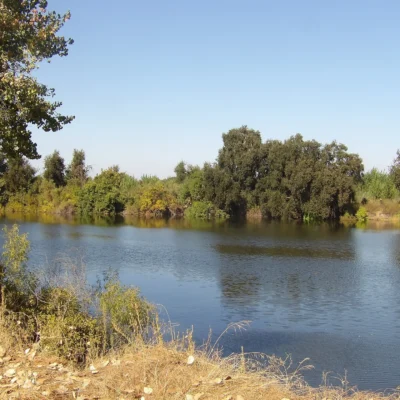
O’Neill Forebay is the smaller regulating pool that feeds water into and out of the main reservoir. For anglers, this is sacred ground—five world-record or former world-record striped bass have come from these waters. The forebay also offers designated swimming areas, multiple boat ramps, and the most accessible recreation in the SRA. It’s windier than you expect and better for fishing than most people realize.
Los Banos Creek Reservoir is the hidden gem: a tranquil 410-acre lake with a strict 5 mph speed limit, nestled in oak-dotted foothills away from the wind and crowds. This is where you go for quiet kayaking, bass fishing, and primitive camping in genuine solitude. Note that Los Banos Creek Reservoir is closed September through mid-April annually for habitat management and infrastructure improvements.
Fishing: World-Record Waters
San Luis Reservoir State Recreation Area is one of the most productive fisheries in California, and the striped bass fishing at O’Neill Forebay is genuinely world-class—not marketing hyperbole, but documented fact. Five world-record or former world-record striped bass have been caught here, making it a pilgrimage site for serious bass anglers from across the country. Beyond stripers, the waters hold American shad, channel catfish, and seasonal runs that keep the action varied year-round.
| Species | Best Season | Where | Tips |
|---|---|---|---|
| 🐟 Striped Bass | Spring & Fall | O’Neill Forebay | Trolling with swimbaits; early morning topwater action in fall |
| 🐟 Largemouth Bass | Spring-Summer | Los Banos Creek Reservoir | Work the shoreline structure with plastics; 5 mph limit means quiet water |
| 🐟 American Shad | May-June | O’Neill Forebay | Shad darts on ultralight tackle; incredible fight-to-size ratio |
| 🐟 Channel Catfish | Summer nights | San Luis Reservoir, O’Neill Forebay | Cut bait on the bottom; fish the warm shallows after dark |
| 🐟 Bluegill & Crappie | Spring-Fall | Los Banos Creek Reservoir | Small jigs and bobber rigs; great for families and kids |
| 🐟 Rainbow Trout | Winter-Spring | Los Banos Creek Reservoir | Stocked seasonally; PowerBait or small spinners |
A valid California fishing license is required for all anglers 16 and older—no exceptions, and wardens are active. Be aware that algae blooms can affect water quality and fish behavior during summer months, particularly in O’Neill Forebay. Check current conditions before planning a trip; the park posts regular fishing reports through its social media channels. Bank fishing is productive at multiple access points, but a boat dramatically expands your options on the larger water bodies.
Boating & Windsurfing
The Pacheco Pass funnels wind through this valley with the consistency and force that has made San Luis Reservoir State Recreation Area one of the premier windsurfing and sailing destinations in Central California. When conditions are right—which is often—the steady 15-25 mph afternoon winds create perfect planning conditions on O’Neill Forebay. More experienced windsurfers head to the main reservoir, though the larger fetch can build significant chop that demands skill and respect.
Motorboat access is available at multiple launch ramps. The Dinosaur Point ramp serves San Luis Reservoir, while O’Neill Forebay has ramps at Donohugh Road and Gonzaga Road entrances. Los Banos Creek Reservoir allows boats but enforces a strict year-round 5 mph speed limit—ideal for fishing boats, canoes, and kayaks, but not for waterskiing or tubing. Boating hours are 6 AM to sunset; all vessels must be off the water by sundown. Vessel inspections for aquatic invasive species are conducted at O’Neill Forebay—cooperation is mandatory and protects these waters for everyone.
Wind warning: The wind here is not a joke. Warning lights around the reservoir flash when conditions become dangerous, and the transition from calm to hazardous can happen in 20 minutes. Capsizing in cold, wind-churned water with strong currents has killed people at San Luis Reservoir. Wear a PFD, check the wind forecast, and respect the warning lights.
Camping
The recreation area offers four campgrounds spanning the spectrum from full-hookup convenience to primitive backcountry solitude. The landscape is open and exposed—expect big skies, golden hills, and minimal shade. Summer heat can be intense (100°F+), and wind is constant enough that stake-down your tent properly or it will become a kite.
| Campground | Sites | Amenities | Price |
|---|---|---|---|
| San Luis Creek | 53 | Water & electric hookups, flush toilets, showers | $40/night |
| Medeiros | 44 | Primitive, vault toilets, no hookups | $20/night |
| Los Banos Creek | 12 | Primitive, vault toilets, peaceful setting | $20/night |
| Basalt | Closed | Closed for Dam Safety Project (since 2022) | — |
The San Luis Creek Campground is the most developed option, with electric and water hookups that accommodate RVs and trailers. Group camping is also available here by reservation. Medeiros Campground is first-come, first-served and offers a more open, primitive experience—it rarely fills completely, making it a reliable fallback. Los Banos Creek Campground is the quietest, with only 12 sites tucked into the oak foothills near the small reservoir, but it’s closed September through mid-April.
Reserve through ReserveCalifornia.com for San Luis Creek sites, especially for weekends from March through October.
Trails & Hiking
San Luis Reservoir SRA isn’t primarily a hiking destination, but the trail system offers pleasant walks with water views and wildlife-spotting opportunities that complement the fishing and boating.
| Trail Name | Distance | Difficulty | Highlights |
|---|---|---|---|
| San Luis Creek Trail | 5.0 mi | Easy | Accessible shoreline path along O’Neill Forebay; level and paved |
| Lone Oak Trail | 6.0 mi RT | Moderate | Hill climb near Basalt; panoramic reservoir views from ridgeline |
| North Rim Fire Road | Varies | Moderate | Los Banos Creek area; open grassland, wildflowers in spring |
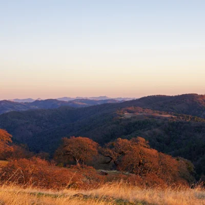
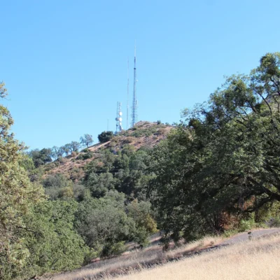
The Lone Oak Trail is the standout for hikers—a 6-mile round-trip climb to a ridge that delivers sweeping views across San Luis Reservoir and the Diablo Range. The trail is exposed, so bring plenty of water and sun protection. In spring (March-April), the surrounding grasslands erupt in wildflower displays—California poppies, lupines, and owl’s clover paint the golden hills in vivid color.
Wildlife & Birding
The intersection of water, grassland, and oak woodland at San Luis Reservoir creates habitat that supports over 100 bird species and an impressive array of mammals. The area’s greatest wildlife comeback story is the tule elk—California’s native elk subspecies that was hunted to near extinction in the 19th century. Reintroduced herds now roam the grasslands around the reservoir, and sighting a bull elk silhouetted against the golden hills at sunset is one of the most dramatic wildlife encounters in Central California.
| Species | Best Months | Where to Look | Tips |
|---|---|---|---|
| 🦌 Tule Elk | Year-round (rut: Aug-Oct) | Grasslands west of reservoir | Most active dawn/dusk; bulls bugle during rut season |
| 🦅 Bald Eagle | Nov-Mar | Over reservoir, perched in oaks | Overwintering; scan treetops near shoreline |
| 🦅 Golden Eagle | Year-round | Ridgelines, Lone Oak Trail area | Soaring on thermals; binoculars essential |
| 🦊 Gray Fox | Year-round | Oak woodlands near Los Banos Creek | Nocturnal; sometimes spotted at dawn near campsites |
| 🐗 Wild Pig | Year-round | Oak-studded hillsides | Keep distance; can be aggressive with piglets |
| 🐦 White-tailed Kite | Year-round | Open grasslands hovering over prey | Distinctive hovering flight pattern; unmistakable |
History: From Yokuts Land to California’s Water Lifeline
Long before engineers envisioned pumping Delta water over Pacheco Pass, the Yokuts and Mutsun Ohlone peoples inhabited these oak-grassland valleys for thousands of years, sustained by the diverse ecosystems of seasonal creeks and natural wetlands. Spanish exploration arrived in 1805 with Lieutenant Gabriel Moraga, and the area later became part of El Rancho San Luis Gonzaga, granted to Juan Perez Pacheco in 1843—an enormous Mexican-era land grant that shaped the region’s ranching identity for over a century.
The modern reservoir was born out of California’s perpetual water challenge: how to move surplus northern water to the arid south. Construction began in 1962 with the building of B.F. Sisk Dam—a 382-foot-high earth-fill embankment that impounded San Luis Reservoir when completed in 1967. The reservoir serves as a joint facility for both the California State Water Project and the federal Central Valley Project, storing up to 2 million acre-feet of water pumped uphill from the Delta via the California Aqueduct. Today it stands as a testament to the scale of California’s water infrastructure—and a reminder of the human ingenuity (and political complexity) behind every glass of water in the state.
Seasonal Guide
| Season | Weather | Crowds | Best For |
|---|---|---|---|
| 🌸 Spring (Mar-May) | 60-80°F, wildflowers | Moderate | Wildflowers, bass fishing, comfortable camping |
| ☀️ Summer (Jun-Aug) | 90-105°F, strong winds | High | Windsurfing, swimming at O’Neill Forebay, night fishing |
| 🍂 Fall (Sep-Nov) | 70-90°F, clear | Low-Moderate | Striped bass peak, tule elk rut, pleasant temps |
| ❄️ Winter (Dec-Feb) | 45-60°F, occasional rain | Low | Bald eagle viewing, trout fishing, solitude |
Spring is the most balanced season: temperatures are comfortable, wildflowers carpet the hills, and the fishing picks up after winter’s slower pace. Fall brings the best striped bass fishing and the tule elk rutting season—any outdoor enthusiast’s dream combination. Summer is all about water sports, but the heat is punishing for camping and hiking—plan activities for early morning and evening. Winter offers surprising rewards: overwintering bald eagles, uncrowded campgrounds, and stocked trout at Los Banos Creek (when open).
Sample Itineraries
Day Trip: Angler’s Special (8 Hours)
Arrive at O’Neill Forebay by 5:30 a.m.—striped bass are most active at dawn. Launch at the Gonzaga Road ramp and work the forebay’s structure with swimbaits or live bait until mid-morning. Break for lunch at the day-use picnic area with reservoir views. Afternoon: switch to the shore and try for catfish or shad (May-June) on lighter tackle. Or drive to Dinosaur Point for a different angle on the main reservoir. Day-use parking: $10/vehicle + $7 boat launch.
Weekend Camping & Exploration
Day 1: Check into San Luis Creek Campground (reserve ahead). Set up camp, then drive to the Romero Visitor Center to learn about the State Water Project infrastructure. Evening: fish from shore at O’Neill Forebay as the wind dies down. Day 2: Hike the Lone Oak Trail (6 mi RT) in the cool morning for ridge-top views. Afternoon: boat or kayak on the forebay. Scan the grasslands west of the reservoir for tule elk at dusk. Pack out by noon Sunday to beat the weekend exodus.
Visitor Information
| Detail | Information |
|---|---|
| Location | 31426 Gonzaga Rd, Gustine, CA 95322 |
| Phone | 209-826-1196 |
| Day-Use Fee | $10/vehicle; $7 boat launch |
| Camping | $20-$40/night (see campground table) |
| Reservations | ReserveCalifornia.com or call 800-444-7275 |
| Fishing License | Required for ages 16+; purchase at wildlife.ca.gov |
| Hours | Sunrise to sunset (day use); 24/7 (camping) |
Budget Planning
| Expense | Day Trip | Weekend | Notes |
|---|---|---|---|
| Day Use/Parking | $10 | Included | Per vehicle |
| Boat Launch | $7 | $7 | Per launch |
| Camping | — | $40-80 | $20-40/night × 2 |
| Fishing License | $17.02 | $17.02 | 1-day license; annual $55.46 |
| Total per Person | ~$34 | ~$85-145 | Depends on hookup vs. primitive |
Safety & Hazards
| Hazard | Risk Level | Prevention |
|---|---|---|
| 💨 Extreme Wind | High | Watch wind warning lights; don’t boat when flashing; secure tents |
| 🌡️ Heat Exhaustion | High (Summer) | Carry 2+ liters water for hiking; avoid midday sun exposure |
| 🌊 Cold Water/Currents | High | Always wear PFD; don’t swim in main reservoir; cold even in summer |
| 🐍 Rattlesnakes | Moderate | Watch step on trails and near rocks; most active in warm months |
| 🦠 Algae Blooms | Seasonal | Check current advisories; avoid water contact during active blooms |
Nearby Attractions
San Luis Reservoir sits at the crossroads of Central California. The Romero Visitor Center on-site offers fascinating exhibits about the State Water Project and how water travels from the Delta to Southern California. The historic town of Pacheco State Park (adjacent) preserves the legacy of the Pacheco rancho with scenic ridgeline trails and panoramic valley views. For a full Central California outdoor weekend, combine San Luis Reservoir fishing with a drive through the San Luis National Wildlife Refuge (30 minutes south) for world-class waterfowl viewing, or head west over Pacheco Pass to Henry W. Coe State Park—one of the largest and wildest state parks in California.
Frequently Asked Questions
What are the world-record fish caught at San Luis Reservoir?
O’Neill Forebay has produced five world-record or former world-record striped bass, making it one of the most legendary striped bass fisheries in the United States. The precise records vary as new catches occasionally surpass previous ones, but the forebay’s unique combination of warm water, abundant baitfish, and the constant water flow from the California Aqueduct creates ideal growing conditions for trophy-sized stripers.
Can I swim at San Luis Reservoir?
Designated swimming areas are available at O’Neill Forebay, which is the safest location for water contact activities. Swimming is strongly discouraged in the main San Luis Reservoir due to unpredictable currents, sudden wind events, and cold water temperatures that can cause hypothermia even in summer. Always wear a life jacket when in or near the water.
How windy does it get at San Luis Reservoir?
Very windy. The Pacheco Pass creates a natural wind funnel, and afternoon winds of 15-25 mph are common, with gusts exceeding 40 mph possible. This makes the area excellent for windsurfing but dangerous for small boats and inexperienced kayakers. Wind warning lights around the reservoir flash when conditions become hazardous—if they’re flashing, stay off the water.
Is the Basalt Campground still closed?
Yes—Basalt Campground and boat ramp have been closed since May 31, 2022, due to the B.F. Sisk Dam Safety of Dams Modification Project. There is currently no announced reopening date. San Luis Creek, Medeiros, and Los Banos Creek (seasonal) campgrounds remain open and operational.
Do I need a fishing license at San Luis Reservoir?
Yes—a valid California fishing license is required for all anglers 16 years and older. Licenses can be purchased online at wildlife.ca.gov, at sporting goods stores, or at the park entrance. A 1-day license costs approximately $17, while an annual license is about $55. Rangers actively enforce licensing requirements throughout the recreation area.
What’s the best time for striped bass fishing?
Spring (March-May) and fall (September-November) are the peak seasons for striped bass at O’Neill Forebay. Early morning is consistently the most productive time—plan to be on the water before sunrise. Topwater action can be explosive during the fall run. Summer fishing is possible but can be affected by algae blooms and spawning activity. Winter offers slower but still productive fishing for persistent anglers.
Are there tule elk at San Luis Reservoir?
Yes—reintroduced tule elk herds roam the grasslands surrounding the reservoir. The best time to see them is during the rutting season (August-October) when bulls become more vocal and visible, but they can be spotted year-round. The grasslands west and south of the main reservoir offer the best viewing. Bring binoculars and maintain a respectful distance—these are large, wild animals.
Can I bring my RV to San Luis Reservoir SRA?
Yes—San Luis Creek Campground offers 53 sites with water and electric hookups suitable for RVs and trailers. The sites can accommodate most standard RVs; check with the park for maximum length restrictions. Reservations through ReserveCalifornia.com are strongly recommended, especially for weekends from March through October.
🎣 Ready to Fish World-Record Waters?
Whether you’re chasing trophy stripers at O’Neill Forebay, windsurfing the Pacheco Pass wind corridor, or watching tule elk graze against a golden sunset, San Luis Reservoir State Recreation Area delivers Central California outdoor experiences that punch far above their tourist profile.
Do I need a reservation to visit California state parks?
Many popular California state parks, especially coastal and desert parks like Anza-Borrego and Crystal Cove, now require day-use reservations on weekends and holidays. Check the park website or ReserveCalifornia.com before your visit.
How much does it cost to enter a California state park?
Most California state parks charge a day-use parking fee of $10 per vehicle. An annual parks pass costs $125 and covers unlimited vehicle entry to all state parks.
Are dogs allowed in California state parks?
Dogs are allowed in campgrounds and on paved roads in most California state parks, but they are generally not permitted on trails or beaches. Service animals are always welcome. Check specific park rules before bringing your pet.
What is the best time of year to visit California state parks?
Coastal parks are best from spring through fall, desert parks from October through April, and mountain parks from June through October. Spring brings wildflower super blooms, and fall offers fewer crowds with pleasant weather.
Explore More California State Parks
San Luis Reservoir State Recreation Area is one of many outstanding state parks in California. Discover more parks in our Best State Parks in California guide, or use our Park Finder to search by activity, location, or features.

Park Location
Plan your gear for San Luis Reservoir State Recreation Area
From our editorial guides, matched to this park’s activities: