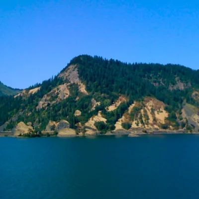
There are state parks with visitor centers and paved trails. There are state parks with campgrounds and ranger programs. And then there’s Bowers Rock State Park—568 acres of wild Willamette River bottomland where there is no parking lot, no signage, no formal trails, and no guarantee you’ll be able to get there at all.
This is one of Oregon’s most unusual state parks: a riparian wilderness tucked between the river and private farmland just west of Albany, where the best access is by boat and the land access involves walking a disputed easement past skeptical neighbors. It’s not a park for casual visitors seeking amenities. It’s a park for explorers, paddlers, and fisherfolk willing to work for their solitude.
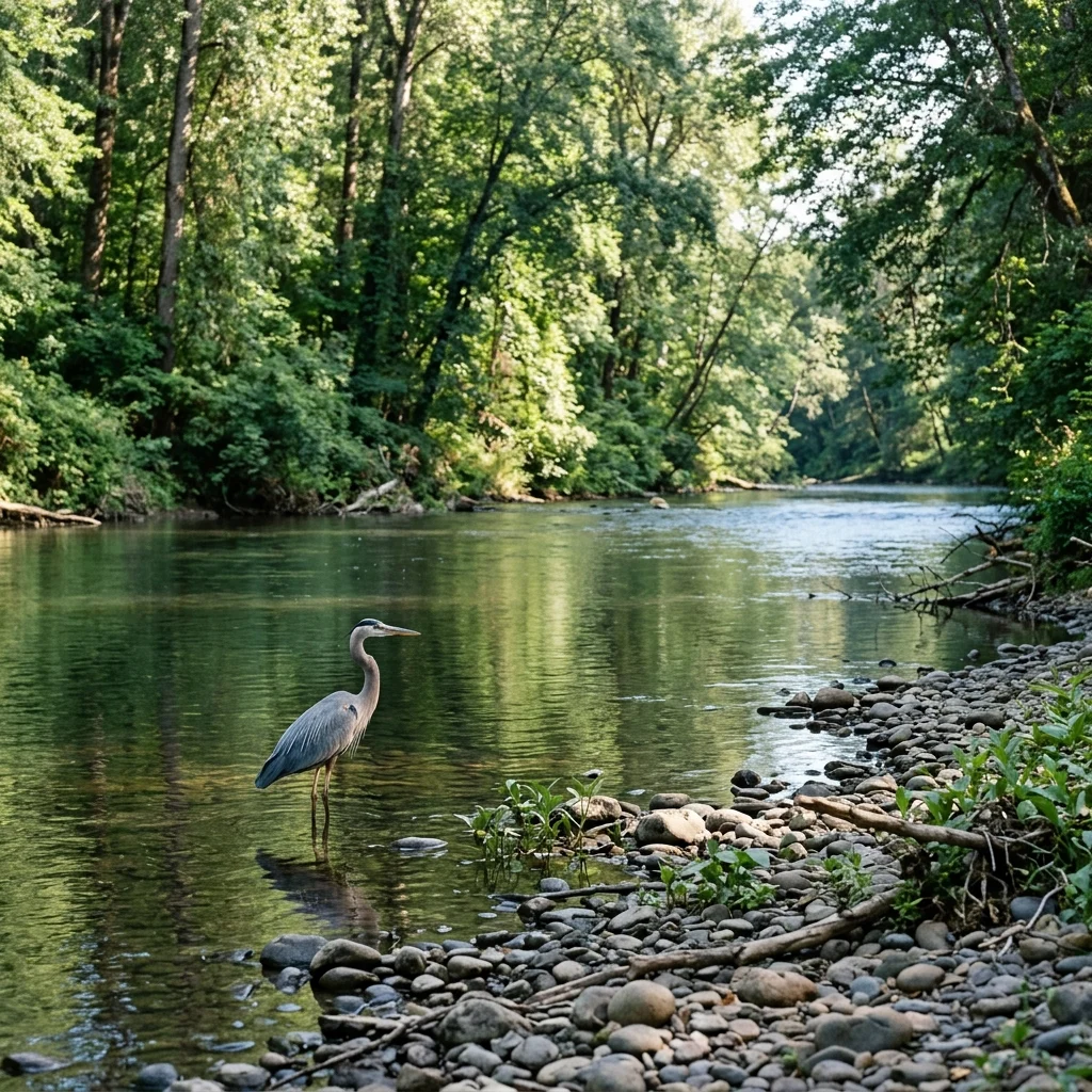
What you’ll find if you make it in: nearly two miles of undeveloped Willamette River shoreline, old-growth cottonwood forests, hidden sloughs teeming with fish and wildlife, and the ghostly traces of human history stretching back to the Kalapuya people who fished these waters long before Bowers Rock became a cattle ranch, and then a state park that Oregon seems to have partly forgotten.
What Makes Bowers Rock Unique
True Wilderness
568 acres of undeveloped riparian forest—no trails, no facilities, no crowds.
River Access
Nearly 2 miles of Willamette River frontage—best accessed by canoe or kayak.
Hidden Fishing
50-acre pond and sloughs full of bass, crappie, and catfish.
Wildlife Haven
Deer, elk, beavers, and herons—the wildest stretch of river near Albany.
Understanding Bowers Rock
Bowers Rock is not a typical state park—it’s more accurate to think of it as protected public land that happens to be managed by Oregon State Parks. Here’s what you need to know before planning a visit.
The Basics
| Detail | Information |
|---|---|
| 📏 Size | 568 acres |
| 📍 Location | ~1 mile west of Albany, Oregon |
| 🌊 River Frontage | Nearly 2 miles on Willamette River |
| 🅿️ Parking | None—no official parking lot |
| 🥾 Trails | None marked—explore at your own risk |
| 🚻 Facilities | None |
| 💲 Fee | Free (no services to pay for) |
Why Is It So Undeveloped?
Oregon began acquiring land for Bowers Rock in 1973, but development never followed. The park sits in a complicated geography—surrounded by private farmland with limited road access and a history of conflict between state access rights and neighboring landowners. Rather than resolve these disputes, the state has largely left Bowers Rock in its natural condition, which ironically makes it one of the most authentic wilderness experiences available within minutes of the Willamette Valley’s population centers.
⚠️ Know Before You Go
Bowers Rock is undeveloped with no facilities whatsoever. There are no restrooms, no water, no marked trails, and no cell service in all areas. Land access involves walking a disputed easement. This park is best suited for experienced outdoor recreationists comfortable with route-finding, insects, and potentially muddy conditions.
How to Access Bowers Rock
Getting to Bowers Rock is part of the adventure—and part of the challenge. There are two options:
Option 1: By Water (Recommended)
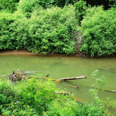
The easiest and most conflict-free access is by canoe, kayak, or small boat from the Willamette River. The park has nearly two miles of river frontage where you can beach your vessel and explore.
| Launch Point | Distance to Park | Notes |
|---|---|---|
| 🚤 Bryant Park (Albany) | ~1-2 miles downstream | Easy paddle; follow river right (west bank) |
| 🚤 Takena Landing | ~2-3 miles upstream | Paddle downstream; look for undeveloped western shore |
🚣 Water Access Tips
- Look for the large cottonwood forests on the river’s west bank—that’s Bowers Rock
- Beach your vessel on gravel bars or gentle shoreline areas
- The 50-acre pond is inland—explore sloughs that connect to the river
- River camping is permitted from the water
Option 2: By Land (Complicated)
There is a legal pedestrian and bicycle easement to access Bowers Rock by land, but it’s not straightforward:
- 📍 Route: Bryant Drive off Bryant Way, northwest of Albany
- 🚗 Parking: NO parking available at the trailhead or along roads
- 🚶 Access: Walk or bicycle in via the state easement
- ⚠️ Warning: Some adjacent landowners have disputed this access historically
The Oregon Parks and Recreation Department affirms that the public has legal right to use the Bryant Drive easement, but practical experience suggests you may encounter resistance. If you choose land access, be polite, don’t block any roads, and stay on the easement.
The Landscape: Riparian Wilderness
Bowers Rock protects a type of landscape that was once common throughout the Willamette Valley but is now rare: intact riparian bottomland forest. Before European settlement, the Willamette’s banks were lined with extensive cottonwood and willow forests, seasonal wetlands, and side channels that flooded with the river’s spring rise. Agriculture and development eliminated most of this habitat.
What You’ll Find
- 🌳 Old-Growth Cottonwoods: Massive black cottonwood trees line the river and sloughs
- 🌿 Dense Understory: Oregon ash, willow, and blackberry (wear long pants!)
- 💧 Sloughs & Side Channels: Quiet backwaters that flood seasonally
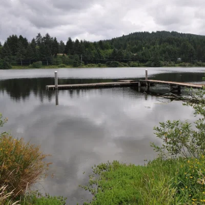
- 🏊 50-Acre Pond: Built in 1975, now being restored to connect with native fish habitat
- 🪨 Bowers Rock: The park’s namesake—a rock formation visible from the river
Restoration Work
In 2020, Oregon began restoration work at Bowers Rock to improve native fish habitat. The project reconnects the 50-acre pond to the Willamette River via Coon Creek, allowing native fish species to use the pond as critical off-channel habitat during floods and droughts. This work makes the park even more valuable for fishing in coming years.
Fishing Guide
Fishing is arguably the best reason to visit Bowers Rock. The 50-acre pond and associated sloughs support excellent warmwater fishing:
| Species | Where | Notes |
|---|---|---|
| 🐟 Largemouth Bass | Pond, sloughs, river edges | Excellent population; topwater in morning |
| 🐟 Crappie | Pond, submerged structure | Spring and fall best; hold near brush |
| 🐟 Bluegill | Shallow pond edges | Great for beginners; spawn in early summer |
| 🐱 Bullhead Catfish | Pond and sloughs | Night fishing productive; bait on bottom |
| 🐟 Common Carp | Throughout | Large specimens; overlooked but fun on light tackle |
Fishing Access Tips
- 🎣 Bank Fishing: Possible from pond and slough edges (access can be brushy)
- 🚣 Boat Fishing: Ideal—paddle into sloughs inaccessible from shore
- 📜 License: Oregon fishing license required
- 🌊 River Fishing: Willamette shoreline offers additional options for bass and catfish
Wildlife
The undeveloped nature of Bowers Rock makes it a wildlife haven in a region where most river habitat has been converted to agriculture:
| Species | When/Where | Notes |
|---|---|---|
| 🦌 Black-tailed Deer | Throughout | Common; watch for at dawn/dusk |
| 🦬 Roosevelt Elk | Occasionally seen | Rare in this area—Bowers Rock provides habitat |
| 🦫 Beavers | Sloughs and pond | Active signs everywhere; best seen at dusk |
| 🦅 Great Blue Herons | River and pond edges | Common; often startled while exploring |
| 🦆 Waterfowl | Pond and sloughs | Ducks, geese, especially during migration |
| 🦅 Bald Eagles | Over river and pond | Hunting fish; nesting possible in large cottonwoods |
A Brief History
The land that became Bowers Rock State Park has a layered history:
- 🪶 Kalapuya Era: The Kalapuya people fished and hunted these river bottoms for thousands of years before European contact
- 🐄 Ranch Era (1800s): The Bowers family established a ranch here, giving the rock formation—and later the park—its name
- 🏛️ State Acquisition (1973+): Oregon began acquiring land for a future state park
- 🔧 Restoration Era (2020+): Habitat restoration projects aim to reconnect the pond with the river for native fish
Camping
There is no developed camping at Bowers Rock. However, river camping is legal for those who access the park by water:
- ⛺ River Camping: Permitted on the park’s river shoreline (access by boat)
- 🔥 Fires: Use extreme caution; no fire rings or facilities
- 💧 Water: Bring all water—none available
- 🚻 Facilities: None—practice Leave No Trace principles
⛺ River Camping Tips
Choose a gravel bar or gentle slope above the high water mark. Summer is best when water levels are low and stable. In spring, the river can rise overnight from upstream snowmelt—don’t camp in areas that could flood.
When to Visit
🌸 Spring (March – May)
River levels can be high and variable. The cottonwoods leaf out, creating lush green canopy. Fishing picks up as water warms. Mosquitoes emerge—bring repellent. Land access can be muddy.
Best for: Early-season fishing, paddling when water is up
☀️ Summer (June – August)
Prime season. River levels drop and stabilize, making beach landings and camping easier. Fishing is excellent in early morning and evening. Heat can be intense—shade of cottonwoods welcome. Insects are present.
Best for: Paddling, fishing, river camping
🍂 Fall (September – November)
Excellent conditions. Cooler temperatures, fewer insects, cottonwoods turn golden. River remains accessible. Fishing stays productive. Late fall rains begin—check water levels.
Best for: Fishing, photography, peaceful exploration
❄️ Winter (December – February)
River can be high and turbulent. Access more difficult. Wildlife watching good—fewer leaves means better visibility. Land can be flooded or extremely muddy. Only for experienced adventurers.
Best for: Dedicated wildlife observers, experienced paddlers only
Practical Information
| Item | Details |
|---|---|
| 🎟️ Entry Fee | FREE (no facilities = no fee) |
| 🅿️ Parking | None at park; use public boat launches nearby |
| 🚻 Restrooms | None |
| 💧 Water | None—bring all water |
| 📶 Cell Service | Variable; may be limited in park interior |
Nearby Launches & Services
- 🚤 Bryant Park (Albany): Boat launch, parking, restrooms
- 🚤 Takena Landing: Boat launch upstream
- 🏪 Albany: Full services (gas, food, supplies)
- 🏕️ Willamette Mission State Park: Developed camping ~20 miles north
Frequently Asked Questions
Is Bowers Rock really a state park?
Yes. Oregon State Parks has owned and managed this land since the 1970s. It’s simply never been developed with the trails, parking, and facilities typical of more visited parks.
Can I drive to Bowers Rock?
No. There is no parking lot and parking on roads near the park is not permitted. Access is by boat (recommended) or by walking/biking the Bryant Drive easement.
Is camping allowed?
Yes—river camping from boats is legal. There is no developed campground or land-based camping infrastructure.
Is it worth the effort to visit?
That depends on what you’re seeking. If you want a developed park with clear trails and amenities, Bowers Rock is not for you. If you want genuine solitude, excellent fishing, and the chance to explore wild river bottomland that few Oregonians have seen, it’s absolutely worth it.
Do I need a permit?
No park permit required. An Oregon fishing license is required if you’re fishing.
🌲 Oregon’s Forgotten Wilderness
Bowers Rock State Park is not for everyone—and that’s precisely its appeal. No parking lots. No trails. No crowds. Just 568 acres of wild Willamette River bottomland waiting for those willing to paddle in and explore. Bring a canoe, bring a fishing rod, and bring a sense of adventure. Leave the expectations of a typical state park at home.
📍 Location: ~1 mile west of Albany, Oregon on the Willamette River
📞 Phone: (800) 551-6949 (Oregon Parks)
Frequently Asked Questions
Are Oregon state parks free?
Oregon state parks are free to enter on foot or by bicycle. Vehicle access requires a $5 day-use permit or a $30 annual permit. Oregon’s entire coastline is public by law, guaranteeing beach access everywhere.
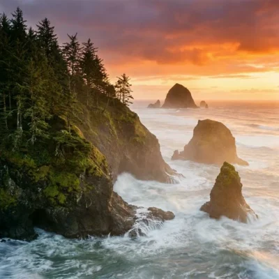
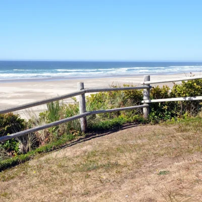
What are the best state parks on the Oregon Coast?
Top coastal parks include Ecola (stunning viewpoints), Cape Lookout (rainforest hiking), Shore Acres (botanical gardens and storm watching), Samuel H. Boardman (dramatic sea stacks), and Oswald West (surfer’s cove).
Can I camp on the beach in Oregon?
While camping directly on Oregon beaches is not permitted, several oceanfront campgrounds like Cape Lookout, Sunset Bay, and Harris Beach offer campsites just steps from the shore. Reserve months ahead for summer.
When is the best time to visit Oregon state parks?
June through September is prime season for dry weather. The coast can be enjoyed year-round. Spring brings spectacular wildflowers in the Columbia River Gorge (April-May). Winter offers dramatic storm watching along the coast.
Explore More Oregon State Parks
Bowers Rock State Park is one of many outstanding state parks in Oregon. Discover more parks in our Best State Parks in Oregon guide, or use our Park Finder to search by activity, location, or features.
More parks nearby: Sarah Helmick State Recreation Site is a short drive away, while W. B. Nelson State Recreation Site lies a short drive away.

Park Location
Plan your gear for Bowers Rock State Park
From our editorial guides, matched to this park’s activities:
Top Tours & Activities Near Eugene
 from $525
 from $20
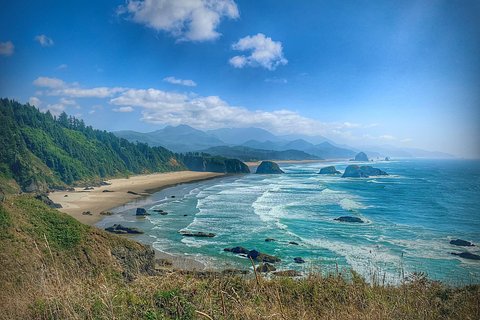 from $750