
Cascade River State Park
Where a Mountain River Plunges 120 Feet to Lake Superior
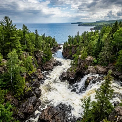
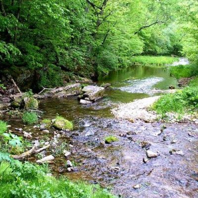
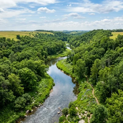
Cascade River State Park captures the wild essence of Minnesota’s North Shore in 2,865 acres of rugged boreal forest. The park’s namesake river drops 120 feet through a twisting volcanic gorge in a series of dramatic cascades before meeting Lake Superior. With 18 miles of hiking trails climbing from the lakeshore to the Sawtooth Mountains, a campground nestled in the northern forest, and over a mile of Superior shoreline, this is one of the most breathtaking destinations along scenic Highway 61.
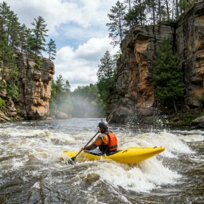
The Cascades: A Dramatic River Gorge
The Cascade River earned its name from the spectacular series of waterfalls that define the park. As the river carves through ancient basalt lava flows from the Precambrian era, it creates a deep, narrow gorge that twists and turns before emptying into Lake Superior.
Waterfall Highlights
| Falls | Drop | Access | Notes |
|---|---|---|---|
| The Cascades (Main) | 25 ft | 0.2-mile paved path | Most photographed, accessible from parking lot |
| Upper Cascades | 15 ft | 0.5 miles upstream | Multiple drops in narrow gorge |
| Hidden Falls | 20 ft | 0.8-mile hike from SHT lot | Secluded, less crowded, worth the detour |
The best waterfall views come during spring snowmelt (April–May) when the river runs at peak flow. A 1.2-mile loop trail visits several cascades, with footbridges spanning the gorge at dramatic viewpoints where you can feel the mist on your face.
Hiking: From Lakeshore to Sawtooth Summits
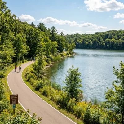
Cascade River State Park’s 18 miles of hiking trails offer everything from easy lakeside strolls to strenuous ridge climbs with panoramic views of Lake Superior and the Superior National Forest.
Top Trails
| Trail | Distance | Difficulty | Highlights |
|---|---|---|---|
| Waterfall Loop | 1.2 miles | Easy | Multiple cascades, footbridges, gorge views |
| Lake Superior Shoreline | 3.0 miles RT | Easy–Moderate | Rocky shoreline, waves, agate hunting |
| Lookout Mountain Loop | 3.5 miles | Moderate | Panoramic views, Hiking Club Trail |
| Cascade River Loop | 7.8 miles | Strenuous | Both river banks, multiple waterfalls, 500+ ft gain |
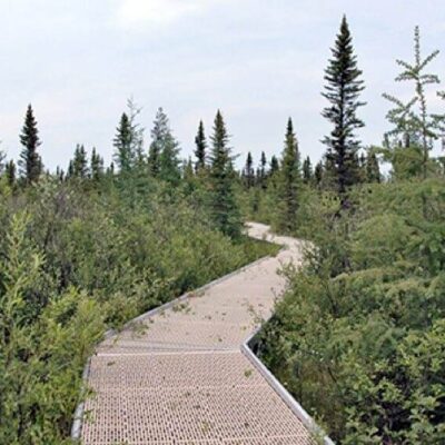
The Superior Hiking Trail passes through the park, offering connections to neighboring state parks and backcountry campsites. Sturdy boots are essential — trails can be rocky, rooty, and steep, especially along the river gorge.
Lake Superior Shoreline
The park’s 1.5+ miles of Lake Superior shoreline offer some of the most dramatic coastal scenery on the North Shore. Walk along the rocky edge of the continent’s largest lake, listen to waves crash against ancient basalt, and search for agates among the smooth stones. Several picnic sites sit directly on the shoreline with unobstructed views across the open water.
Camping in the Northern Forest
Cascade River’s campground sits under a canopy of birch, spruce, and cedar — a classic North Shore camping experience with the sound of the river as your soundtrack.
Campground Details
| Type | Sites | Season | Features |
|---|---|---|---|
| Drive-In (some electric) | 41 | Year-round | Pull-thru available, RVs up to 35 ft |
| Group Sites | 2 | Seasonal | Large group gatherings |
| Backpack Sites | 5 | Year-round | Secluded, hike-in only |
Modern facilities include flush toilets, hot showers, and an RV dump station (May–October). Winter camping is available with vault toilets. Firewood and ice are sold at the park office. Book 1–2 weeks ahead during peak fall color season.
Seasonal Highlights
- Spring (April–May): Peak waterfall flow after snowmelt, migrating warblers, trillium blooms
- Summer (June–August): Warm hiking, Lake Superior beach days, long daylight hours
- Fall (September–October): Spectacular North Shore foliage, fewer crowds, crisp air
- Winter (December–March): Cross-country skiing, snowshoeing, frozen waterfall photography
Visitor Information
Getting There
The park is located on Highway 61, approximately 10 miles southwest of Grand Marais and 100 miles northeast of Duluth. The main parking area is well-signed from the highway.
Fees
A Minnesota State Parks vehicle permit is required: $7 daily or $35 annual. Camping fees vary by site type and season.
Frequently Asked Questions
How long does it take to see the main waterfalls?
The main cascades are a short 0.2-mile paved walk from the parking lot, taking about 10 minutes. The 1.2-mile Waterfall Loop visits multiple cascades and takes 45-60 minutes at a leisurely pace.
Can I swim in Lake Superior at this park?
There is no designated swimming beach, and Lake Superior water temperatures rarely exceed 55°F. However, you can wade along the rocky shoreline. The Cascade River pools above the falls offer slightly warmer water for brave swimmers.
Is this park connected to the Superior Hiking Trail?
Yes! The Superior Hiking Trail passes directly through the park. You can access it from the SHT trailhead parking lot and hike in either direction along the 310-mile trail system.
Explore More Minnesota State Parks
Cascade River State Park is one of many outstanding state parks in Minnesota. Discover more parks in our Best State Parks in Minnesota guide, or use our Park Finder to search by activity, location, or features.
Wildlife & Nature
Cascade River SP — on the North Shore of Lake Superior — features a series of cascading waterfalls as the Cascade River drops 900 feet over 3 miles through a narrow basalt gorge. The park provides access to the Superior Hiking Trail. Moose, black bears, and gray wolves inhabit the forest. Brook trout fill the pools. Peregrine falcons nest on the cliffs.
Nearby Attractions
Lutsen — adjacent — has Lutsen Mountains ski resort and the Alpine Slide. Grand Marais — 10 miles north. Superior Hiking Trail — traverses the park. Caribou Trail — nearby — has the backcountry access.

Park Location

Top Tours & Activities Near Minneapolis-Saint Paul
 from $79
 from $110
 from $195