Chimney Bluffs State Park: New York’s Otherworldly Lakeside Landscape
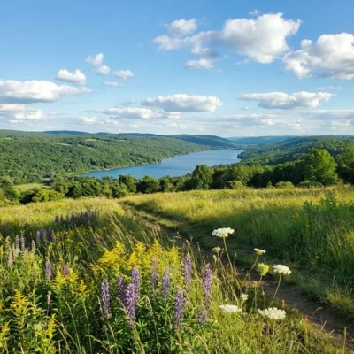
On the southern shore of Lake Ontario, in Wayne County, New York, one of the most surreal geological landscapes in the eastern United States rises from the water’s edge. Chimney Bluffs State Park protects a stretch of dramatic eroded drumlin formations — towering spires, pinnacles, and knife-edge ridges of glacial clay that reach up to 150 feet above the lake. The formations look like they belong in the badlands of the American West, not on the shores of a Great Lake.
These constantly shifting clay formations are carved not by centuries, but by millennia of wind, rain, snow, and the relentless waves of Lake Ontario. They erode at a rate of 1 to 5 feet per year, meaning the landscape you see today will look different next season. Chimney Bluffs is a living geology lesson — a place where the forces that shaped the continent during the last Ice Age are still visibly at work.
Park Facts at a Glance
| Information | Details |
|---|---|
| 📍 Location | Wolcott, Wayne County, New York |
| 📐 Park Size | 597 acres |
| 🏔️ Bluff Height | Up to 150 feet above Lake Ontario |
| 🥾 Total Trail Miles | ~5 miles (6 trails) |
| 🏕️ Camping | No camping (nearby Chimney Bluffs Campground) |
| 💰 Entry Fee | $5 parking fee |
| 🕐 Hours | Open year-round, dawn to dusk |
| 📞 Phone | (315) 947-5205 |
| 🌐 Website | parks.ny.gov |
| 📍 Address | 7700 Garner Road, Wolcott, NY 14590 |
History: From Ice Age to Smugglers’ Landing
The story of Chimney Bluffs begins approximately 10,000 to 24,000 years ago, during the last glacial period. Massive ice sheets — some exceeding 3,000 feet in height — covered what is now New York State. As these glaciers advanced and retreated, they deposited enormous quantities of glacial till: a heterogeneous mixture of clay, sand, gravel, and boulders scraped from the bedrock.
One glacier deposited the till, and a subsequent south-moving glacier reshaped it into drumlins — elongated, teardrop-shaped hills with their blunt ends pointing in the direction of glacial flow. The drumlins at Chimney Bluffs are part of a massive drumlin field of approximately 10,000 formations scattered across the landscape south and east of Lake Ontario, one of the largest drumlin concentrations in the world.
For centuries, the bluffs served primarily as a navigational landmark for fishermen and mariners on Lake Ontario. During Prohibition (1920–1933), the remote shoreline below the bluffs gained a different reputation: it was used by rum-runners and liquor smugglers as a landing point for boats carrying illegal alcohol from Canada across the lake into New York State. The difficult terrain and lack of roads made it nearly impossible for authorities to patrol.
New York State acquired the property in 1963, but the park remained largely undeveloped for decades. It wasn’t until 1999 that significant infrastructure improvements were made — a paved parking lot, heated restrooms, picnic areas with grills, and a network of hiking trails were added, opening this geological jewel to the public in earnest.
Geology: The Science of Eroding Drumlins
Understanding Chimney Bluffs requires understanding drumlins. These glacially deposited hills are composed of unsorted glacial till — a chaotic mixture of clay, silt, sand, gravel, and larger stones. This composition is the key to the park’s dramatic appearance.
As Lake Ontario’s waves, winter storms, spring rain, and freeze-thaw cycles attack the exposed face of the drumlin along the shoreline, the different materials within the till erode at different rates. Sandy sections wash away quickly, while sticky clay sections resist erosion. This differential erosion creates the park’s signature formations:
- Spires and Pinnacles: Tall, narrow towers of clay capped by more resistant material that protects the column beneath
- Knife-Edge Ridges: Thin, sharp-crested ridges with steep drops on both sides
- Caves and Overhangs: Undercut sections where softer material has eroded beneath harder layers
- Grooves and Gullies: Deep channels carved by rainwater running down the bluff face
The bluffs erode at a measured rate of 1 to 5 feet per year, though storm events can remove much more in a single night. This constant reshaping means the park is literally a different place from season to season. The formations visible today are ephemeral — some of the pinnacles photographed a decade ago no longer exist, while new ones have emerged from the retreating hillside.
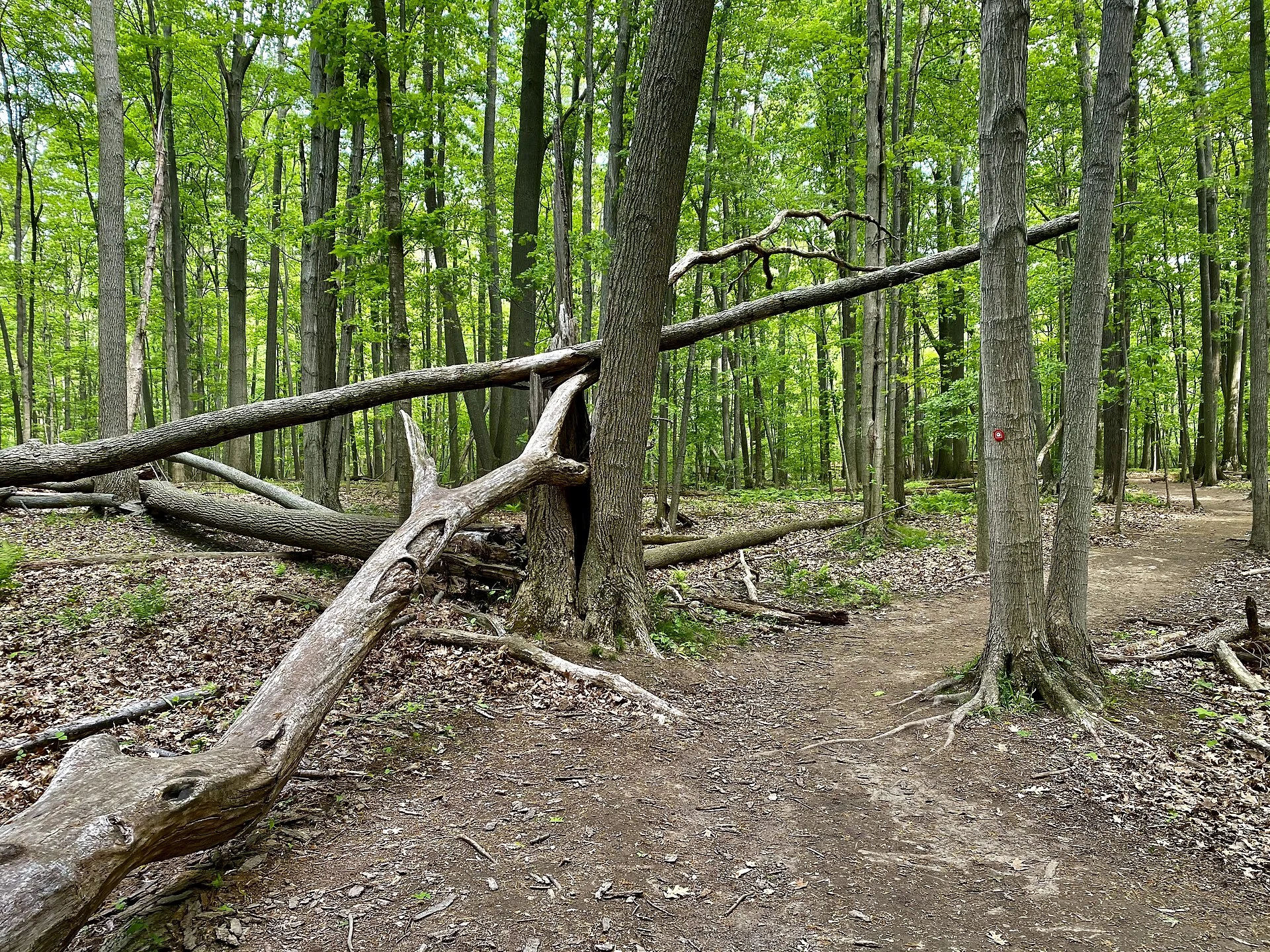
Hiking Trails: Complete Guide
Chimney Bluffs features approximately 5 miles of trails across six named routes. The park has two parking areas: the main Garner Road lot (paved, with restrooms and accessible bluff views) and the smaller East Bay Road lot (dirt/gravel, closer to the bluffs).
| Trail | Distance | Difficulty | Highlights |
|---|---|---|---|
| Bluff Trail | 1.3 mi | Moderate | Best views! Runs along cliff tops with lake panoramas |
| Meadow Trail | 0.5 mi | Easy (paved) | Accessible path from Garner Rd parking to bluff viewpoint |
| Drumlin Trail | 0.75 mi | Moderate | Climbs through evergreen forest, connects to Bluff Trail |
| East-West Trail | 1.5 mi | Easy-Mod | Connector trail parallel to Garner Road |
| Garner Point Trail | 0.75 mi | Easy | Views of Lake Ontario and Sodus Bay |
| Picnic Area Path | 0.3 mi | Easy | Lake access through picnic facilities |
Recommended Loop: The Chimney Bluffs Circuit
The most popular route is the Chimney Bluffs Loop — a 2.7 to 3.5-mile circuit combining the Meadow Trail → Bluff Trail → Drumlin Trail → East-West Trail. This loop takes approximately 1.5 to 2 hours and delivers the full Chimney Bluffs experience: accessible meadow views, dramatic clifftop walking, forest hiking, and panoramic Lake Ontario vistas.
Activities and Things to Do
Hiking and Photography
The primary draw is the trail network along and above the bluffs. Photographers flock here for golden hour light that paints the clay formations in warm orange and amber tones. The best photography conditions are during late afternoon in fall, when low sun angle creates dramatic shadows on the pinnacles.
Beach Exploration
Access the gravel and cobblestone beach below the bluffs from the East Bay Road parking area. Walking the shoreline provides the most dramatic upward views of the towering formations. Non-motorized boats can be launched from the beach. Swimming is prohibited due to dangerous currents and abrupt depth changes in Lake Ontario.
Birdwatching
The Lake Ontario shoreline is a major flyway for migratory birds. Spring and fall migrations bring warblers, raptors, shorebirds, and waterfowl along the lakeshore. The park’s meadows and forest transitions support diverse resident species year-round.
Winter Activities
The park is open year-round. In winter, trails are available for cross-country skiing, snowshoeing, and snowmobiling (via a designated trailhead). The bluffs take on an entirely different character when covered in ice and snow — formations that eroded in summer may be frozen in dramatic ice curtains and icicle cascades.
Seasonal Guide: When to Visit
| Season | Conditions | Best For |
|---|---|---|
| 🌸 Spring (Apr–May) | Muddy trails, active erosion after snowmelt, wildflowers emerging | Bird migration, witnessing erosion changes, fewer crowds |
| ☀️ Summer (Jun–Aug) | Warm, dry trails, long daylight hours, busiest season | Full trail access, beach walking, picnicking |
| 🍂 Fall (Sep–Nov) | Best light for photography, fall foliage backdrop, cooler temps | Photography, hawk migration, golden hour views |
| ❄️ Winter (Dec–Mar) | Ice formations on bluffs, snow-covered trails, limited parking | Snowshoeing, XC skiing, unique ice pinnacle photography |
Nearby Attractions
| Attraction | Distance | Highlights |
|---|---|---|
| Sodus Bay Lighthouse Museum | 10 min | 1871 lighthouse, Lake Ontario maritime history |
| Seneca Lake Wine Trail | 35 min | 30+ wineries, Finger Lakes’ best Riesling |
| Watkins Glen State Park | 1 hr | 19 waterfalls in a narrow gorge, iconic Gorge Trail |
| Fair Haven Beach State Park | 25 min | Lake Ontario beach, camping, kayaking |
| Montezuma National Wildlife Refuge | 30 min | Major bird sanctuary, migratory waterfowl |
| Cayuga Lake State Park | 40 min | Swimming, camping, gateway to Finger Lakes |
Practical Tips for Your Visit
- Wear sturdy shoes: Trails can be extremely muddy, especially in spring. Waterproof hiking boots are strongly recommended.
- Use the East Bay Road lot for the fastest access to the most dramatic bluff views and shoreline access.
- Visit during golden hour (1-2 hours before sunset) for the best photography light on the clay formations.
- Bring binoculars: The lakeshore is excellent for spotting migratory birds, especially hawks in September-October.
- Check after storms: Major weather events can dramatically reshape the bluffs overnight — the formations may look completely different after a storm.
- No camping in the park: The nearest campground is the private Chimney Bluffs Campground on Lummisville Road, about 2 miles away.
- Respect all barriers: Erosion makes cliff edges genuinely dangerous. People have been seriously injured falling from unstable bluffs.
- Pack out all trash: There are limited waste facilities. Practice Leave No Trace.
How to Get There
Chimney Bluffs State Park is located at 7700 Garner Road, Wolcott, NY 14590, on the southern shore of Lake Ontario in Wayne County.
From Syracuse (55 minutes)
Take I-90 West to Exit 41 (Waterloo). Follow NY-414 North to NY-104 West. Turn north on Lummisville Road, then right on Garner Road to the main parking lot.
From Rochester (1 hour)
Take I-90 East to Exit 42 (Geneva). Follow NY-14 North to NY-104 East. Turn north on Lake Bluff Road, then east on Garner Road.
Parking
Two parking areas: Garner Road (main, paved, with restrooms) and East Bay Road (smaller, dirt). A $5 parking fee may apply during peak season. Both lots fill quickly on summer weekends — arrive before 10 AM.
Frequently Asked Questions
How were the formations at Chimney Bluffs created?
The formations are eroded drumlins — teardrop-shaped hills deposited by glaciers during the last Ice Age (10,000-24,000 years ago). Wind, rain, snow, and Lake Ontario waves continuously erode the glacial clay at different rates, creating the dramatic spires and pinnacles. The bluffs erode 1 to 5 feet per year, so the landscape is always changing.
Can you camp at Chimney Bluffs State Park?
No, there is no camping within Chimney Bluffs State Park. The nearest camping is at the private Chimney Bluffs Campground on Lummisville Road (about 2 miles away), or at Fair Haven Beach State Park (25 minutes east), which offers lakeside camping with full facilities.
Can you swim at Chimney Bluffs?
No, swimming is prohibited at Chimney Bluffs due to dangerous currents and abrupt drop-offs in Lake Ontario. The gravel beach below the bluffs is accessible for walking and viewing the formations from below, but not for swimming. The nearest designated swimming beach is at Fair Haven Beach State Park.
How long does it take to hike at Chimney Bluffs?
The popular Chimney Bluffs Loop (Meadow Trail → Bluff Trail → Drumlin Trail) is 2.7-3.5 miles and takes 1.5 to 2 hours. A quick out-and-back on the paved Meadow Trail to the bluff viewpoint takes about 30 minutes. Plan extra time for photography — the views are hard to leave.
When is the best time to visit Chimney Bluffs?
Fall (September-November) offers the best photography light, hawk migration, and fall foliage. Summer (June-August) has the driest trails and longest hours. Spring is muddy but shows dramatic erosion changes. Winter brings unique ice formations but limited parking. Golden hour (1-2 hours before sunset) is the best time of day for dramatic light on the formations.
Is Chimney Bluffs dog-friendly?
Yes, dogs are welcome at Chimney Bluffs State Park but must be kept on a leash at all times. Keep dogs away from bluff edges, as the unstable clay can collapse without warning. The beach area is also accessible to leashed dogs.
Is there an entrance fee for Chimney Bluffs?
A $5 parking fee may apply during peak season (typically summer weekends). Outside of peak times, parking is generally free. The park itself has no entrance gate — you can walk or bike in at no charge. The main Garner Road parking lot has paved spaces and heated restrooms.
How far is Chimney Bluffs from Watkins Glen?
Chimney Bluffs State Park is approximately 60 miles (about 1 hour drive) from Watkins Glen State Park. The two parks make an excellent Finger Lakes road trip — Chimney Bluffs for glacial geology on Lake Ontario, and Watkins Glen for its famous gorge with 19 waterfalls.
What activities are available at this state park?
Common activities include hiking, camping, fishing, swimming, picnicking, and wildlife watching. Check the park website for specific offerings, trail maps, and seasonal programs.
Do I need a reservation to camp?
Reservations are recommended for camping, especially on weekends and holidays during peak season. Most state park systems offer online reservation portals where you can book sites months in advance.
Are dogs allowed at this state park?
Dogs are typically allowed in campgrounds and on most trails but must be kept on a leash (usually 6 feet). Dogs are often prohibited at swimming beaches. Service animals are always welcome. Check specific park rules.
What is the best time to visit?
Spring and fall generally offer the most comfortable weather for outdoor activities. Summer is peak for swimming and camping. Check the specific park for seasonal closures and optimal visiting conditions.
Explore More New York State Parks
Chimney Bluffs State Park is one of many outstanding state parks in New York. Discover more parks in our Best State Parks in New York guide, or use our Park Finder to search by activity, location, or features.
Keep exploring: The closest neighbors are Chimney Bluff State Park (a short drive away) and Fair Haven Beach State Park (a short drive away).

Park Location
Plan your gear for Chimney Bluffs State Park
From our editorial guides, matched to this park’s activities:


Top Tours & Activities Near New York
 from $53
 from $1,700
 from $40