Mount Tamalpais State Park: San Francisco’s Mountain Playground
🏆 Official Guide: Mount Tamalpais State Park — Offering the best panoramic views of the San Francisco Bay Area.
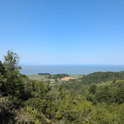
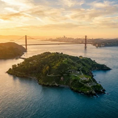
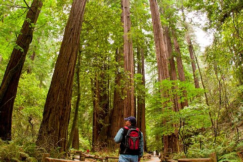
Rising 2,571 feet above the Pacific, Mount Tamalpais — “Mount Tam” to locals — is the crown jewel of the Marin County landscape and one of the most accessible mountain parks in California. Just 30 minutes north of the Golden Gate Bridge, this 6,300-acre state park drops from windswept summit ridges through old-growth redwood canyons all the way down to the surf at Stinson Beach.
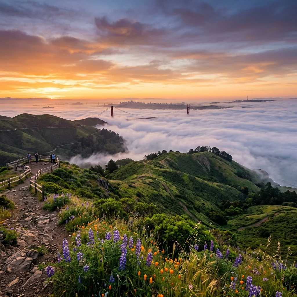
On a clear day, the East Peak summit delivers a jaw-dropping 360-degree panorama: the Farallon Islands 25 miles offshore, the San Francisco skyline, the Bay Bridge, Mount Diablo to the east, and — on rare pristine days — the snow-capped Sierra Nevada nearly 200 miles away. It’s one of the most spectacular viewpoints in the western United States.
Park Facts at a Glance
| Information | Details |
|---|---|
| 📍 Location | Mill Valley, Marin County, California |
| 📐 Park Size | 6,300 acres (25,000+ acres with adjacent public lands) |
| ⛰️ East Peak Elevation | 2,571 feet |
| 🥾 Trail Miles | 60+ miles (200+ in connected network) |
| 🕐 Hours | 7:00 AM – Sunset daily |
| 💰 Entry/Parking | $8/vehicle (East Peak, Pantoll, Bootjack) |
| 🏕️ Camping | Walk-in tent sites + Steep Ravine cabins |
| 📞 Phone | (415) 388-2070 |
| 🌐 Website | parks.ca.gov |
| ⭐ Highlights | 360° Bay views, Steep Ravine, Stinson Beach access |
Top Trails
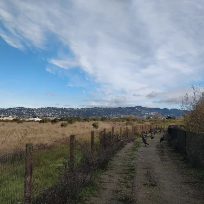
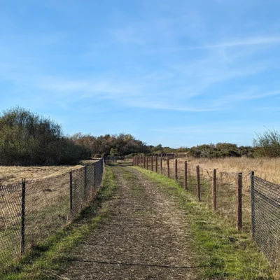
Mount Tam’s trail network is legendary — over 60 miles within the park itself, connecting to a 200+ mile network spanning Muir Woods, Marin Municipal Water District, and Golden Gate National Recreation Area.
| Trail | Distance | Difficulty | Highlight |
|---|---|---|---|
| Steep Ravine Trail | 2.1 mi one-way | Moderate | Redwood canyon, wooden ladders, waterfalls |
| Matt Davis Trail | 3.3 mi one-way | Moderate | Coastal views, wildflowers, connects to Stinson Beach |
| Dipsea Trail | 7 mi point-to-point | Strenuous | Famous race course, Mill Valley to Stinson Beach |
| Verna Dunshee Loop | 0.7 mi loop | Easy (ADA) | Paved summit loop, 360° panoramic views |
| Cataract Trail | 3 mi one-way | Moderate | Series of waterfalls in winter/spring |
| Old Railroad Grade | 7.5 mi one-way | Easy-Moderate | Historic rail bed, gradual climb to summit |
The Steep Ravine Experience
The Steep Ravine Trail is Mount Tam’s most iconic hike — a descent into a mist-shrouded redwood canyon with fern-draped walls, wooden ladder sections built into exposed rock, and a seasonal waterfall that thunders during winter rains. Combined with the Matt Davis Trail, it creates a spectacular loop from Pantoll to Stinson Beach and back.
Summit Views
The East Peak (2,571 ft) is the highest point on Mt. Tam and one of the Bay Area’s most celebrated viewpoints. The paved Verna Dunshee Loop Trail circles the summit, making panoramic views accessible to all visitors. On clear days, you can see:
- West: Farallon Islands, 25 miles offshore in the Pacific
- South: San Francisco skyline, Golden Gate Bridge, Bay Bridge
- East: Oakland Hills, Mount Diablo, Central Valley
- North: Point Reyes, Sonoma County hills
- Far East (rare): Snow-capped Sierra Nevada, ~200 miles away
History: The Mountain Railway
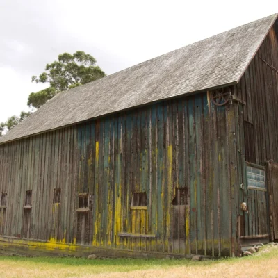
From 1896 to 1930, the famous Mount Tamalpais & Muir Woods Railway — dubbed “The Crookedest Railroad in the World” — carried passengers from Mill Valley to the East Peak summit via 281 curves in just 8.2 miles. The Old Railroad Grade trail follows this historic route today, offering a gentle, gradual climb to the summit that’s popular with hikers and mountain bikers alike.
The mountain also played a role in the birth of mountain biking — the sport was essentially invented on Mt. Tam’s fire roads in the late 1970s by pioneers like Gary Fisher and Joe Breeze.
Camping
| Option | Cost/Night | Reservation | Features |
|---|---|---|---|
| Pantoll Campground | $25 ($23 seniors) | First-come, first-served | Walk-in tent sites, picnic tables, food lockers |
| Bootjack Campground | $25 ($23 seniors) | First-come, first-served | Walk-in tent sites, restrooms |
| Steep Ravine Cabins | $100/night | ReserveCalifornia (6 mo advance) | 10 rustic cabins on cliffs above Pacific |
| Steep Ravine Campsites | $35/night | ReserveCalifornia (6 mo advance) | 6 primitive sites, ocean views |
| Alice Eastwood Group Camp | By reservation | ReserveCalifornia | Group camping, forested setting |
Seasonal Guide
| Season | Highlights | Notes |
|---|---|---|
| 🌸 Spring (Mar-May) | Wildflowers, waterfalls, green hills, clearest views | Best overall season, but trails can be muddy |
| ☀️ Summer (Jun-Aug) | Warm coastal days, fog below summit, Stinson Beach | East Peak often above fog layer — stunning! |
| 🍂 Fall (Sep-Nov) | Warmest weather, clear skies, least fog | Fire season — check alerts before visiting |
| ❄️ Winter (Dec-Feb) | Cataract waterfalls, green hillsides, rain hikes | Steep Ravine at its most dramatic |
Budget Planner
| Expense | Cost | Notes |
|---|---|---|
| Day-Use Parking | $8/vehicle | $7 for seniors, CA State Parks Pass accepted |
| Pantoll/Bootjack Camping | $25/night | Walk-in, first-come first-served |
| Steep Ravine Cabin | $100/night | Reservation required, books instantly |
| Steep Ravine Campsite | $35/night | Reservation required |
| CA State Parks Pass | $125/year | Day-use at all CA state parks |
Nearby Attractions
- Muir Woods National Monument — Old-growth redwoods, directly adjacent (shuttle required)
- Stinson Beach — 3.5-mile golden sand Pacific beach, connected by trail
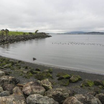
- Point Reyes National Seashore — Dramatic coastal wilderness, 25 miles north
- Sausalito — Waterfront town, houseboats, ferries to San Francisco, 10 miles south
- Golden Gate Bridge — Walk or bike across, 15 miles south
- Tennessee Valley Trail — Easy coastal trail to a hidden beach, 8 miles south
Safety and Tips
- Fog & temperatures: Summit can be 20°F cooler than Mill Valley. Bring layers even in summer
- Parking: Pantoll and East Peak lots fill early on weekends. Arrive before 9 AM
- Steep Ravine ladders: Can be slippery when wet. Wear proper hiking boots
- Mountain lions: Present but rarely seen. Keep children close, don’t hike alone at dawn/dusk
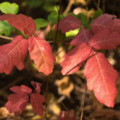
- Poison oak: Common on lower trails. Learn to identify and avoid
- Fire season: Check for closures during fire weather. Park may close on Red Flag days
Frequently Asked Questions
Wildlife & Nature
Mt. Tamalpais SP — 6,300 acres — the “birthplace of mountain biking” (1970s). The park’s 2,571-foot summit offers 360-degree views from the Farallon Islands to the Sierra Nevada. The park’s redwood groves, grasslands, and chaparral support northern spotted owls, mountain lions, and bobcats. The Dipsea Trail (host of the oldest trail race in America, since 1905) starts nearby.
What is the best trail at Mount Tamalpais?
The Steep Ravine Trail is widely considered Mount Tam’s most spectacular trail — a descent through a fern-draped redwood canyon with wooden ladders and seasonal waterfalls. For panoramic views, the Verna Dunshee Loop at East Peak is unbeatable. For a full-day adventure, combine the Matt Davis and Steep Ravine trails for a loop from Pantoll to Stinson Beach.
How do I get to the top of Mount Tamalpais?
You can drive to the East Peak parking lot ($8/vehicle), then walk the short Plank Trail or Verna Dunshee Loop to the summit fire lookout. On foot, the Old Railroad Grade (7.5 miles, gradual) or the Bootjack Trail (shorter but steeper) will take you to the top. Mountain bikers often ride Old Railroad Grade. The East Peak Visitor Center is open weekends, noon to 4 PM.
Can I hike from Mount Tamalpais to Stinson Beach?
Yes — several trails connect the mountain to Stinson Beach! The Matt Davis Trail (3.3 miles from Pantoll) descends through meadows with coastal views directly to Stinson Beach. The Dipsea Trail (7 miles) runs from Mill Valley to Stinson Beach via the mountain. You can also combine the Steep Ravine and Matt Davis trails for a spectacular loop that includes redwood canyons and ocean views.
How do I book a Steep Ravine cabin?
Steep Ravine cabins and campsites are booked through ReserveCalifornia.com, opening exactly 6 months in advance. They sell out within minutes of release. Set up an account beforehand, know your dates, and be ready to book the moment they open. There are 10 cabins ($100/night) and 6 campsites ($35/night). The cabins are rustic — no electricity, no running water.
Is Mount Tamalpais the birthplace of mountain biking?
Yes — Mount Tamalpais is widely regarded as the birthplace of modern mountain biking. In the late 1970s, riders like Gary Fisher, Joe Breeze, and Charlie Kelly began racing modified cruiser bikes down the mountain’s fire roads, leading to the development of purpose-built mountain bikes. The annual “Repack” downhill race on Pine Mountain was the sport’s foundational event.
Is there an entrance fee for Mount Tamalpais?
There is no general entrance fee — only parking fees at developed lots. East Peak, Pantoll, and Bootjack parking areas charge $8 per vehicle ($7 for seniors). California State Parks passes are accepted. Pantoll accepts credit cards during business hours, while East Peak and Bootjack use self-registration with cash or check.
Where is Mount Tamalpais State Park?
Mount Tamalpais State Park is in Marin County, California, about 30 minutes north of San Francisco via the Golden Gate Bridge and Highway 101. The main Pantoll Ranger Station is reached via Panoramic Highway from Highway 1 or from Mill Valley. The East Peak can be reached via East Ridgecrest Boulevard.
Getting There
Mount Tamalpais State Park is just north of San Francisco:
- San Francisco: 30 minutes via US-101 & Panoramic Hwy
- Oakland/East Bay: 45 minutes via I-580 & Richmond-San Rafael Bridge
- Sausalito: 15 minutes via Panoramic Hwy
Address (Pantoll): 3801 Panoramic Hwy, Mill Valley, CA 94941
Official Park Ranger Clarification
“Please note that Mount Tamalpais State Park encompasses roughly 6,000 acres, while the remaining 18,000 acres (including Alpine Dam, Alpine Lake, Carson Falls, and Cataract Falls) are owned and managed by the Marin Municipal Water District (MMWD). Swimming in any lake or stream is strictly prohibited on MMWD lands as it is a major source of the county’s drinking water supply.”
Nearby state parks: If you have extra time, China Camp State Park is a short drive away, and Samuel P. Taylor State Park is a short drive away.
🏕️ Ready to Experience Mount Tamalpais State Park?
Start planning your hike above the clouds. Parking fills up early on weekends, so arrive before 8 AM if possible.
Explore More California State Parks
Mount Tamalpais State Park is one of many outstanding state parks in California. Discover more parks in our Best State Parks in California guide, or use our Park Finder to search by activity, location, or features.

Park Location
Plan your gear for Mount Tamalpais State Park
From our editorial guides, matched to this park’s activities: