

Water drops 95 feet through a stone amphitheater into a pool carved by millions of years of erosion. Mist rises from the base, catching morning light. This is Cedar Falls—the crown jewel of Arkansas’s very first state park. When Petit Jean State Park was established in 1923, it set the standard for what Arkansas would become: a state with one of the most impressive park systems in America, built on landscapes that range from mountains to canyons to crystal-clear streams.
Welcome to Petit Jean State Park, perched atop Petit Jean Mountain between the Ozark and Ouachita ranges. Over 20 miles of trails wind through forests, across creek-carved canyons, past natural arches and grottos, and to overlooks that span miles of Arkansas wilderness. Whether you’re chasing the famous Cedar Falls, exploring the Seven Hollows where ancient geology created seven separate canyons, staying in a 1930s CCC lodge, or camping beside Lake Bailey, Petit Jean delivers the experience that started Arkansas’s state park tradition.
What Makes Petit Jean Legendary
Arkansas’s First
Established 1923—the park that started Arkansas’s state park system.
Cedar Falls
Iconic 95-foot waterfall plunging into Cedar Creek Canyon.
20+ Miles of Trails
Seven Hollows, Cedar Falls Trail, Canyon Trail, and more.
Historic CCC Lodge
Mather Lodge—1930s Civilian Conservation Corps architecture.
Cedar Falls

The Cedar Falls is Arkansas’s most iconic waterfall and Petit Jean’s most famous feature. Water plunges 95 feet from the rim into Cedar Creek Canyon, creating a spectacular display that changes with the seasons.
| Cedar Falls Info | Details |
|---|---|
| ⬇️ Height | 95 feet |
| 🥾 Trail Distance | 2 miles round trip |
| 💪 Difficulty | Moderate to Strenuous |
| 📍 Trailhead | Behind Mather Lodge |
| ♿ Overlook | Accessible overlook available with falls view |
💧 Best Waterfall Season
Cedar Falls flows strongest in late winter through spring after seasonal rains. Summer may see reduced flow. After heavy rain, the falls become spectacular.
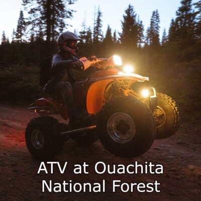
Hiking Trails
Petit Jean offers over 20 miles of hiking trails ranging from easy strolls to challenging canyon explorations:
| Trail | Distance | Difficulty | Highlights |
|---|---|---|---|
| 💧 Cedar Falls Trail | 2 mi RT | Mod-Strenuous | Base of 95ft waterfall |
| 🕳️ Seven Hollows | 4.5 mi loop | Moderate | 7 canyons, natural arch, grotto waterfall |
| 🐻 Bear Cave Trail | 1 mi | Easy-Mod | Rock shelter, bluff views |
| 🏠 Rock House Cave | 0.5 mi | Easy | Native American pictographs; historic shelter |
| 🚴 CCC Hike & Bike | 8+ mi | Moderate | Multi-use; connects park areas |
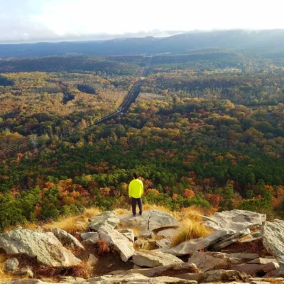
Seven Hollows Trail
The Seven Hollows Trail is Petit Jean’s signature hiking experience. This 4.5-mile loop meanders through seven separate canyons carved by streams over millions of years. Highlights include:
- 🌉 Natural Arch: Stone bridge formation
- 💧 Grotto Waterfall: Falls through rock overhang
- 🪨 Bluffs: Sandstone formations throughout
- 🌊 Creek Crossings: Multiple stream fords
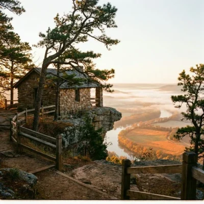
Mather Lodge

The Mather Lodge, built by the Civilian Conservation Corps in the 1930s, is a historic 24-room lodge overlooking Cedar Creek Canyon. Named after Stephen Mather (first director of the National Park Service), it offers:
- 🏨 24 guest rooms with rustic charm and modern amenities
- 🍽️ Full-service restaurant
- 🔥 Lobby fireplace (winter season)
- 🎁 Gift shop
- 👀 Canyon views from lodge
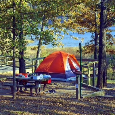
Camping & Lodging
| Accommodation | Details |
|---|---|
| 🏕️ Class AAA Sites | Full hookups: 50-amp electric, water, sewer; near Lake Bailey |
| 🔌 Class B Sites | Electric and water hookups |
| 🏠 Cabins | 33 cabins; some with kitchens; various sizes |
| 🛖 Yurts | 4 Rent-A-Yurt options |
| 🏛️ Mather Lodge | 24 historic CCC-era rooms |
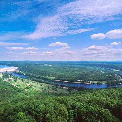
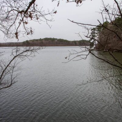
Lake Bailey
Lake Bailey offers fishing, swimming, and paddle sports. Campgrounds are conveniently located near the lake shore. Species include bass, catfish, and bream.
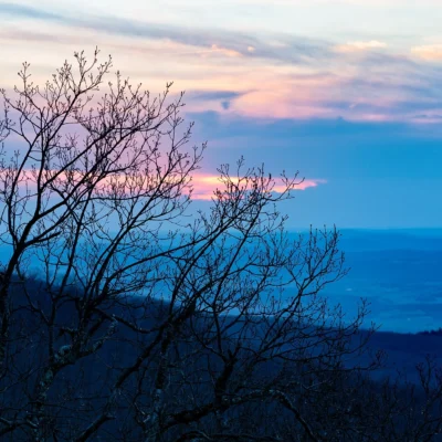
When to Visit
🌸 Spring (March – May)
Peak waterfall season. Cedar Falls at maximum flow after winter rains. Wildflowers on trails. Comfortable temperatures. Moderate crowds.
Best for: Waterfalls, wildflowers, hiking
☀️ Summer (June – August)
Hot and humid. Waterfall flow reduced. Lake Bailey swimming popular. Early morning hiking recommended. Shaded trails comfortable.
Best for: Lake swimming, early hiking, camping
🍂 Fall (October – November)
Fall foliage spectacular. Comfortable hiking weather. Crowds moderate. Some waterfall flow. Peak scenic beauty.
Best for: Fall colors, photography, pleasant hiking
❄️ Winter (December – February)
Quiet. Lodge fireplace lit. Occasional ice on trails. Strong waterfall flow after rain. Fewest crowds.
Best for: Solitude, lodge getaway, waterfall viewing
Practical Information
| Item | Details |
|---|---|
| 🎟️ Entry Fee | Free (Arkansas State Parks) |
| 🏕️ Camping | From $15/night; reservations at arkansasstateparks.com |
| 🏛️ Lodge | Reservations recommended; year-round |
| ⏰ Hours | 8 AM – 10 PM daily |
Getting There
- 📍 Address: 1285 Petit Jean Mountain Rd, Morrilton, AR 72110
- 📍 From Little Rock: ~75 miles northwest via I-40
- 📍 From Fort Smith: ~90 miles east via I-40
Frequently Asked Questions
How hard is the Cedar Falls Trail?
Moderate to strenuous. The 2-mile round trip includes significant elevation change descending to and ascending from the canyon floor. Most reasonably fit hikers complete it in 2 hours.
Is Seven Hollows Trail worth it?
Absolutely. The 4.5-mile loop is considered Petit Jean’s best hike—the geology that inspired the park’s creation. Allow 3-4 hours and expect creek crossings.
When is Cedar Falls flowing best?
Late winter through early spring after seasonal rains. Check recent rainfall—extended dry periods reduce flow significantly.
⭐ Where Arkansas State Parks Began
In 1923, this mountain became Arkansas’s first state park—and a century later, it remains one of the finest. Cedar Falls drops 95 feet into a canyon carved over millennia. Seven Hollows reveals the ancient geology that convinced early conservationists to protect this place. Mather Lodge, built by CCC workers in the 1930s, still welcomes guests with its stone fireplace and canyon views. This is where Arkansas’s park tradition began—and where it still shines brightest.
📍 Address: 1285 Petit Jean Mountain Rd, Morrilton, AR 72110
📞 Phone: (501) 727-5441
Geology and Formation
Petit Jean Mountain rises 1,120 feet above the Arkansas River Valley, its summit capped by a layer of Pennsylvanian-age sandstone deposited roughly 300 million years ago when this region lay beneath shallow coastal waters. Below this resistant caprock, softer shales and siltstones have eroded away over millennia, creating the dramatic cliff faces, deep canyons, and rock shelters that define the park’s landscape. Cedar Creek Canyon, the park’s centerpiece, was carved by the creek that feeds the 95-foot Cedar Falls — the largest waterfall in Arkansas accessible by trail. The canyon walls reveal millions of years of geological history in their layered sediments, and the overhanging bluffs contain petroglyphs and archaeological evidence of Native American habitation dating back over 10,000 years. The park also features unique geological curiosities including Bear Cave (a natural rock shelter formed by massive boulders), the Rock House Cave (containing ancient pictographs), and the Seven Hollows area where seven separate ravines converge in a natural amphitheater.
Cedar Falls and Canyon
The crown jewel of Petit Jean is Cedar Falls, a stunning 95-foot waterfall that plunges into a crystal-clear pool surrounded by towering sandstone walls draped in ferns and moss. The Cedar Falls Trail descends 1.5 miles from the canyon rim to the base of the falls, losing approximately 350 feet of elevation through a series of switchbacks and stone steps. The trail passes through diverse forest ecosystems — from dry ridgetop oak-hickory at the top to moist, hemlock-shaded ravine forest near the falls. Water flow varies dramatically with rainfall: after spring storms, the falls become a thundering cascade that fills the canyon with mist, while late summer may reduce the flow to a gentle veil. The pool at the base is popular for wading and photography, though swimming is discouraged due to unpredictable currents during high water.
History and Legend
Petit Jean Mountain takes its name from a romantic French legend. According to tradition, a young French woman disguised herself as a boy (using the name “Petit Jean” — Little John) to follow her explorer lover across the Atlantic to the New World. She traveled up the Arkansas River with French explorers, but fell ill and was buried atop the mountain that now bears her name. While historians consider this a legend rather than documented history, the story has been embraced by the local community, and a grotto near Mather Lodge marks the supposed burial site. Petit Jean became Arkansas’s first state park in 1923, and the Civilian Conservation Corps (CCC) built the rustic Mather Lodge, stone shelters, and many trails during the 1930s — infrastructure still in excellent use today.
Activities and Recreation
Beyond hiking, Petit Jean offers a 31-acre lake with fishing (bass, bream, catfish) and paddleboating, an Olympic-sized swimming pool open seasonally, miniature golf, tennis courts, and a nature center with native wildlife exhibits. The park’s location atop the mountain provides exceptional stargazing opportunities, and ranger-led astronomy programs are offered seasonally. Horseback riding is available at the park’s equestrian center, and mountain biking trails traverse the plateau forest. The 1930s-era Mather Lodge has 24 guest rooms, a restaurant with panoramic valley views, and a gift shop featuring Arkansas-made crafts and local art.
Planning Your Visit
A full-day visit allows time for the Cedar Falls hike (3 hours round trip), exploration of Bear Cave and Rock House Cave, and lunch at Mather Lodge. The Seven Hollows Trail loop adds a challenging but rewarding 4.4-mile circuit for those wanting more trail time. Overnight visitors can choose from lodge rooms, fully equipped cabins (some with hot tubs), tent campsites with electric and water hookups, or primitive backcountry sites. The park is located approximately 75 miles west of Little Rock via I-40 and Highway 154, making it an easy weekend getaway from the state capital.
Frequently Asked Questions
Are Arkansas state parks free?
Yes, all Arkansas state parks are free to enter. There are no entrance fees or vehicle permits. Camping, cabin, and lodge fees apply separately. The free admission makes them exceptionally accessible.
What are the best state parks in the Ozarks?
Top Ozark parks include Devil’s Den (sandstone caves), Petit Jean (canyon views), Mount Magazine (Arkansas’ highest point), and Hobbs State Park (lakeside trails near Beaver Lake).
Can I explore caves at Arkansas state parks?
Yes, Devil’s Den State Park features stunning sandstone caves and crevices that visitors can explore along marked trails. Blanchard Springs Caverns (US Forest Service) nearby offers guided cave tours.
What is the best time to visit Arkansas state parks?
Spring and fall are ideal. Spring brings dogwood and redbud blooms. Fall foliage peaks in late October. Summer is hot and humid. Winter is mild enough for comfortable hiking most days.
Explore More Arkansas State Parks
Petit Jean State Park is one of many outstanding state parks in Arkansas. Discover more parks in our Best State Parks in Arkansas guide, or use our Park Finder to search by activity, location, or features.
Make it a road trip: Pair a visit with Mount Nebo State Park (within about an hour’s drive) or Lake Sylvia Recreation Area (within about an hour’s drive).

Park Location
Plan your gear for Petit Jean State Park
From our editorial guides, matched to this park’s activities:

Top Tours & Activities Near Hot Springs
 from $67
 from $15
 from $20