💧 Where Rivers Spring From Rock — A six-unit park system spanning Idaho’s Snake River Canyon, with massive waterfalls erupting from volcanic cliff faces, a 250-foot-deep gorge, the Devil’s Washbowl, Ritter Island’s spring-fed falls, and one of the most unique geological landscapes in the American West
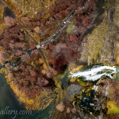
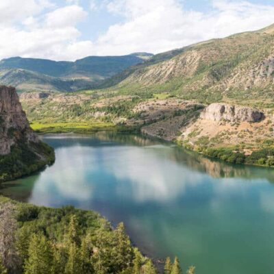
Along the northern rim of the Snake River Canyon in south-central Idaho, between the towns of Hagerman and Buhl, the earth performs a geological magic trick that has fascinated visitors for over a century. Thousands of natural springs burst directly from the basalt canyon walls — some as gentle seeps, others as thundering waterfalls — pouring millions of gallons of crystal-clear water per day into the Snake River below. This is Thousand Springs, one of the most remarkable hydrological features in North America, and the scattered parklands that protect these springs form Thousand Springs State Park: a six-unit system spread across the Magic Valley that offers some of the most dramatic waterfall scenery in the western United States.
The springs themselves are the terminus of the Lost River system — rivers and streams that sink into the porous volcanic rock of the Snake River Plain near Arco, Idaho, and travel underground through the massive Snake River Aquifer for decades before erupting from the canyon walls near Hagerman. Some of this water fell as rain or snow over 200 years ago. The result is a strikingly blue, year-round flow of some of the purest natural spring water in the world, cascading from basalt cliffs in ribbons, curtains, and torrents that transform the arid canyon into something closer to a tropical grotto.
The Six Park Units
1. Malad Gorge Unit
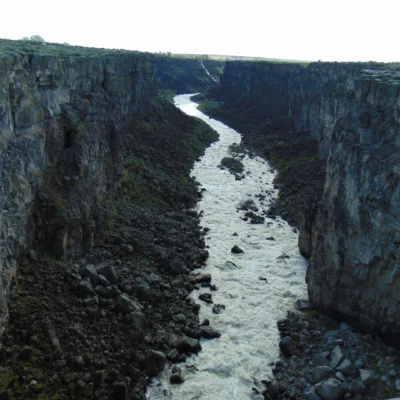
The most accessible and dramatic unit. The Malad River has carved a 250-foot-deep, 2.5-mile-long gorge through layers of volcanic basalt, creating sheer cliff walls and terminating at the Devil’s Washbowl — a powerful 60-foot waterfall where the river plunges into a churning cauldron of whitewater before joining the Snake River.
| Feature | Details |
|---|---|
| Gorge Depth | 250 feet |
| Devil’s Washbowl | 60-foot waterfall, viewable from bridge |
| Trail | Short paved paths along rim + bridge crossing gorge |
| Difficulty | Easy (wheelchair accessible to main overlook) |
| Picnic Area | Sheltered tables near gorge rim |
2. Ritter Island Unit
A lush, irrigated island in the Snake River canyon accessible by a winding road down the canyon wall. Historic agricultural buildings from the early Idaho settlement era sit amid green pastures fed by spring water, with several waterfalls visible from the island.
| Feature | Details |
|---|---|
| Lemmon Falls | Visible year-round from the island |
| Minnie Miller Falls | Best viewed from island trails |
| Access | Memorial Day – Labor Day (vehicle access seasonal) |
| Historic Structures | Early 1900s ranch buildings |
| Fishing | Snake River access — trout, bass |
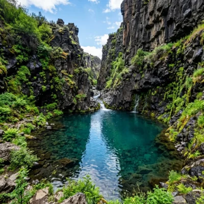
3. Earl M. Hardy Box Canyon Springs
A nature preserve protecting one of the largest natural springs in the US. An 11th-magnitude spring emerges from a box canyon in startlingly deep blue water, creating a 20-foot waterfall. The preserve has a short interpretive trail and viewing platform.
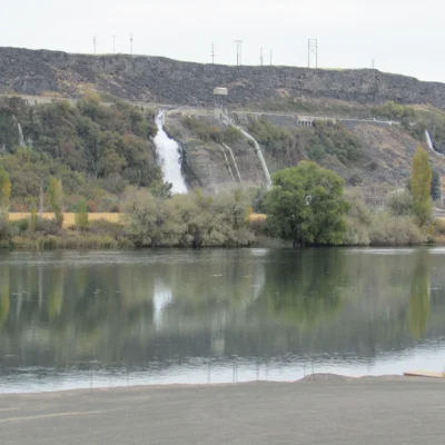
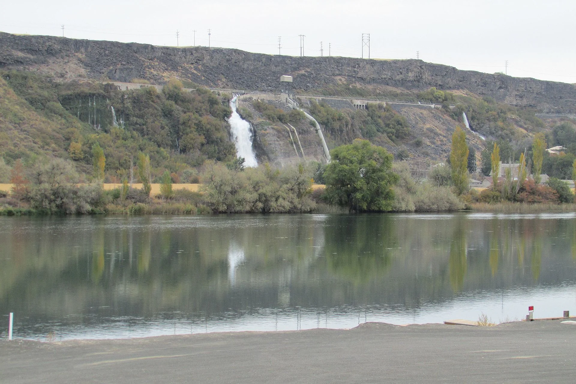
4. Niagara Springs
Named for its resemblance (in miniature) to Niagara Falls, this unit features a unique waterfall that emerges directly from the canyon wall — not flowing over the top, but bursting out of the rock face itself, dramatically illustrating the underground aquifer system.
5. Billingsley Creek Unit
A spring-fed creek popular for fly fishing (catch-and-release trout) with a small campground and picnic area. The creek’s constant temperature and clarity make it excellent habitat for rainbow and brown trout.
| Feature | Details |
|---|---|
| Fishing | Fly fishing, catch-and-release, rainbow/brown trout |
| Camping | Small campground with basic facilities |
| Activities | Fishing, picnicking, birdwatching |
6. Kelton Trail Unit
The most remote unit, featuring a historic emigrant trail and rugged canyon scenery. Primarily of interest to history enthusiasts and those seeking solitude.
Essential Visitor Information
| Detail | Information |
|---|---|
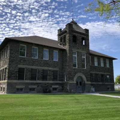
| Visitor Center | Located in Hagerman — start here for maps and orientation |
| Hours | Dawn to dusk (varies by unit) |
| Entrance Fee | $7 per vehicle (Idaho Parks motor vehicle fee, covers all units for the day) |
| Annual Pass | Idaho State Parks Passport $40/year |
| Camping | Billingsley Creek unit — basic campground |
| Phone | (208) 837-4505 |
Getting There
The park units are scattered along the Snake River Canyon between Hagerman and Buhl, Idaho, accessible from US Highway 30 (Thousand Springs Scenic Byway).
- From Twin Falls: 25-45 miles west depending on unit (~30-50 min)
- From Boise: 120 miles southeast (~2 hours)
- From Sun Valley/Ketchum: 80 miles south (~1.5 hours)
Suggested Route: Start at the Hagerman Visitor Center, then drive the Thousand Springs Scenic Byway (US-30) westward, stopping at Ritter Island, Niagara Springs, Box Canyon, and Malad Gorge in sequence. The full circuit takes 3-5 hours depending on time spent at each site.
Best Time to Visit
| Season | Highlights | Crowd Level |
|---|---|---|
| Spring (Apr-May) | Peak water flow, green canyon, Ritter Island opening | Low-Moderate |
| Summer (Jun-Aug) | All units open, fishing, full access | Moderate |
| Fall (Sep-Oct) | Autumn colors in canyon, quiet, excellent light | Low |
| Winter (Nov-Mar) | Icy falls, dramatic mist, some units closed | Very Low |
Nearby Attractions
- Hagerman Fossil Beds National Monument: Adjacent — Pliocene-era horse fossils, Snake River views
- Shoshone Falls: 30 miles east (Twin Falls) — 212-foot waterfall, “Niagara of the West”
- Snake River Canyon: Base jumping, zip line, Evel Knievel jump site
- Balanced Rock: 25 miles east — 40-foot balanced rock formation
- Craters of the Moon: 90 miles northeast — volcanic landscapes, lava tube caves
Wildlife & Nature
Thousand Springs SP — one of the most spectacular natural spring complexes in the world — where springs cascade from the canyon walls of the Snake River Canyon. Fed by water that traveled underground for 200 years through the Snake River Plain aquifer. The park’s springs, canyon, and river support bald eagles, ospreys, and rainbow trout.
What are the Thousand Springs in Idaho?
The Thousand Springs are natural springs that emerge from the basalt cliff walls of the Snake River Canyon in south-central Idaho. They are fed by the enormous Snake River Aquifer — water that entered the ground as rainfall or snowmelt far to the northeast, traveled underground through porous volcanic rock for decades (some over 200 years), and emerges as crystal-clear springs and waterfalls cascading from the canyon walls. The name refers to the numerous individual springs that were historically visible before irrigation diverted some of the flow.
Can you visit all six units of Thousand Springs State Park in one day?
Yes! The units are spread across approximately 20 miles along the Snake River Canyon and can be visited in a single day trip. Start at the Hagerman Visitor Center for maps, then drive the Thousand Springs Scenic Byway (US-30). Budget 3-5 hours to see the major units (Malad Gorge, Ritter Island, Box Canyon, Niagara Springs). A single vehicle entry fee covers all units for the day.
Is Thousand Springs the same as Shoshone Falls?
No. They are separate attractions approximately 30 miles apart. Thousand Springs State Park features springs erupting from canyon walls in multiple units near Hagerman. Shoshone Falls (often called the “Niagara of the West”) is a single massive 212-foot waterfall on the Snake River near Twin Falls. Both are spectacular and can be visited as part of the same Idaho trip.
More parks nearby: Ritter Island State Park is a short drive away, while Billingsley Creek State Park lies a short drive away.

Park Location
Plan your gear for Thousand Springs State Park
From our editorial guides, matched to this park’s activities: