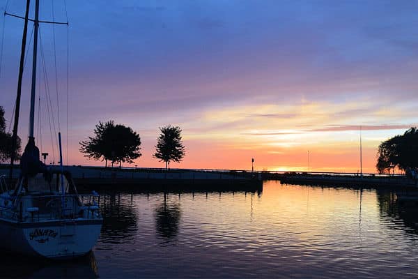
 Wisconsin boasts some of the most beautiful and enchanting state parks in the whole of America.
According to the Wisconsin DNR, the state’s parks, forests, trails and recreation areas see more than 20 million visits a year, and the state park system has nearly 156,000 acres of land open to visitors (checked October 2026).
For those living in or around Green Bay these state parks provide plenty of opportunity for outdoor recreational activities like swimming, hiking, boating and camping.
They also give you a fabulous chance to learn about nature and conservation too, as well as appreciate the beauty of the world we live in.
When the pressures of city life get too much, these state parks are the perfect place to head to for a bit of rest and relaxation.
But with so many to choose from, it can be difficult to know where to go. That is why we have come up with this selection of 9 wonderful state parks near Green Bay to give you some inspiration.
Map of State Parks Near Green Bay WI
Here is a map of the Wisconsin state parks covered in this post:
List of State Parks Near Green Bay
The 9 state parks showcased below are all situated within a couple of hours drive from the city. All of them are excellent destinations for day trips, and six of them (High Cliff, Point Beach, Potawatomi, Governor Thompson, Peninsula and Hartman Creek) also have campgrounds.
1. Lost Dauphin State Park
Distance from Green Bay: about 10 miles southwest of Green Bay (straight-line).
Location: 2940 Lost Dauphin Road, De Pere, Wisconsin 54115
Lost Dauphin State Park is a 19-acre state park on the Fox River just south of De Pere, operated locally by the Town of Lawrence, with rolling hiking trails and picnic areas; no vehicle admission sticker is required. Source: Wisconsin DNR, checked October 2026.
See our full Lost Dauphin State Park guide for fees, hours, and what to expect.
2. High Cliff State Park
Distance from Green Bay: about 28 miles southwest of Green Bay (straight-line).
Location: N7630 State Park Rd, Sherwood, WI 54169
High Cliff State Park has the distinction of being the only state-owned recreational area around Lake Winnebago, Wisconsin’s largest lake.
The 1,187-acre park lies on the northeast corner of Lake Winnebago. It takes its name from the magnificent limestone cliffs of the Niagara Escarpment, which runs parallel to Lake Winnebago’s eastern shore, and is notable for the impressive 12-foot statue of Winnebago Tribe Chief Red Bird, which stands high on a huge granite rock overlooking the lake.
An excellent spot for boating, fishing and hiking the lake also provides plenty of fabulous photograph opportunities too.
For those who want to camp here the park features a family campground that hosts 112 sites as well as eight group campsites.
There is also an accessible cabin for people with disabilities that sleeps up to six, and pets are permitted in the family and group campgrounds.
See our full High Cliff State Park guide for fees, hours, and what to expect.
3. Point Beach State Forest
Distance from Green Bay: about 32 miles southeast of Green Bay (straight-line).
Location: 9400 County Highway O, Two Rivers, WI 54241
Point Beach State Forest covers about 3,000 acres near Two Rivers in Manitowoc County, with 6 miles of sandy beach on Lake Michigan, the Rawley Point Lighthouse and a family campground of 127 sites, 70 of them with electricity. Source: Wisconsin DNR, checked October 2026.
See our full Point Beach State Forest guide for fees, hours, and what to expect.
4. Copper Culture State Park
Distance from Green Bay: about 26 miles north of Green Bay (straight-line).
Location: Oconto, WI
Copper Culture State Park covers 42 acres in Oconto County, Wisconsin.
Just west of Oconto, 42-acre Copper Culture State Park protects a prehistoric cemetery of the Old Copper Complex people (about 4000 to 2000 BC); you can walk the grounds along the Oconto River, and the Oconto County Historical Society runs the park and its museum, open Memorial Day to Labor Day. Source: Wisconsin DNR, checked October 2026.
See our full Copper Culture State Park guide for fees, hours, and what to expect.
5. Potawatomi State Park
Distance from Green Bay: about 38 miles northeast of Green Bay (straight-line).
Location: 3740 County Hwy PD, Sturgeon Bay, WI 54235
Beautifully positioned on the shore of Sturgeon Bay, Potawatomi State Park features 1,200 acres of steep slopes, rolling hills and breathtaking rugged limestone cliffs.
It lies in a bay within a bay, on Sturgeon Bay off the waters of Green Bay.
A lovely area to explore on foot, or by kayak, it has lots of trails and waterways dotted around the region.
The main campground here offers 123 sites, with 40 of them being set up with electricity. In addition there are also four group sites that can each accommodate 30 people, as well as a cabin by the bay in the south campground, which a committee of people with disabilities helped design.
The cabin has two hospital beds, a full-sized sofa sleeper and two cots for up to six people, a bathroom with a wheel-in shower, air conditioning, and a low counter with a refrigerator, microwave and stove.
Potawatomi State Park is a 1,200-acre (486 ha) Wisconsin state park northwest of the city of Sturgeon Bay, Wisconsin in the Town of Nasewaupee.
See our full Potawatomi State Park guide for fees, hours, and what to expect.
6. Fischer Creek State Recreation Area
Distance from Green Bay: about 42 miles south of Green Bay (straight-line).
Location: County Highway LS, Town of Centerville, Wisconsin
Fischer Creek State Recreation Area has about one mile of Lake Michigan shoreline, with wooded bluffs that rise up to 40 feet above the water, grasslands and wetlands; you can hike, picnic, watch wildlife and relax on the beach. Manitowoc County operates the property, and a vehicle admission sticker is required. Source: Wisconsin DNR, checked October 2026.
See our full Fischer Creek State Recreation Area guide for fees, hours, and what to expect.
7. Governor Thompson State Park
Distance from Green Bay: about 58 miles north of Green Bay (straight-line).
Location: N10008 Paust Ln, Crivitz, WI 54114
Boasting more than 2,800 acres of woods, the Governor Thompson State Park is a fabulous spot for those who love hiking and exploring.
The park has hiking trails you can explore on foot, and ski trails in winter.
Blessed with 6 miles of shoreline on the Caldron Falls Flowage, the park is also adjacent to the Peshtigo River, a popular free-flowing river for fly-fishing and canoeing.
There is also a 150-foot sand beach on Woods Lake for swimming, with a grassy sunning area, while the overall atmosphere is tranquil and relaxed.
A family campground is located on the northern side of the park, and accommodates 100 sites for tents, campers or RVs, across three different loops.
There are also three boat-in campsites here too, as well as a number of vault toilets and water fountains dotted throughout the campground.
Governor Thompson State Park is a 2,800-acre (1,133 ha) state park in Wisconsin, United States, about 14 miles (22 km) northwest of Crivitz (straight-line).
See our full Governor Thompson State Park guide for fees, hours, and what to expect.
8. Peninsula State Park
Distance from Green Bay: about 59 miles northeast of Green Bay (straight-line).
Location: 9462 Shore Rd, Fish Creek, WI 54212
Peninsula State Park boasts eight miles of Door County shoreline on Green Bay.
Considered by some to be one of the most complete state parks in Wisconsin, Peninsula boasts a wonderful sandy beach, an 18 hole golf course, a historic lighthouse and several miles of hiking and biking trails.
It also runs a theater in the summer and has both a public boat launch, and a pier, that offers terrific opportunities for fishing. In addition there is playground equipment for the kids and a general camp store for all your basic supplies too.
Accommodating five campgrounds that between them house 468 family sites, the park also features three group campsites for tent camping.
Peninsula State Park is a Wisconsin state park with eight miles (13 km) of Green Bay shoreline in Door County.
See our full Peninsula State Park guide for fees, hours, and what to expect.
9. Hartman Creek State Park
Distance from Green Bay: about 61 miles west of Green Bay (straight-line).
Location: N2480 Hartman Creek Rd, Waupaca, WI 54981Situated on the picturesque Chain O’ Lakes, Hartman Creek State Park is a state park of about 1,500 acres that is located near the town of Waupaca.
It will take you about 75 minutes to drive there from Green Bay, but once you arrive you can swim at the 300-foot sand beach on Hartman Lake or paddle to crystal-clear Marl Lake.
Throughout the state park there are a number of wonderful trails – including the Ice Age National Scenic Trail – that you can explore on foot, via horseback or mountain bike. You will also find plenty of excellent spots for fishing, as well as the Hellestad House log cabin, and four picnic areas too.
The park also has a family campground with 103 sites, as well as five group camping sites. These are located in either a red pine forest, or an old apple orchard. Both of which provide scenic settings.
Hartman Creek State Park is a Wisconsin state park of about 1,500 acres (about 610 ha) west of Waupaca, Wisconsin.
See our full Hartman Creek State Park guide for fees, hours, and what to expect.