
Picacho Peak State Park: Arizona’s Wildflower Volcano
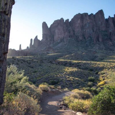
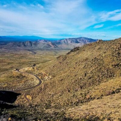
Rising 1,500 feet from the Sonoran Desert floor between Phoenix and Tucson, Picacho Peak is one of Arizona’s most recognizable landmarks — a dramatic volcanic spire that has guided travelers for thousands of years. The 3,747-acre state park surrounding it preserves a landscape of towering saguaro cacti, challenging cable-assisted summit trails, and one of the most spectacular wildflower super blooms in the American West.
But Picacho Peak is more than stunning desert scenery. This is where the westernmost Civil War battle with casualties took place — the Battle of Picacho Pass on April 15, 1862, when Confederate and Union forces clashed in the Arizona desert. Today, the park offers everything from gentle nature walks through saguaro forests to heart-pumping, hand-over-hand cable climbs to the summit, where panoramic views stretch across the desert in every direction.
Park Facts at a Glance
| Information | Details |
|---|---|
| 📍 Location | Picacho, Pinal County, Arizona (I-10 exit 219) |
| 📐 Park Size | 3,747 acres |
| ⛰️ Peak Elevation | 3,374 feet (1,500 ft above desert floor) |
| 🏛️ Established | May 30, 1968 |
| 🕐 Hours | 5:00 AM – 8:00 PM daily (closed Christmas) |
| 💰 Entry Fee | $10/vehicle (1 person), $20/vehicle (2-4 people) |
| 🏕️ Camping | 85 sites with electric hookups |
| 📞 Phone | (520) 466-3183 |
| 🌐 Website | azstateparks.com |
| ⭐ Highlights | Wildflower blooms, cable-assisted summit, Civil War site |
The Summit: Cable-Assisted Desert Climbing
The crown jewel of Picacho Peak is the Hunter Trail — a strenuous 2-mile climb up the north face to the 3,374-foot summit. This isn’t a casual walk. The final section involves steel cable anchors bolted into the rock that you grip hand-over-hand to haul yourself up steep, exposed volcanic faces. It’s thrilling, demanding, and rewards you with 360-degree desert panoramas stretching from the Santa Catalina Mountains to the distant peaks around Phoenix.
The climb typically takes 2-3 hours up and 1.5-2 hours down. Gloves are strongly recommended to protect your hands on the cables, and the trail is entirely exposed to sun — start early.
Top Trails
| Trail | Distance | Difficulty | Highlight |
|---|---|---|---|
| Hunter Trail | 2 mi one-way | Strenuous | Cable-assisted summit climb, 360° views |
| Sunset Vista Trail | 3 mi one-way | Moderate-Strenuous | South approach, connects to Hunter Trail |
| Calloway Trail | 0.5 mi one-way | Moderate | Saguaro forest views, less crowded |
| Nature Trail | 0.5 mi loop | Easy | Interpretive signs, desert vegetation |
| Children’s Cave Trail | 0.2 mi one-way | Easy | Small cave, great for kids |
The Sunset Vista Trail (3 miles) approaches the peak from the south and can connect with the Hunter Trail for a challenging loop. For a more relaxed experience, the Calloway Trail offers beautiful views of the saguaro forest without the cable sections.
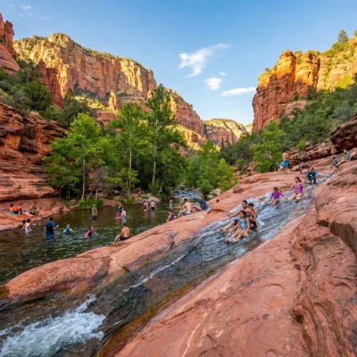
Wildflower Super Blooms
Picacho Peak is one of Arizona’s premier wildflower destinations. When winter and fall rains cooperate, the slopes erupt in stunning displays of:
- Mexican Gold Poppies: The star of the show — bright yellow-orange flowers carpeting entire hillsides
- Lupine: Purple blooms mixing with poppies for spectacular color combinations
- Owl’s Clover: Pink-purple flowers adding variety to the palette
- Brittlebush: Yellow daisy-like flowers on silver-leafed shrubs
- Saguaro Blossoms: Arizona’s state flower, blooming white in late spring (May-July)
Peak bloom: Typically mid-March, but varies dramatically with rainfall. Follow the park’s social media or call ahead for current conditions. A “super bloom” year draws photographers from around the world.
Civil War History: Battle of Picacho Pass
On April 15, 1862, Picacho Peak became the site of the Battle of Picacho Pass — the largest Civil War engagement in Arizona and the westernmost battle in the war to result in fatalities. A dozen Union cavalry soldiers from California clashed with a small Confederate patrol in the mesquite thickets at the base of the peak.
The battle lasted over an hour, resulting in three Union deaths (including Lieutenant James Barrett, one of the first Union officers killed in the Arizona Territory) and several wounded on both sides. Though a relatively small skirmish, it successfully delayed Union forces from making a surprise attack on Tucson. Historical markers throughout the park commemorate this engagement.
Camping
| Option | Cost/Night | Season | Features |
|---|---|---|---|
| Standard Sites (Sep-May) | $50/vehicle | Peak season | Electric hookup, picnic table, fire ring |
| Standard Sites (Jun-Aug) | $40/vehicle | Off-peak (hot!) | Same amenities, lower price |
| Rustic Camping (Oct-Apr) | $25/night | Cool season only | No hookups, basic site |
| Group Sites | By reservation | Year-round | Rustic, no hookups |
| Second Vehicle | +$15/night | Year-round | Additional vehicle at same site |
The park has 85 tent and RV sites with picnic tables, fire rings, and electric hookups. Two modern, handicap-accessible restroom and shower buildings serve campers. An off-leash dog park is available for registered campers — a rare perk among Arizona state parks.
Seasonal Guide
| Season | Highlights | What to Pack |
|---|---|---|
| 🌸 Spring (Mar-May) | WILDFLOWER SEASON, best hiking weather (70-85°F) | Camera, sun hat, water, wildflower guide |
| ☀️ Summer (Jun-Aug) | Extreme heat (105-115°F), no summit hiking | Avoid hiking, water activities elsewhere |
| 🍂 Fall (Sep-Nov) | Cooling temps, saguaro fruit, clear skies | Layers, camera, hiking gear |
| ❄️ Winter (Dec-Feb) | Mild days (60-70°F), excellent hiking, sunsets | Warm layers for mornings, sun protection |
Wildlife
The park’s Sonoran Desert setting supports a rich variety of wildlife:
- Large Mammals: Bighorn sheep (rare but present), mule deer, javelina (collared peccary), coyote
- Small Mammals: Jackrabbits, cottontails, ringtails (AZ state mammal — rarely seen), ground squirrels
- Reptiles: Western diamondback rattlesnake, Gila monster (venomous but rare), desert tortoise, chuckwalla
- Birds: Greater roadrunner, Gila woodpecker, cactus wren (AZ state bird), Harris’s hawk, Gambel’s quail
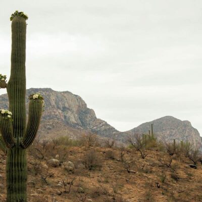
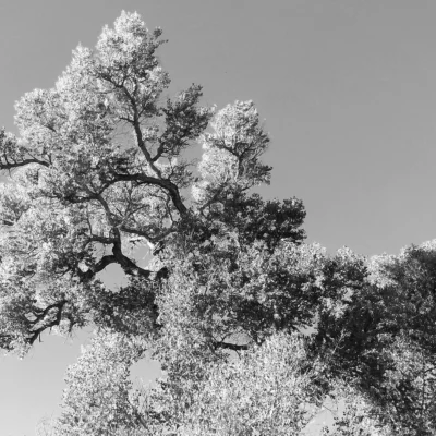
- Flora: Saguaro cactus (up to 60 ft tall, 200 years old), prickly pear, cholla, ocotillo, palo verde, ironwood
Budget Planner
| Expense | Cost | Notes |
|---|---|---|
| Day Entry (1 person) | $10/vehicle | Walk-in/bike $5 |
| Day Entry (2-4 people) | $20/vehicle | Best value for groups |
| Camping (Peak Season) | $50/night | Sep-May, includes hookup |
| Camping (Summer) | $40/night | Jun-Aug, includes hookup |
| AZ State Parks Annual Pass | $75 | Unlimited day-use entry |
| Climbing Gloves | $10-$25 | Essential for Hunter Trail cables |
Nearby Attractions
- Saguaro National Park — Two districts near Tucson, 50 miles southeast
- Casa Grande Ruins National Monument — Ancient Hohokam ruin, 25 miles north
- Tucson — Arizona-Sonora Desert Museum, Pima Air Museum (50 mi south)
- Phoenix — Desert Botanical Garden, South Mountain (60 mi north)
- Ironwood Forest National Monument — Remote desert wilderness, 40 mi southwest
- Tom Mix Monument — Roadside memorial to the silent film cowboy star, 5 miles south on I-10
Safety and Tips
- Start early: Begin summit hikes at dawn, especially October-May. The trail is fully exposed
- Bring gloves: Leather or mechanics gloves are essential for the cable sections
- Water: Carry at least 2-3 liters per person for the summit hike. There is no water on the trail
- Snakes: Watch for rattlesnakes on trails, especially in warmer months
- Saguaros: It’s illegal to damage saguaro cacti in Arizona — do not touch, carve, or lean against them
- Wildflower etiquette: Stay on trails during bloom season. Do not pick flowers or trample vegetation for photos
Frequently Asked Questions
How hard is the Hunter Trail at Picacho Peak?
The Hunter Trail is rated strenuous. The 2-mile climb gains about 1,500 feet in elevation, with the final sections requiring hand-over-hand cable climbing on steep, exposed volcanic rock. You’ll need upper body strength, comfort with heights, and proper footwear. Budget 2-3 hours up and 1.5-2 hours down. Gloves are essential for the cable sections.
When do wildflowers bloom at Picacho Peak?
Wildflowers typically peak around mid-March, but timing varies dramatically based on fall and winter rainfall. In a good rain year, millions of yellow-orange Mexican poppies carpet the hillsides in a “super bloom.” Call the park or check social media for current bloom status. Drought years may produce minimal flowers.
Can I hike Picacho Peak in summer?
No — the park strongly advises against summit hikes from June through August. Temperatures at the exposed summit regularly exceed 115°F. The trail has no shade, no water, and heat-related rescues are common. The park remains open for camping and easy trails near the base, but summit hiking should be reserved for cooler months (October-April).
Can dogs hike the Hunter Trail?
Leashed dogs are allowed on the Hunter Trail only up to the saddle/cable section. Dogs cannot safely navigate the cable-assisted portions and are not permitted beyond this point. The Sunset Vista Trail allows dogs to a similar point. For dog-friendly hiking, the Calloway Trail and Nature Trail are fully accessible with leashed pets.
What Civil War battle happened at Picacho Peak?
The Battle of Picacho Pass occurred on April 15, 1862, between Union cavalry from California and a Confederate patrol. It was the westernmost Civil War battle to result in fatalities and the largest Civil War engagement in Arizona. Three Union soldiers were killed, including Lt. James Barrett. Historical markers in the park tell the story of this lesser-known but significant battle.
How much does it cost to enter Picacho Peak State Park?
Day-use entry is $10 per vehicle with one person, or $20 per vehicle for 2-4 people. Walk-ins and cyclists pay $5. The Arizona State Parks Annual Pass ($75) provides unlimited day-use access to all Arizona state parks and is great value if you plan to visit multiple parks.
Where is Picacho Peak located?
Picacho Peak State Park is located along Interstate 10 at exit 219, roughly halfway between Phoenix and Tucson — about 60 miles from either city. The prominent peak is visible from the highway, making it a popular stop for travelers passing between Arizona’s two largest cities.
Getting There
Picacho Peak State Park is located directly off Interstate 10 at exit 219, between Phoenix and Tucson:
- Tucson: 50 miles northwest (45 min)
- Phoenix: 60 miles southeast (1 hr)
- Casa Grande: 25 miles south (25 min)
Address: 15520 E Picacho Peak Rd, Picacho, AZ 85141
Explore More Arizona State Parks
Picacho Peak State Park is one of many outstanding state parks in Arizona. Discover more parks in our Best State Parks in Arizona guide, or use our Park Finder to search by activity, location, or features.
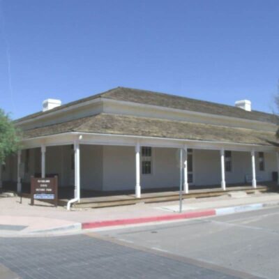
Make it a road trip: Pair a visit with McFarland State Historic Park (within about an hour’s drive) or Catalina State Park (within about an hour’s drive).

Park Location

Top Tours & Activities Near Tucson
 from $55
 from $50
 from $69