🏆 Researched by State Park Experts — Based on Florida State Parks data, National Register of Historic Places records, and National Underground Railroad Network to Freedom documentation for this 409-acre barrier island park
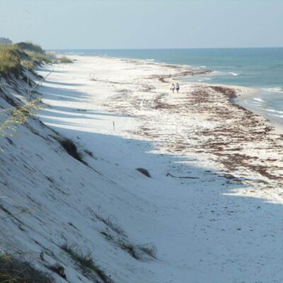
There’s a moment on the beach at Bill Baggs Cape Florida State Park when you look north and see the Miami skyline rising out of the heat haze like a mirage—glass towers shimmering in the afternoon light, a city of 6 million people going about its business—and then you look south and see nothing but turquoise water, white sand, and the oldest standing structure in Miami-Dade County: a lighthouse built in 1825. That contrast—urban megacity behind you, wild barrier island ahead—defines the Bill Baggs experience. This is Miami’s escape from Miami, a mile-long sweep of pristine Atlantic beach at the southern tip of Key Biscayne that has been ranked among the top ten beaches in America by multiple publications, and it exists precisely because someone had the foresight to protect it.
Bill Baggs Cape Florida State Park encompasses 409 acres at the southernmost point of Key Biscayne, a barrier island connected to Miami by the Rickenbacker Causeway. The park protects coastal strand, mangrove wetlands, seagrass flats, and over a mile of Atlantic beachfront, along with the historic Cape Florida Lighthouse and its restored keeper’s cottage. The lighthouse itself tells one of the most dramatic stories in Florida history—attacked and burned by Seminole warriors in 1836, rebuilt, raised to 95 feet, decommissioned, and relighted a century later—and today you can climb its 109 iron spiral steps for panoramic views of Biscayne Bay, the Atlantic Ocean, and the Miami skyline.
But the real draw at Bill Baggs is the beach. The emerald-clear water, protected by an offshore reef that calms the surf, laps onto fine coral sand that stays cool enough to walk on barefoot even in August. There are no high-rises, no jet skis, no boardwalk vendors—just natural coastline, palm shade, and the sound of waves. Combined with excellent biking trails, kayak launches, two waterfront restaurants, mangrove nature trails, and a rich birding habitat, Bill Baggs delivers a complete day-trip experience that feels like it belongs in the Caribbean rather than ten minutes from South Beach.
History: The Cape Florida Lighthouse & Underground Railroad
The Cape Florida Lighthouse was first lit in 1825 to guide ships through the treacherous Florida Channel between the reef and the mainland. At 65 feet tall, it was one of the first permanent structures in what would become Miami-Dade County, and it stood watch over a coastline that was, at the time, part of the Seminole homeland.
In 1836, during the Second Seminole War, a band of Seminole warriors attacked the lighthouse. The keeper, John Thompson, and his assistant, Aaron Carter, retreated up the tower as the attackers set fire to the wooden door and stairs. Carter was killed, and Thompson—severely wounded and trapped on the burning platform—made the desperate decision to throw a keg of gunpowder down the shaft, creating an explosion he hoped would attract the attention of a Navy vessel offshore. The gamble worked. The USS Motto rescued Thompson, who survived, and the lighthouse was rebuilt with fireproof brick construction in 1846. In 1855, the tower was raised to its current 95 feet and fitted with a powerful second-order Fresnel lens.
Perhaps less known but equally significant, the Cape Florida area served as a departure point for escaped slaves seeking freedom in the British Bahamas during the 1820s–1840s. Recognizing this history, the National Park Service designated the park as part of the National Underground Railroad Network to Freedom—a reminder that this beautiful beach was once a place of desperate courage and the final step on a journey from bondage to liberty.
Beach Guide
The park’s beach stretches over a mile along the Atlantic coast, with numbered beach access points and facilities distributed along its length. The water is remarkably clear—tinted emerald and turquoise by the sandy bottom and seagrass beds—and an offshore reef breaks the largest swells, creating gentle wave conditions that are ideal for swimming and wading.
| Beach Area | Features | Best For |
|---|---|---|
| Beach Access #1–3 (North) | Closer to entrance, kayak launch at #1 | Kayaking, quieter swimming, early arrivals |
| Beach Access #4–6 (Central) | Lighthouse Cafe nearby, Mobi Mat at #6, umbrella/chair rentals | Families, dining access, wheelchair beach access |
| Beach Access #7–8 (South/Lighthouse) | Near lighthouse, rocky shore for snorkeling, most scenic | Photography, snorkeling near rocks, lighthouse views |
Important: There are no lifeguards on duty. The beach is generally safe for swimming, but check the Beach Warning Flags posted at the ranger station. Rip currents can occur, particularly near the southern tip. Beach wheelchairs and a swimming wheelchair are available free of charge—ask at the entrance station.
Trail Guide
| Trail | Distance | Difficulty | Highlights |
|---|---|---|---|
| Paved Bike/Walk Path | 1.5 mi one-way | Easy (paved) | Runs length of park from entrance to lighthouse; bike/pedestrian |
| Mangrove Wetlands Trail | 1.5 mi | Easy | Boardwalk through mangrove habitat; wading birds, crabs, fish |
| Robin’s Birding Trail | 0.5 mi | Easy | Prime birding habitat; migratory warblers, raptors, shorebirds |
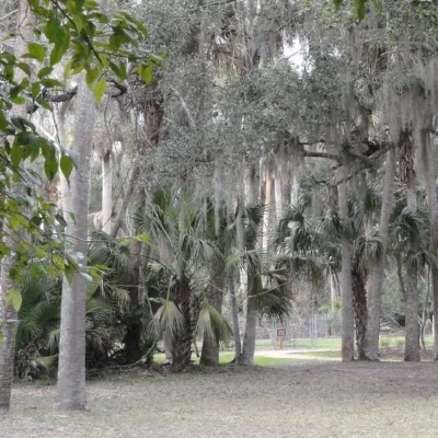
| Coastal Strand Trail | 0.8 mi | Easy | Sea grape and coastal vegetation; connects beach to bay side |
| Bill Baggs Lighthouse Trail | 0.3 mi | Easy | Bay-side views, No Name Harbor overlook |
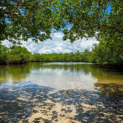
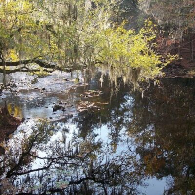
The Mangrove Wetlands Trail is the park’s best nature trail—a 1.5-mile walk through a red mangrove ecosystem where the tangled root systems serve as nurseries for juvenile fish, crabs, and shrimp. Great blue herons, roseate spoonbills, yellow-crowned night herons, and white ibis are commonly spotted from the boardwalk sections, and during fall migration (September–November), the trail is one of the best birding spots in Miami-Dade County.
Lighthouse Tours
Free tours of the Cape Florida Lighthouse and the restored keeper’s cottage are offered Thursday through Monday at 10:00 AM and 1:00 PM (weather permitting). The tour includes a guided climb of the lighthouse’s 109 iron spiral steps to a platform with 360-degree views of the Atlantic, Biscayne Bay, the Miami skyline, and on clear days, the northern Keys. Children must be at least 42 inches tall to climb. The keeper’s cottage has been restored to its 1850s appearance and contains period furnishings and interpretive displays about lighthouse keeping on the Florida frontier.
No Name Harbor
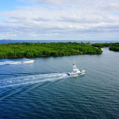
On the Biscayne Bay side of the park, No Name Harbor provides a protected anchorage for sailboats and powerboats, with a seawall for fishing, a picnic area, and the waterfront Boater’s Grill restaurant. The harbor is a popular departure point for sailors heading to the Bahamas (Bimini is 48 miles east), and on any given weekend you’ll see a mix of cruising sailboats, fishing boats, and kayakers. Overnight boat camping is available at $20/night per vessel.
Best Time to Visit: A Seasonal Guide
| Season | Weather | Crowds | Best For |
|---|---|---|---|
| Winter (Dec–Feb) | 68–78°F, low humidity | High (snowbirds) | Perfect beach weather, best birding migration, comfortable humidity |
| Spring (Mar–May) | 75–85°F, moderate | Moderate–High | Warm water, spring break, nesting sea turtles begin May |
| Summer (Jun–Aug) | 85–92°F, very humid | Moderate | Warmest water, afternoon thunderstorms, sea turtle nesting, locals’ park |
| Fall (Sep–Nov) | 80–88°F, hurricane risk | Low | Best birding (fall migration), fewest crowds, hurricane season caution |
Winter is prime time at Bill Baggs—perfect beach weather, lower humidity, and the best birding of the year as migratory species flock to the park’s mangroves and coastal strand. The trade-off is crowds: weekend parking fills by 10 AM in January and February. For the best experience, arrive before 9 AM on weekends or visit midweek.
Photography Guide
📸 Best Photo Opportunities & Settings
• Lighthouse at Sunset: Position yourself on the beach south of the lighthouse for the classic composition: white lighthouse against a warm sunset sky with palm trees and turquoise water. Golden hour magic. 35-70mm, f/8.
• Miami Skyline from Beach: Looking north from the beach, the downtown Miami skyline rises above the water. Best at blue hour (20 min after sunset) when city lights begin to glow. 70-200mm, f/8, tripod essential.
• Lighthouse Interior Spiral: The 109-step iron spiral staircase creates a mesmerizing spiral composition from below. Look straight up or down for the full effect. 14-16mm ultra-wide, f/8, high ISO.
• Mangrove Reflections: Calm mornings in the mangrove wetlands produce mirror-like reflections. Overcast skies eliminate harsh shadows. 24-70mm, f/8, polarizing filter to control reflections.
• Birds in Flight: Roseate spoonbills, pelicans, and ospreys are regularly photographed from the trails. 150-600mm telephoto, 1/2000s shutter speed, continuous AF.
Budget Planning
| Expense | Cost | Notes |
|---|---|---|
| Park Entry (per vehicle) | $8 | 2–8 people; single occupant/motorcycle $4; pedestrian/bike $2 |
| Rickenbacker Causeway Toll | $2.25 | Each way; SunPass discount available |
| Lighthouse Tour | Free | Thu–Mon, 10 AM and 1 PM |
| Bike Rental | $15–30 | Single and quad bikes at Lighthouse Cafe concession |
| Chair/Umbrella Rental | $15–30 | Available at beach concessions |
| Lunch (Lighthouse Cafe) | $12–25/person | Casual beach dining; Cuban specialties, seafood |
| Kayak Rental | $25–40/hr | Ocean kayaks at beach concession |
| Day Trip Total | $25–100 | Family of 4, including lunch and one activity |
Wildlife
| Species | Best Season | Where to Look | Notes |
|---|---|---|---|
| 🦩 Roseate Spoonbill | Year-round | Mangrove Wetlands Trail | Bright pink wading birds; feed in shallow water, best early morning |
| 🐢 Sea Turtles (Loggerhead) | May–Oct | Beach (nesting) | Nest on the beach May–October; hatchlings emerge Jun–Nov; do not disturb nests |
| 🐬 Bottlenose Dolphins | Year-round | Offshore from beach, No Name Harbor | Pods frequently visible from beach; often feeding near shore in morning |
| 🦅 Osprey | Year-round | Channel markers, lighthouse area | Nesting platforms visible; dramatic fish-catching dives |
| 🦎 Knight Anole | Year-round | Trees throughout park | Large green lizard (up to 18 inches); introduced species, harmless, common |
| 🐟 Seahorses | Year-round | Seagrass near rocky shoreline | Occasionally spotted while snorkeling near lighthouse rocks; rare and exciting |
Safety & Hazards
| Hazard | Risk Level | Prevention |
|---|---|---|
| ☀️ Sun/Heat | Very High | Little natural shade on beach. Bring sun protection, water, and umbrella. Heatstroke risk real in summer. Hydrate aggressively |
| 🌊 No Lifeguards | Moderate | No lifeguards on duty. Swim near other people. Watch for rip currents at southern tip. Check Beach Warning Flags |
| 🪼 Portuguese Man-of-War | Moderate (seasonal) | Beach patrol posts warnings when present. Do not touch blue-tentacled organisms on sand. Vinegar for stings |
| 🅿️ Parking Capacity | High (weekends) | Park closes when capacity is reached on busy weekends. Arrive before 9 AM. Consider biking from Crandon Park |
| 🌀 Hurricanes | Seasonal (Jun–Nov) | Park closes during tropical weather. Check forecasts before visiting during hurricane season |
Visitor Information
| Detail | Information |
|---|---|
| Address | 1200 S. Crandon Blvd., Key Biscayne, FL 33149 |
| Phone | (305) 361-5811 |
| Hours | 8:00 AM – Sunset, 365 days/year |
| Entry Fee | $8/vehicle (2-8 people); $4 single/motorcycle; $2 pedestrian/bike |
| Lighthouse Tours | Free, Thu–Mon, 10 AM and 1 PM |
| Dining | Lighthouse Cafe (beachside), Boater’s Grill (bay-side at No Name Harbor) |
| Boat Camping | No Name Harbor, $20/boat/night |
| Picnic Pavilions | 18 available, some reservable for events |
Getting There & Nearby Attractions
Bill Baggs Cape Florida State Park is located at the southern tip of Key Biscayne, accessible via the Rickenbacker Causeway from downtown Miami. The drive from South Beach takes approximately 20 minutes. Note the $2.25 toll (each way) on the causeway. From Miami International Airport, the drive is approximately 30 minutes via I-95 and the Rickenbacker Causeway.
| Attraction | Distance | Drive Time | Highlights |
|---|---|---|---|
| Crandon Park Beach | 2 mi | 5 min | Larger beach with lifeguards, marina, nature center, family cabanas |
| Miami Seaquarium | 4 mi | 10 min | Marine park on Virginia Key; dolphins, sea lions, reef aquarium |
| Vizcaya Museum & Gardens | 7 mi | 15 min | Italian Renaissance villa and gardens on Biscayne Bay |
| Biscayne National Park | 25 mi | 35 min | Snorkeling and diving on pristine coral reefs; glass-bottom boat tours |
| Everglades National Park | 40 mi | 50 min | Shark Valley tram, Anhinga Trail, airboats, mangrove kayaking |
Frequently Asked Questions
Is Bill Baggs Cape Florida State Park worth visiting?
Absolutely—Bill Baggs is consistently ranked among the top beaches in the United States, and for good reason. The combination of a pristine Atlantic beach, the historic Cape Florida Lighthouse (oldest structure in Miami-Dade County), mangrove nature trails, waterfront dining, and proximity to downtown Miami makes it one of the most complete day-trip experiences in South Florida. If you have even half a day in the Miami area and want a beach experience that feels genuinely natural rather than urban, Bill Baggs is the answer.
Can I climb the Cape Florida Lighthouse?
Yes—free guided tours that include climbing the 109 iron spiral steps are offered Thursday through Monday at 10:00 AM and 1:00 PM. The view from the top includes Biscayne Bay, the Atlantic Ocean, and the Miami skyline. Children must be at least 42 inches tall to climb. Tours may be cancelled during severe weather. No reservation needed; tours are first-come, first-served.
Is the water good for swimming?
The water at Bill Baggs is excellent for swimming—clear, warm year-round (72–86°F), and calmed by an offshore reef that reduces wave energy. However, there are no lifeguards on duty, so swim near others and check the Beach Warning Flags at the ranger station. Rip currents can occasionally occur near the southern tip of the island. Beach wheelchairs and a swimming wheelchair are available free of charge.
Does the park get crowded?
Yes, particularly on winter weekends (January–March) when perfect weather draws large crowds. The park closes when maximum capacity is reached, which can happen by 10 AM on busy Saturdays. To guarantee entry, arrive before 9 AM. Weekdays are significantly less crowded year-round. An alternative approach is to bike to the park from Crandon Park, bypassing vehicle capacity limits.
What is No Name Harbor?
No Name Harbor is a protected anchorage on the Biscayne Bay side of the park, popular with boaters heading to the Bahamas (Bimini is 48 miles east). The harbor features a seawall for fishing, picnic areas, restrooms, and the Boater’s Grill restaurant. Overnight boat camping is available at $20 per vessel per night. Even if you don’t have a boat, No Name Harbor is worth visiting for sunset views over Biscayne Bay and excellent fishing from the seawall.
Nearby state parks: If you have extra time, Bill Baggs Cape State Park is a short drive away, and Cape Florida State Park is a short drive away.
🏖️ Ready for Miami’s Most Beautiful Beach?
Walk a mile of Atlantic coastline, climb the oldest lighthouse in Miami-Dade County, kayak through mangrove tunnels, and dine waterfront—all within minutes of South Beach.
How much does it cost to enter a Florida state park?
Most Florida state parks charge $4 to $6 per vehicle (up to 8 occupants). An individual annual pass costs $60, and a family annual pass costs $120, covering unlimited visits to all state parks.
Can I swim with manatees at Florida state parks?
While you cannot swim with manatees (they are protected), several spring parks like Blue Spring State Park offer excellent viewing from boardwalks. Manatees gather in springs from November through March when river temperatures drop.
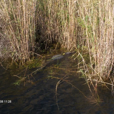
Are alligators dangerous in Florida state parks?
Alligators are present in virtually all freshwater bodies in Florida. They are generally not aggressive toward humans, but you should never approach, feed, or harass them. Keep children and pets at a safe distance from water edges.
What is the best time to visit Florida state parks?
Winter and spring (November through April) offer the best conditions: pleasant temperatures, low humidity, fewer mosquitoes, and peak manatee viewing. Summer brings extreme heat, humidity, and daily thunderstorms.
Explore More Florida State Parks
Bill Baggs Cape Florida State Park is one of many outstanding state parks in Florida. Discover more parks in our Best State Parks in Florida guide, or use our Park Finder to search by activity, location, or features.

Park Location
Plan your gear for Bill Baggs Cape Florida State Park
From our editorial guides, matched to this park’s activities: