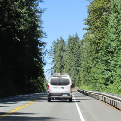
Unlike a traditional state park with a consolidated entrance and a single main loop of attractions, Forks of the Sky State Park is uniquely distributed. It consists of a 1,300-acre collection of stunning day-use areas, rugged trails, and climbing sites strung intermittently along the deeply scenic U.S. Highway 2 corridor near the town of Index, Washington.
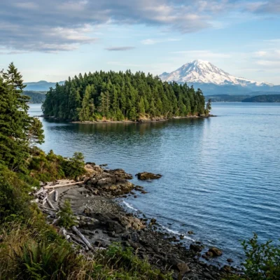
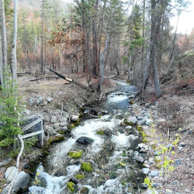
Administered as a satellite property by the much larger Wallace Falls State Park, Forks of the Sky is heavily defined by the free-flowing, emerald-green waters of the Skykomish River and the jagged, granite spires of the Cascade Mountains. From the legendary rock climbing routes of the Index Town Wall to the moss-draped, old-growth hiking trails leading to hidden alpine lakes, this “decentralized” park is an absolute paradise for serious outdoor adventurers and white-water enthusiasts.
Forks of the Sky State Park at a Glance
- Location: Multiple access points along U.S. Hwy 2 near Index, WA 98256 (Snohomish County)
- Entry Fee: A Washington Discover Pass ($10 daily / $30 annual) is required for vehicle access.
- Main Attractions: The Skykomish River, Index Town Wall climbing, Lake Serene Trail
- Water Activities: World-class whitewater kayaking, riverside beaches for swimming, and fly fishing.
- Pet Policy: Leashed dogs are permitted on most trails and at the riverside day-use areas.
World-Class Rock Climbing: The Index Town Wall
For rock climbers across the Pacific Northwest, the name “Index” commands immense respect. The park encompasses the Stimson Bullitt Climbing Preserve, more commonly known as the Index Town Wall. These sheer, 500-foot vertical granite cliffs tower ominously over the river valley and offer some of the highest-quality, most technically demanding traditional crack climbing and sport routes in the state of Washington.
With over 500 documented routes ranging from challenging to downright extreme, it is a vertical playground. Even if you aren’t a climber, the steep, heavily switchbacked hiking trail leading to the top of the Upper Town Wall is well worth the sweat, rewarding hikers with dizzying, panoramic views of Mount Index, Mount Persis, and the winding Skykomish River below.
Hiking and Riverside Recreation
If you prefer to keep your feet firmly on the ground or in the water, the various disconnected units of Forks of the Sky offer plenty of distinct experiences just off the highway.
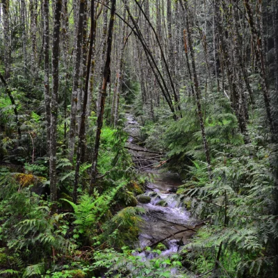
Lake Serene & Bridal Veil Falls
This 7.3-mile (round trip) trail is one of the most popular and punishing day hikes in the region. The route begins with a heart-pounding ascent past the roaring, multi-tiered Bridal Veil Falls before culminating at Lake Serene, a breathtaking, icy alpine lake tucked directly beneath the towering, snow-capped rock face of Mount Index.
Heybrook Lookout
A much shorter but still steep option, this 2.6-mile (round trip) trail climbs through dense, mossy second-growth forest to a historic, 67-foot-tall wooden fire lookout tower. Climbing the countless wooden stairs to the observation deck provides spectacular 360-degree views of the surrounding Cascade peaks.
Big Eddy & Raptor Point
These two primary day-use areas directly border the Skykomish River. Big Eddy is highly developed with picnic tables, restrooms, and a major boat launch for whitewater rafters and kayakers tackling the turbulent Class IV and V rapids downstream. Raptor Point offers quieter, undeveloped riverside access perfect for reading or tossing a line.
Picnic Bend
Located just east of Index, Picnic Bend requires a short, peaceful stroll through a deep forest of alder trees and massive sword ferns. It terminates at secluded, sandy riverside spots ideal for a quiet afternoon lunch away from the highway noise.
Important Visitor Considerations
Because the park is spread out, planning is essential. Most of the individual trailheads and day-use parking lots—especially for Lake Serene and Heybrook Lookout—can fill up entirely by 8:00 AM on summer weekends. Have a backup plan if your chosen trailhead is full, and never park illegally on the narrow shoulders of Highway 2.
| Amenity/Facility | Details & Location |
|---|---|
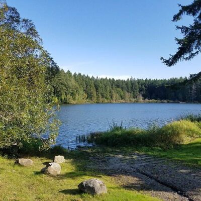
| Camping & Cabins | There is no standard car camping at Forks of the Sky. However, Wallace Falls (the administrating park nearby) offers standard tent sites and five highly sought-after reservable cabins. |
| Backcountry Camping | Permit-only backcountry “hike-in” camping is available at Jay Lake and Wallace Lake. You must call park staff at (360) 793-0420 to secure these remote sites. |
Wildlife & Nature
Forks of the Sky SP — on the Skykomish River in the Cascade Mountains. The park’s river, old-growth forest, and mountains support bald eagles, steelhead trout, and black bears.
Nearby Attractions
Gold Bar — nearby. Mt. Baker-Snoqualmie NF — surrounding.
Frequently Asked Questions
Is it safe to swim in the Skykomish River?
Extreme caution is required. While there are calm, sandy beaches during the late summer months (August/September), the Skykomish River is fed directly by glacial snowmelt. In the spring and early summer, the water is dangerously freezing, incredibly fast-moving, and filled with hidden debris. There are no lifeguards on duty; swim entirely at your own risk.
Are there restrooms at every trailhead?
No. The more developed day-use areas like Big Eddy have standard comfort stations, and popular major trailheads (Lake Serene, Heybrook) typically have vault toilets in the parking lots. However, the smaller pull-offs like Raptor Point and Picnic Bend are completely undeveloped and lack facilities.
Is the park open year-round?
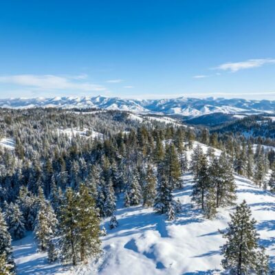
The park’s operating hours fluctuate dramatically based on the season and weather. Many of the day-use areas and smaller parking lots undergo seasonal closures. Notably, portions of the park are frequently closed on Mondays and Tuesdays from October through April. Always check the official Washington State Parks website for real-time alerts before driving up Highway 2.
Keep exploring: The closest neighbors are Nisqually State Park (a short drive away) and Sequim Bay State Park (a short drive away).
Plan Your Skykomish River Adventure
Discover the rugged beauty and adrenaline-pumping terrain of the western Cascades.
📍 Primary Location: U.S. Hwy 2 near Index, WA 98256
🌐 Official Website: Washington State Parks – Forks of the Sky
📞 Park Administration (Wallace Falls): (360) 793-0420
Explore More Washington State Parks
Forks Of The Sky State Park is one of many outstanding state parks in Washington. Discover more parks in our Best State Parks in Washington guide, or use our Park Finder to search by activity, location, or features.

Park Location
Plan your gear for Forks Of The Sky State Park
From our editorial guides, matched to this park’s activities: