Revolutionary War-Era Fort Guarding the Piscataqua River at Maine’s Southern Gateway — State Historic Site at the Mouth of the Piscataqua River in Kittery Point, Fortification Guarding the River Since the Early 1700s Through Multiple American Wars, Distinctive Hexagonal Blockhouse — the Last Remaining Structure of its Kind in Maine, Granite Walls and Earthworks From the Civil War Expansion, Listed on the National Register of Historic Places, Scenic Grounds With Views of Portsmouth Harbor and the Isles of Shoals, Picnic Areas Along the Rocky Coastline, Near Kittery Point York County Southern Maine
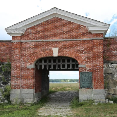
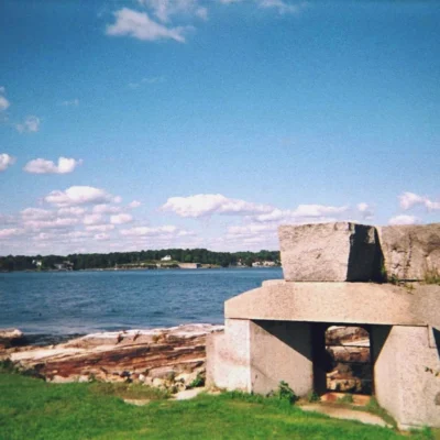
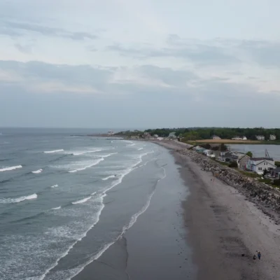
Fort McClary State Historic Site is a state historic site at the mouth of the Piscataqua River in Kittery Point, York County, southern Maine, managed by Maine Bureau of Parks and Lands. The site features fortifications that have guarded the Piscataqua River since the early 1700s through the American Revolution, War of 1812, Civil War, and Spanish-American War, a distinctive hexagonal blockhouse — the last remaining structure of its kind in Maine, granite walls and earthworks from the Civil War-era expansion, National Register of Historic Places listing, scenic grounds with views of Portsmouth Harbor, the Isles of Shoals, and the Portsmouth Naval Shipyard, picnic areas along the rocky coastline, and a multi-century military history at Maine’s strategic southern gateway.
The hexagonal blockhouse is iconic — this distinctive six-sided wooden structure is the last of its kind in Maine and one of the most photographed historic structures on the southern Maine coast. Its unusual shape allowed defenders to fire in all directions while minimizing exposed wall surface.
The strategic importance of this location spanned centuries — the Piscataqua River was the border between Maine and New Hampshire, and controlling its mouth meant controlling access to the vital Portsmouth harbor and the naval shipyard. Every American conflict from the 1700s through the 1890s prompted fortification upgrades at this site.
Things to Do
- Blockhouse — hexagonal, last in ME
- Fort — granite walls, earthworks
- Harbor views — Portsmouth
- Isles of Shoals — ocean views
- Picnicking — rocky coast
- History — 1700s-1898
Park Information
| Feature | Details |
|---|---|
| Location | Kittery Point, York County, ME |
| History | 1700s through Spanish-American War |
| Blockhouse | Hexagonal — last in Maine |
| NRHP | Listed |
| Camping | Not available |
| Managed By | Maine Bureau of Parks & Lands |
| Coordinates | 43.0833° N, 70.7000° W |
Frequently Asked Questions
Wildlife & Nature
Fort McClary SHS — a colonial-era fort guarding Kittery Harbor — the oldest town in Maine (1623). Fortified during every American war from the Revolution to World War I. The 1846 hexagonal blockhouse is one of the last remaining in the US. The site’s rocky coast supports eiders, cormorants, and harbor seals.
Nearby Attractions
Kittery — adjacent — Maine’s oldest town. Portsmouth, NH — across the river. Kittery Outlets — 3 miles north.
What is the hexagonal blockhouse at Fort McClary?
The hexagonal blockhouse at Fort McClary State Historic Site in Kittery Point, Maine is the last remaining six-sided wooden blockhouse in the state. Part of fortifications guarding the Piscataqua River since the 1700s through the Spanish-American War, the site also features granite Civil War walls, views of Portsmouth Harbor and the Isles of Shoals, and picnic areas on the rocky coastline. Listed on the National Register of Historic Places.
Last updated: May 2026
Nearby state parks: If you have extra time, John Paul Jones State Historic Site is a short drive away, and Vaughan Woods Memorial State Park is a short drive away.