
🌤 Weather at Kent Falls State Park by season
| Spring | Summer | Fall | Winter |
|---|---|---|---|
| 23–72 °F | 53–85 °F | 29–76 °F | 14–40 °F |
Each range runs from the coldest monthly average low to the warmest monthly average high in that season (1991-2020 climate normals), measured at Falls Village, 13 mi away, elevation 550 ft. Conditions at the park can differ from the station, especially where elevation differs — check a forecast before you go.

🍂 Connecticut’s Tallest Waterfall — 250 Feet of Cascades, a Covered Bridge, and Litchfield Hills Foliage — A 295-acre day-use park with Connecticut’s highest waterfall dropping 250 feet through a forested gorge, covered bridge, ADA-accessible base, and world-class fall foliage — Litchfield County, Connecticut
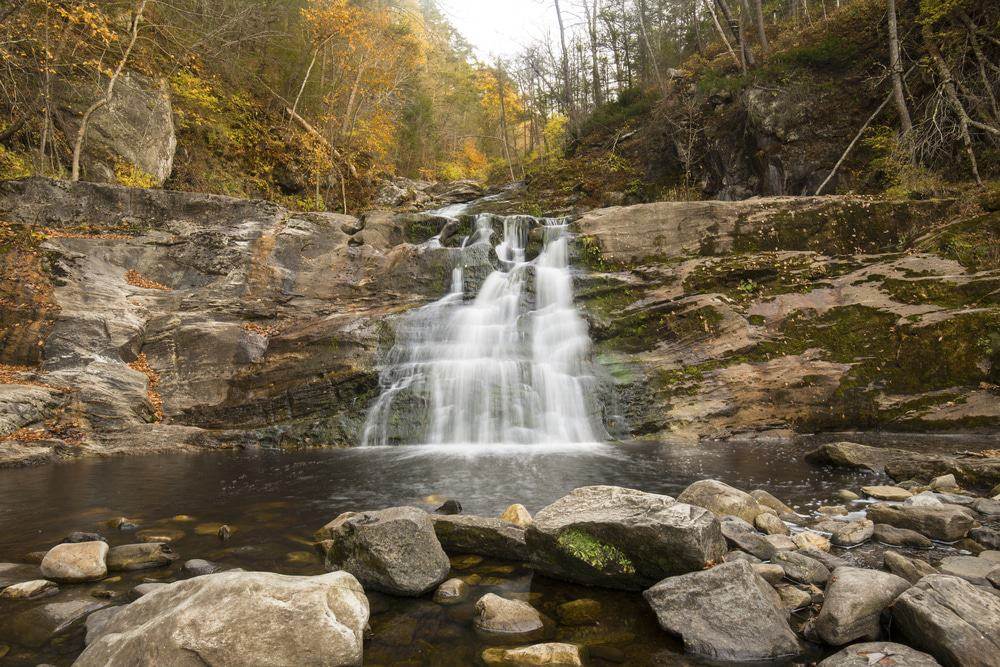
Kent Falls State Park is home to Connecticut’s tallest waterfall — a spectacular series of cascades where Falls Brook drops 250 feet in under a quarter mile through a lush, forested gorge in the Litchfield Hills. The largest single cascade plunges more than 70 feet into a crystal-clear reflecting pool before the brook continues its descent to the Housatonic River below.
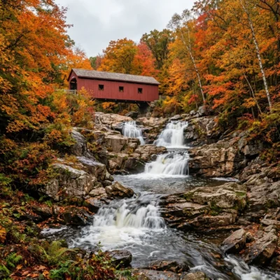
At the base of the falls, a charming covered bridge (built in 1974 by a park employee) spans the brook, framing one of the most photographed scenes in New England. An ADA-accessible paved path leads to the base viewing area, while a more challenging steps trail climbs alongside the falls with multiple overlooks. During peak fall foliage (typically mid-October), the waterfall framed by blazing red and gold leaves draws photographers from across the Northeast.
The Falls
| Feature | Details | Notes |
|---|---|---|
| Total Drop | 250 feet | Connecticut’s tallest waterfall |
| Largest Cascade | 70+ feet | Single drop into reflecting pool |
| Trail | Kent Falls Steps Trail | Moderate, multiple overlooks |
| Accessible Path | Paved to base | ADA-accessible, stroller-friendly |
| Covered Bridge | At base of falls | Iconic photo spot |
What to Do
| Activity | Details | Notes |
|---|---|---|
| Waterfall Hiking | Steps trail alongside falls | ~0.5 mi, moderate, viewing platforms |
| Photography | Covered bridge + cascades | Peak foliage mid-Oct = stunning |
| Picnicking | Grassy lawns at base | Tables, scenic setting |
| Trout Fishing | Falls Brook below base | Stocked, CT license required |
Best Time to Visit
| Season | Weather | Best For |
|---|---|---|
| Fall (Oct) | 42–62°F | Peak foliage — waterfall + autumn colors |
| Spring (Apr–May) | 48–65°F | Strongest water flow, wildflowers |
| Summer (Jun–Aug) | 72–85°F | Swimming holes nearby, picnicking |
| Winter (Dec–Feb) | 22–38°F | Ice formations on falls (dramatic) |
💰 Trip Cost Estimator
| Expense | Cost | Notes |
|---|---|---|
| CT Resident | FREE | CT-registered vehicles (Passport to the Parks) |
| Non-Resident | $10–$15/vehicle | $10 weekdays, $15 weekends/holidays (Apr–Oct) |
| Day Trip | $0–$15 | Waterfall + covered bridge + picnic |
Frequently Asked Questions
Is it really the tallest waterfall in Connecticut?
Yes. At 250 feet total drop, Kent Falls is Connecticut’s tallest waterfall — a multi-tiered cascade with the largest single drop exceeding 70 feet.
When is peak foliage?
Mid-October is typically peak in the Litchfield Hills. The waterfall framed by fall colors is one of the most photographed scenes in New England. Expect crowds and arrive early.
Is it accessible?
Partially. A paved, ADA-accessible path leads to the base viewing area. The steps trail alongside the falls is steeper and not wheelchair-accessible.
Wildlife & Nature
Kent Falls — Connecticut’s tallest waterfall at 250 feet — cascades down a series of steps through a lush hemlock-hardwood forest. The mist zone around the falls creates a microclimate supporting moisture-loving ferns, mosses, and liverworts that carpet the surrounding rocks. Walking fern — which reproduces by growing new plants at its leaf tips — clings to the calcium-rich rocks. The brook above the falls supports native brook trout in cold, clean water. Eastern hemlock — the dominant tree in the ravine — faces an existential threat from the hemlock woolly adelgid, an invasive insect from Asia that has killed millions of hemlocks across the eastern US since the 1980s. Loss of hemlock shade would fundamentally alter the falls’ microclimate and stream ecology.
Nearby Attractions
Kent village has become an art destination — galleries line the main street, and the Eric Sloane Museum celebrates early American tools and craftsmanship alongside a reconstructed 1800s cabin. Macedonia Brook State Park offers challenging ridge hiking with views of the Catskill Mountains across the border in New York. Bulls Bridge — one of Connecticut’s two surviving covered bridges — spans a dramatic gorge where the Housatonic tumbles through car-sized boulders. Schaghticoke Road follows the river through one of the most scenic drives in the state. The Appalachian Trail passes through Kent — through-hikers often resupply in the village.
Keep exploring: The closest neighbors are Stanley Works Wildlife Management Area (a short drive away) and Housatonic River Wildlife Management Area (a short drive away).
🍂 Connecticut’s Crown Jewel
250 feet of cascading water, a covered bridge, and Litchfield Hills foliage — Connecticut’s tallest and most beautiful waterfall.

🐾 Dogs & Pets at Kent Falls State Park
- Pets allowed? statewide rule
- Pets on a leash are permitted in most Connecticut state parks and forests, but not in buildings, swimming areas or state park campgrounds.
- Leash rule statewide rule
- Pets must be leashed and under control at all times; in state forest camping areas the leash may be no longer than 7 feet.
- Beaches & swim areas statewide rule
- Pets are prohibited in swimming areas; Sherwood Island and Squantz Pond State Parks ban pets entirely April 15 - September 30.
- Cabins & lodging statewide rule
- Pets are banned from all state park campgrounds; they are allowed only in the American Legion, Pachaug and Salt Rock state forest campgrounds, but not on rustic cabin sites.
- Statewide exceptions statewide rule
- Pets prohibited year-round at Dinosaur State Park and in the formal gardens and beach at Harkness Memorial State Park.
Are dogs allowed at Kent Falls State Park?
Pets on a leash are permitted in most Connecticut state parks and forests, but not in buildings, swimming areas or state park campgrounds. Individual parks can post stricter rules — check signage on arrival.
Rules verified July 2026 via portal.ct.gov. More: Connecticut state parks guide · Dog rules in all 50 states compared
Park Location
Plan your gear for Kent Falls State Park
From our editorial guides, matched to this park’s activities:

Top Tours & Activities Near Connecticut
 from $100
 from $28from $75