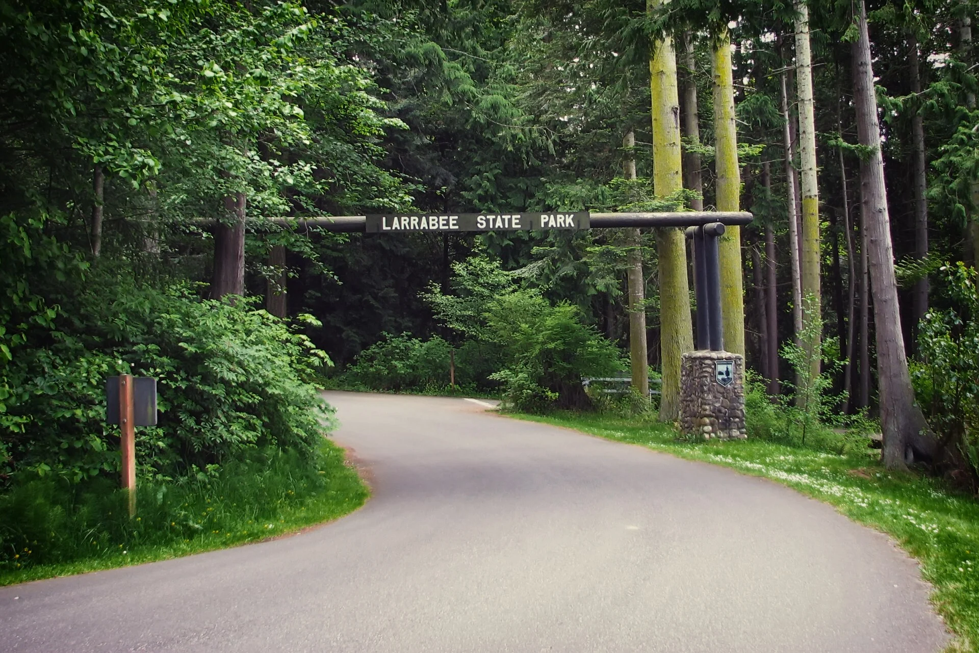
Larrabee State Park — Washington’s first state park, established in 1915 — sprawls across 2,683 acres from saltwater beach to mountain summit along the legendary Chuckanut Drive (SR-11), one of the most scenic drives in the Pacific Northwest. Named for the Larrabee family who donated the original 20 acres of waterfront, the park now encompasses a stunning diversity of landscapes: rocky Samish Bay shoreline with world-class tidepools, freshwater Fragrance Lake hidden 1,000 feet above in the Chuckanut Mountains, old-growth forest, and dramatic sandstone formations sculpted by millennia of wave action.
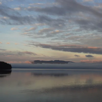
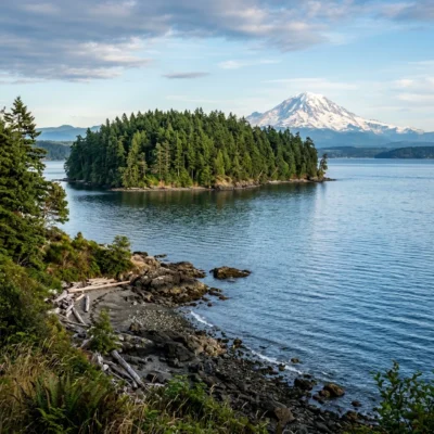
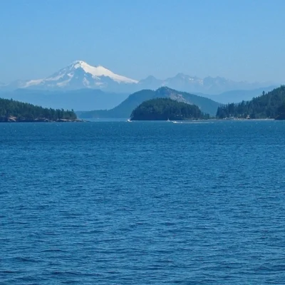
The park’s 8,100 feet of Samish Bay shoreline faces west toward the San Juan Islands, providing spectacular sunsets and views of Lummi, Orcas, and Cypress Islands. The Interurban Trail — following the grade of the historic Bellingham-Mount Vernon electric railway (1912-1930) — connects the park to Bellingham’s Fairhaven neighborhood, creating one of Washington’s finest urban-to-wilderness corridor trails.
History & Significance
In 1915, Charles Xavier Larrabee — a prominent Bellingham banker, real estate developer, and member of one of Whatcom County’s founding families — donated 20 acres of Samish Bay shoreline to the State of Washington, creating the state’s very first state park. This pioneering act predated the formal creation of the Washington State Parks and Recreation Commission (1947) by three decades. The Larrabee family’s gift catalyzed a statewide movement that would eventually grow into a system of 120+ state parks spanning 100,000+ acres.
The park expanded dramatically through subsequent land acquisitions, growing from that original 20-acre waterfront parcel to today’s 2,683 acres stretching from sea level to over 1,000 feet elevation. The Civilian Conservation Corps (CCC) developed many of the park’s facilities during the 1930s, including stone picnic shelters and trail improvements that remain in use today. The park’s relationship with Chuckanut Drive — completed in 1916, just one year after the park’s establishment — made it one of Washington’s earliest automobile-accessible scenic destinations.
Camping
| Site Type | Count | Details |
|---|---|---|
| 🏕️ Standard Tent | 51 | Wooded sites, fire rings, picnic tables |
| ⚡ Utility (RV to 60ft) | 26 | Water + electric hookups |
| ⛺ Primitive | 8 | Walk-in tent sites, more secluded |
| 👥 Group Camp | 1 | Up to 40 people, reservable |
🚂 Note: The BNSF Railway mainline runs through the campground — freight trains pass day and night. Bring earplugs! The trade-off is worth it for the stunning waterfront location.
Reservations are available at washington.goingtocamp.com and are strongly recommended for summer weekends (June-September). The campground is open year-round, though some sites close seasonally. A Discover Pass ($30/year or $10/day) is required for vehicle access.
Beach & Tidepools
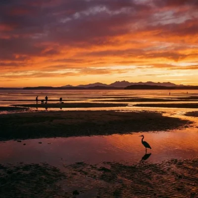
Clayton Beach — the park’s signature shoreline destination — features dramatic sandstone cliffs eroded into honeycomb patterns (tafoni weathering), sea caves, and some of the richest tidepools in the greater Bellingham area. The 0.5-mile trail from the Chuckanut Drive trailhead descends through forest to a rocky beach strewn with sandstone boulders and cobble.
| Beach Feature | Details |
|---|---|
| 🏖️ Total Shoreline | 8,100 feet on Samish Bay |
| 🦀 Clayton Beach | Sandstone cliffs, tafoni weathering, rich tidepools |
| 🌊 Wildcat Cove | Protected cove, boat launch, kayak put-in |
| 🔬 Tidepool Species | Purple sea urchins, ochre stars, giant green anemones, hermit crabs, chitons, nudibranchs |
Wildcat Cove — at the park’s south end — is a protected rocky cove with a boat launch, making it the primary put-in point for kayakers exploring the Chuckanut shoreline and nearby islands. The cove is sheltered from prevailing northwest winds, but tidal currents can be strong — check tide tables and plan accordingly.
⏰ Tidepool Tip: Visit Clayton Beach at low tides of +1.0 feet or lower for the best tidepool viewing. Check NOAA tide predictions for Bellingham Bay. Walk carefully on wet rocks — seaweed-covered surfaces are extremely slippery.
Hiking & Trails
Larrabee’s 18+ miles of trails range from easy shoreline walks to challenging mountain climbs, connecting beach, forest, and freshwater lake ecosystems.
| Trail | Distance | Difficulty | Highlights |
|---|---|---|---|
| 🏔️ Fragrance Lake | 5.6 mi RT | Moderate (1,000 ft gain) | Stunning mountain lake, old-growth forest |
| 🏖️ Clayton Beach | 1.0 mi RT | Easy-Moderate | Tidepools, sandstone formations, sunset views |
| 🚴 Interurban Trail | 6.0 mi one-way | Easy (paved/gravel) | Historic railway grade to Bellingham, bay views |
| 🌲 Lost Lake Trail | 3.5 mi RT | Moderate | Secluded forest lake, birding |
| ⛰️ Chuckanut Ridge | 7.0 mi RT | Strenuous (1,800 ft gain) | Ridge-top views, connects to Oyster Dome |
Fragrance Lake — the park’s crown jewel hike — climbs through old-growth Douglas fir forest to a secluded 8-acre mountain lake at 1,050 feet elevation. The lake — named for the fragrance of surrounding evergreens — is ringed by moss-draped conifers and offers a forested swimming experience on warm summer days. The trail is hikeable year-round, though the upper sections can be muddy November through April.
The Chuckanut Ridge Trail connects to the popular Oyster Dome trail (outside the park boundary) — a 2,025-foot summit with one of the most spectacular panoramic views in the Bellingham area, encompassing the San Juan Islands, Mount Baker, and the Skagit Valley.
Geology & Natural History
Larrabee State Park’s geological story spans 80+ million years. The park’s distinctive Chuckanut Formation sandstone — deposited during the Late Cretaceous to Eocene periods (80-40 million years ago) — contains fossilized tropical and subtropical plant remains, evidence that this landscape once resembled modern-day Louisiana. The sandstone — tilted and folded by tectonic forces — creates the dramatic cliffs and tide-sculpted formations visible at Clayton Beach.
The tafoni weathering patterns visible in the sandstone — honeycomb-like cavities created by salt crystallization and wind erosion — are among the finest examples on the Pacific Coast. Pleistocene glaciation (15,000 years ago) carved Samish Bay and deposited the glacial till that forms much of the park’s upland soils.
Wildlife & Nature
Larrabee State Park — 2,683 acres along Chuckanut Drive (SR-11) — holds the distinction of being Washington’s first state park, established in 1915. The park’s diverse landscape ranges from saltwater beach and rocky headlands to freshwater Fragrance Lake high in the Chuckanut Mountains. The rocky intertidal zones support purple sea urchins, ochre sea stars, giant green anemones, chitons, and nudibranchs. Harbor seals rest on offshore rocks. Bald eagles nest in the old-growth Douglas fir above the beach. River otters are spotted in Wildcat Cove.
The park’s forests support an impressive diversity of bird life — pileated woodpeckers, varied thrushes, winter wrens, chestnut-backed chickadees, and Pacific-slope flycatchers inhabit the old-growth and second-growth stands. Barred owls call at dusk. During fall salmon runs, bald eagles concentrate along nearby creeks. The freshwater lakes (Fragrance Lake and Lost Lake) support Pacific tree frogs, rough-skinned newts, and northwestern salamanders. Black-tailed deer browse throughout the park.
Nearby Attractions
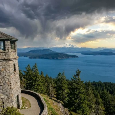
Chuckanut Drive (SR-11) — one of Washington’s most scenic roads, completed 1916 — winds 21 miles from Burlington to Bellingham through the park, with dramatic clifftop views of Samish Bay and the San Juan Islands. Bellingham — 7 miles north — has the historic Fairhaven district (bookstores, restaurants, the Alaska ferry terminal), Western Washington University, and a thriving craft brewery scene. Oyster Dome trailhead — 3 miles south — provides a popular 2,025-foot summit hike with panoramic San Juan Islands views. Taylor Shellfish Farms — on Chuckanut Drive — sells fresh oysters to eat at waterfront picnic tables. Birch Bay State Park — 25 miles north — has warm-water swimming. Teddy Bear Cove — 3 miles north — has a clothing-optional beach.
Is Larrabee really Washington’s first state park?
Yes! Larrabee State Park was established in 1915 when Charles Xavier Larrabee donated 20 acres of Samish Bay shoreline, making it Washington’s very first state park. The park has since grown to 2,683 acres encompassing beach, forest, and mountain lake habitats.
How do I get to Fragrance Lake?
The Fragrance Lake Trail starts from two trailheads: the main trailhead on the Interurban Trail (park at the Chuckanut Drive lot and walk 0.3 miles south on the Interurban Trail), or from the Cyrus Gates Overlook on Chuckanut Drive. The hike is 5.6 miles round trip with 1,000 feet of elevation gain — allow 3-4 hours.
When is the best time to visit the tidepools?
Visit Clayton Beach during low tides of +1.0 feet or lower for the best tidepool viewing. The best low tides occur in summer (June-August) during morning hours. Check NOAA tide predictions for Bellingham Bay before your visit.
Is the campground noisy?
The BNSF Railway mainline runs through the campground, and freight trains pass both day and night. Bring earplugs — most campers adapt quickly, and the stunning waterfront location more than compensates. The primitive walk-in sites are slightly farther from the tracks.
Nearby state parks: If you have extra time, Chuckanut Bay Preserve is a short drive away, and Saddlebag Island Marine State Park is a short drive away.
🌊 Experience Washington’s Historic First State Park
Where old-growth forest meets saltwater beach on legendary Chuckanut Drive. Reserve at WA State Parks.
Location & Getting There
Larrabee State Park is located at 245 Chuckanut Drive, Bellingham, WA 98229, 7 miles south of Bellingham on scenic Chuckanut Drive (SR-11). From I-5, take Exit 231 (Chuckanut Drive/SR-11 South) and drive 7 miles south. The park entrance is on the right. GPS coordinates: 48.6553, -122.4919. Amtrak’s Cascades line stops in Bellingham (Fairhaven station), 7 miles north.
Quick Facts
- Established: 1915 (Washington’s first state park)
- Acreage: 2,683 acres
- Shoreline: 8,100 feet on Samish Bay
- Elevation Range: Sea level to 1,940 feet
- Coordinates: 48.6553, -122.4919
- Activities: Hiking, Camping, Tidepooling, Kayaking, Swimming, Mountain Biking
- Pass Required: Discover Pass ($30/year or $10/day)
- Pets: Allowed on leash in most areas
Best Time to Visit
June through September offers the best weather for camping, hiking, and tidepooling. Summer mornings often feature the lowest tides — ideal for Clayton Beach exploration. October through November brings dramatic fall colors and fewer crowds. Winter delivers powerful storms and crashing waves — dramatic but cold. The park is open year-round.
Explore More Washington State Parks
Larrabee State Park is one of many outstanding state parks in Washington. Discover more parks in our Best State Parks in Washington guide, or use our Park Finder to search by activity, location, or features.

🐾 Dogs & Pets at Larrabee State Park
- Pets allowed? statewide rule
- Pets are allowed in most Washington state parks but must be under physical control on a leash at all times.
- Leash rule statewide rule
- 8 ft maximum leash required; pets must be under physical control
- Beaches & swim areas statewide rule
- Pets are not permitted on designated swim beaches
- Cabins & lodging statewide rule
- Pets are not allowed inside vacation houses but are permitted in designated pet-friendly cabins and yurts (e.g. Cape Disappointment, Grayland Beach, Seaquest, Ike Kinswa), typically up to two pets, with a pet fee
- Pet fees statewide rule
- No day-use pet fee; $15 per night pet fee in pet-friendly cabins/yurts
- Statewide exceptions statewide rule
- Director-designated off-leash areas are exempt from the leash rule and are conspicuously posted
Are dogs allowed at Larrabee State Park?
Pets are allowed in most Washington state parks but must be under physical control on a leash at all times. Individual parks can post stricter rules — check signage on arrival.
Rules verified July 2026 via parks.wa.gov. More: Washington state parks guide · Dog rules in all 50 states compared
Park Location
Plan your gear for Larrabee State Park
From our editorial guides, matched to this park’s activities:

Top Tours & Activities Near San Juan Islands
 from $680
 from $29
 from $260