

St. Francis State Park

🏔️ Hike the Ancient Loess Hills of Crowley’s Ridge — A Geological Island in the Arkansas Delta — A forested park on one of America’s most unusual geological formations, with fishing lake, cabins, CCC stonework, and trails through 50-foot-deep windblown silt — Clay County, Arkansas
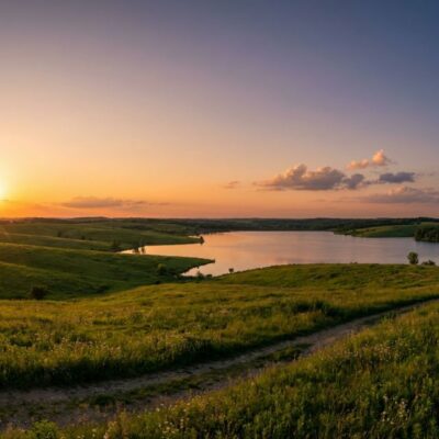
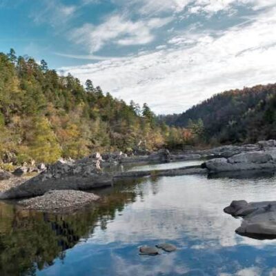
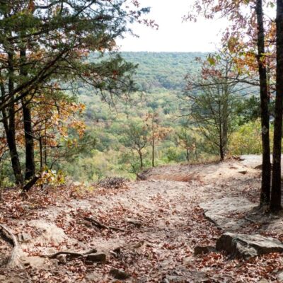
St. Francis State Park sits atop Crowley’s Ridge — one of the most geologically unusual features in North America. This narrow, hilly landform rises 250 to 550 feet above the otherwise pancake-flat Mississippi Delta, stretching 150 miles from southeastern Missouri to Helena, Arkansas. The ridge is composed of loess — fine windblown silt deposited during the Ice Age to depths of 50 feet — creating steep slopes and narrow valleys that feel utterly unlike the surrounding Delta farmland.
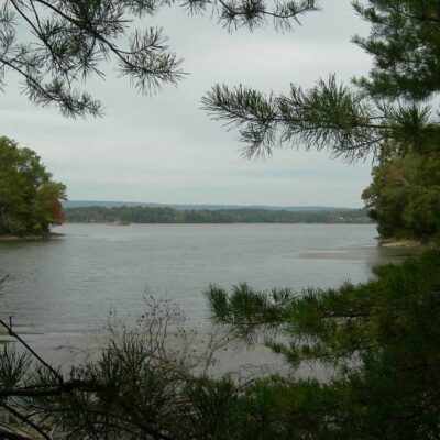
The park covers 817 acres of this ridge landscape, offering a forested retreat with a fishing lake, Civilian Conservation Corps-era stone structures, hiking trails through the distinctive loess hills, and a campground with modern amenities. The terrain here — rolling, wooded, and cut by deep ravines — exists because Crowley’s Ridge was once an island between the ancient Mississippi and Ohio rivers, left high and dry when those rivers shifted course thousands of years ago.
Trails
| Trail | Distance | Difficulty | Highlights |
|---|---|---|---|
| Ridge Trail | 1.5 mi | Moderate | Ridge-top views, loess geology, ravines |
| Lake Loop Trail | 1 mi | Easy | Around fishing lake, wildlife |
| Swimming Pool Trail | 0.5 mi | Easy | Connector trail, forest canopy |
What to Do
| Activity | Details | Notes |
|---|---|---|
| Fishing | 14-acre lake | Bass, bream, catfish — AR license required |
| Camping | 25 sites with hookups | Water/electric, bathhouse, tent pads |
| Cabins | CCC-era stone cabins | Fully equipped, A/C, seasonal availability |
| Swimming | Seasonal pool | Memorial Day through Labor Day |
| Hiking | 3+ miles of trails | Loess geology, ravines, hardwood forest |
| Picnicking | CCC stone shelters | Original 1930s stonework |
Best Time to Visit
| Season | Weather | Best For |
|---|---|---|
| Spring (Mar–May) | 55–78°F | Wildflowers, dogwood bloom, fishing |
| Summer (Jun–Aug) | 82–95°F | Pool open, hot/humid, full facilities |
| Fall (Oct–Nov) | 50–72°F | Fall color on the ridge, best hiking weather |
| Winter (Dec–Feb) | 30–50°F | Quiet, cabin getaways, barren loess landscape visible |
💰 Trip Cost Estimator
| Expense | Cost | Notes |
|---|---|---|
| Day Use | FREE | No entrance fee |
| Campsite | $12–$28/night | 25 sites, water/electric |
| Cabin | $65–$100/night | CCC stone construction |
| Day Trip | $0 | Trails + fishing + picnicking |
Frequently Asked Questions
What is Crowley’s Ridge?
A 150-mile-long, narrow hill formation rising above the flat Mississippi Delta. Formed from windblown loess (glacial silt) deposited during the Ice Age, it was once an island between the ancient courses of the Mississippi and Ohio rivers. The geology is unique in America.
What is loess?
Fine-grained glacial silt (pronounced “luss”) blown by wind and deposited in layers up to 50 feet deep. It erodes into steep slopes and narrow ravines — creating the ridge’s distinctive hilly terrain in an otherwise flat landscape.
Can I swim in the lake?
No lake swimming. The park has a seasonal swimming pool (Memorial Day–Labor Day).
Are the CCC structures still intact?
Yes. Original 1930s Civilian Conservation Corps stone cabins and picnic shelters are still in use. The craftsmanship is excellent and worth seeing.
How far from Memphis?
About 80 miles (1.5 hours) northwest via I-55 and US-63.
Is there good birding?
Yes. Crowley’s Ridge is a significant migration corridor. The ridge’s elevation creates a forested island in the agricultural Delta, attracting neotropical migrants, woodpeckers, and warblers.
Can I mountain bike?
Trails are primarily for hiking. The terrain (loess soil) can be slippery when wet. Check with park staff for current bike policies.
🏔️ A Geological Island in the Delta
817 acres on Crowley’s Ridge — an Ice Age landform like nowhere else in America. CCC cabins, fishing lake, and trails through 50-foot loess ravines.

Park Location

Top Tours & Activities Near Memphis
 from $69
 from $68
 from $495