
Where the Rarest Pines in America Guard San Diego’s Last Wild Coast
Standing on the eroded sandstone bluffs of Torrey Pines State Natural Reserve, with the Pacific Ocean crashing 300 feet below and ancient, wind-sculpted pines clinging to the cliffs above, it’s hard to believe you’re just 20 minutes from downtown San Diego. This 2,000-acre coastal wilderness protects the rarest pine tree in North America — the Torrey pine (Pinus torreyana), which grows naturally in only two places on Earth: right here and on Santa Rosa Island, 175 miles offshore.
Designated a National Natural Landmark in 1977, the reserve offers dramatic ocean panoramas, sculptured sandstone gorges painted in geological layers of amber and rust, and over 400 species of native plants. Whether you’re hiking the iconic bluff trails, spotting gray whales from Razor Point, or descending to the pristine beach below, Torrey Pines delivers one of Southern California’s most unforgettable natural experiences.
Hiking Trails at Torrey Pines
Torrey Pines features a compact but spectacular network of trails ranging from gentle loops to steep descents to the beach. Most trails are easy to moderate, and the longest is under 3 miles roundtrip. The reserve’s relatively small footprint means you can hike every trail in a single visit, though most visitors focus on the three most scenic routes: Guy Fleming, Razor Point, and Beach Trail.
| Trail Name | Distance | Difficulty | Highlights |
|---|---|---|---|
| Guy Fleming Trail | 0.67 mi loop | Easy | Best ocean panoramas, wildflowers, diverse habitats |
| Razor Point Trail | 1.3 mi RT | Easy-Moderate | Sculpted sandstone gorges, Yucca Point overlook |
| Beach Trail | 1.5 mi RT | Moderate | 300-ft descent to pristine beach, stairs at bottom |
| Broken Hill Trail (South Fork) | 2.6 mi RT | Moderate | Longest trail, chaparral, scenic overlook, beach access |
| Broken Hill Trail (North Fork) | 2.8 mi RT | Moderate | Sagebrush, converges with Beach Trail at Flat Rock |
| Parry Grove Trail | 0.5 mi loop | Easy-Moderate | Secluded pine grove, 100+ stone steps, Whitaker Garden |
| High Point Trail | 100 yards | Easy | Panoramic views of reserve, lagoon, and inland areas |
| Mar Scenic Trail | 0.5 mi | Easy | Extension area — seasonal creek, peaceful walk |
| DAR Trail | 0.5 mi | Easy | Extension — marsh views to main reserve and ocean |
| Margaret Fleming Trail | 0.75 mi | Easy | Extension — coastal sage scrub habitat exploration |
| Red Ridge Loop | 0.33 mi | Easy | Extension — lagoon views, unique geologic formations |
Trail Tips from Experienced Hikers
- Best combo: Start with Guy Fleming Trail for views, then take Razor Point for geology, and finish with Beach Trail for a beach visit
- Avoid crowds: Use the Broken Hill Trail (South Fork) to reach the beach instead of the popular Beach Trail
- Morning is best: Arrive by 8 AM for cooler temperatures, easier parking, and the best light for photography
- No food allowed: Only water is permitted on trails — this is strictly enforced to protect wildlife
The Rare Torrey Pine: A Living Relic
The Torrey pine is the star of this reserve and one of the world’s most fascinating botanical stories. Fewer than 9,000 Torrey pines exist in the wild, making it North America’s rarest pine species. These remarkable trees have adapted to life on harsh, nutrient-poor sandstone cliffs with several ingenious survival strategies:
- Fog harvesting: Their distinctive five-needle bundles are shaped to condense coastal fog into water droplets that drip down to the tree’s roots
- Deep root systems: Intricate root networks anchor them to unstable bluffs while mining deep for moisture
- Wind sculpting: The trees’ dramatically twisted shapes result from constant exposure to salt-laden Pacific winds
- Two populations only: Found naturally only here and on Santa Rosa Island — separated by 175 miles of open ocean
Botanist Charles Christopher Parry officially described and named the tree in 1850, honoring his mentor Dr. John Torrey. Spanish explorers had earlier called the area “Punto de Los Arboles” (Point of Trees), using these unusual groves as a navigational landmark.
Wildlife Watching at Torrey Pines
The reserve’s protected habitats — from coastal bluffs to salt marshes to chaparral — support an extraordinary diversity of wildlife. Over 200 bird species have been documented here, and the Los Peñasquitos Lagoon is designated critical habitat for several endangered species.
| Category | Notable Species | Best Viewing Season |
|---|---|---|
| Marine Mammals | Gray whales, dolphins, sea lions, harbor seals | Dec–Apr (whale migration) |
| Birds of Prey | Red-tailed Hawk, Osprey, Northern Harrier, White-tailed Kite | Year-round |
| Shorebirds | Western Snowy Plover (endangered), Black-necked Stilt, Killdeer | Spring/Fall migration |
| Songbirds | Wrentit, California Quail, Anna’s Hummingbird, Scrub Jay | Year-round |
| Lagoon Birds | Great Blue Heron, Belding’s Savannah Sparrow (endangered) | Winter/Spring |
| Land Mammals | Bobcat, gray fox, coyote, raccoon, rabbit | Dawn/dusk year-round |
| Tidepools | Hermit crabs, sea anemones, limpets, mussels, shore crabs | Low tide events |
Whale Watching from the Bluffs
During the annual gray whale migration (December through April), Torrey Pines offers some of the best land-based whale watching in California. Razor Point and Guy Fleming Trail provide elevated vantage points where you can spot spouts and breaches without binoculars on clear days. Peak migration occurs in January and February.
History and Conservation
The land now protected as Torrey Pines State Natural Reserve has been home to the Kumeyaay people for thousands of years. The reserve’s modern conservation story spans over a century of dedicated preservation efforts:
- 1899: San Diego City Council establishes a 364-acre public park to protect the Torrey pines
- 1923: Philanthropist Ellen Browning Scripps funds construction of the Torrey Pines Lodge (now the Visitor Center)
- 1924: Reserve expands to 1,000 acres
- 1936: Scripps donates the North and Parry Groves, significantly enlarging the protected area
- 1959: Officially designated as a California State Park
- 1970: Additional land annexed, bringing the reserve to its current size
- 1977: Named a National Natural Landmark
- 2007: Renamed to Torrey Pines State Natural Reserve
Plant Communities
With over 400 documented plant species, Torrey Pines encompasses six distinct plant communities, each adapted to specific conditions within the reserve’s varied terrain:
| Plant Community | Location | Key Species |
|---|---|---|
| Torrey Pine Woodland | Bluff tops and slopes | Torrey pine, coastal live oak, lemonade berry |
| Coastal Sage Scrub | South-facing slopes | California sagebrush, black sage, buckwheat |
| Chaparral | North-facing slopes | Ceanothus, chamise, manzanita |
| Coastal Strand | Beach areas | Sea rocket, beach evening primrose, sand verbena |
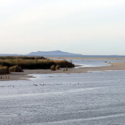
| Salt Marsh | Los Peñasquitos Lagoon | Pickleweed, cordgrass, salt grass |
| Freshwater Marsh | Creek areas | Cattails, bulrush, willow |
Wildflower season (February through May, peaking after wet winters) transforms the bluffs with wild heliotrope, sea dahlia, popcorn flower, and a rare coastal California poppy.
Seasonal Guide
| Season | Weather | Highlights | Considerations |
|---|---|---|---|
| Spring (Mar–May) | 60–72°F, mild | Peak wildflowers, bird migration, clear skies | Busiest season — arrive early for parking |
| Summer (Jun–Aug) | 68–78°F, foggy mornings | Beach time, long days, marine layer burns off by noon | Very crowded weekends, parking fills by 9 AM |
| Fall (Sep–Nov) | 65–80°F, Santa Anas | Best visibility, warm beach days, fewer crowds | Fire risk during Santa Ana winds, possible closures |
| Winter (Dec–Feb) | 50–65°F, occasional rain | Gray whale migration, green hillsides, lowest crowds | Shorter days, slippery trails after rain |
Visitor Guide and Budget Planner
Getting There
Torrey Pines is located along the coast between La Jolla and Del Mar in San Diego. Take I-5 to Carmel Valley Road, then head west to North Torrey Pines Road. The main entrance is on the east side of the road, with South Beach and North Beach parking lots at the base of the bluffs.
Parking and Fees
| Parking Area | Day Use Fee | Notes |
|---|---|---|
| South Beach Lot (+ Reserve access) | $15–$25 | Demand-based pricing, includes upper reserve lots |
| North Beach Lot | $10–$25 | Beach access only, no reserve access |
| Highway 101 Roadside | Free | Limited spots, walk to trails required |
| Annual State Parks Pass | $125/year | Valid at all California State Parks |
Budget Breakdown
| Expense | Cost |
|---|---|
| Parking (typical weekday) | $15 |
| Parking (weekend/holiday) | $20–$25 |
| Trail access (with parking) | Included |
| Guided nature walk | Free (weekends/holidays) |
| Nearby lunch in Del Mar | $15–$25 |
| Total half-day visit | $30–$50 |
Rules and Safety
Torrey Pines is a natural reserve — not a regular park — with strict rules to protect its fragile habitats:
- No food or drinks on trails (water only) — strictly enforced
- No pets — not even on leash, anywhere in the reserve
- No drones — federal and state regulations prohibit drone use
- No collecting — pine cones, flowers, rocks, and shells must stay
- Stay on trails — the sandstone is fragile and erosion-prone
- No cliff climbing — deadly rockslides occur regularly
- No alcohol — prohibited throughout the reserve
- Day use only — no overnight camping allowed
Beach Safety
- Always check tide times before descending to the beach — at high tide, sand between cliffs and waves can disappear entirely
- Cliffs are unstable sandstone — never walk directly beneath them and watch for falling rocks
- Strong rip currents are common — swim at your own risk (no lifeguards in reserve beach)
- Watch for rattlesnakes on trails — they’re native and protected
Packing Essentials
| Item | Why You Need It |
|---|---|
| Water bottle | Only water allowed on trails — no food/drinks permitted |
| Sunscreen + hat | Little shade on bluff trails, strong coastal sun |
| Binoculars | Essential for whale watching and birding |
| Good hiking shoes | Sandy trails and steep descents to beach |
| Camera/phone | Stunning photo opportunities at every turn |
| Tide chart | Critical for safe beach access timing |
| Layers | Coastal fog can make mornings chilly year-round |
Nearby Attractions
- Torrey Pines Gliderport — Watch hang gliders and paragliders launch from the cliffs (0.5 miles south)
- Los Peñasquitos Lagoon — Birding hot spot, part of the reserve extension
- Torrey Pines Golf Course — Host of the Farmers Insurance Open PGA tournament
- La Jolla Cove — Sea lions, snorkeling, and the La Jolla Underwater Park (10 minutes south)
- Del Mar Beach & Village — Charming seaside town with restaurants and Del Mar Racetrack (5 minutes north)
Frequently Asked Questions
How long does it take to visit Torrey Pines State Natural Reserve?
Most visitors spend 2–3 hours exploring the reserve. You can hike the three most popular trails (Guy Fleming, Razor Point, and Beach Trail) in about 2.5 hours. To hike every trail in the main reserve, plan for 3–4 hours. Add time for the Extension trails or a beach visit.
Is Torrey Pines State Reserve dog friendly?
No. Dogs are not allowed anywhere in the reserve — not on trails, not on the beach within reserve boundaries, and not even in the parking lots (except service animals). This is to protect the fragile ecosystem and wildlife. The nearby Del Mar Dog Beach is a great alternative for pet owners.
Can you eat food on the trails at Torrey Pines?
No. Only water is allowed on the trails and in the upper reserve. Food and drinks (other than water) are restricted to the beach area only. This strict rule protects wildlife from human food sources and keeps the trails clean. Eat before or after your hike, or bring food to enjoy on the beach below.
What makes the Torrey pine tree so rare?
The Torrey pine (Pinus torreyana) is the rarest pine species in North America, with fewer than 9,000 trees remaining in the wild. It grows naturally in only two places on Earth: Torrey Pines State Natural Reserve in San Diego and Santa Rosa Island off the Santa Barbara coast. The trees have unique five-needle bundles that condense fog into water droplets, allowing them to survive in harsh coastal sandstone conditions.
When is the best time to visit Torrey Pines?
Fall (September–November) offers the best combination of warm weather, clear skies, and smaller crowds. Spring (March–May) is ideal for wildflowers and bird migration. Winter brings gray whale watching opportunities (December–April) and the fewest visitors. Summer is warmest but extremely crowded — parking fills by 9 AM on weekends.
Is the hike at Torrey Pines hard?
Most trails are easy to moderate. The Guy Fleming Trail and Razor Point Trail are gentle walks with minimal elevation change. The Beach Trail involves a 300-foot descent (and return climb) with stairs at the end. The Broken Hill trails are the longest at about 1.3–1.4 miles each way. Overall, Torrey Pines is suitable for beginners and families, though the return climb from the beach can be strenuous in warm weather.
How do I avoid paying for parking at Torrey Pines?
Free parking is available along Highway 101 (North Torrey Pines Road) south of the reserve entrance. From there, you can walk up the paved park road to the trailheads (about 1.5 miles and 300 feet elevation gain). Arrive early, as free spots fill quickly. Alternatively, consider a California State Parks annual pass ($125) if you visit multiple state parks throughout the year.
Do I need a reservation to visit California state parks?
Many popular California state parks, especially coastal and desert parks like Anza-Borrego and Crystal Cove, now require day-use reservations on weekends and holidays. Check the park website or ReserveCalifornia.com before your visit.
How much does it cost to enter a California state park?
Most California state parks charge a day-use parking fee of $10 per vehicle. An annual parks pass costs $125 and covers unlimited vehicle entry to all state parks.
Are dogs allowed in California state parks?
Dogs are allowed in campgrounds and on paved roads in most California state parks, but they are generally not permitted on trails or beaches. Service animals are always welcome. Check specific park rules before bringing your pet.
What is the best time of year to visit California state parks?
Coastal parks are best from spring through fall, desert parks from October through April, and mountain parks from June through October. Spring brings wildflower super blooms, and fall offers fewer crowds with pleasant weather.
Explore More California State Parks
Torrey Pines State Natural Reserve is one of many outstanding state parks in California. Discover more parks in our Best State Parks in California guide, or use our Park Finder to search by activity, location, or features.
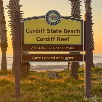
More parks nearby: Cardiff State Beach is a short drive away, while San Elijo State Beach lies a short drive away.

🐾 Dogs & Pets at Torrey Pines State Natural Reserve
- Pets allowed? statewide rule
- Dogs are permitted in California State Parks only in developed areas — campgrounds, picnic areas, parking lots and paved roads — and are prohibited on most trails, beaches and undeveloped areas unless specifically designated as dog-friendly.
- Leash rule statewide rule
- Maximum 6-foot leash at all times; dogs may not be left unattended.
- Beaches & swim areas statewide rule
- Dogs are prohibited on most state beaches; only beaches specifically designated as dog-allowed permit them (varies by park).
- Cabins & lodging statewide rule
- Pets are generally not allowed in buildings or cabins; overnight campers must keep dogs inside a tent or vehicle at night.
- Statewide exceptions statewide rule
- Designated dog-friendly trails and beaches vary park by park; misrepresenting a pet as a service animal is a misdemeanor.
Are dogs allowed at Torrey Pines State Natural Reserve?
Dogs are permitted in California State Parks only in developed areas — campgrounds, picnic areas, parking lots and paved roads — and are prohibited on most trails, beaches and undeveloped areas unless specifically designated as dog-friendly. Individual parks can post stricter rules — check signage on arrival.
Rules verified July 2026 via parks.ca.gov. More: California state parks guide · Dog rules in all 50 states compared
Park Location
Plan your gear for Torrey Pines State Natural Reserve
From our editorial guides, matched to this park’s activities:

Top Tours & Activities Near La Jolla
 from $45
 from $108
 from $90