
Clarks Lookout State Park
Lewis and Clark Expedition Lookout Point in Montana’s Beaverhead Valley — 8-Acre Historic State Park Where Captain William Clark Surveyed the Beaverhead Valley on August 13, 1805, Short Trail to the Summit With Monument Marking Clark’s Compass Readings, Panoramic Views of the Beaverhead Valley and the Pioneer Mountains, Part of the Lewis and Clark National Historic Trail, Interpretive Signs Describing the Expedition’s Journey Through Montana, Picnic Area at the Base of the Lookout, Near Dillon Beaverhead County Southwestern Montana
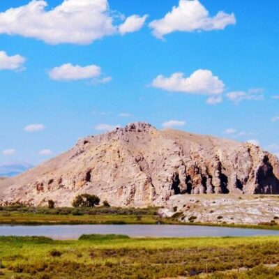
Clark’s Lookout State Park is an 8-acre historic state park near Dillon, Beaverhead County, southwestern Montana, managed by Montana Fish, Wildlife & Parks. The park preserves the hilltop where Captain William Clark of the Lewis and Clark Expedition stood on August 13, 1805 to survey the surrounding Beaverhead Valley, a short hiking trail to the summit with a monument marking Clark’s original compass readings, panoramic views of the Beaverhead Valley and the Pioneer Mountains from the lookout point, official status as part of the Lewis and Clark National Historic Trail, interpretive signs describing the expedition’s journey through Montana and their search for the Shoshone Indians and horses to cross the Rocky Mountains, and a picnic area at the base for quiet reflection.
Standing on the same hilltop where Clark stood over 220 years ago, looking out over the same valley and same mountain ranges, creates a powerful connection to history. The landscape is remarkably unchanged — the Beaverhead Valley remains open rangeland backed by the Pioneer Mountains, much as Clark described it in his journal.
The expedition was at a critical juncture here — they desperately needed Shoshone horses to cross the Rocky Mountains before winter. Clark climbed this hill to scout the route ahead and look for signs of the Shoshone. The monument at the summit reproduces his actual compass bearings from that August day.
Things to Do
- Summit trail — Clark’s lookout
- Monument — compass readings
- Valley views — Beaverhead
- Lewis & Clark Trail — historic
- Picnic area — base
- Photography — mountains
Park Information
| Feature | Details |
|---|---|
| Location | 1 mi N of Dillon, Beaverhead County, MT |
| Size | 8 acres |
| Historic Date | August 13, 1805 |
| Trail | Lewis & Clark NHT |
| Camping | Not available |
| Managed By | Montana FWP |
| Coordinates | 45.2333° N, 112.6333° W |
Frequently Asked Questions
What happened at Clark’s Lookout?
On August 13, 1805, Captain William Clark climbed this hilltop near present-day Dillon, Montana to survey the Beaverhead Valley and search for the Shoshone Indians whose horses were essential for crossing the Rocky Mountains. Clark’s Lookout State Park preserves this 8-acre site with a summit trail, monument marking his compass readings, and panoramic valley views. Part of the Lewis and Clark National Historic Trail.
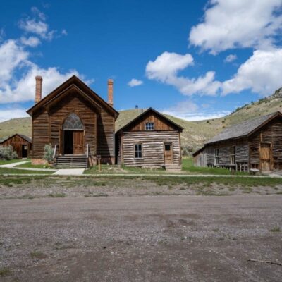
At only 8 acres, Clark’s Lookout is one of Montana’s smallest state parks — but its historical significance is enormous. The short hike to the summit takes just minutes, making it a perfect roadside stop for travelers on I-15 between Butte and the Idaho border. Combined with nearby Bannack State Park (Montana’s best-preserved ghost town), it makes for an excellent historical day trip in the Beaverhead Valley.
Last updated: May 2026

Park Location

Top Tours & Activities Near Big Sky
 from $1,999
 from $350
 from $1,999