Lewis & Clark’s Beaverhead Valley Scout Point — Historic 1805 Overlook, Compass Monument & Interpretive Trail Near Dillon
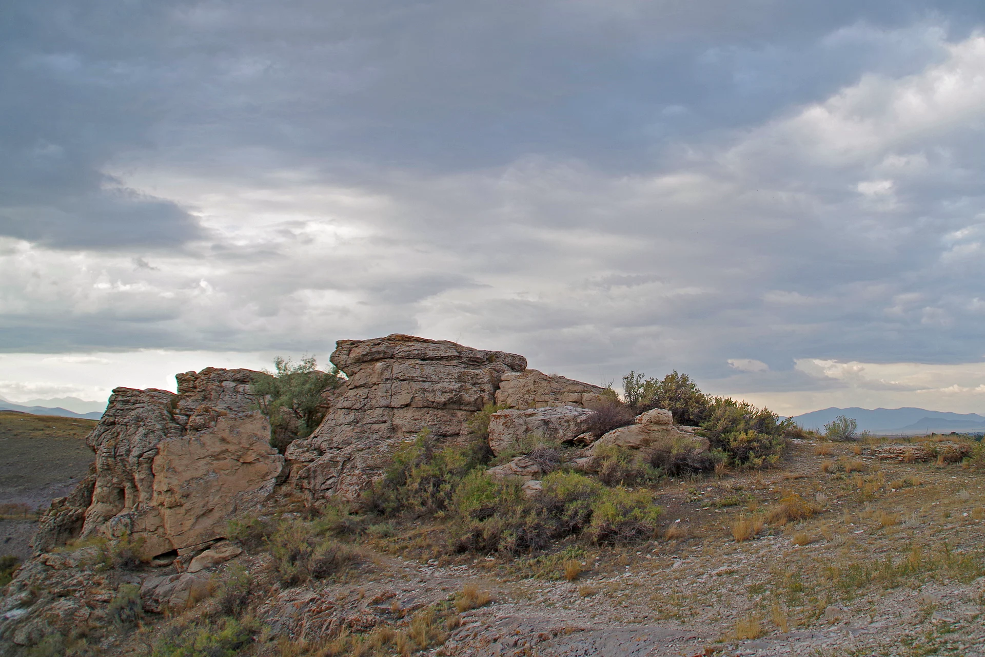
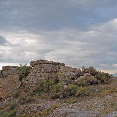
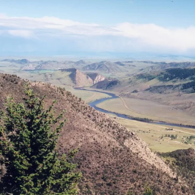
Clark’s Lookout State Park is an 8.2-acre historic site located one mile north of Dillon, Montana, along the Beaverhead River. On August 13, 1805, Captain William Clark climbed this rocky outcrop to survey the surrounding Beaverhead Valley and scout the route ahead for the Corps of Discovery — taking three compass readings that are now commemorated by a compass-shaped monument at the summit.
Designated a High Potential Historic Site on the Lewis and Clark National Historic Trail, Clark’s Lookout is small but historically significant — visitors can stand in the same spot Clark occupied over 200 years ago and see essentially the same sweeping valley panorama he recorded in his journal. A short quarter-mile loop trail leads to the summit with interpretive panels explaining the expedition’s navigational methods and their passage through this critical junction of their westward journey.
Things to Do
Historic Trail & Overlook
The park’s centerpiece — a quarter-mile loop trail to the summit:
- Compass monument: Marks the exact point where Clark took three compass readings on August 13, 1805
- Panoramic views: Sweeping vista of the Beaverhead Valley — the same view Clark documented
- Interpretive panels: Explain the Corps of Discovery’s navigational methods, their route through the valley, and the significance of this scouting point
- Difficulty: Easy — short but steep in places; approximately 10–15 minutes to the summit
Wildlife & Nature
- Beaverhead River: The park borders the river — birding, wildlife viewing, and photography along the riparian corridor
- Raptors: Hawks, eagles, and osprey frequent the river corridor
- Wildflowers: Spring and early summer bring native wildflower displays on the rocky outcrop
Picnicking & Photography
- Picnic area at the base of the lookout
- The summit offers exceptional photography opportunities — golden hour light on the valley is spectacular
- Ideal for Lewis & Clark Trail enthusiasts documenting the expedition route
Best Time to Visit
| Season | Highlights | Considerations |
|---|---|---|
| Summer (Jun–Aug) | ⭐ Full interpretive experience; wildflowers; longest days; Beaverhead Valley green; photography | Hot afternoons; bring water; open sun exposure on summit |
| Fall (Sep–Nov) | Golden cottonwoods along Beaverhead River; cool hiking; harvest-season valley; quiet | Park closes Nov 30; shorter days; chilly mornings |
| Spring (Apr–May) | Park reopens April 1; wildflowers; birding migration; snowmelt greening valley | Variable weather; muddy trail possible; windy |
| Winter (Dec–Mar) | Park closed | Opens April 1 |
Visitor Tips
- Day-use only: Clark’s Lookout is a small historic site — no camping, no visitor center. Plan for a 30–60 minute visit to hike the trail, read the interpretive panels, and take in the view.
- Lewis & Clark Trail: This is a designated High Potential Historic Site on the Lewis and Clark National Historic Trail. If you’re following the expedition route, this is one of the most accessible and well-preserved scouting points along the entire trail.
- Compass monument: The compass-shaped monument at the summit marks Clark’s three compass readings from August 13, 1805. Stand where he stood and compare the valley view to his journal descriptions — it’s remarkably unchanged.
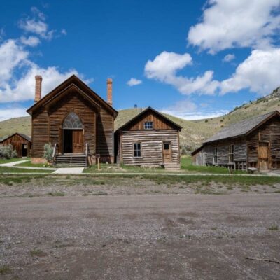
- Dillon base: The town of Dillon (1 mile south) provides full services — hotels, restaurants, gas, and the University of Montana Western campus. Dillon is also a gateway to the Big Hole Valley and Bannack State Park (ghost town).
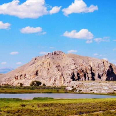
- Combine visits: Pair Clark’s Lookout with Bannack State Park (25 miles west) — Montana’s best-preserved ghost town and another must-see in the Beaverhead Valley region.
- Season: Open April 1 through November 30, 8:00 AM to sunset. Check the Montana FWP website for current alerts before visiting.
Frequently Asked Questions
Why is Clark’s Lookout historically significant?
On August 13, 1805, Captain William Clark of the Lewis and Clark Expedition climbed this rocky outcrop to survey the Beaverhead Valley and scout the route ahead for the Corps of Discovery. He took three compass readings from the summit, which are now commemorated by a compass-shaped monument. The site is designated a High Potential Historic Site on the Lewis and Clark National Historic Trail by the National Park Service. Visitors can stand in the same spot Clark occupied and see essentially the same valley panorama he recorded in his journal over 200 years ago.
How long does it take to visit Clark’s Lookout?
Plan for 30 to 60 minutes. The quarter-mile loop trail to the summit takes approximately 10–15 minutes of walking (easy, with some steep sections). Allow additional time to read the interpretive panels about the Lewis and Clark Expedition, examine the compass monument, and enjoy the panoramic views of the Beaverhead Valley. The park has a picnic area at the base if you want to extend your visit. There is no camping or visitor center — Clark’s Lookout is a focused historic site.
Last updated: April 2026
Make it a road trip: Pair a visit with Clarks Lookout State Park (a short drive away) or Beaverhead Rock State Park (a short drive away).
Park Location


Top Tours & Activities Near Big Sky
 from $1,999
 from $350
 from $1,999