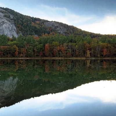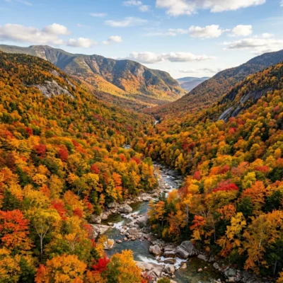
Crawford Notch State Park — 5,775 acres in the heart of New Hampshire’s White Mountains — encompasses one of the most dramatic mountain passes in the eastern United States. The notch — a deep, glacially carved U-shaped valley — slices through the Presidential Range with walls rising over 2,000 feet. Home to Arethusa Falls (the tallest waterfall in New Hampshire at 176 feet), the Crawford Path (the oldest continuously maintained hiking trail in America, established 1819), and road-visible cascades, Crawford Notch delivers a landscape that rivals anything in the American East.
The park straddles Route 302, the historic highway connecting the Connecticut River valley to the Mount Washington region. Every turn reveals a new vista: granite cliffs streaked with ice in winter, cascading brooks plunging through moss-covered ravines, and dense spruce-fir forest that gives way to alpine tundra on the surrounding peaks. This is quintessential New Hampshire wilderness — dramatic, challenging, and endlessly beautiful.
History & The Willey Tragedy
Crawford Notch is steeped in history, beginning with its naming after the Crawford family, who operated the first mountain inns here in the early 1800s. Ethan Allen Crawford (1792-1846) — known as the “Giant of the Hills” at 6’3″ — established the Crawford Path in 1819 as a bridle trail to the summit of Mount Washington, making it the oldest continuously maintained hiking trail in the United States.
The notch’s most famous event is the Willey Disaster of 1826. On the night of August 28, 1826, heavy rains triggered a massive landslide that swept toward the Willey family homestead. The family of seven, plus two hired men, fled the house in terror — and were all killed by the slide. Ironically, the house itself was spared when a boulder split the avalanche around it. The tragedy — immortalized by Nathaniel Hawthorne in his story “The Ambitious Guest” — became a national sensation and helped establish Crawford Notch as a tourist destination.
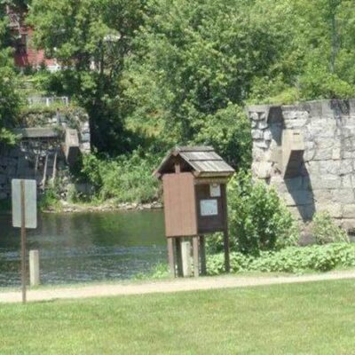
The Willey House Historic Site — now a gift shop and visitor center — marks the location of the original homestead. The landslide scar is still visible on the mountain above.
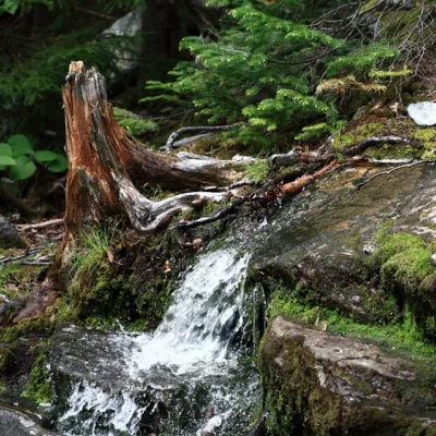
Waterfalls
Crawford Notch contains some of the most spectacular waterfalls in New England, from towering plunges to delicate cascades visible from the highway.
| Waterfall | Height | Hike | Highlights |
|---|---|---|---|
| 💧 Arethusa Falls | 176 ft | 2.6 mi RT, moderate | Tallest waterfall in NH, spectacular spring flow |
| 💧 Ripley Falls | 100 ft | 1.0 mi RT, easy-moderate | Dramatic sliding cascade over granite slabs |
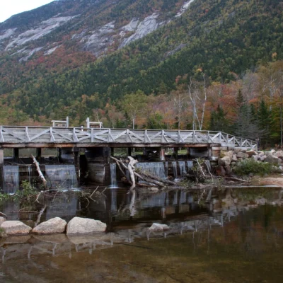
| 💧 Silver Cascade | 250 ft total drop | Roadside | Visible from Route 302, long sliding cascade |
| 💧 Flume Cascade | ~60 ft | Roadside | Visible from Route 302, narrow granite chute |
| 💧 Kedron Flume | ~50 ft | Short walk | Narrow gorge with cascading brook |
Arethusa Falls — the crown jewel — drops 176 feet over a granite cliff face, making it the tallest single-drop waterfall in New Hampshire. Named for the Greek mythological nymph transformed into a spring, the falls are most impressive in spring (late April-early June) when snowmelt maximizes flow. The 2.6-mile round-trip hike follows Bemis Brook through old-growth spruce forest. A more challenging loop (4.5 miles) connects Arethusa Falls, Frankenstein Cliffs, and stunning overlooks of the notch.
⚠️ Safety Note: The rocks near all waterfalls are extremely slippery — several fatal falls have occurred. Stay behind railings and fencing. Never climb on wet rocks near the falls’ edge.
Hiking & Trails
Crawford Notch offers some of the finest hiking in the White Mountains, from easy waterfall walks to strenuous Presidential Range traverses.
| Trail | Distance | Difficulty | Highlights |
|---|---|---|---|
| 🥾 Crawford Path | 8.5 mi to Mt. Washington | Strenuous | Oldest trail in America (1819), above-treeline |
| 🥾 Arethusa Falls Trail | 2.6 mi RT | Moderate | NH’s tallest waterfall (176 ft) |
| 🥾 Frankenstein Cliff Trail | 4.5 mi loop | Moderate-Strenuous | Dramatic cliff views over the notch |
| 🥾 Webster Cliff Trail (AT) | 6.6 mi RT to Mt. Webster | Strenuous (2,700 ft gain) | Appalachian Trail, spectacular ridge views |
| 🥾 Sam Willey Trail | 1.5 mi RT | Easy | Flat riverside walk, family-friendly |
| 🥾 Ripley Falls Trail | 1.0 mi RT | Easy-Moderate | 100-ft sliding cascade |
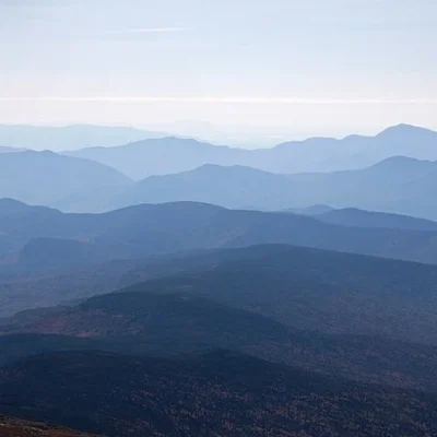
The Crawford Path — beginning at the AMC Highland Center at Crawford Notch — climbs 8.5 miles to the summit of Mount Washington (6,288 ft), traversing the exposed Presidential Range ridge above treeline. This trail — maintained continuously since 1819 — passes over or near Mount Clinton (Pierce), Mount Eisenhower, Mount Franklin, Mount Monroe, and past the Lakes of the Clouds AMC Hut before the final summit push. The above-treeline section (approximately 5 miles) is exposed to extreme weather and should only be attempted by experienced hikers with proper gear.
⛰️ White Mountain Warning: Weather above treeline changes rapidly and can be life-threatening. Mount Washington holds the former world wind speed record (231 mph). Carry warm layers, rain gear, extra food, and a map even on clear summer days. Turn back if conditions deteriorate.
Geology
Crawford Notch was carved by glacial erosion during the Pleistocene Ice Age. The Laurentide Ice Sheet — over a mile thick — ground through the notch, deepening and widening a pre-existing river valley into the dramatic U-shaped pass visible today. The notch walls expose Conway granite (200+ million years old) and older metamorphic rock. The landslide scars visible on the slopes — including the 1826 Willey Slide — testify to the ongoing erosive power of water on these steep, glacially over-steepened slopes.
Camping & Lodging
| Accommodation | Details |
|---|---|
| 🏕️ Dry River Campground | 30 tent sites, riverside, seasonal (late May-mid October) |
| 🏠 AMC Highland Center | Lodge rooms, bunkrooms, meals included, year-round |
| ⛺ AMC Huts (backcountry) | Lakes of the Clouds, Mizpah Spring — on the ridge above |
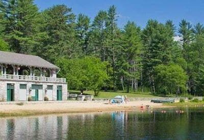
The Dry River Campground — in the heart of the notch along the Saco River — offers 30 wooded tent sites with the sounds of the river and occasional train whistles (the Conway Scenic Railroad passes through). The AMC Highland Center at Crawford Notch — a full-service lodge operated by the Appalachian Mountain Club — offers rooms, meals, guided hikes, and educational programs year-round.
Wildlife & Nature
Crawford Notch State Park — 5,775 acres in the heart of the White Mountains — features the most dramatic glacially carved mountain pass in New Hampshire. Arethusa Falls — 176 feet — is the tallest waterfall in the state. The Crawford Path (1819) is the oldest continuously maintained hiking trail in America. The Notch’s dense spruce-fir forest transitions to alpine tundra on the surrounding Presidential Range peaks. Moose are frequently spotted at dawn and dusk on Route 302 through the notch. Black bears inhabit the dense forest — proper food storage is essential. Peregrine falcons nest on the cliff faces. Bicknell’s thrush — one of the rarest songbirds in North America — breeds in the high-elevation fir forest. American marten (rare in NH) may inhabit the remote spruce forest. Brook trout inhabit the Saco River and its tributaries.
Nearby Attractions
Mount Washington — accessible via the Cog Railway (from Bretton Woods, 3 miles north of the notch) or the Auto Road (from Pinkham Notch, 15 miles north) — is the highest peak in the Northeast at 6,288 feet, with the most extreme weather station in the world. Bretton Woods — at the notch’s north end — has the Omni Mount Washington Resort (site of the 1944 Bretton Woods Conference that established the World Bank and IMF) and Bretton Woods Ski Area. AMC Highland Center — at Crawford Notch — offers lodging, meals, and guided programs. Frankenstein Trestle — a dramatic railroad bridge visible from the trail — is an engineering marvel. North Conway — 20 miles south — has outlet shopping, the Conway Scenic Railroad, and Echo Lake State Park. Franconia Notch State Park — 15 miles west — has the Flume Gorge and Cannon Mountain.
How tall is Arethusa Falls?
Arethusa Falls is 176 feet, making it the tallest single-drop waterfall in New Hampshire. The 2.6-mile round-trip hike is moderate in difficulty. The falls are most spectacular in spring (late April-early June) when snowmelt maximizes water flow.
What is the Crawford Path?
The Crawford Path — established by Ethan Allen Crawford in 1819 — is the oldest continuously maintained hiking trail in America. It runs 8.5 miles from Crawford Notch to the summit of Mount Washington (6,288 ft), traversing the Presidential Range ridge. Much of the trail is above treeline and exposed to extreme weather.
What happened to the Willey family?
On August 28, 1826, a massive landslide swept toward the Willey family homestead in Crawford Notch. The family of seven plus two hired men fled the house and were all killed. Ironically, a boulder split the slide around the house, which survived intact. The tragedy became a national sensation and is commemorated at the Willey House Historic Site.
Can I see waterfalls from the road?
Yes! Silver Cascade (250-foot total drop) and Flume Cascade (~60 feet) are both visible directly from Route 302 through the notch. Pull-off areas allow safe stopping. For the larger Arethusa Falls (176 ft) and Ripley Falls (100 ft), short hikes are required.
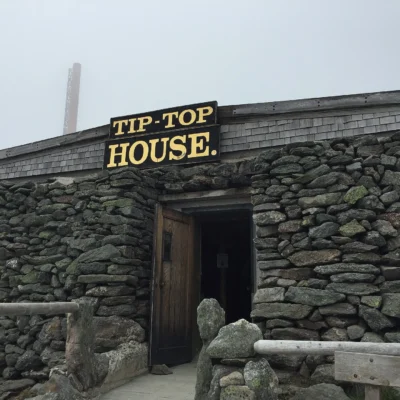
Make it a road trip: Pair a visit with Willey House (a short drive away) or Tip-Top House (a short drive away).
Camping reservations: Book campsites and cabins for New Hampshire state parks online at newhampshirestateparks.reserveamerica.com.
🏔️ Experience the Heart of the White Mountains
Where glacial cliffs, 176-foot waterfalls, and America’s oldest hiking trail converge. Camp at Dry River or stay at the AMC Highland Center.
Location & Getting There
Crawford Notch State Park stretches along Route 302 between Bartlett and Hart’s Location in the White Mountains. From North Conway (20 miles southeast), take Route 302 west through Bartlett. From Bretton Woods/Twin Mountain (10 miles north), take Route 302 south. The Willey House visitor center is approximately at the notch’s midpoint. GPS coordinates: 44.1481, -71.3972. The nearest Amtrak station is in White River Junction, VT (65 miles). Portland Jetport (100 miles) and Manchester-Boston Regional Airport (130 miles) are the nearest commercial airports.
Quick Facts
- Acreage: 5,775 acres
- Established: 1911
- Highest Waterfall: Arethusa Falls (176 ft)
- Oldest Trail: Crawford Path (1819)
- Coordinates: 44.1481, -71.3972
- Activities: Hiking, Camping, Waterfall Viewing, Rock Climbing, Cross-Country Skiing
- Pass Required: NH State Parks day-use fee ($4/adult, $2/child)
- Pets: Allowed on leash on most trails
Best Time to Visit
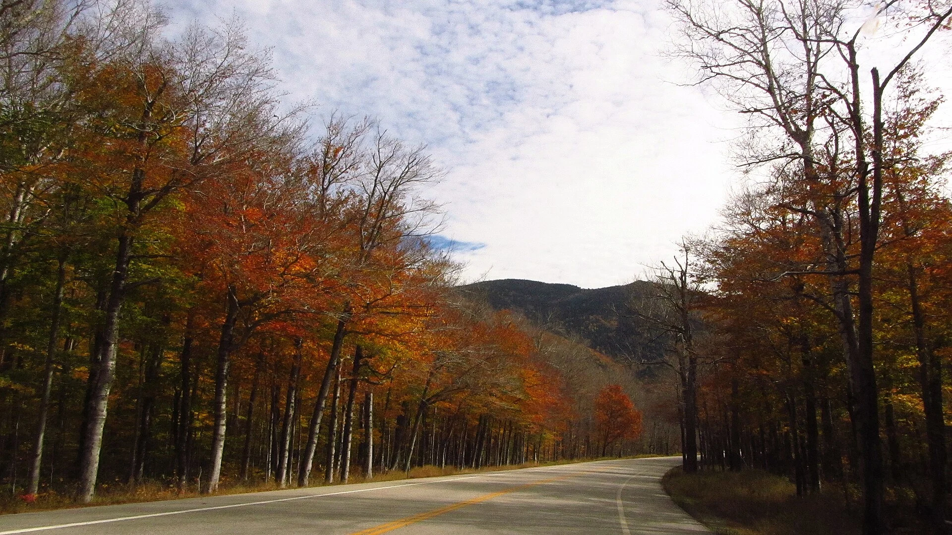
Late May through June offers peak waterfall flow from snowmelt. July-August is ideal for hiking and camping. Late September through mid-October brings spectacular fall foliage — the hardwood forests of the notch are among the most dramatic in New England. Winter offers snowshoeing, cross-country skiing, and frozen waterfall viewing. The notch is open year-round (Route 302 is maintained in winter).
Explore More New Hampshire State Parks
Crawford Notch State Park is one of many outstanding state parks in New Hampshire. Discover more parks in our Best State Parks in New Hampshire guide, or use our Park Finder to search by activity, location, or features.

Park Location
Plan your gear for Crawford Notch State Park
From our editorial guides, matched to this park’s activities: