Lakelands Trail State Park
Overview: Michigan’s Great Lake-to-Lake Connector
Stretching over 30 miles across the rolling glacial landscape of south-central Michigan, the Mike Levine Lakelands Trail State Park is one of the longest and most ambitious rail-trail conversions in the state. This linear park follows the abandoned corridor of the former Grand Trunk Western Railroad through Livingston, Ingham, and Jackson counties, passing through a scenic patchwork of farmland, hardwood forests, wetlands, and historic small towns. In 2018, the trail was officially renamed in honor of Mike Levine, a Michigan philanthropist and champion of trail development.
What makes the Lakelands Trail genuinely significant beyond its considerable length is its role as a critical segment of Michigan’s Great Lake-to-Lake Trail, Route #1—an enormously ambitious, multi-decade project to create a continuous non-motorized trail spanning the entire Lower Peninsula from Lake Michigan at South Haven to Lake Huron at Port Huron. When fully completed, this cross-state corridor will be one of the longest continuous trail systems in the United States. The Lakelands Trail provides the vital interior link, connecting the well-developed trail networks near Jackson and Lansing to the recreation areas surrounding the Pinckney-Hamburg corridor and eventually to the coast.
The Railroad Heritage
The Grand Trunk Western Railroad, which operated this corridor from the mid-19th century through the late 20th century, was one of the major rail systems serving Michigan’s agricultural interior. The railroad transported grain, livestock, dairy products, and manufactured goods between the small farming communities of Livingston and Ingham counties and the larger processing and distribution hubs in Jackson and Lansing.
As economic shifts and interstate highway construction rendered many rural rail lines unprofitable, the Grand Trunk Western gradually abandoned segments of this corridor during the 1970s and 1980s. The State of Michigan, recognizing the immense recreational and transportation potential of the flat, cleared right-of-way, acquired the corridor and began the lengthy process of converting it into a multi-use trail. The gentle railroad grade—designed to accommodate heavy freight trains—ensures that the Lakelands Trail maintains a remarkably easy, consistent slope ideal for cyclists and walkers of all ability levels.
Trail Surface and Sections
The Lakelands Trail’s surface varies by section, reflecting the phased nature of its development and improvement over the years.
Eastern Section: Hamburg to Pinckney (Paved)
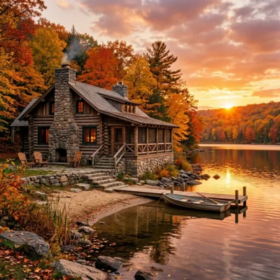
The easternmost section, running through Hamburg Township and toward the community of Pinckney, features a smooth asphalt surface. This paved segment is the newest and most polished, suitable for road bikes, inline skates, strollers, and wheelchairs. It provides convenient access to the Pinckney State Recreation Area and the Huron River corridor.
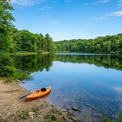
Central and Western Sections (Crushed Stone/Limestone)
The majority of the trail’s length features a hard-packed crushed limestone or slag surface. In dry conditions, this surface is firm and enjoyable for hybrid and mountain bikes, but narrow road bike tires will struggle. After significant rainfall, sections can become soft and muddy, particularly in low-lying areas near wetlands and stream crossings. Horseback riding is permitted on designated sections, typically on a separated parallel tread alongside the main trail.
The 17 Interpretive Historic Markers
One of the Lakelands Trail’s most distinctive features is its series of 17 interpretive markers installed at intervals along the corridor. Each marker documents a specific aspect of the local history connected to the railroad and the communities it served. Topics range from the founding of small towns along the line, to the history of Michigan’s grain trade, to the role of the railroad in the Civil War-era “Underground Railroad” movement. For history-minded hikers and cyclists, reading all 17 markers during a full trail traverse provides a fascinating, self-guided history lesson that transforms the ride from a purely physical experience into an educational journey.
Landscape and Natural Features
The Lakelands Trail traverses a classic southern Michigan glacial landscape—a gentle, undulating terrain shaped by the retreat of the continental ice sheets approximately 10,000 years ago.
Farmland and Meadows
Long stretches of the trail pass through active agricultural land, including corn and soybean fields, hay meadows, and horse pastures. These open sections provide wide-horizon views and spectacular sunset riding opportunities during the late summer and autumn months.
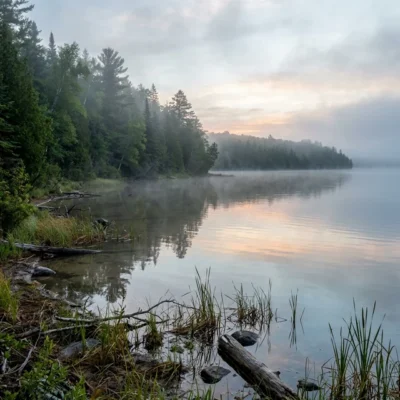
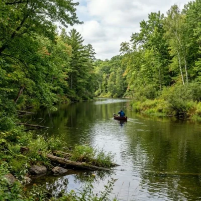
Wetlands and Stream Crossings
The trail crosses numerous small streams and skirts the edges of kettle-hole wetlands—depressions left by melting glacial ice blocks. These wetlands are biological hotspots, supporting dense stands of cattails, sedges, and willow thickets that harbor frogs, turtles, muskrats, and a tremendous diversity of nesting and migrating birds. Great blue herons, sandhill cranes, and red-winged blackbirds are commonly observed from the trail in these sections.
Hardwood Forests
Intermittent forest blocks along the corridor feature mature stands of oak, hickory, maple, and beech. These shaded sections provide welcome relief during hot summer rides and explode with color during the Michigan autumn. Pileated woodpeckers, white-tailed deer, and wild turkeys are frequently spotted in these wooded stretches.
Connections to the Regional Trail Network
The Lakelands Trail’s importance extends far beyond its own boundaries. It serves as the critical middle segment connecting several major Michigan trail systems.
- Great Lake-to-Lake Trail (Route #1): The trail is a designated segment of this 275+ mile cross-state route from South Haven to Port Huron.
- Pinckney State Recreation Area: The eastern trailhead connects to the extensive hiking and mountain biking trail network within the 11,000-acre Pinckney Recreation Area, including the famous Potawatomi and Silver Lake trails.
- Lansing River Trail: At its western end, the trail approaches connections to the Lansing-area trail network, providing potential access to the state capital’s extensive non-motorized transportation system.
- Mike Levine’s Vision: The trail’s renaming honors the philanthropist whose financial support accelerated the development and paving of critical sections, bringing the Lake-to-Lake dream significantly closer to reality.
Seasonal Guide
Spring (April–May)
Wildflowers emerge along the wooded sections, and the wetlands come alive with frog chorus and nesting waterfowl. Trail surfaces may be soft and muddy, especially on unpaved sections. Mosquitoes increase as temperatures warm.
Summer (June–August)
Peak riding season. The full trail is accessible and surfaces are generally firm. Long daylight hours allow for full end-to-end rides. Carry ample water; shade is intermittent on the open farmland sections.
Autumn (September–October)
Widely considered the best season for the Lakelands Trail. The hardwood forests produce stunning fall color displays, temperatures are comfortable, and the trail sees significantly less traffic than summer.
Winter (November–March)
The trail is not groomed for winter sports. Cross-country skiing and fat-tire biking are possible but conditions are unpredictable. Some trailhead parking lots may not be plowed. Snowmobile use is not permitted on the Lakelands Trail.
Practical Information
Key Trailheads
- Hamburg Township (Eastern): Off Merrill Road near M-36. Parking, restrooms available. Connects to Pinckney State Recreation Area.
- Pinckney: Near downtown Pinckney off Pearl Street. Convenient access to local restaurants and shops.
- Stockbridge: Parking available at several access points near the historic downtown. A quiet, mid-trail staging point.
Vehicle Pass
A Michigan Recreation Passport ($14 residents, $36 non-residents) or daily vehicle pass is required at designated trailhead parking areas.
Frequently Asked Questions
How long does it take to ride the entire Lakelands Trail? At a moderate cycling pace of 10–12 mph, a full one-way traverse of the 30+ mile trail takes approximately 3 to 3.5 hours. An out-and-back ride doubles the time commitment. Most day riders choose a section rather than attempting the full length.
Can I ride the whole trail on a road bike? Only the eastern paved section near Hamburg is suitable for narrow road bike tires. The majority of the trail is crushed limestone, which requires a hybrid or mountain bike. Gravel bikes with wider tires (35mm+) can handle the surface in dry conditions.
Is horseback riding allowed? Yes, on designated sections. Equestrians typically use a separated parallel tread to avoid conflicts with cyclists and walkers. Check the Michigan DNR website or trailhead signage for specific equestrian-permitted segments.
Are there camping options near the trail? There are no campgrounds directly on the Lakelands Trail itself. However, the nearby Pinckney State Recreation Area offers both modern and rustic camping within easy cycling distance of the eastern trailhead. Private campgrounds and cabin rentals are also available near Stockbridge and Pinckney.
Why was the trail renamed? In 2018, the trail was officially renamed the Mike Levine Lakelands Trail State Park in honor of Mike Levine, a Michigan businessman and philanthropist whose significant financial contributions accelerated the development and paving of critical trail sections, advancing the broader Great Lake-to-Lake Trail vision.
Wildlife & Nature
Lakelands Trail — a 26-mile trail through Michigan’s lake country — passes through wetlands and forests. Sandhill cranes and great blue herons frequent the marshes. White-tailed deer cross the trail regularly.
Nearby Attractions
Pinckney SRA — adjacent. Hell, MI — nearby. Brighton — 15 miles north.