
🌤 Weather at Riverside State Park by season
| Spring | Summer | Fall | Winter |
|---|---|---|---|
| 32–67 °F | 51–84 °F | 30–74 °F | 24–40 °F |
Each range runs from the coldest monthly average low to the warmest monthly average high in that season (1991-2020 climate normals), measured at Spokane Intl Airport, 5 mi away, elevation 2,353 ft. Conditions at the park can differ from the station, especially where elevation differs — check a forecast before you go.

🪨 Spokane’s Urban Wilderness — 9,000+ Acres — Washington’s second-largest state park featuring the iconic Bowl and Pitcher basalt formations, a CCC-era swinging bridge over the Spokane River, 55+ miles of multi-use trails, 25 miles of equestrian trails, Deep Creek Canyon, a 600-acre ORV area, rock climbing, kayaking, and camping — all minutes from downtown Spokane
Just minutes from downtown Spokane — Washington’s second-largest city — lies one of the most remarkable urban-adjacent wilderness areas in the American West. Riverside State Park stretches across over 9,000 acres along the Spokane and Little Spokane Rivers, making it Washington’s second-largest state park. This is not a manicured city park. This is a genuine wild landscape of basalt canyons, whitewater rivers, dense pine forests, rattlesnake-country trails, and geological formations carved by the cataclysmic Missoula Floods that reshaped the Pacific Northwest 15,000 years ago.
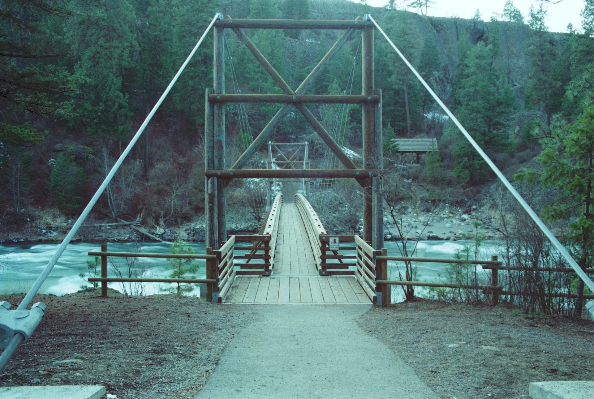
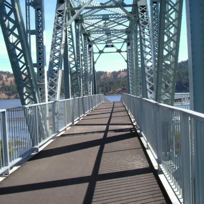
The park’s most iconic feature is the Bowl and Pitcher area — a dramatic stretch of the Spokane River where massive basalt rock columns rise from churning whitewater, connected by a historic Civilian Conservation Corps (CCC) suspension bridge built in the 1930s. From this swinging bridge, the river below looks almost primordial — a scene that belongs in a national park, not five miles from a city of 230,000.
Bowl and Pitcher
| Feature | Details |
|---|---|
| Rock Formations | Basalt columns sculpted by Missoula Floods (~15,000 years ago) |
| Swinging Bridge | CCC-built suspension bridge (1930s) — connects trails |
| River | Spokane River whitewater — Class II-III in spring |
| Views | Most photographed spot in the Spokane region |
Deep Creek Canyon
South of the main park area, Deep Creek Canyon offers a more rugged, less-visited wilderness experience. Dramatic basalt columns, talus slopes, seasonal wildflower displays (spring), and sweeping views of the channeled scablands landscape make this a favorite with serious hikers and mountain bikers.
Trails — 55+ Miles
| Type | Miles | Highlights |
|---|---|---|
| Hiking | 55+ miles | River corridors, canyon rims, forest loops |
| Equestrian | 25 miles | Dedicated horse trails + arena, round pen, obstacle course |
| Mountain Biking | 30+ miles | Singletrack through basalt and pine forest |
Water Sports
- Kayaking/Canoeing: Spokane and Little Spokane Rivers — flatwater and whitewater sections
- Fishing: Trout and bass in both rivers
- Swimming: Seasonal river swimming (use caution — currents)
Camping
| Campground | Type | Features |
|---|---|---|
| Bowl and Pitcher | Standard sites | Near iconic formations, river access |
| Equestrian Camp | Horse-friendly | Corrals, 25mi dedicated trails |
| Lake Spokane | Waterfront | Quieter, on Lake Spokane section |
Off-Road Vehicle Area
A dedicated 600-acre ORV area within the park provides legal off-road riding for motorcycles, ATVs, and 4×4 vehicles — one of few such areas near a major city in Washington.
Essential Visitor Information
| Detail | Information |
|---|---|
| Location | Northwest Spokane, WA (5 minutes from downtown) |
| Size | 9,000+ acres |
| Parking | Discover Pass required ($45/year or $10/day) |
Wildlife & Nature
Riverside State Park — 14,000+ acres along the Spokane and Little Spokane Rivers — is one of the largest state parks in Washington. The park features the dramatic Bowl and Pitcher basalt formations — swirling basalt spires sculpted by the Spokane River — accessible via a suspension bridge. The Centennial Trail (37 miles) connects through the park. White-tailed deer, moose, and coyotes inhabit the pine forests. Osprey and bald eagles fish the rivers. River otters play in the rapids. The Little Spokane River Natural Area preserves pristine river habitat for canoeing and wildlife viewing.
Nearby Attractions
Spokane — adjacent — is Washington’s second city with Riverfront Park (Expo ’74 site), Manito Park, and craft breweries. Mount Spokane State Park — 30 miles northeast — has alpine skiing. Coeur d’Alene, Idaho — 35 miles east — has a stunning lake resort area.
Insider Tips
Spokane’s backyard: Riverside is Washington’s third-largest state park — 10,000 acres of river canyons, basalt formations, and ponderosa pine forest minutes from downtown Spokane. Pro tip: The Bowl and Pitcher area features dramatic basalt rock formations and a suspension bridge over the Spokane River. Mountain biking: 55+ miles of trails.
Best Time to Visit
Spring: Spokane River at peak flow. Summer: Hiking and mountain biking. Fall: Golden ponderosa pine. Winter: Cross-country skiing and snowshoeing.
Frequently Asked Questions
What is the Bowl and Pitcher?
The Bowl and Pitcher is a dramatic basalt formation where the Spokane River carved through ancient lava flows. A suspension bridge spans the river, providing stunning views of the rock formations and whitewater below. It’s the most iconic feature of Riverside State Park.
What are the Bowl and Pitcher rock formations?
The Bowl and Pitcher formations are massive basalt rock columns rising from the Spokane River within Riverside State Park. They were sculpted approximately 15,000 years ago by the catastrophic Missoula Floods — one of the largest flood events in Earth’s history. The formations are connected by a historic CCC-built suspension bridge from the 1930s. The name refers to the shapes of the rocks: one resembles a bowl, another a pitcher. It’s the most photographed location in the Spokane region.
Make it a road trip: Pair a visit with Centennial Trail (a short drive away).

🐾 Dogs & Pets at Riverside State Park
- Pets allowed? statewide rule
- Pets are allowed in most Washington state parks but must be under physical control on a leash at all times.
- Leash rule statewide rule
- 8 ft maximum leash required; pets must be under physical control
- Beaches & swim areas statewide rule
- Pets are not permitted on designated swim beaches
- Cabins & lodging statewide rule
- Pets are not allowed inside vacation houses but are permitted in designated pet-friendly cabins and yurts (e.g. Grayland Beach, Seaquest, Ike Kinswa — Cape Disappointment does NOT allow pets in its yurts), typically up to two pets, with a pet fee
- Pet fees statewide rule
- No day-use pet fee; $15 per night pet fee in pet-friendly cabins/yurts
- Statewide exceptions statewide rule
- Director-designated off-leash areas are exempt from the leash rule and are conspicuously posted
Are dogs allowed at Riverside State Park?
Pets are allowed in most Washington state parks but must be under physical control on a leash at all times. Individual parks can post stricter rules — check signage on arrival.
Rules verified July 2026 via parks.wa.gov. More: Washington state parks guide · Dog rules in all 50 states compared
Park Location
Plan your gear for Riverside State Park
From our editorial guides, matched to this park’s activities:
Top Tours & Activities in Washington
 from $95
 from $40
 from $599