🏔️ Tennessee’s Grand Canyon — 60 miles of trails through 1,500-foot-deep gorges, the Great Stone Door cliff passage, Savage Falls, Greeter Falls, backcountry camping on the Cumberland Plateau, and some of the most dramatic geology in the eastern United States
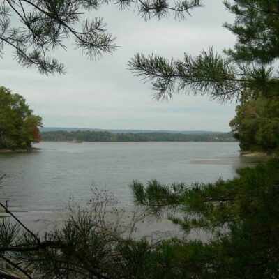
Deep in the heart of Tennessee’s Cumberland Plateau, approximately 60 miles northwest of Chattanooga, the landscape cracks open into a series of immense gorges — steep-walled, forested canyons carved over millions of years by the patient work of Big Creek, Collins River, and Savage Creek through layers of sandstone and limestone. This is Savage Gulf State Natural Area, part of South Cumberland State Park, and it is one of the most spectacular and challenging hiking destinations in the entire Southeast.
Savage Gulf protects over 15,000 acres of old-growth forest, sheer sandstone cliff lines, thundering waterfalls, and a network of approximately 60 miles of trails that range from easy plateau-top strolls to strenuous multi-day backpacking routes that descend 1,000+ feet into the gulfs. The signature feature — the Great Stone Door — is a massive crack in the cliff face that drops 100 feet into the gorge below, used for centuries as a passage between the plateau and the gulf floor. From the overlooks along the rim, the views rival anything in the Appalachian chain. This is Tennessee’s wild heart, protected and accessible but never tamed.
The Great Stone Door
The Great Stone Door is a natural rock formation — a 100-foot-deep, 10-foot-wide crack in the sandstone cliff that forms a narrow passage from the plateau rim down to the gulf floor. Native Americans used this passage for centuries as a route between the plateau top and the valley below, and early European settlers recorded it as one of the wonders of the Tennessee wilderness.
| Detail | Information |
|---|---|
| Depth | Approximately 100 feet |
| Trail to Stone Door | 1.0 mile (easy, from Stone Door Ranger Station) |
| Overlooks | Multiple along the rim — panoramic gulf views |
| Difficulty | Easy to the overlook; strenuous if descending through the Door |
| Historical Use | Native American passage, early settler route |
The trail from the Stone Door Ranger Station to the Great Stone Door and its overlooks is an easy 2-mile out-and-back walk — one of the most rewarding short hikes in Tennessee. The overlooks along the rim provide jaw-dropping views across the gulf, especially in fall when the canopy below erupts in color.
Hiking Trails
Savage Gulf’s trail system covers approximately 60 miles, offering everything from quick waterfall visits to multi-day backpacking loops through deep gorges.
| Trail | Distance | Difficulty | Highlights |
|---|---|---|---|
| Stone Door Trail | 2.0 mi (out & back) | Easy | Great Stone Door, rim overlooks |
| Savage Day Loop | 4.2 miles | Moderate | Savage Falls, Rattlesnake Point |
| Big Creek Rim Trail | 7.6 miles | Moderate | Panoramic rim views, old-growth |
| Big Creek Gulf Trail | 8.5 miles | Strenuous | Canyon floor, creek crossings, waterfalls |
| Greeter Falls Loop | 2.0 miles | Moderate | Multiple waterfalls, swimming hole |
| Full Savage Gulf Loop | ~20 miles | Strenuous | Multi-day backpack, complete gorge traverse |
Best Hikes by Experience Level
- Beginner/Families: Stone Door Trail (2 mi) — flat, spectacular payoff. Greeter Falls Loop (2 mi) — moderate, waterfalls
- Intermediate: Savage Day Loop (4.2 mi) — Savage Falls, creek, Rattlesnake Point overlook
- Advanced: Big Creek Gulf Trail (8.5 mi) — strenuous descent, creek crossings, overnight recommended
- Backpackers: Full Savage Gulf Loop (~20 mi) — 2-3 day trip through the complete gorge system
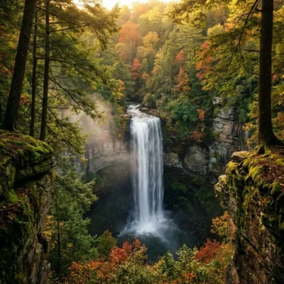
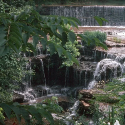
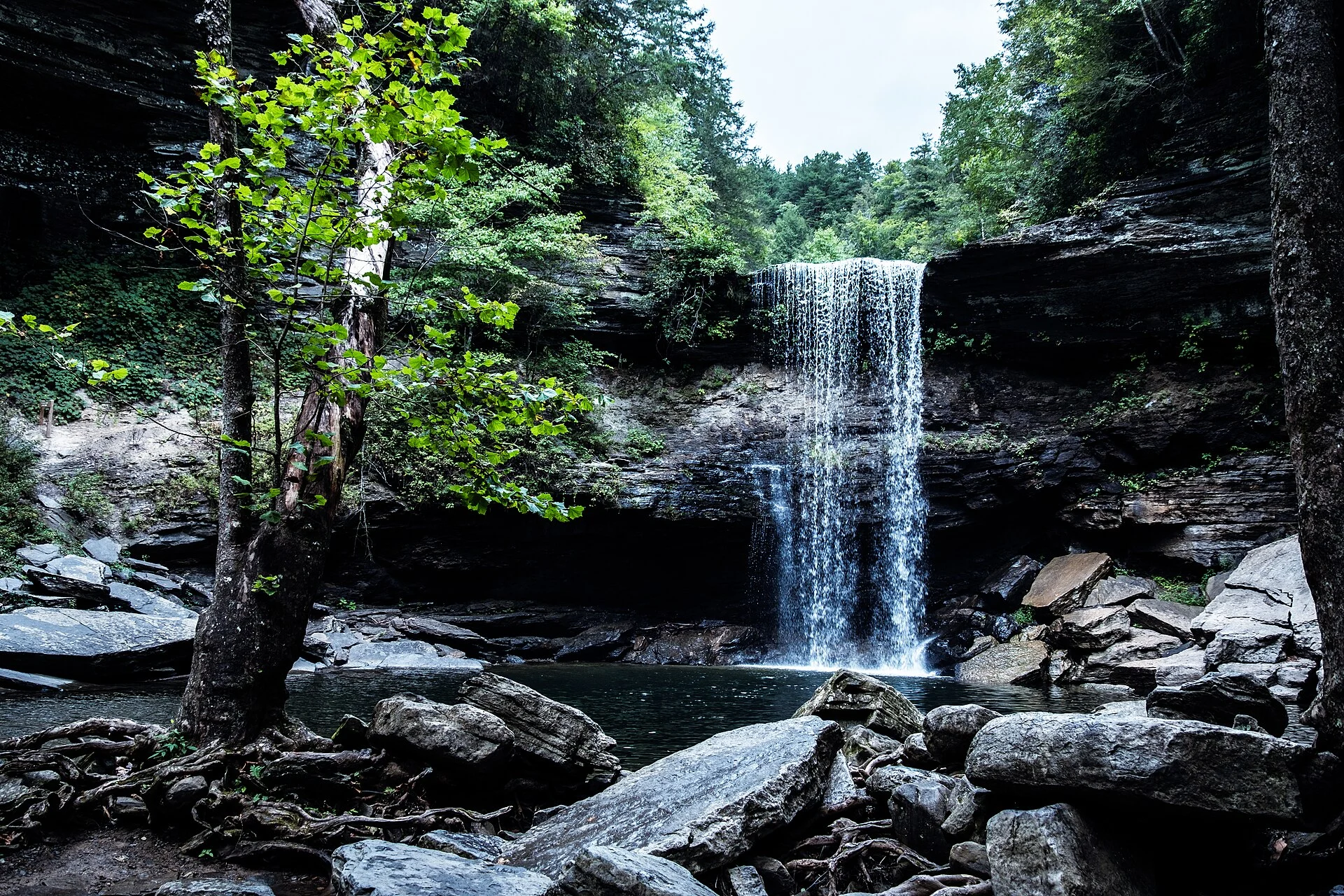
Waterfalls
| Waterfall | Height | Access |
|---|---|---|
| Savage Falls | 30 feet | 4.2-mile Savage Day Loop |
| Greeter Falls (Upper) | 15 feet | 2-mile Greeter Falls Loop |
| Greeter Falls (Lower) | 50 feet | Short spur from upper falls |
| Boardtree Falls | 25 feet | Via Savage Day Loop spur |
Camping
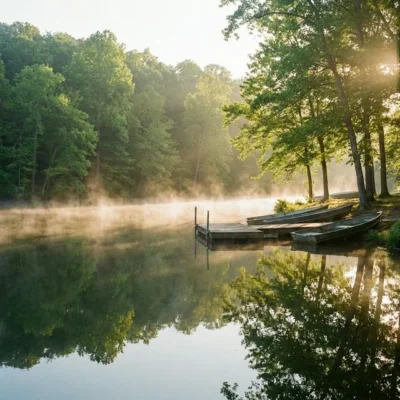
Savage Gulf offers backcountry camping only — there are no drive-up campgrounds. All campsites require hiking to reach, and all must be reserved in advance through the Tennessee State Parks reservation system.
| Campground | Access | Notes |
|---|---|---|
| Stone Door | 0.3 mi from trailhead | Most accessible, near ranger station |
| Savage Station | 0.5 mi from trailhead | Good for beginners to backcountry |
| Alum Gap | 3 miles in | Central location for loop hikes |
| Sawmill | 5 miles in | Deep gulf, remote |
| Hobbs Cabin | Varies | Rustic cabin, reservable |
Important: No cell service in much of the park. Download maps and trail information before arriving. Hikers must be off trails by dark. Carry-in/carry-out trash policy. Water filtration required — creek water available but must be treated.
Essential Visitor Information
| Detail | Information |
|---|---|
| Address | 1183 Stone Door Rd, Beersheba Springs, TN 37305 |
| Hours | Sunrise to Sunset (trails close at dark) |
| Entrance Fee | Free |
| Camping Fee | $8-$12/night per site (reservation required) |
| Rappelling | Permit required (Stone Door area only) |
| Pets | Leashed pets allowed on most trails |
| Phone | (931) 692-3887 |
Getting There
The Stone Door Ranger Station (main access point) is located off Highway 56 near Beersheba Springs, Tennessee.
- From Chattanooga: 60 miles northwest (~1 hour 15 minutes)
- From Nashville: 90 miles southeast (~1 hour 45 minutes)
- From Murfreesboro: 65 miles south (~1 hour 15 minutes)
Best Time to Visit
| Season | Highlights | Crowd Level |
|---|---|---|
| Spring (Mar-May) | Waterfalls at peak flow, wildflowers, green canopy | Moderate |
| Summer (Jun-Aug) | Swimming holes, full foliage, long days | High |
| Fall (Oct-Nov) | Peak foliage — spectacular from rim overlooks | Very High |
| Winter (Dec-Feb) | Frozen falls, dramatic views through bare trees | Low |
Nearby Attractions
- South Cumberland State Park: Same park system — Fiery Gizzard Trail, Foster Falls, Grundy Forest
- Falls Creek Falls State Park: 30 miles east — 256-foot waterfall, Tennessee’s tallest
- Chattanooga: 60 miles — Lookout Mountain, Tennessee Aquarium, Rock City
- McMinnville: 30 miles north — Cumberland Caverns, town dining
Wildlife & Nature
Savage Gulf SNA — part of South Cumberland SP — preserves a spectacular canyon system on the Cumberland Plateau with three deep gorges converging. The park’s cliffs, waterfalls, and virgin forest support black bears, timber rattlesnakes, and peregrine falcons. Stone Door — a 10-foot-wide crack in the cliff face — provides a dramatic gorge entrance.
How hard is the Stone Door trail?
The trail from the Stone Door Ranger Station to the Great Stone Door overlook is an easy 2-mile out-and-back walk — flat, well-maintained, and suitable for most fitness levels including families with children. The dramatic views at the overlook make it one of the best effort-to-reward ratios of any hike in Tennessee. However, if you descend through the Stone Door into the gorge below, the difficulty increases significantly to strenuous.
Can you camp at Savage Gulf?
Yes, but it is backcountry camping only. There are no drive-up campgrounds. All campsites require hiking to reach, and reservations are required in advance through the Tennessee State Parks reservation system. The Stone Door and Savage Station campgrounds are the most accessible (0.3-0.5 miles from trailheads), while deeper sites like Alum Gap and Sawmill offer a more remote experience.
Is there cell phone service at Savage Gulf?
Cell service is unreliable to nonexistent throughout much of Savage Gulf, especially in the gorges. Download maps, trail information, and any needed apps before arriving. Bring a physical trail map as backup. This is genuine wilderness — plan accordingly with proper gear, water filtration, and let someone know your itinerary.
More parks nearby: Greeter Falls Trail is a short drive away, while Sequatchie Cave State Natural Area lies a short drive away.

🐾 Dogs & Pets at Savage Gulf State Natural Area
- Pets allowed? statewide rule
- Dogs, cats and other pets are permitted in Tennessee State Parks, including all campgrounds, if leashed, crated or otherwise under physical restrictive control at all times.
- Leash rule statewide rule
- 6 ft physical leash required; pets must not be left unattended
- Beaches & swim areas statewide rule
- Pets are prohibited on designated swimming beaches and at pools at all times
- Cabins & lodging statewide rule
- Pets prohibited in park lodges and cabins except designated pet-friendly units; each park offers a limited number of pet-friendly lodge rooms and one pet-friendly cabin ($20 per pet per night)
- Pet fees statewide rule
- No day-use or campground pet fee; $20 per pet per night in designated lodge rooms/cabins
- Statewide exceptions statewide rule
- Park management may post additional no-pet areas on trails; proof of rabies vaccination may be required
Are dogs allowed at Savage Gulf State Natural Area?
Dogs, cats and other pets are permitted in Tennessee State Parks, including all campgrounds, if leashed, crated or otherwise under physical restrictive control at all times. Individual parks can post stricter rules — check signage on arrival.
Rules verified July 2026 via tnstateparks.com. More: Tennessee state parks guide · Dog rules in all 50 states compared
Park Location
Plan your gear for Savage Gulf State Natural Area
From our editorial guides, matched to this park’s activities: