🌤 Weather at Fiery Gizzard State Park by season
| Spring | Summer | Fall | Winter |
|---|---|---|---|
| 37–74 °F | 61–83 °F | 37–78 °F | 26–49 °F |
Each range runs from the coldest monthly average low to the warmest monthly average high in that season (1991-2020 climate normals), measured at Monteagle, 4 mi away, elevation 1,850 ft. Conditions at the park can differ from the station, especially where elevation differs — check a forecast before you go.

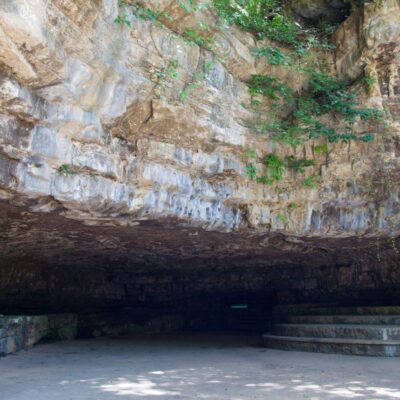
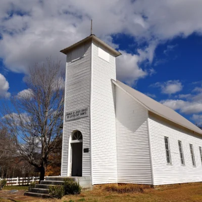
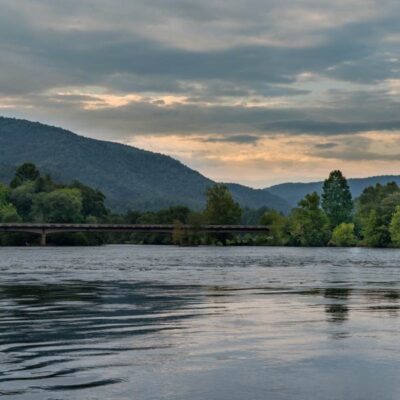
Fiery Gizzard State Park is a Tennessee state park on the southern Cumberland Plateau near Monteagle and Tracy City, in Marion and Grundy counties. Until October 2025 it was part of South Cumberland State Park. Tennessee has split that park into three: Savage Gulf became a state park of its own in 2022, the Lost Cove section became Head of the Crow State Park, and this section now carries the name of its best-known trail. Fiery Gizzard State Park covers 7,816 acres.
Quick Facts
| State | Tennessee |
| Nearest City | Monteagle |
| Counties | Marion, Grundy |
| Park Size | 7,816 acres |
| State park since | October 2025 (before that part of South Cumberland State Park) |
| Signature trail | Fiery Gizzard Trail, 12.8 miles one way, rated hard |
| Entry | Free |
Location & Getting There
The park is not one block of land but several areas a few miles apart. The visitor center on the plateau near Monteagle has a gift shop, aviaries, a picnic shelter, restrooms and playgrounds. Grundy Forest, with the north end of the Fiery Gizzard Trail, and the historic Grundy Lakes lie near Tracy City. Foster Falls and Denny Cove are in the south of the park, about 8 miles southeast of the visitor center. The park’s coordinates are 35.2588, -85.7888.
Hiking Trails
The park’s map lists about 24 miles of trails. These are the main ones:
| Trail | Distance | Rating | What you’ll see |
|---|---|---|---|
| Fiery Gizzard Trail | 12.8 mi one way | Hard | From the North Trailhead at Grundy Forest to the South Trailhead at Foster Falls, past several waterfalls and overlooks and the Sycamore Falls swimming hole |
| Grundy Forest Day Loop | 2 mi loop | Moderate | Waterfalls, a historic Civilian Conservation Corps area and swimming holes |
| Dog Hole Trail | 2.85 mi | Moderate | Werner Point Overlook, Yellow Pine Falls and Sycamore Falls |
| Lone Rock, Coke Oven and Ridge trails | 2.3 mi round trip | Easy | A circuit around the historic Grundy Lakes and their coke ovens |
| Denny Falls Trail | 1 mi one way | Hard | Denny Falls, which the park calls one of its best views |
| Meadow Trail | 0.8 mi loop | Easy | Wildflowers, a pond and berries; an all-terrain wheelchair route |
| Climbers Access Trail | 0.8 mi | Moderate | Passes Foster Falls and links the Foster Falls and Father Adamz campgrounds |
Because the Fiery Gizzard Trail runs one way, plan a car shuttle between the two trailheads or hike part of it as an out-and-back.
Waterfalls and Overlooks
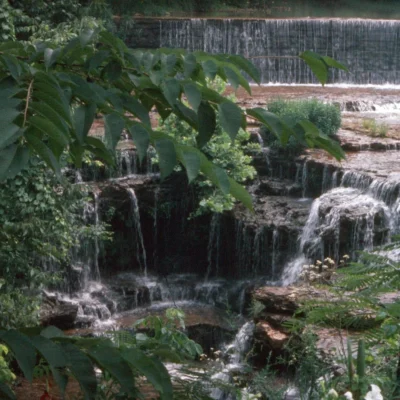
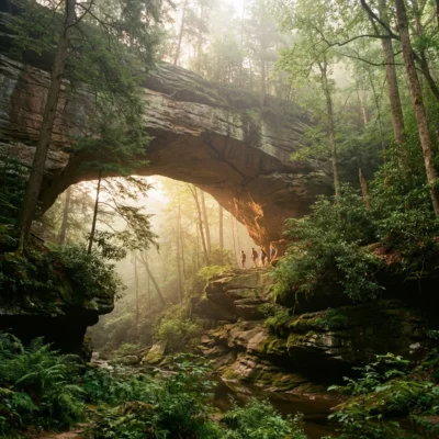
Foster Falls drops 60 feet and Denny Cove Falls 70 feet. Sycamore Falls, Yellow Pine Falls and Blue Hole Falls are smaller. For views, head to the Denny Cove, Ravens Point and Werner Point overlooks.
Swimming, Fishing and Climbing
Grundy Lakes has a swimming beach and fishing on the Main Lake, next to a picnic area. The park’s trail notes also mention swimming holes on the Grundy Forest Day Loop and at Sycamore Falls. Rock climbers use the bluffs at Foster Falls (Climbers Access Trail) and at Denny Cove (Denny East and Denny West trails).
Camping
The campground at Foster Falls has restrooms and a bathhouse. Book Tennessee state park campsites at reserve.tnstateparks.com.
Savage Gulf and Head of the Crow
Two former sections of South Cumberland are now parks of their own. Savage Gulf State Park, with the Great Stone Door and Greeter Falls, lies about 15 miles northeast of the visitor center. Head of the Crow State Park, dedicated in October 2025 from the Lost Cove section, lies about 8 miles southwest near Sewanee; it includes the Sherwood Forest and Hawkins Cove state natural areas.
Nearby Attractions
Fiery Gizzard Trail and Grundy Forest State Natural Area — inside the park, near Tracy City. Foster Falls Small Wild Area — inside the park, about 8 miles southeast. Savage Gulf State Park — about 15 miles northeast. Fall Creek Falls State Park — about 37 miles northeast. Distances are straight-line from the visitor center.
Frequently Asked Questions
Is Fiery Gizzard State Park the same as South Cumberland State Park?
Largely, yes. Tennessee renamed South Cumberland State Park as Fiery Gizzard State Park in October 2025, after it had split off the Lost Cove section as Head of the Crow State Park; Savage Gulf had already become a separate state park in 2022. Fiery Gizzard State Park covers 7,816 acres in Marion and Grundy counties.
How long is the Fiery Gizzard Trail?
The Fiery Gizzard Trail is 12.8 miles one way, from the North Trailhead at Grundy Forest to the South Trailhead at Foster Falls, and the park rates it hard.
Can you swim in Fiery Gizzard State Park?
Yes. Grundy Lakes has a swimming beach on the Main Lake, and the park’s trail notes mention swimming holes on the Grundy Forest Day Loop and at Sycamore Falls; there are no lifeguards on the trails.
Keep exploring: See all Tennessee state parks, or use our Park Finder to search by activity or feature.
Sources: Tennessee State Parks map, trail and campsite data (Tennessee Department of Environment and Conservation), as of October 2026; FOX 17, October 20, 2025; NewsChannel 9, September 23, 2022.

🐾 Dogs & Pets at Fiery Gizzard State Park
- Pets allowed? statewide rule
- Dogs, cats and other pets are permitted in Tennessee State Parks, including all campgrounds, if leashed, crated or otherwise under physical restrictive control at all times.
- Leash rule statewide rule
- 6 ft physical leash required; pets must not be left unattended
- Beaches & swim areas statewide rule
- Pets are prohibited on designated swimming beaches and at pools at all times
- Cabins & lodging statewide rule
- Pets prohibited in park lodges and cabins except designated pet-friendly units; each park offers a limited number of pet-friendly lodge rooms and one pet-friendly cabin ($20 per pet per night)
- Pet fees statewide rule
- No day-use or campground pet fee; $20 per pet per night in designated lodge rooms/cabins
- Statewide exceptions statewide rule
- Park management may post additional no-pet areas on trails; proof of rabies vaccination may be required
Are dogs allowed at Fiery Gizzard State Park?
Dogs, cats and other pets are permitted in Tennessee State Parks, including all campgrounds, if leashed, crated or otherwise under physical restrictive control at all times. Individual parks can post stricter rules — check signage on arrival.
Rules verified July 2026 via tnstateparks.com. More: Tennessee state parks guide · Dog rules in all 50 states compared
Park Location
Plan your gear for Fiery Gizzard State Park
From our editorial guides, matched to this park’s activities: