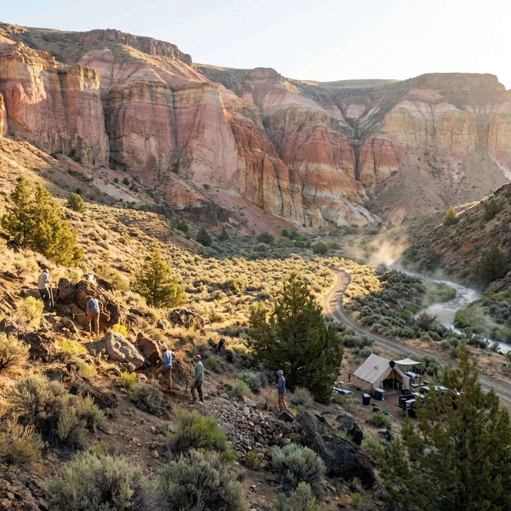
The first thing you notice at Succor Creek State Natural Area isn’t the towering canyon walls painted in shades of pink, cream, and burnt orange. It’s the silence. A profound, almost unsettling quiet broken only by the occasional cry of a red-tailed hawk circling above the rim. Here, in one of Oregon’s most remote corners, you’ve stepped into a landscape that feels more like Mars than the Pacific Northwest—a 15-million-year-old volcanic wonderland where the earth itself has been waiting to share its treasures.
This is Oregon’s secret rockhounding paradise, a place where patient diggers unearth thundereggs—the state’s official rock—from the same volcanic ash that ancient eruptions deposited when mastodons still roamed North America. It’s also one of the last truly wild camping experiences in Oregon: no reservations, no cell service, no potable water, no crowds. Just you, the canyon, and millions of years of geological history spread across multicolored cliffs that glow like embers at sunset.
If you’re looking for amenities and creature comforts, turn back now. But if you crave authentic wilderness, world-class rockhounding, and nights so dark the Milky Way casts shadows—you’ve found your place.
What Makes Succor Creek Extraordinary
Thunderegg Paradise
Oregon’s premier thunderegg hunting grounds—dig for agate-filled volcanic geodes you can take home.
15-Million-Year Canyon
Multicolored volcanic tuff cliffs from the ancient Three Fingers Caldera eruption.
True Wilderness Camping
23 primitive sites with no reservations, no fees, and absolute solitude.
Pristine Dark Skies
Zero light pollution—the Milky Way is so bright you can read by its glow.
The Succor Creek Experience
Driving into Succor Creek feels like traveling back in time. The paved road surrenders to gravel somewhere past Adrian, and soon you’re winding down a dusty track as the canyon walls rise around you. The colors are the first surprise—not the drab browns you might expect from “remote Oregon canyon,” but layers of cream, salmon pink, rust orange, and pale lavender, stacked like a geological layer cake.
Park at one of the primitive pullouts and step out into air that smells of sage and sunbaked rock. The creek—usually little more than a trickle by late summer—winds through the canyon bottom, its banks dotted with ancient cottonwoods that provide welcome shade. This is the moment most visitors experience what can only be described as temporal vertigo: the realization that humans have been coming to this exact spot for thousands of years, first Native Americans who found shelter in the overhangs, then ranchers, miners, and now rockhounds like you—all drawn by the same mysterious pull of this hidden canyon.
Your First Morning
Wake before dawn. The canyon walls, still in shadow, create a natural amphitheater that amplifies the quietest sounds—your coffee percolating, a canyon wren’s descending song, the soft crunch of your boots on volcanic gravel. As the sun crests the eastern rim, the cliffs ignite. What looked gray in twilight now blazes orange and pink, the ancient volcanic layers catching and holding the light like they’re made of compressed sunset.
This is when photographers should be shooting. The first ninety minutes after sunrise paint the canyon walls in colors that simply don’t exist at midday. Position yourself on the west side of the creek, looking back at the main cliffs—the layered bands of tuff will seem to glow from within.
The Complete Rockhounding Guide
Oregon designated the thunderegg as its state rock in 1965, and Succor Creek remains one of the best places on Earth to find them. But successful rockhounding here requires knowledge, preparation, and patience. Here’s everything you need to know.
Understanding What You’re Seeking
A thunderegg is a spherical nodule of volcanic origin—imagine a ball of rhyolite (volcanic glass) that formed a hollow center which later filled with agate, chalcedony, or opal over millions of years. From the outside, they look disappointingly ordinary: rough, brownish-gray spheres ranging from golf ball to softball size. The magic is inside—crack one open and you might find stunning blue agate, banded patterns in cream and orange, or if you’re exceptionally lucky, fire opal.
Native American legend held that these rocks were thrown by battling gods during thunderstorms, hence the name. Geologically, they formed about 15 million years ago when gases expanded within cooling rhyolite flows, creating cavities that slowly filled with mineral-rich solutions over eons.
Where to Find Them: Specific Locations
| Location | What to Look For | Difficulty |
|---|---|---|
| 💎 Main Thunderegg Bed | Cross the footbridge, follow the trail uphill 200 meters, look for exposed rhyolite matrix | Moderate (requires digging) |
| 🌊 Creek Gravel Bars | Water-worn agates, jasper, and occasional tumbled thundereggs | Easy (surface collecting) |
| 🏔️ Western Hillsides | Picture jasper, plant fossils in exposed layers | Easy-Moderate |
| 🌵 Dry Wash Gullies | Tumbled specimens washed down from higher elevations | Easy |
| 🪨 East Canyon Wall Base | Petrified wood fragments, agate nodules | Easy |
💎 The Insider’s Thunderegg Secret
The best thundereggs aren’t lying on the surface—they’re still embedded in their rhyolite matrix. Cross the footbridge near the main camping area and hike uphill about 200 meters until you see exposed beds of crumbly, grayish volcanic rock. This is where the thundereggs hide. Bring a geology pick to chip away at the matrix—the eggs will often “pop” out when you find the right angle. The freshly exposed ones have the best crystal formations inside.
Essential Rockhounding Gear
- Rock hammer or geology pick: For extracting specimens from matrix
- Flat-head screwdriver: For prying eggs from softer matrix
- Small garden shovel: For digging in gravel areas
- 5-gallon bucket: For carrying finds (and measuring your 1-gallon daily limit)
- Heavy work gloves: The rhyolite edges are razor-sharp
- Knee pads: You’ll be kneeling on volcanic rock for hours
- Spray bottle with water: Wet rocks reveal patterns invisible when dry
- Safety glasses: Mandatory when hammering—rock chips fly
Collecting Rules & Etiquette
Oregon allows limited rockhounding in state natural areas. Know the rules:
- 📏 Daily Limit: 1 gallon per person per day
- 📅 Annual Limit: 3 gallons per person per year
- 🚫 Tools: Hand tools only—no power equipment
- 🌱 Fill Your Holes: Refill any holes you dig
- ♻️ Pack Out Everything: Including broken rock fragments you don’t want
What Else You’ll Find
Thundereggs get the glory, but Succor Creek offers a remarkable variety of specimens for the observant collector:
| Specimen | Where to Look | Notes |
|---|---|---|
| 🌈 Picture Jasper | Western hillsides, creek gravel | Landscape-like patterns, browns and creams |
| 🪵 Petrified Wood | Canyon floor, cliff bases | 15-million-year-old trees, some with bark texture |
| 🍂 Plant Fossils | Sedimentary layers on hillsides | Ancient leaves, stems, and seeds |
| 🔮 Clear Agate | Creek gravel bars | Water-tumbled, translucent pieces |
| 🟤 Banded Agate | All areas | Striped patterns in cream, orange, and red |
Reading the Canyon Walls: A Geology Primer
Stand in the center of Succor Creek and look up. You’re standing in the aftermath of one of North America’s most violent volcanic episodes—and the walls around you are a 15-million-year record of fire and time.
About 15.5 million years ago, the Three Fingers Caldera erupted catastrophically, blanketing hundreds of square miles with volcanic ash, pumice, and superheated pyroclastic flows. Layer upon layer accumulated, each eruption adding another band to what would become the Succor Creek Formation. The volcanic ash—a material geologists call “tuff”—compacted and lithified, the minerals within it slowly oxidizing into the rainbow of colors you see today.
Decoding the Colors
| Color | What It Means |
|---|---|
| 🟡 Cream/White | Pure volcanic ash with little iron content |
| 🟠 Orange/Rust | Iron-rich layers oxidized over millions of years |
| 🩷 Pink/Salmon | Trace manganese combined with iron oxides |
| 🟣 Lavender/Purple | Rare: higher manganese content |
| ⚫ Black/Dark Brown | Organic material or dense volcanic glass |
The horizontal banding tells you each color represents a distinct volcanic event—a different eruption, a different day in the deep past when this land was a hellscape of ash clouds and lava flows. Today, those ancient disasters have weathered into something almost impossibly beautiful.
Wilderness Camping: The Real Deal
Succor Creek offers primitive camping in the truest sense—and that’s precisely its appeal. There are no RV hookups, no shower buildings, no camp store, no Wi-Fi, no cell towers. There’s just you and the canyon.
Campsite Overview
| Area | Sites | Best For |
|---|---|---|
| 🚗 West Bank (Drive-Up) | 8 sites | Larger vehicles, easier access, morning sun |
| 🥾 East Bank (Walk-In) | 14-15 sites | More seclusion, better afternoon shade, closer to main thunderegg bed |
Choosing Your Campsite
For rockhounders: Choose an east bank walk-in site. You’ll be closer to the main thunderegg bed across the footbridge, and the morning walk with coffee while the cliffs catch first light is worth every step.
For photographers: The west bank sites offer unobstructed views of the eastern canyon wall—ideal for capturing sunset’s final glow on the multicolored cliffs without having to leave camp.
For stargazers: Any site works, but the more northern sites have slightly less canyon-wall obstruction and wider sky views for Milky Way photography.
What to Bring: The Complete List
There is NO potable water at Succor Creek. There are NO services within 25 miles. Plan accordingly.
- 💧 Water: Minimum 1 gallon per person per day—bring more in summer (2+ gallons)
- 🍽️ All food: And proper storage (daytime temps attract animals)
- 🪵 Firewood: Collecting is prohibited—bring your own or use a camp stove
- ⛽ Extra fuel: The nearest gas station is 25+ miles away
- 🔦 Multiple light sources: Flashlights, headlamps, lanterns—it gets DARK
- 🩹 Full first aid kit: Include snakebite protocols (rattlesnakes are present)
- 📱 Paper maps: Your phone is useless for navigation here
- 🧰 Basic tools: Tire repair kit, tow strap, basic mechanic tools
- 🧊 Coolers with extra ice: Summer temps can exceed 100°F
⚠️ This Is Real Wilderness
Succor Creek has no cell service, no staff, and no emergency services nearby. If something goes wrong, you are entirely on your own. Tell someone your plans, bring a satellite communicator if you have one, and know basic first aid including snakebite and heat stroke response. This is not an exaggeration—preparation here isn’t optional.
When to Visit: A Seasonal Guide
🌸 Spring (April – May)
The canyon’s best-kept secret. Wildflowers dot the hillsides in April, and the creek actually has water—sometimes enough to create small cascades over volcanic shelves. Daytime temperatures hover in the comfortable 60s-70s°F, cool enough for serious rockhounding without heat stress. Rattlesnakes are emerging from hibernation—watch where you step. Nights can still dip below freezing, so bring cold-weather sleeping gear.
Best for: Serious rockhounders, photographers, comfortable camping
☀️ Summer (June – August)
Brutally hot. Daytime temperatures routinely exceed 100°F, making midday rockhounding dangerous. The creek often reduces to isolated pools. If you come in summer, plan to rockhound only in the first two hours after dawn and final hour before sunset. Spend midday in shade, swimming in the deeper creek pools (if water levels permit), or simply waiting out the heat.
Best for: Stargazing (shortest nights but clearest skies), heat-tolerant adventurers only
🍂 Fall (September – October)
Prime time. The summer heat breaks, temperatures return to the 70s-80s°F, and the canyon walls seem to glow even brighter against the deep blue autumn sky. Rattlesnakes become less active. The crowds (such as they are) from summer have departed, and you may have the entire canyon to yourself on weekdays. Late September through early October offers the most consistent ideal conditions.
Best for: Everyone—this is the sweet spot
❄️ Winter (November – March)
The park technically remains open, but access becomes unreliable. The dirt road can become impassable with snow or mud, especially the southern approach. Temperatures drop below freezing at night, and while the canyon can be hauntingly beautiful with frost on the tuff, this is not beginner territory. Experienced winter campers with proper gear and 4WD may find complete solitude.
Best for: Experienced winter campers, solitude seekers, ice photographers
The Photographer’s Guide to Succor Creek
Succor Creek offers extraordinary photographic opportunities for those willing to work for them. Here’s how to capture its magic:
Best Shots & When to Get Them
| Shot | Location | Best Time |
|---|---|---|
| 🌅 Canyon Wall Glow | West bank, facing east | First 30 minutes after sunrise (golden hour) |
| 🌌 Milky Way over Canyon | North end, wide shot south | Moonless nights, midnight-2am (summer core season) |
| 💎 Thunderegg Details | Any flat surface, open shade | Overcast day or open shade (no harsh shadows) |
| 🏜️ Layer Abstracts | Close to cliff walls, 200mm+ lens | Any time—the colors carry their own light |
| 🦅 Raptors Soaring | Open areas with cliff backdrop | Late morning thermals (10am-noon) |
Technical Tips
- 📷 Bring a polarizer: The volcanic colors pop dramatically with polarized light
- 🌡️ Protect your gear: Fine volcanic dust is everywhere—keep cameras bagged when not shooting
- 🌌 For astro: f/2.8 or faster, ISO 3200-6400, 15-20 second exposures work well
- 🔋 Extra batteries: Extreme temperatures (hot and cold) drain them fast
Sample Itineraries
🌟 The Perfect Weekend (2 Days)
Day 1:
- 2:00 PM: Arrive at Succor Creek, set up camp on east bank walk-in site
- 4:00 PM: First exploratory walk up canyon, identify tomorrow’s rockhounding spots
- 6:00 PM: Light dinner at camp, watch sunset ignite the western wall
- 9:00 PM: Star photography or simply marvel at the Milky Way
Day 2:
- 5:30 AM: Wake before dawn, coffee while watching the eastern wall ignite
- 6:00-10:00 AM: Serious rockhounding at the main thunderegg bed—the cool morning hours are your window
- 10:30 AM: Return to camp, sort and clean finds, decision: stay another night or pack out
- 12:00 PM: Break camp and drive out, stopping at creek gravel bars for final surface collecting
⭐ The Extended Expedition (4-5 Days)
For serious rockhounds and those wanting to truly absorb this landscape:
- Day 1: Arrive, set up base camp, evening exploration and photography
- Day 2: Dawn thunderegg hunting at main bed, afternoon creek gravel collecting
- Day 3: Day trip to Leslie Gulch (30 min drive)—Oregon’s most alien landscape
- Day 4: Western hillside exploration for picture jasper and fossils, canyon rim hike
- Day 5: Final morning hunt at your best-producing spot, pack out midday
Wildlife of the High Desert
Despite its harsh appearance, Succor Creek Canyon teems with life adapted to this extreme environment:
| Species | When/Where | Notes |
|---|---|---|
| 🦌 Mule Deer | Dawn and dusk, creek bottom | Common; often seen browsing near cottonwoods |
| 🐑 California Bighorn Sheep | Cliff faces, canyon rim | Uncommon but spectacular; watch the high walls |
| 🦅 Golden Eagles | Soaring above canyon | Regular; watch for them riding thermals midday |
| 🦉 Great Horned Owls | Night, nesting in cliff overhangs | Listen for their deep hooting at dusk |
| 🐍 Western Rattlesnakes | Rocky areas, morning basking | WATCH WHERE YOU STEP—they’re here |
| 🦎 Collared Lizards | Sunny rocks, midday | Beautiful blue and yellow—often seen while rockhounding |
Getting There: The Practical Guide
Succor Creek is remote by design. Getting there is part of the adventure—and part of the filter that keeps it uncrowded.
Routes
| Approach | Distance | Road Conditions |
|---|---|---|
| 📍 From Adrian (North) | ~25 miles | Best approach—graded gravel, passable by most vehicles in dry conditions |
| 📍 From OR-201 (South) | ~15 miles | Rougher road—4WD recommended, high clearance required |
From Boise, Idaho: 1.5 hours. Take I-84 west to Exit 3 (Nyssa), south on OR-201 past Adrian, then west on Succor Creek Road.
From Ontario, Oregon: 1 hour. The nearest town with full services (fuel, groceries, lodging).
Vehicle Requirements
- Northern approach (from Adrian): Most passenger cars can make it in dry conditions, but a high-clearance vehicle is recommended
- Southern approach: 4WD strongly recommended; not suitable for low-clearance vehicles
- After rain: All approaches become significantly more difficult—wait for dry conditions
Nearby Adventures
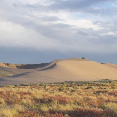
Succor Creek sits at the heart of Oregon’s wildest region—the Owyhee. While you’re here, consider exploring:
- 🏜️ Leslie Gulch (30 min): Otherworldly rock hoodoos and spires—like an alien planet dropped into Oregon
- 🐝 The Honeycombs (45 min): Bizarre honeycomb-textured volcanic formations found nowhere else
- 🎨 Painted Canyon (40 min): Even more vibrant volcanic color than Succor Creek
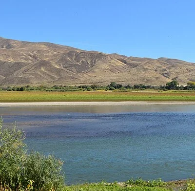
- 🚤 Owyhee Reservoir (1 hour): Dramatic desert lake for fishing and boating
- ♨️ Crystal Crane Hot Springs (1.5 hours): Natural hot springs for a post-adventure soak
Park Information
| Item | Cost |
|---|---|
| 🎟️ Park Entry | FREE |
| 🏕️ Camping | FREE |
| 💎 Rockhounding | FREE (1 gal/day limit) |
Season: Officially April 1 – October 31, but accessible year-round (weather and road permitting)
Reservations: None needed—first-come, first-served
Frequently Asked Questions
Do I really need 4WD?
For the northern approach from Adrian in dry conditions, no—most vehicles with reasonable clearance will make it. For the southern approach or after any rain, yes. When in doubt, err on the side of more capable vehicles. Getting stuck here means a long walk with no cell service.
How much water should I bring?
Minimum 1 gallon per person per day for drinking alone. In summer, bring 2+ gallons per person per day. Add more for cooking and cleaning. There is ZERO potable water at the park—the creek water should not be consumed without treatment.
Can I keep the rocks I find?
Yes! Limited collecting is allowed: up to 1 gallon per person per day, maximum 3 gallons per person per year. That’s actually a generous limit—a gallon of thundereggs is quite a haul.
Will I definitely find thundereggs?
If you dig in the right spots (especially the main bed uphill from the footbridge) and spend a few hours at it, yes—almost everyone finds at least a few. The quality varies, but even “ordinary” Succor Creek thundereggs often have beautiful banded agate interiors. Surface collecting in the creek gravel yields more immediate results, though specimens are typically tumbled and smaller.
Are rattlesnakes really a concern?
Yes. Western rattlesnakes are present throughout the canyon, especially in rocky areas where you’ll be rockhounding. They’re not aggressive—most bites happen when people accidentally step on or reach near them. Watch where you put your hands and feet, wear boots, and give any snake you encounter plenty of space. They generally want to avoid you too.
Is there any cell service?
No. Zero bars. Not a single carrier works in the canyon. Plan accordingly. Tell someone where you’re going and when you expect to return. Consider bringing a satellite communicator (Garmin inReach, Zoleo, SPOT) for emergencies—it could save your life.
What if it rains while I’m camping?
The roads can become impassable with even moderate rain—the volcanic clay turns to slick, gripless mud. If rain is forecast, either leave before it starts or be prepared to be stuck for a day or two until things dry out. This is another reason to bring extra food, water, and supplies.
💎 Discover Oregon’s Hidden Treasure Ground
Succor Creek isn’t just a destination—it’s a test. A test of your preparation, your self-reliance, and your willingness to venture beyond the comfortable and curated. Those who pass find a reward that’s becoming increasingly rare: a genuine wilderness experience, abundant natural treasures you can take home, and nights so dark the stars feel close enough to touch.
This is Oregon as it existed before the crowds found it. Come with respect, come prepared, and come ready to work for your treasures. The canyon has been waiting 15 million years to share them.
📍 Location: Malheur County, Oregon (off Succor Creek Road from Adrian)
📞 Regional Office: (541) 473-5120 (Ontario office)
Frequently Asked Questions
Are Oregon state parks free?
Oregon state parks are free to enter on foot or by bicycle. Vehicle access requires a $5 day-use permit or a $30 annual permit. Oregon’s entire coastline is public by law, guaranteeing beach access everywhere.
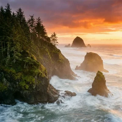
What are the best state parks on the Oregon Coast?
Top coastal parks include Ecola (stunning viewpoints), Cape Lookout (rainforest hiking), Shore Acres (botanical gardens and storm watching), Samuel H. Boardman (dramatic sea stacks), and Oswald West (surfer’s cove).
Can I camp on the beach in Oregon?
While camping directly on Oregon beaches is not permitted, several oceanfront campgrounds like Cape Lookout, Sunset Bay, and Harris Beach offer campsites just steps from the shore. Reserve months ahead for summer.
When is the best time to visit Oregon state parks?
June through September is prime season for dry weather. The coast can be enjoyed year-round. Spring brings spectacular wildflowers in the Columbia River Gorge (April-May). Winter offers dramatic storm watching along the coast.
Explore More Oregon State Parks
Succor Creek State Park is one of many outstanding state parks in Oregon. Discover more parks in our Best State Parks in Oregon guide, or use our Park Finder to search by activity, location, or features.
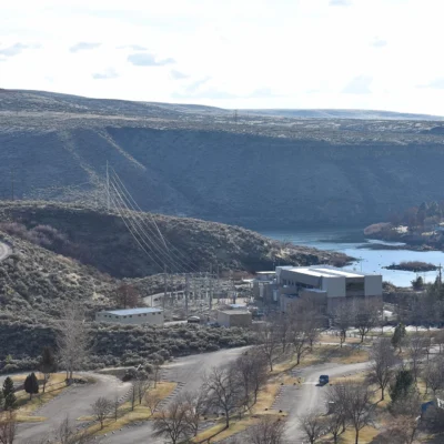
Nearby state parks: If you have extra time, Ontario State Recreation Site is within about an hour’s drive, and Farewell Bend State Recreation Area is elsewhere in the state.

Park Location
Plan your gear for Succor Creek State Park
From our editorial guides, matched to this park’s activities: