

Tumalo Falls
🌤 Weather at Tumalo Falls by season
| Spring | Summer | Fall | Winter |
|---|---|---|---|
| 24–65 °F | 37–84 °F | 24–76 °F | 19–43 °F |
Each range runs from the coldest monthly average low to the warmest monthly average high in that season (1991-2020 climate normals), measured at Sunriver, 12 mi away, elevation 4,180 ft. Conditions at the park can differ from the station, especially where elevation differs — check a forecast before you go.

🌲 Guide to Bend’s Most Iconic Waterfall
Bend’s Crown Jewel
Just a short drive from downtown Bend, Oregon, Tumalo Falls is a breathtaking 97-foot waterfall on Tumalo Creek. It is one of the most photographed and accessible natural landmarks in Central Oregon. Whether you are looking for a quick family-friendly stop or a gateway to a backcountry adventure in the Deschutes National Forest, Tumalo Falls delivers.
In summer, the viewpoint is easily accessible, offering a thundering display of glacial-fed water. In winter, when the access road closes to cars, it transforms into a serene cross-country ski and snowshoe destination. The area is also a trailhead for mountain bikers and hikers heading deeper into the Three Sisters Wilderness.
Hiking the Falls
You don’t have to be an mountaineer to enjoy the views, but unparalleled adventures await if you are willing to hike further.
Trail Options
| Trail / Route | Distance (Round Trip) | Difficulty | Highlights |
|---|---|---|---|
| Main Viewpoint | ~100 yards | Easy | The classic “postcard” view from the parking lot. Wheelchair accessible. |
| Upper Viewpoint | 0.5 miles | Easy/Mod | A short uphill switchback to the top of the falls. Feel the mist! |
| North Fork Trail | 4–7 miles | Moderate | Continues past Tumalo Falls to Double Falls, Middle Tumalo Falls, and many unnamed cascades. |
| Tumalo Creek Loop | 7 miles | Moderate | A loop hike returning via Bridge Creek Trail. Great for solitude. |
Winter Access (Nov–May) ❄️
The road to the falls (Tumalo Falls Road / FS 4603) is closed to vehicles during winter manageable snow levels. This turns the road into a popular trail.
- Parking: Park at Skyliner Sno-Park.
- Distance: It is approximately 2.5 miles (one way) from Skyliner to the falls.
- Mode of Travel: Cross-country skis, snowshoes, or fat bikes.
- Permit: An Oregon Sno-Park Permit is required to park at Skyliner Nov 1 – Apr 30.
Planning Your Visit
Fees & Passes
| Pass Type | Cost | Where to Buy |
|---|---|---|
| NW Forest Pass | $5 / day | On-site kiosk (Cash/Credit) or local vendors |
| Annual Pass | $30 / year | Forest Service offices, REI, Bend Visitor Center |
| America the Beautiful | $80 / year | Accepted here (National Parks Pass) |
| Sno-Park Permit | $4 / day (Winter only) | DMV or local vendors (Required Nov-Apr at Skyliner) |
Best Time to Go
- Spring (May-June): Peak flow! The falls are roaring with snowmelt.
- Summer (July-Sept): Accessible and warm, but very crowded. Arrive before 9 AM or after 5 PM to find parking.
- Autumn (Oct): Beautiful fall colors (willows and aspens) along the creek.
- Winter: Magical solitude, but requires effort to reach.
Safety & Regulations
- Dogs: Allowed but must be on a leash.
- Parking: The parking lot is small and fills up instantly in summer. Do not park illegally on the narrow access road; you will be ticketed or towed.
- Swimming: The water is glacial-melt cold (rarely above 45°F). Swimming is possible in calm pools downstream, but dangerous near the falls.
- Biking: Mountain bikes are allowed on the road and specific trails (like Mrazek) but prohibited on the hiking-only trail immediately adjacent to the falls viewpoints.
Frequently Asked Questions
Is the road paved?
The first part of Skyliners Road is paved. The final ~2.5 miles (Tumalo Falls Road) is a gravel forest road. It can be washboarded and dusty but is generally passable for sedans in summer.
Can I drive up in winter?
No. A gate closes the road about 2.5 miles from the falls once snow accumulates. You must hike, ski, or bike from there.
How tall is the waterfall?
Tumalo Falls is officially measured at 97 feet (30 meters) high.
Are there bathrooms?
Yes, there is a vault toilet at the Tumalo Falls parking area and another at Skyliner Sno-Park.
Can I camp here?
There is no camping allowed at the trailhead or parking lot. Dispersed camping is allowed in the National Forest further away from the developed recreation area, or you can stay at developed campgrounds nearby like Tumalo State Park (north of Bend).
Explore More Oregon State Parks
Tumalo Falls is a U.S. Forest Service recreation site, not a state park — but Oregon state parks such as Tumalo State Park and Pilot Butte State Scenic Viewpoint are close to Bend. Discover more parks in our Best State Parks in Oregon guide, or use our Park Finder to search by activity, location, or features.
Wildlife & Nature
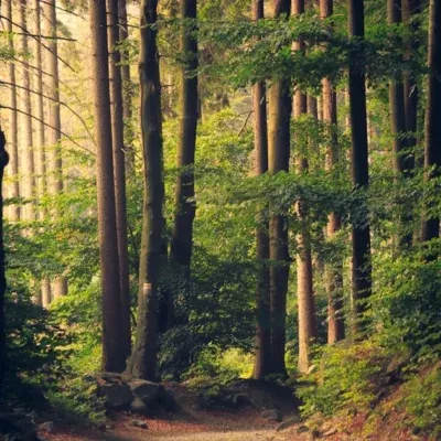
Tumalo Falls — a 97-foot waterfall on Tumalo Creek in the Deschutes National Forest. The falls’ alpine forest, volcanic terrain, and creek support American dippers, osprey, and mule deer. A trail continues upstream to additional waterfalls.
Nearby Attractions
Bend — 14 miles east. Mount Bachelor — 12 miles south. Deschutes NF — surrounding.
Keep exploring: The closest neighbors are Tumalo State Park (a short drive away) and Pilot Butte State Scenic Viewpoint (a short drive away).

Park Map
Plan your gear for Tumalo Falls
From our editorial guides, matched to this park’s activities:


Top Tours & Activities Near Bend
 from $160
 from $215
 from $150