🏆 Where Oregon’s Wild Deschutes Meets the Columbia — World-class steelhead, roaring rapids, and 13 miles of canyon solitude
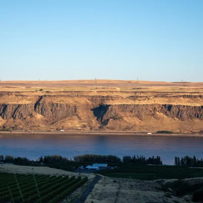
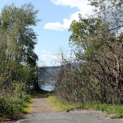
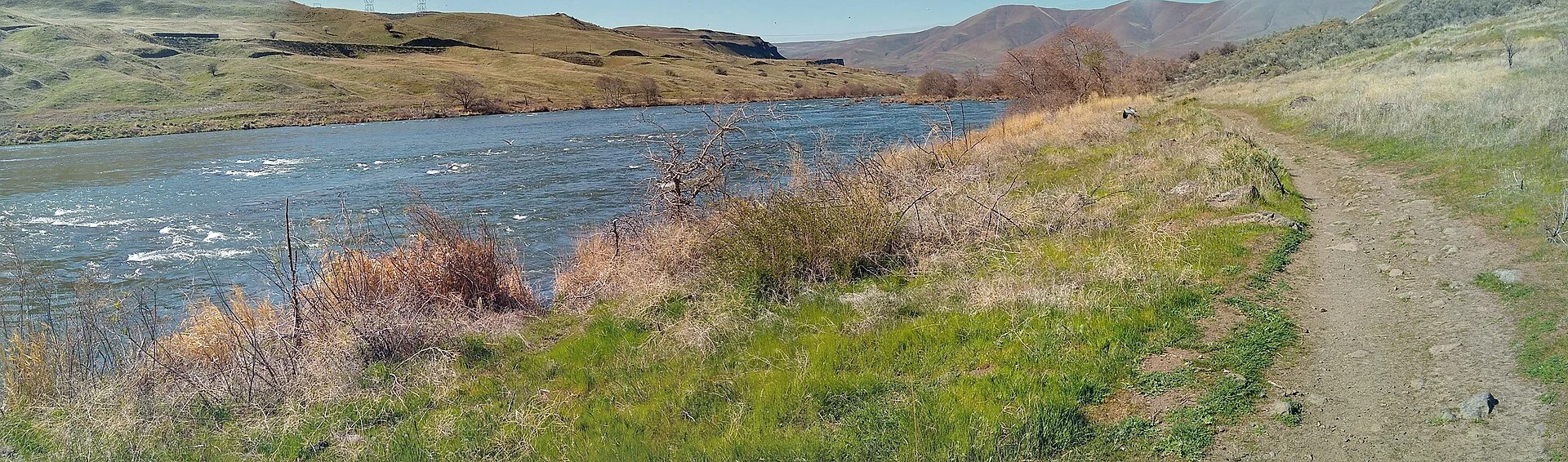
The Deschutes doesn’t arrive at the Columbia River quietly. After carving 250 miles through Oregon’s high desert, it crashes through one final gauntlet of whitewater—Rattlesnake, Moody, Washout—before surrendering to the mightier stream. And right there, where the canyon walls finally relent and the two rivers embrace, lies one of Oregon’s most underrated outdoor destinations.
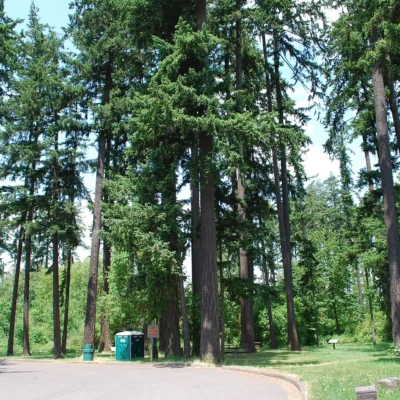
Deschutes River State Recreation Area isn’t a manicured park with paved nature trails and gift shops. It’s a basecamp for river people—the fly fishers chasing legendary steelhead at dawn, the rafters bouncing through Class III rapids with whoops echoing off basalt walls, the mountain bikers grinding 13 miles up an old railbed into ever-deepening canyon silence. If you’re looking for wild Oregon, real Oregon, this is where you find it.
The Essentials
| Category | Details |
|---|---|
| 📍 Location | I-84 Exit 97, 17 miles east of The Dalles, OR |
| ⏰ Hours | Day use: dawn to dusk. Camping: year-round |
| 💰 Fees | Day use: $5/vehicle. Camping: $19-29/night |
| 🥾 Trails | 13-mile Deschutes River Trail + 6+ miles of singletrack |
| 🏕️ Camping | 34 sites (25 electric) + primitive riverbank camping |
| 🌡️ Summer Temps | Frequently 100°F+ (plan accordingly) |
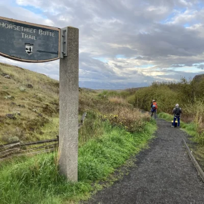
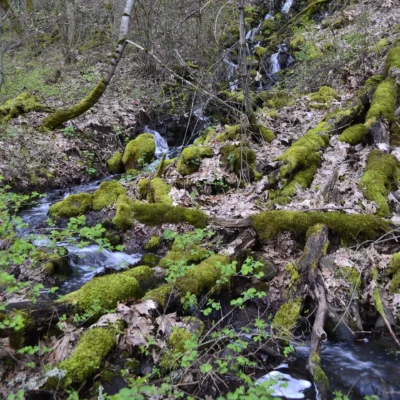
The Deschutes River Trail: 13 Miles Into the Wild
The Deschutes River Trail begins where the pavement ends and keeps going—13 miles of old railroad grade hugging the east bank, climbing almost imperceptibly as the canyon walls grow taller and the crowds thin out. By mile 5, you might not see another soul. By mile 10, you’ll understand why people make pilgrimages here.
The trail is flat enough for beginners but long enough to humble anyone. Mountain bikers love it for the gradual grade and endless views. Hikers use it to access backcountry camping spots along the river. And fishermen treat it as a 13-mile access road to some of the best steelhead water in the Pacific Northwest.
Trail Options at a Glance
| Trail | Distance | The Experience |
|---|---|---|
| Deschutes River Trail | 13 mi one-way | The main event. Old railbed along the river. Flat, wide, mountain-bike friendly. Backcountry camping permitted. |
| Ferry Springs Trail | 1.3 mi | Singletrack climbing toward the canyon rim. Bring water—there’s no shade. Panoramic views reward the sweat. |
| Blackberry-Riverview Loop | 3 mi loop | River-edge singletrack on the east side. Watch for rattlesnakes in warm months. |
| Rock Pile Trail | 2 mi | West side trail from Heritage Landing. Good for a quick leg-stretcher before or after a river run. |
Backcountry Camping
The Deschutes River Trail offers something rare in Oregon: legal primitive camping along a world-class river. Pack your gear, hike or bike a few miles in, and pitch your tent on a sandy bench as the sun drops behind the canyon walls. No reservations needed—just the $5 day-use fee and a Lower Deschutes River Boater Pass if you plan to fish or float.
Steelhead, Trout, and the Art of the Swing
For fly fishers, the Deschutes is sacred water. The native redbands (a subspecies of rainbow trout) are legendary—wild, strong, and notoriously selective. But it’s the summer steelhead that make grown anglers whisper the river’s name with reverence.
The steelhead run peaks from July through October, and the lower river—including the water accessible from this recreation area—offers some of the best swing fishing anywhere. The rules are simple but strict: artificial flies and lures only. No bait. Single, barbless hooks. The last two miles before the Columbia confluence are bank fishing only—no wading, no floating.
| Species | Season | Notes |
|---|---|---|
| Summer Steelhead | July – October | The main attraction. Swing flies through tailouts at dawn and dusk. Catch-and-release for wild fish; hatchery fish may be kept. |
| Redband Trout | Late May – October | Wild and wary. Smaller dries and nymphs. Best in early morning before heat sets in. |
| Smallmouth Bass | May – September | Aggressive feeders in slower pools. Fun on light tackle when the trout aren’t cooperating. |
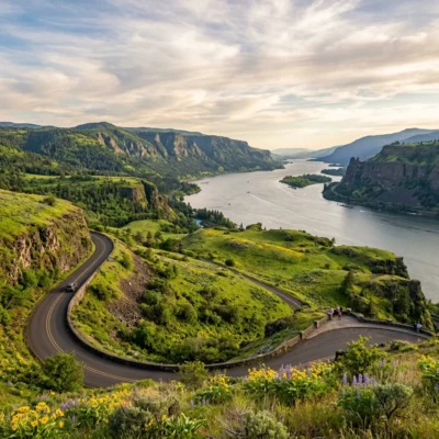
Whitewater: Rafting the Lower Deschutes
The final 25 miles of the Deschutes deliver the kind of whitewater that leaves you grinning and sun-burned. Class II-III rapids with names like Rattlesnake, Colorado, and Moody punch through at regular intervals, with calm stretches between for swimming, fishing, and marveling at the canyon walls rising 800 feet above.
This is approachable whitewater—experienced paddlers can run it in personal inflatable kayaks, while first-timers can book guided trips with outfitters based in Maupin (about 40 miles upriver). The put-in for the lower stretch is at Heritage Landing, just across the river from the main recreation area.
What You Need to Know
- Lower Deschutes Boater Pass: Required for everyone on a watercraft or floating device. Purchase at recreation.gov.
- Best Season: June through September. Water levels drop by late summer but remain runnable.
- Guided Trips: Outfitters like Deschutes River Adventures and Imperial River Company offer half-day to multi-day trips.
- Takeout: Heritage Landing boat ramp at the recreation area.
Camping: River Sounds and Train Whistles
Let’s be honest about the campground: it’s beautifully situated along the river, but it comes with a soundtrack. The Union Pacific mainline runs along the canyon’s west wall, and freight trains pass at all hours. Some campers find the distant rumble and horn blasts oddly soothing—others pack earplugs. Know thyself.
| Site Type | Count | Price | Notes |
|---|---|---|---|
| Electric Sites | 25 | $26-29/night | 30 amp service. Popular with RVs. |
| Non-Electric | 9 | $19-22/night | Tent-friendly. Closer to river in some cases. |
| Primitive (Backcountry) | Unlimited | $5 day-use | Along the Deschutes River Trail. Pack in/pack out. |
Practical Notes
- Reservations: Recommended April–October. Book at oregonstateparks.reserveamerica.com up to 6 months ahead.
- Off-Season: A-Loop electric sites available first-come, first-served. Water and showers turned off; vault toilets remain open; potable water at frost-free spigot near office.
- Horses: Not permitted in campground, even in trailers. Equestrian trails available March 1 – June 30 with reservation.
Wildlife Worth Watching
The canyon walls aren’t just scenic—they’re habitat. California bighorn sheep pick their way along impossible ledges above the river. Golden eagles and prairie falcons ride thermals. River otters surface in the calm pools, and if you’re very lucky, you might spot a rattlesnake sunning on a trailside rock (give it space).
Spring mornings are best for wildlife. The canyon is still cool, the animals are active, and you’ll have the trails largely to yourself.
When to Go: A Seasonal Reality Check
| Season | Weather | What to Expect |
|---|---|---|
| Spring (Apr-May) | 55-75°F | Wildflowers, comfortable hiking, early fishing. Best balance of weather and crowds. |
| Summer (Jun-Aug) | 85-105°F | Prime steelhead season, but brutally hot. Start early, seek shade, swim often. Fire restrictions in effect. |
| Fall (Sep-Oct) | 55-75°F | Steelhead still running. Cooler temps, golden light, fewer crowds. Ideal for camping. |
| Winter (Nov-Mar) | 35-50°F | Quiet and moody. Limited services. Great for solitude seekers who don’t need hot showers. |
Getting There
The recreation area sits just off I-84 at Exit 97, about 17 miles east of The Dalles and 100 miles east of Portland. Coming from Portland, plan 1.5-2 hours depending on Gorge traffic. Heritage Landing (boat ramp and west-side trails) is accessed via Exit 97 on the west side of the river.
Frequently Asked Questions
Is the Deschutes River good for beginner rafters?
The lower stretch (Class II-III) is manageable for beginners on guided trips. If you’re going solo, prior whitewater experience is strongly recommended. The current is powerful, and cold water makes swims serious business.
Can I fish without a drift boat?
Absolutely. Bank access is excellent from the Deschutes River Trail, and the last two miles before the Columbia are bank-only anyway. Wade carefully—the river bottom is slick and the current deceptively strong.
How hot does it really get in summer?
Regularly over 100°F. The canyon acts like an oven. Bring shade, start activities at dawn, and plan to be off the trails by noon. The river is cold enough for refreshing swims.
Are dogs allowed?
Yes, on leash (6 feet max). The rattlesnake risk is real in warm months—keep dogs on-trail and alert. Bring extra water for them; it’s hot down here.
What’s the train noise like at the campground?
Noticeable. Trains pass day and night with horns blaring. Some people love the atmosphere; others don’t sleep well. Bring earplugs if you’re sensitive to noise.
Do I need a boater pass just to hike?
No. The Lower Deschutes River Boater Pass is required only if you’re on a watercraft or floating device (including inner tubes). Hikers and mountain bikers only need to pay the standard $5 day-use fee.
Is there cell service?
Limited to none inside the canyon. Don’t count on it for navigation; download maps before you arrive.
More parks nearby: Mayer State Park is within about an hour’s drive, while Memaloose State Park lies within about an hour’s drive.
🎣 Ready to Chase Steelhead and Run Rapids?
The Deschutes doesn’t wait. Wild trout are rising. The canyon is calling. Time to get your hands on an oar—or a rod.
Are Oregon state parks free?
Oregon state parks are free to enter on foot or by bicycle. Vehicle access requires a $5 day-use permit or a $30 annual permit. Oregon’s entire coastline is public by law, guaranteeing beach access everywhere.
What are the best state parks on the Oregon Coast?
Top coastal parks include Ecola (stunning viewpoints), Cape Lookout (rainforest hiking), Shore Acres (botanical gardens and storm watching), Samuel H. Boardman (dramatic sea stacks), and Oswald West (surfer’s cove).
Can I camp on the beach in Oregon?
While camping directly on Oregon beaches is not permitted, several oceanfront campgrounds like Cape Lookout, Sunset Bay, and Harris Beach offer campsites just steps from the shore. Reserve months ahead for summer.
When is the best time to visit Oregon state parks?
June through September is prime season for dry weather. The coast can be enjoyed year-round. Spring brings spectacular wildflowers in the Columbia River Gorge (April-May). Winter offers dramatic storm watching along the coast.
Explore More Oregon State Parks
Deschutes River State Recreation Area is one of many outstanding state parks in Oregon. Discover more parks in our Best State Parks in Oregon guide, or use our Park Finder to search by activity, location, or features.

🐾 Dogs & Pets at Deschutes River State Recreation Area
- Pets allowed? statewide rule
- Pets are welcome in Oregon state parks and on most ocean beaches but must be leashed except in designated off-leash areas.
- Leash rule statewide rule
- Leash no longer than 6 feet required in developed park areas
- Beaches & swim areas statewide rule
- Pets are allowed on most ocean beaches under direct control; western snowy plover nesting areas restrict pets March 15 - Sept. 15; leash required on the beach at some parks (e.g. Cape Lookout)
- Cabins & lodging statewide rule
- Designated pet-friendly yurts and cabins at many parks (South Beach has 14 pet-friendly yurts, Tugman 8); maximum two dogs and/or cats; $10 per night pet fee
- Pet fees statewide rule
- $10 per night for pet-friendly yurts/cabins; no pet fee for day use or campsites
- Statewide exceptions statewide rule
- Pets prohibited at Dabney SRA, the Trail of Ten Falls at Silver Falls, and Shore Acres; off-leash areas at Stub Stewart, Willamette Mission, Elijah Bristow, Cottonwood Canyon and LaPine
Are dogs allowed at Deschutes River State Recreation Area?
Pets are welcome in Oregon state parks and on most ocean beaches but must be leashed except in designated off-leash areas. Individual parks can post stricter rules — check signage on arrival.
Rules verified July 2026 via stateparks.oregon.gov. More: Oregon state parks guide · Dog rules in all 50 states compared
Park Location
Plan your gear for Deschutes River State Recreation Area
From our editorial guides, matched to this park’s activities: