⛰️ Ozarks Gateway to the 165-Mile Trail — The western terminus of the Ozark Highlands National Recreation Trail in the Boston Mountains, with a 1,420-acre lake and marina, 10 cabins, 30 full-hookup campsites, swimming pool with water slides, and some of the most rugged terrain in Arkansas
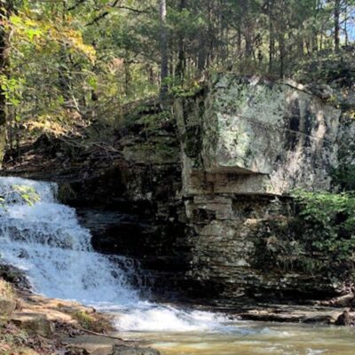
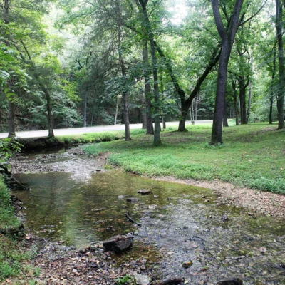
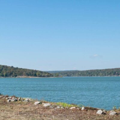
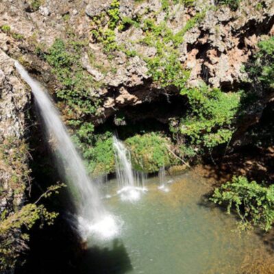
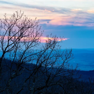
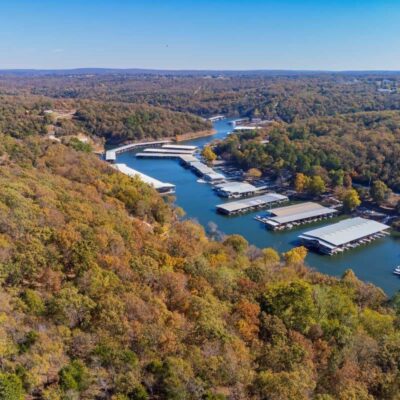
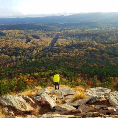
High in the Boston Mountains — the tallest and most rugged section of the Ozark Highlands — Lake Fort Smith State Park perches at 1,400 feet elevation above a glittering 1,420-acre lake that serves as the primary water supply for Fort Smith and the surrounding region. This is not a gentle, rolling Ozarks park. The Boston Mountains are the real deal: steep-walled valleys cut by fast-flowing creeks, dense hardwood forests clinging to sandstone bluffs, and the kind of rugged, elevation-changing terrain that makes this section of the Ozarks the most physically demanding — and most rewarding — in Arkansas.
The park’s ultimate claim to fame is its status as the western terminus of the 165-mile Ozark Highlands National Recreation Trail — one of the premier long-distance backpacking routes in the central United States, connecting here at Lake Fort Smith all the way east to Lake Sylvia near Little Rock. Thru-hikers begin (or end) their journey at this park, and day hikers can sample the trail’s character on any of the park’s shorter loops. But the park is far more than a trailhead: 10 fully-equipped cabins, a full-service marina with boat rentals, a swimming pool complex with water slides, and a modern campground make it a complete family destination in the heart of the Ozarks.
Lake Fort Smith
| Feature | Details |
|---|---|
| Surface Area | 1,420 acres |
| Elevation | ~1,400 feet |
| Use | Recreation and water supply for Fort Smith region |
| Motor Policy | No jet skis, no water skiing, no wake boarding |
| Marina | Kayak, canoe, pedal boat, motorboat rentals |
| Boat Ramp | Double-lane paved ramp |
| Swimming | Not permitted in lake |
The 165-Mile Ozark Highlands Trail
Lake Fort Smith State Park is the official western terminus of the Ozark Highlands National Recreation Trail (OHT) — a 165-mile point-to-point trail that traverses the most remote and scenic sections of the Ozark National Forest, crossing mountain ridges, creek valleys, and sandstone bluffs between Lake Fort Smith and Lake Sylvia near Little Rock.
- Distance: 165 miles (thru-hike: 10-14 days)
- Terrain: Strenuous — constant elevation changes, stream crossings
- Water Sources: Creek crossings (filter required)
- Permits: Not required, but registration recommended
Swimming Pool Complex
| Feature | Details |
|---|---|
| Pool | Full swimming pool (no lake swimming) |
| Water Slides | 2 water slides |
| Splash Pad | Toddler/wading area |
| Season | Memorial Day – Labor Day weekend |
Camping
| Type | Sites | Details |
|---|---|---|
| Class AAA (Full Hookup) | 20 | Water, sewer, 50-amp electric |
| Class B (Partial) | 10 | Water, 30-amp electric |
| Total | 30 | Modern restrooms, central location |
Cabins
| Feature | Details |
|---|---|
| Number | 10 cabins |
| Amenities | Full kitchen, heat/AC, satellite TV |
| Season | Year-round |
Fishing
| Species | Season | Notes |
|---|---|---|
| Largemouth Bass | Spring, Fall | Points, bluffs, timber |
| Striped Bass | Spring, Fall | Open water trolling |
| Crappie | Spring | Brush piles, deep structure |
| Channel Catfish | Summer | Night fishing, cut bait |
| Bream/Sunfish | Summer | Bank fishing, docks |
Essential Visitor Information
| Detail | Information |
|---|---|
| Address | 15458 Sheperd Springs Road, Mountainburg, AR 72946 |
| Visitor Center | 8 AM – 5 PM daily |
| Phone | (479) 369-2469 |
| [email protected] | |
| Entrance Fee | Free day use; camping/cabin fees apply |
Getting There
- From Fort Smith: 30 miles northeast (~40 minutes)
- From Fayetteville: 35 miles south (~45 minutes via I-49)
- From Little Rock: 160 miles northwest (~2 hours 40 minutes)
- From Tulsa: 120 miles east (~2 hours)
Wildlife & Nature
Lake Fort Smith SP — 523 acres at the southern trailhead of the Ozark Highlands Trail — one of the premier long-distance hiking trails in the central US (218 miles). The park’s lake, Ozark forest, and mountain streams support black bears, bald eagles, and wild turkeys.
Nearby Attractions
Mountainburg — adjacent. Fort Smith — 20 miles south — the “Gateway to the West” and site of Judge Isaac Parker’s court (“Hanging Judge”). Devil’s Den SP — 15 miles east.
Can you swim in Lake Fort Smith?
No — swimming is not permitted in the lake. Lake Fort Smith is a drinking water supply reservoir, so body contact is prohibited. However, the park has a full swimming pool complex with two water slides, a splash pad, and a wading pool, open from Memorial Day through Labor Day.
What is the Ozark Highlands Trail?
The Ozark Highlands National Recreation Trail (OHT) is a 165-mile long-distance hiking trail through the Ozark National Forest. Lake Fort Smith State Park is the official western terminus. The trail runs east to Lake Sylvia near Little Rock, traversing the most rugged and scenic sections of the Ozarks — mountain ridges, creek valleys, sandstone bluffs, and remote forest. A thru-hike typically takes 10-14 days.
Insider Tips
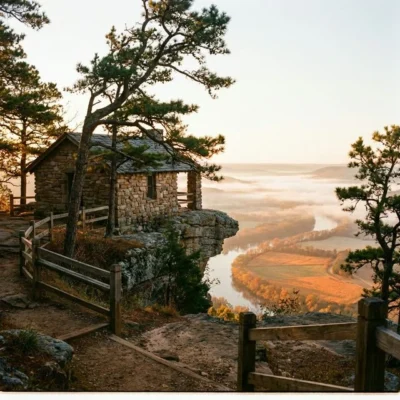
Ozark Trail: Lake Fort Smith is the western terminus of the 165-mile Ozark Highlands Trail — one of the premier long-distance trails in the South. Pro tip: The visitor center is one of the finest in the Arkansas state park system. Swimming pool: The infinity-edge pool overlooking the lake is stunning.
Best Time to Visit
Fall: Ozark foliage — spectacular. Spring: Wildflowers and waterfalls. Summer: Pool and lake swimming. Winter: Quiet hiking.
Frequently Asked Questions
What is the Ozark Highlands Trail?
The Ozark Highlands Trail stretches 165 miles across the Ozark Mountains of northwest Arkansas. It connects Lake Fort Smith State Park to the Buffalo National River. The trail traverses rugged terrain with multiple creek crossings, waterfalls, and stunning Ozark scenery. Through-hikers typically take 10-14 days.
Make it a road trip: Pair a visit with Devil’s Den State Park (a short drive away) or Prairie Grove Battlefield State Park (within about an hour’s drive).
Camping reservations: Book campsites and cabins for Arkansas state parks online at reserve.arkansasstateparks.com.

🐾 Dogs & Pets at Lake Fort Smith State Park
- Pets allowed? statewide rule
- Pets are allowed in Arkansas State Parks, including many trails, but must be restrained and under the owner's direct physical control at all times.
- Leash rule statewide rule
- Pets must be leashed, caged or otherwise restrained under direct physical (not verbal) control; no maximum leash length is specified.
- Beaches & swim areas statewide rule
- Pets (other than service animals) are not permitted at swimming beaches or pools at any time, nor in public buildings.
- Cabins & lodging statewide rule
- Designated dog-friendly cabins and lodge rooms exist at all lodging parks (about 25% of cabins at 14+ parks incl. Petit Jean, Mount Magazine, DeGray Lake Resort, Devil's Den); limit 2 dogs per unit, non-refundable per-dog fee at check-in, proof of vaccinations required.
- Pet fees statewide rule
- No day-use pet fee; a non-refundable per-dog fee applies for dog-friendly cabins/lodge rooms.
- Statewide exceptions statewide rule
- Only dogs (no other pet types) are allowed in lodging units.
Are dogs allowed at Lake Fort Smith State Park?
Pets are allowed in Arkansas State Parks, including many trails, but must be restrained and under the owner's direct physical control at all times. Individual parks can post stricter rules — check signage on arrival.
Rules verified July 2026 via codeofarrules.arkansas.gov. More: Arkansas state parks guide · Dog rules in all 50 states compared
Park Location
Plan your gear for Lake Fort Smith State Park
From our editorial guides, matched to this park’s activities: