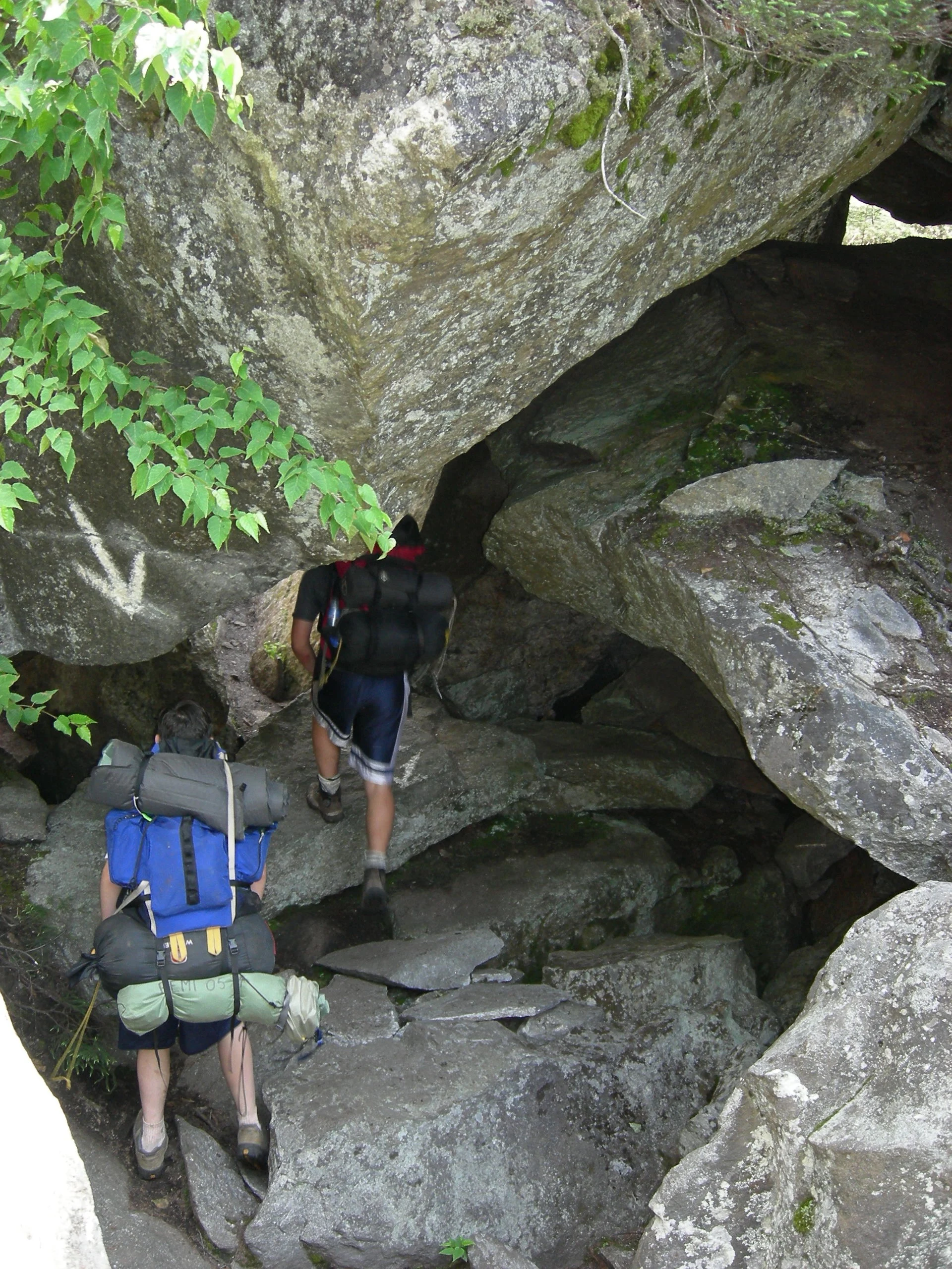

🏆 AT’s Toughest Mile — 27,253-acre wilderness containing the most notoriously difficult mile on the entire 2,190-mile Appalachian Trail
Mahoosuc Public Reserved Land covers 27,253 acres of the Mahoosuc Range — home to the infamous Mahoosuc Notch, universally regarded as the toughest mile on the entire 2,190-mile Appalachian Trail. The Notch is a boulder-choked ravine where hikers scramble under, over, and between massive boulders — some with ice caves underneath that stay frozen into August. The full traverse takes most hikers 2–4 hours to cover just one mile. Beyond the Notch, Mahoosuc Arm is the steepest sustained climb on the AT.
Visitor Information
| Detail | Information |
|---|---|
| Location | Grafton/Riley Townships, Oxford, ME |
| Size | 27,253 acres! |
| Entry Fee | Free |
| Trail | AT’S TOUGHEST MILE — Mahoosuc Notch! |
| Time | 2–4 hours for ONE mile! |
Frequently Asked Questions
How hard is Mahoosuc Notch really?
Imagine scrambling through a mile of house-sized boulders in a deep ravine, with your pack catching on every rock. Some passages require removing your pack and pushing it through gaps. Ice persists in caves below the boulders well into summer. It’s the most talked-about mile on the entire AT.
About Mahoosuc
Mahoosuc public reserved land encompasses rugged mountain terrain in the western Maine mountains — part of the famous Mahoosuc Range that the Appalachian Trail traverses. Mahoosuc Notch — a mile-long boulder cave passage on the AT — is often called “the hardest mile on the Appalachian Trail.” The mountains rise to over 3,700 feet and support subalpine spruce-fir forest.
Things to Do
Hiking the Appalachian Trail through Mahoosuc Notch (legendary scramble through a boulder-filled ravine), summit hiking, backcountry camping, fishing for brook trout in mountain streams, and fall foliage viewing. Serious hiking territory.
More parks nearby: Grafton Notch State Park is a short drive away, while Richardson lies within about an hour’s drive.
Wildlife & Nature
Mahoosuc — 27,253 acres — encompasses part of the Mahoosuc Range. The Appalachian Trail traverses the area, including Mahoosuc Notch — widely considered the most difficult mile on the entire 2,190-mile Appalachian Trail (a boulder-choked ravine with ice caves that retain snow into July). Moose, black bears, and spruce grouse inhabit the forest.
Nearby Attractions
Grafton Notch SP — adjacent. Bethel — 15 miles south. Sunday River — 10 miles south.

🐾 Dogs & Pets at Mahoosuc
- Pets allowed? statewide rule
- Pets are allowed at most Maine state parks year-round, including trails, but must be leashed, under the handler's physical control and never left unattended.
- Leash rule statewide rule
- Leash not exceeding 4 feet, under the physical control of the handler
- Beaches & swim areas statewide rule
- Pets are not allowed on state park beaches April 1 through September 30; leashed pets are welcome on beaches October 1 through March 31
- Statewide exceptions statewide rule
- No pets allowed at Sebago Lake State Park campground; park staff may assign pet owners to less congested camping areas
- Dogs & wildlife
- On the Table Rock Loop from the Route 26 trailhead, BPL specifically flags the steep, boulder-strewn orange-blazed Table Rock Trail as not appropriate for pets or young children - take the blue-blazed section instead if your dog is with you.
Are dogs allowed at Mahoosuc?
Pets are allowed at most Maine state parks year-round, including trails, but must be leashed, under the handler's physical control and never left unattended. Individual parks can post stricter rules — check signage on arrival.
Rules verified July 2026 via maine.gov. More: Maine state parks guide · Dog rules in all 50 states compared
🐻 Wildlife at Mahoosuc: What to Watch For — and Watch Out For
Worth watching for: Mahoosuc Public Lands and the adjoining Grafton Notch State Park share a single Maine Bureau of Parks and Lands guide, and BPL says that on the Grafton Notch stretch of the Maine Birding Trail birdwatchers can pick out peregrine falcons, a wide variety of songbirds and, at higher elevations, northern forest species. Lower down, visitors commonly observe large mammals, even in the vicinity of Route 26; hunters come for deer, bear and grouse, and anglers work the area streams for brook trout. The Spruce Meadow Picnic Area has tables looking out over a wildlife-rich marsh toward Old Speck, and the 9,993-acre Ecological Reserve around the sub-alpine tarn at Speck Pond protects rare plant species including alpine blueberry, alpine sweet grass and mountain sandwort on the alpine ridge the AT crosses.
Watch out for: BPL's own warning for this unit is direct: the region's abundant large animals can create hazards - drive slowly on the area roads, particularly in low light, and make sure tents and everything inside them are free of food and food odors. The Bureau's general safety guidance, agency-wide rather than Mahoosuc-specific, adds that campers should store food and toiletries in a vehicle or bear-proof container or suspended well away from camp, and that hikers should stay together and make noise in dense vegetation so they do not surprise a black bear. The same guidance asks you to check yourself, your family and your pets for ticks after walking in woods and along woodland edges. Terrain and weather are the other documented hazards: snow comes early and stays late in these mountains, BPL tells hikers to stay below the tree line in lightning storms, and at the Table Rock summit there is a steep drop-off where the ledge ends with no fencing.
Are there bears at Mahoosuc?
Yes — see above for where they occur in the park and how to behave. Sightings are a normal part of a healthy park; incidents are rare when visitors keep distance and store food properly.
Wildlife information verified July 2026 via apps.web.maine.gov.
Park Location
Plan your gear for Mahoosuc
From our editorial guides, matched to this park’s activities: