🏆🏆🏆🏆🏆 Southern Berkshire Summit — 1,606-foot summit with some of the finest views in southern New England — AT and rare alpine plants
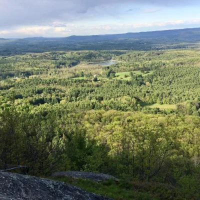
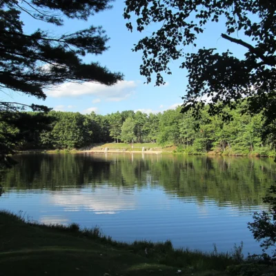
Mount Everett State Reservation protects the 2,602-foot summit of Mount Everett — the second-highest peak in Massachusetts and a highlight of the Appalachian Trail in the Berkshires. The summit features a rare high-elevation pitch pine and scrub oak community, and Guilder Pond (the highest natural body of water in Massachusetts at 2,042 feet) sits in a pristine mountain setting. The views from the summit encompass the Taconic Range, the Housatonic Valley, and on clear days, the Catskills in New York.
Visitor Information
| Detail | Information |
|---|---|
| Location | Mount Washington, Berkshire County, MA |
| Elevation | 2,602 feet (#2 in MA!) |
| Entry Fee | Free |
| Trail | Appalachian Trail! |
| Guilder Pond | Highest natural lake in MA! |
Frequently Asked Questions
How hard is the climb?
The most popular route via the AT is about 5.5 miles round trip with 1,800 feet of elevation gain — strenuous but manageable. The fire tower at the summit adds extra viewing height above the scrub oak.
Can I see three states from the summit?
Yes — Mount Everett’s summit offers views into Massachusetts, Connecticut, and New York. On clear days, the Catskill Mountains are visible to the west (60+ miles), the Litchfield Hills to the south, and Mount Greylock to the north. The 360° panorama is one of the most expansive in southern New England.
Keep exploring: The closest neighbors are Jug End State Reservation and Wildlife Management Area (a short drive away) and Bash Bish Falls State Park (a short drive away).
About Mount Everett
Mount Everett State Reservation in the far southwestern corner of Massachusetts features the state’s third-highest peak at 2,602 feet. The Appalachian Trail traverses the summit, which offers panoramic views of the Taconic Range, the Berkshires, and three states. Near the summit sits Guilder Pond — one of the highest natural ponds in Massachusetts — and an ancient pitch pine forest at the tree line.
Things to Do
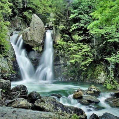
Hiking to the summit via the Appalachian Trail or Guilder Pond Trail, camping, birdwatching for high-elevation species, and visiting Bear Rock Falls — a beautiful cascade on Race Brook. The Bash Bish Falls (Massachusetts’ highest waterfall) is nearby.
Insider Tips
Berkshire summit: Mount Everett (2,602 ft) is one of the highest peaks in the southern Berkshires — the summit offers 360° views of three states (MA, CT, NY). Pro tip: The Appalachian Trail crosses the summit — combine Mount Everett with a longer AT section through the Taconic Range. Pitch pine summit: The summit supports a rare pitch pine community — stunted trees shaped by wind and ice at elevation.
Best Time to Visit
Fall: Summit views of tri-state foliage. Summer: Hike and cool off at Guilder Pond. Spring: Mountain laurel bloom. Winter: Snowshoe to the summit.
Wildlife & Nature
Mount Everett SR — 1,180 acres — protects the second-highest peak in Massachusetts (2,602 ft). Guilder Pond near the summit is the highest natural body of water in Massachusetts. The summit’s pitch pine and scrub oak barrens support timber rattlesnakes and red-tailed hawks. Bash Bish Falls — the tallest waterfall in Massachusetts (80 ft) — is on the slopes.
Nearby Attractions
South Egremont — adjacent. Bash Bish Falls SP — on the mountain. Appalachian Trail — traverses the summit. Great Barrington — 10 miles east.