
Photo: Kiwibirdman, CC BY 3.0, via Wikimedia Commons
🌤 Weather at Upright Channel by season
| Spring | Summer | Fall | Winter |
|---|---|---|---|
| 41–62 °F | 51–69 °F | 42–65 °F | 38–46 °F |
Each range runs from the coldest monthly average low to the warmest monthly average high in that season (1991-2020 climate normals), measured at Olga 2 SE, 5 mi away, elevation 80 ft. Conditions at the park can differ from the station, especially where elevation differs — check a forecast before you go.

🏖️ DNR Day-Use Site — A 20-acre day-use area and beach access on Lopez Island, run by the Washington Department of Natural Resources; formerly a state park
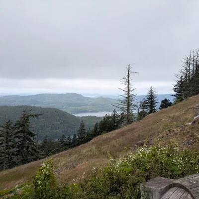
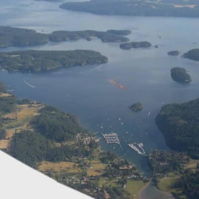
Upright Channel Day-Use Area and Beach Access is a 20-acre day-use site on Lopez Island in the San Juan Islands, facing Upright Channel, the waterway between Lopez and Shaw islands. The Washington Department of Natural Resources (DNR) runs it today. DNR lists trails, beach access and a picnic area. The Lopez Island Chamber of Commerce adds four picnic sites, a short trail to a public beach, parking for several vehicles and a vault toilet.
The site used to be Upright Channel State Park, a day-use park of Washington State Parks on DNR land. By March 2014 it no longer appeared on the State Parks list. San Juan County Parks then took over management of the DNR property for one year, and DNR now lists the site under its own recreation areas. State Parks listed it as a day-use park, not a marine park, and DNR lists no boat ramp or dock.
Visitor Information
| Detail | Information |
|---|---|
| Managed by | Washington DNR, Northwest Region: (360) 856-3500 |
| Location | Military Road, Lopez Island, WA 98261 |
| Size | 20 acres |
| Facilities | Trails, picnic sites, beach access, vault toilet |
| Parking pass | Discover Pass (per the Lopez Island Chamber of Commerce) |
Getting There
DNR’s directions: from the Lopez Island ferry landing, follow Ferry Road for 2 miles, stay right on Fisherman Bay Road for 0.4 mile, turn right on Military Road for 0.2 mile, then turn right and stay on Military Road for another 0.3 mile. The site is on the right.
Frequently Asked Questions
Is Upright Channel still a Washington state park?
No. Washington State Parks no longer manages it. The Department of Natural Resources runs it as a day-use area and beach access.
Can I dig clams on the beach?
State Parks once advertised clamming here, but we found no current source for this beach. Check the Washington Department of Health’s shellfish safety map and WDFW rules before you harvest.
Keep exploring: The closest neighbors are Spencer Spit State Park (a short drive away) and Blind Island Marine State Park (a short drive away).
Sources: Washington DNR recreation pages (Northwest Region); Lopez Island Chamber of Commerce; Washington State Parks park page (archived June 2012); San Juan County Land Bank Commission minutes, May 16, 2014. As of October 2026.
🏖️ Washington DNR Recreation
Upright Channel is a DNR day-use site. Check DNR’s page for current access and alerts.

Park Map
Plan your gear for Upright Channel
From our editorial guides, matched to this park’s activities:



Top Tours & Activities Near San Juan Islands
 from $175
 from $29
 from $260