Overview: Michigan’s Thumb on Saginaw Bay
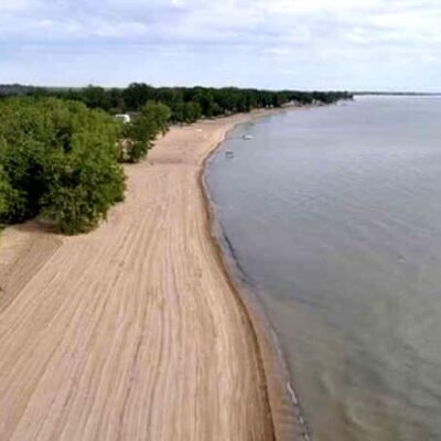
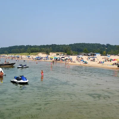
Occupying 723 acres of forested dunes, wetlands, and sandy shoreline near the tip of Michigan’s Thumb region in Huron County, Albert E. Sleeper State Park delivers a warm-water Great Lakes beach experience that differs markedly from the cold, deep-water swimming found at Michigan’s Lake Michigan and Lake Huron parks. The park’s approximately half-mile of sandy beach faces Saginaw Bay—a large, shallow, protected bay that warms significantly faster and to higher temperatures than the open Great Lakes, creating swimming conditions that are genuinely comfortable from mid-June through September.
Named after Albert E. Sleeper, Michigan’s governor from 1917 to 1920 who signed the legislation creating the state park system, this park was established as a county park in 1925, became a state park in 1927, and was formally renamed in 1944. Today, its 226-site modern campground, accessible mini cabin, warm swimming beach, and 4 miles of dune forest trails make it one of the most family-friendly parks in the Thumb—a quiet, agricultural region of Michigan that sees far less tourist traffic than the state’s more celebrated coastal destinations.
Saginaw Bay: The Warm-Water Beach
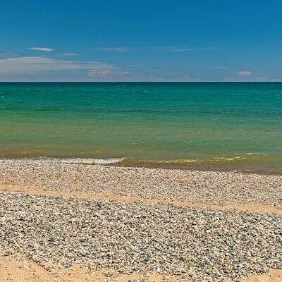
Saginaw Bay’s shallow depth and protected geography allow it to warm substantially during the summer months, producing water temperatures that are consistently warmer than open Lake Huron. The bay’s sandy bottom and gradual depth create an ideal swimming environment for families with young children—the water stays shallow well out from shore, and the protected bay rarely generates the significant wave action that can make open Great Lakes swimming intimidating.
The park’s half-mile beach is wide, sandy, and backed by the forested dune ridge that separates the beach from the campground. During peak summer weekends, the beach draws visitors from across the Thumb and the Saginaw-Bay City-Midland metro area.
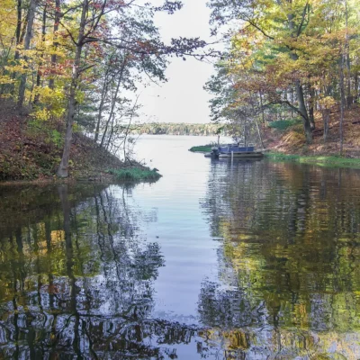
The Dune Forest
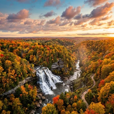
Behind the beach, ancient sand dunes—now fully stabilized and forested—rise above the bay. These old dune formations are covered in a mature forest of oak, pine, and mixed hardwoods that creates a shaded, atmospheric environment dramatically different from the bright, open beach just a few hundred yards away. The dune forest is the park’s most ecologically interesting feature, supporting a diverse community of woodland plants, fungi, and wildlife in the well-drained, sandy soil.
Trails: 4 Miles Through Ancient Dunes
Approximately 4 miles of trails wind through the dune forest and wetland areas, offering hiking, biking, and cross-country skiing through varied terrain.
- Ridgeline Trail: Follows the crest of the old dune formations through mature forest, offering occasional filtered views of the bay
- Wetland Loop: Descends into the lowland areas behind the dunes, passing through wetter habitats where ferns, mosses, and wetland wildflowers thrive
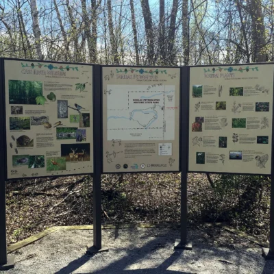
- Interpretive Trail: A shorter, self-guided loop with signage explaining the geology, ecology, and history of the dune forest ecosystem
The Campground
- 226 Modern Sites: Electrical hookups, modern restrooms with flush toilets and hot showers
- ADA Mini Cabin: An accessible mini cabin sleeping up to 5 people provides a sheltered accommodation option
- Pedestrian Bridge: A pedestrian overpass connects the campground to the day-use area and beach across M-25—a critical safety feature that eliminates the need to cross the highway on foot
- Character: Wooded, shaded sites in the dune forest. Pleasant sand-and-pine atmosphere
The Thumb Region
Sleeper State Park’s location near the tip of Michigan’s Thumb provides access to a distinctive region of the state.
- Caseville: The nearest town, known for its annual Cheeseburger in Caseville festival (usually in August)—a week-long, Jimmy Buffett-themed celebration that transforms the small harbor town into a party
- Port Austin: A charming lakefront village at the very tip of the Thumb, featuring a farmers’ market, art galleries, and kayaking at Turnip Rock (a famous mushroom-shaped rock formation accessible only by water)
- Paddling Rivers: The Pigeon and Pinnebog rivers offer scenic, gentle-current paddling through the agricultural Thumb landscape
Seasonal Guide
Spring (April–May)
Campground opens. Bay water begins warming. Wildflowers in the dune forest. Birding improves with spring migration.
Summer (June–August)
Peak season. Saginaw Bay water reaches its warmest (mid-70s°F). Cheeseburger in Caseville festival in August. Reserve campsites in advance for weekends.
Autumn (September–October)
Fall color in the dune forest. Bay water still swimmable through early September. Dramatically reduced crowds.
Winter (December–March)
Cross-country skiing on the trail system. Ice fishing on Saginaw Bay for perch and walleye. Frozen bay ice formations along the shoreline.
Frequently Asked Questions
Is the water at Sleeper warmer than typical Great Lakes beaches? Yes. Saginaw Bay is shallower and more protected than open Lake Huron, allowing it to warm significantly during summer. Water temperatures consistently reach the mid-70s°F—substantially warmer than most Michigan Great Lakes beaches.
What is the pedestrian bridge? A pedestrian overpass that connects the campground (on the inland side of M-25) to the beach and day-use area (on the bay side), allowing safe crossing without interacting with highway traffic.
What is Turnip Rock? A famous mushroom-shaped rock formation near Port Austin at the tip of the Thumb, accessible only by kayak. It is approximately 20 miles from the park and has become one of Michigan’s most photographed natural features.
Who was Albert Sleeper? Albert E. Sleeper served as Michigan’s governor from 1917 to 1920. He signed the legislation that created Michigan’s state park system, and the park was renamed in his honor in 1944.
Make it a road trip: Pair a visit with Sleeper State Park (a short drive away) or Port Crescent State Park (a short drive away).

Park Location
Plan your gear for Albert E. Sleeper State Park
From our editorial guides, matched to this park’s activities: