🏆 Maryland’s Urban Greenway Trail — 4.5 Miles Named for America’s Greatest Explorer — Updated for 2026 with trail access, parking, and year-round riding info
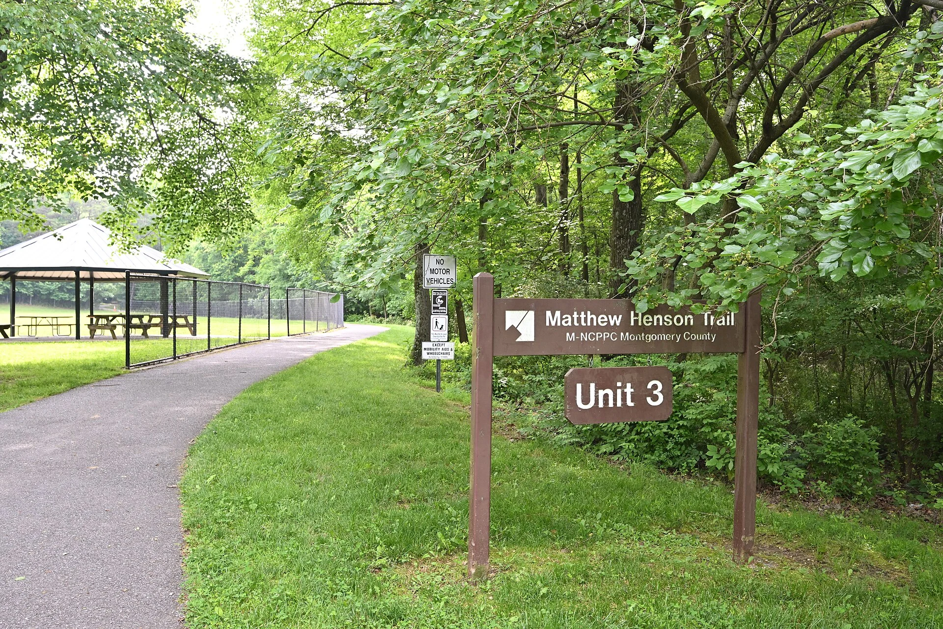
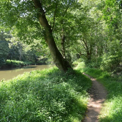
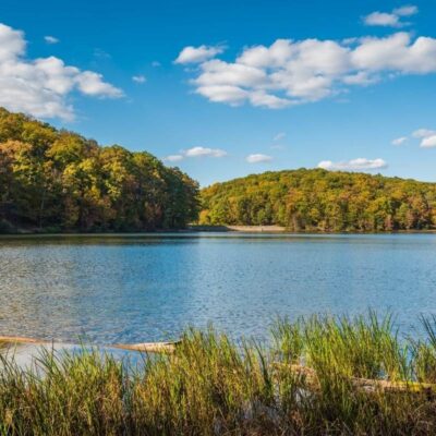
A 4.5-mile paved trail winds through suburban Montgomery County, Maryland, following Turkey Branch through a forested greenway that feels worlds away from the nearby Capital Beltway. Named for Matthew Henson — the African American explorer who co-discovered the North Pole in 1909 alongside Robert Peary — this state park is a living monument to one of America’s greatest, and most overlooked, adventurers.
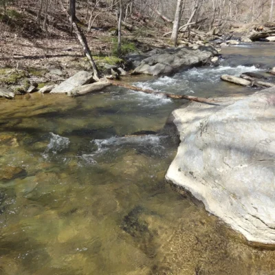
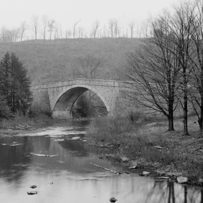
The Matthew Henson Trail connects Rock Creek Trail near Aspen Hill to Alderton Road near Layhill, providing a smooth, 8-foot-wide path for hikers, joggers, cyclists, and rollerbladers. Wooden boardwalks cross sensitive wetlands, bridges span the creek, and the forest canopy arches overhead — creating a green corridor through one of the most densely populated counties in Maryland.
What Makes the Matthew Henson Trail Special
4.5 Miles Paved
Smooth, 8-foot-wide hard-surface trail through a forested greenway. Perfect for exercise.
Forest Greenway
Turkey Branch stream corridor with mature trees, boardwalks over wetlands, and bridge crossings.
Named for an Explorer
Honors Matthew Henson (1866-1955), the first person to reach the Geographic North Pole in 1909.
Trail Connections
Links to Rock Creek Hiker-Biker Trail — extending your ride into the greater DC trail network.
Who Was Matthew Henson?
Matthew Alexander Henson (1866-1955) was an African American explorer who spent 18 years alongside Robert Peary on Arctic expeditions. On April 6, 1909, Henson became the first person to stand at the Geographic North Pole — though Peary received most of the credit during their lifetimes. Henson was finally recognized with the Presidential Medal of Freedom in 2000 and is buried at Arlington National Cemetery. This trail honors his legacy of exploration, endurance, and courage.
Trail Information
| Feature | Details |
|---|---|
| 📏 Length | 4.5 miles (7.2 km) one-way |
| 🛤️ Surface | Paved / hard surface, 8 feet wide |
| 🌉 Boardwalks | 0.6 miles of wooden boardwalks over wetlands |
| 📍 Start | Rock Creek Trail junction near Aspen Hill |
| 📍 End | Alderton Road near Layhill |
| 🚴 Uses | Hiking, biking, jogging, rollerblading, horseback riding |
| 🕐 Hours | Sunrise to sunset, year-round |
Access & Parking
- 🅿️ Winding Creek Park — Edgebrook Rd & Charles Rd
- 🅿️ Georgia & Hewitt Avenues — behind Global Mission Church
- 🅿️ Middlevale Lane — west of Layhill Road
- 🅿️ Queensguard Rd — Layhill Village Park
When to Visit: Seasonal Guide
| Season | Months | Weather | Best For |
|---|---|---|---|
| 🍂 Fall | Sep–Nov | 50-70°F | 🏆 Fall foliage over the creek. Perfect running weather |
| 🌸 Spring | Mar–May | 50-70°F | 🏆 Wildflowers, bird migration, green canopy. Beautiful |
| ☀️ Summer | Jun–Aug | 80-90°F | Shaded trail makes summer bearable. Early morning best |
| ❄️ Winter | Dec–Feb | 30-45°F | Bare trees reveal creek views. Quiet running |
Budget Calculator
| Expense | Amount | Notes |
|---|---|---|
| Trail Access | FREE | No fee required |
| Parking | FREE | Multiple free lots along the trail |
| Total | FREE | One of Maryland’s best free outdoor experiences |
Frequently Asked Questions
Is the trail flat?
Mostly — it follows Turkey Branch stream, so elevation changes are minimal. A few gentle hills. Easy for all fitness levels.
Can I bike it?
Yes — the 8-foot-wide paved surface is excellent for cycling, jogging, and rollerblading. Horseback riding also permitted.
Does it connect to other trails?
Yes — it links to the Rock Creek Hiker-Biker Trail, which extends into DC. You can build a very long ride.
🧭 Walk in the Footsteps of an Explorer
Matthew Henson walked to the North Pole. You can walk this trail named for him through the forests of Montgomery County. It’s not the Arctic, but the boardwalks over the wetlands, the bridges over Turkey Branch, and the canopy of trees arching overhead create a journey that feels like an expedition of its own — a 4.5-mile escape from the suburban grid into a green corridor that honors one of America’s bravest and most overlooked explorers.
📍 Location: Montgomery County, MD (Aspen Hill to Layhill)
Frequently Asked Questions
What activities are available at this state park?
Common activities include hiking, camping, fishing, swimming, picnicking, and wildlife watching. Check the park website for specific offerings, trail maps, and seasonal programs.
Do I need a reservation to camp?
Reservations are recommended for camping, especially on weekends and holidays during peak season. Most state park systems offer online reservation portals where you can book sites months in advance.
What is the best time to visit?
Spring and fall generally offer the most comfortable weather for outdoor activities. Summer is peak for swimming and camping. Check the specific park for seasonal closures and optimal visiting conditions.
Explore More Maryland State Parks
Matthew Henson State Park is one of many outstanding state parks in Maryland. Discover more parks in our Best State Parks in Maryland guide, or use our Park Finder to search by activity, location, or features.
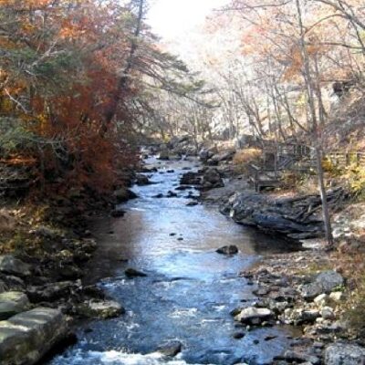
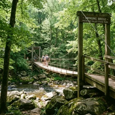
Nearby state parks: If you have extra time, Wolf Den Run State Park is a short drive away, and Patapsco Valley State Park is a short drive away.

🐾 Dogs & Pets at Matthew Henson State Park
- Pets allowed? statewide rule
- Maryland state parks welcome leashed pets, but where they may go is set park by park under the Maryland Park Service Pet Policy — check each park's designated pet areas.
- Leash rule statewide rule
- 6 ft maximum in designated pet areas and 10 ft in undeveloped areas; off-leash under voice control only while swimming in designated areas
- Beaches & swim areas statewide rule
- At most parks pets are barred from sandy swim beaches from Memorial Day weekend through Labor Day; many parks allow shoreline swimming outside the swim beach
- Cabins & lodging statewide rule
- Most cabins are pet-free, but select parks designate pet-friendly cabins (e.g. Herrington Manor cabins 1-10, New Germany cabins 3-7)
- Statewide exceptions statewide rule
- Pets not allowed in park buildings or playgrounds; pets must be licensed and vaccinated
Are dogs allowed at Matthew Henson State Park?
Maryland state parks welcome leashed pets, but where they may go is set park by park under the Maryland Park Service Pet Policy — check each park's designated pet areas. Individual parks can post stricter rules — check signage on arrival.
Rules verified July 2026 via dnr.maryland.gov. More: Maryland state parks guide · Dog rules in all 50 states compared
Park Location
Plan your gear for Matthew Henson State Park
From our editorial guides, matched to this park’s activities:

Top Tours & Activities Near Maryland
 from $235
 from $38
 from $39