🏔️ Maryland’s Largest State Forest — 55,000 Acres of Wilderness, World-Class Whitewater, and 130+ Miles of Trails — Class III-IV Savage River (World Championship venue), Margraff Mountain Bike Trails, wild brook trout, primitive camping at Big Run, hunting across 55,185 acres — Garrett County near Grantsville
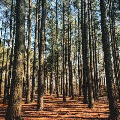
Savage River State Forest is not what most people picture when they think of Maryland. At 55,185 acres, it is the largest state forest in Maryland — a sprawling wilderness of Appalachian mountain ridges, deep hollows, and cold-water streams that stretches across Garrett County like a piece of West Virginia that wandered across the border. The terrain is genuinely rugged: narrow forest roads climb over Meadow Mountain and Big Savage Mountain at elevations reaching 3,000 feet, dropping into valleys where wild brook trout hold in streams so remote that some have never been stocked. The Savage River itself has hosted the World Whitewater Championships, its dam-release rapids creating a 4.5-mile gauntlet of Class III-IV water that draws expert paddlers from across the continent. Over 130 miles of multi-use trails serve hikers, mountain bikers, equestrians, cross-country skiers, and hunters across terrain that ranges from gentle ridgeline fire roads to technical singletrack.
This is not a state park with a visitor center and a paved loop trail. This is working forest — managed for timber, wildlife, and watershed protection — where the recreation opportunities exist because the landscape demands them, not because they were designed for tourists. If you want groomed trails and cabin fireplaces, visit New Germany State Park, which sits inside the forest’s borders. If you want to disappear into 55,000 acres of backcountry where your cell phone is useless and the only sounds are wind in the canopy and water over rock, Savage River State Forest is your place.
7 Best Things to Do at Savage River State Forest
1. Paddle World-Class Whitewater on the Savage River
The 4.5-mile stretch below Savage River Dam is the crown jewel of East Coast whitewater. The dam-controlled releases create continuous Class III-IV rapids through a narrow, forested gorge — the same water that tested the world’s best paddlers at the ICF World Whitewater Championships. This is expert-level water: technical drops, powerful hydraulics, and undercut rocks in a remote canyon where rescue access is limited. Scheduled recreational releases occur several times per year, typically in spring (April-May) and fall (September-October). Commercial rafting outfitters including Precision Rafting and Wilderness Voyageurs offer guided trips on release days — book well in advance, as seats fill fast. For self-guided kayakers, the put-in and take-out are well-marked but the river demands reliable Class IV skills and appropriate safety equipment.
2. Mountain Bike the Margraff Plantation Trails
The Margraff Plantation Trail System is Western Maryland’s purpose-built mountain bike destination. Located within the forest, this system offers tiered difficulty levels — beginner, intermediate, and advanced trails — designed specifically for mountain biking rather than adapted from hiking paths. An adaptive mountain biking loop makes this one of the most inclusive MTB destinations in the region. The singletrack weaves through mixed hardwood forest with roots, rocks, and grade changes typical of Appalachian riding. The Margraff trails connect to the broader forest road network, allowing riders to build custom loops of any length. Check the Maryland DNR website for current trail conditions, as sections may close during hunting season or after heavy weather.
3. Backpack the Big Savage Trail
At 17 miles, the Big Savage Trail is the forest’s premier backpacking route. Following the Big Savage Mountain ridge through dense forest, the trail offers multi-day wilderness immersion with primitive campsites along the route. The terrain is challenging — significant elevation changes, stream crossings, and rocky sections that demand solid backcountry skills. Combined with the Meadow Mountain Trail (12 miles) and connecting forest roads, you can build week-long traverses across the entire forest. No cell service. No water sources other than streams (filter everything). No bailout points on some sections. This is the most demanding backpacking available in Maryland.
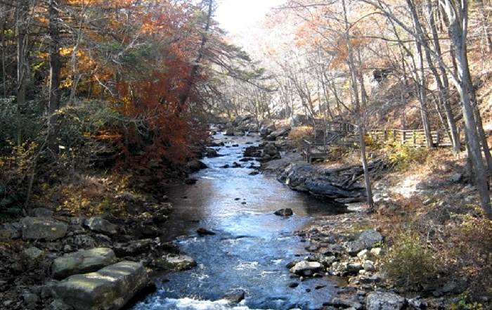
4. Fish Wild Brook Trout Streams
Savage River State Forest contains what many anglers consider the finest wild brook trout habitat in the eastern United States south of Maine. The cold, clean mountain streams — fed by springs at 2,500-3,000 feet elevation — support naturally reproducing populations of native brook trout in water that has never been stocked. The fishing is intimate and technical: small streams under dense canopy, short casts to pocket water, and fish that measure 6-10 inches but fight like they own the stream. The Savage River Reservoir offers different fishing entirely — bass, trout, catfish, and tiger muskie in a 360-acre impoundment. A Maryland freshwater fishing license is required; check stream-specific regulations as some sections are catch-and-release only.
5. Hunt 55,000 Acres
Hunting is permitted across virtually the entire forest — the only exceptions are New Germany State Park and Big Run State Park, where hunting is prohibited. White-tailed deer are the primary draw, but the forest also supports black bear, wild turkey, grouse, squirrel, and other game species. Garrett County is within Maryland’s Region A for deer hunting. The forest’s size means genuine solitude during hunting season — you can walk for hours without encountering another hunter. Accessible hunting areas are available for hunters with disabilities. Several gated forest roads open seasonally to provide vehicle access during hunting season (4WD required). Always wear blaze orange during firearms seasons.
6. Camp at Big Run State Park
Big Run State Park sits at the mouth of the Savage River Reservoir and serves as the primary camping base for the forest. The campground offers 29 primitive sites — some wooded with stone-dust pads, others in an open grassy field. Each site includes a picnic table and fire ring. Two waterless toilet facilities serve the campground. No drinking water is available on-site — bring your own. The Monroe Run Group Campsite accommodates up to 25 people in a shelter with a fireplace and electricity, available by reservation. All sites must be reserved in advance through parkreservations.maryland.gov or by calling 1-888-432-CAMP.
7. Hike Monroe Run and Meadow Mountain
The Monroe Run Trail (4.6 miles one-way) connects New Germany State Park to Big Run State Park along Monroe Run — a creek-side trail with multiple unbridged stream crossings (expect wet feet). This is the most popular day hike in the forest, moderately difficult, with excellent fall foliage and spring wildflowers. The Meadow Mountain Trail (12 miles) follows the crest of Meadow Mountain with periodic views of the surrounding valleys — a full-day hike or a good overnight backpack. The Poplar Lick Trail (6 miles) and Asa Durst Trail (4.5 miles) offer shorter alternatives through characteristic Appalachian hardwood forest.
Trail System Overview
| Trail Name | Distance | Difficulty | Highlights |
|---|---|---|---|
| Big Savage Trail | 17 mi | Difficult | Premier backpacking, ridge traverse |
| Meadow Mountain | 12 mi | Moderate | Ridge views, connects to New Germany |
| Monroe Run | 4.6 mi OW | Moderate | Stream crossings, New Germany–Big Run |
| Poplar Lick | 6 mi | Moderate | Creek-side, fall color |
| Asa Durst | 4.5 mi | Moderate | Forest loop, wildlife |
| Margraff MTB System | 10+ mi | Beginner–Advanced | Purpose-built MTB, adaptive loop |
Camping Options
| Location | Sites | Type | Amenities |
|---|---|---|---|
| Big Run State Park | 29 | Primitive | Table, fire ring, waterless toilets |
| Monroe Run Group | 1 (25 ppl) | Reservable | Shelter, fireplace, electricity |
| Backcountry (dispersed) | Unlimited | Wild | None — pack in/pack out |
Important: No drinking water at Big Run. No cell service in the forest. All campsites require advance reservation. Bring bear-proof food storage — black bears are active throughout the forest.
Best Time to Visit
| Season | Weather | Crowds | Best For |
|---|---|---|---|
| Spring (Mar–May) | 35–65°F, rain/mud | Low | Whitewater releases, trout fishing, wildflowers |
| Summer (Jun–Aug) | 60–82°F, mild | Low-Moderate | Mountain biking, backpacking, swimming |
| Fall (Sep–Nov) | 40–65°F, crisp | Moderate | Foliage, hunting, fall whitewater, MTB |
| Winter (Dec–Feb) | 15–35°F, snow | Very Low | XC skiing, snowshoeing, solitude |
Getting There
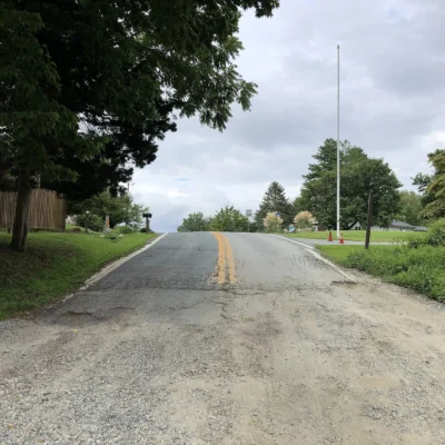
Forest Headquarters: 127 Headquarters Lane, Grantsville, MD 21536. Office hours: Tuesday, Thursday, and Friday, 7am–3:30pm (staff are frequently in the field — call ahead at 301-895-5759). From I-68, take Exit 22 or Exit 24 and follow signs south into the forest. From the DC/Baltimore metro, Grantsville is approximately 170 miles (2.5 hours) via I-70/I-68. Multiple entry points along forest roads provide access to different areas — carry a forest map, as GPS is unreliable inside the forest.
💰 Trip Cost Estimator
| Expense | Day Trip | Weekend | Week |
|---|---|---|---|
| Forest Entry | FREE | FREE | FREE |
| Big Run Camping | — | $20–$40 | $70–$140 |
| Guided Whitewater Trip | $80–$150 | $80–$150 | — |
| Fishing License | $20.50 (annual) | $20.50 | $20.50 |
| Total (Camping + Rafting) | $80–$150 | $100–$190 | $90–$160 |
⚠️ Safety Information
| Hazard | Risk Level | Prevention |
|---|---|---|
| 🌊 Whitewater (Class III-IV) | High | Expert skills only, PFD, helmet, group paddle |
| 🐻 Black Bears | High | Bear canister, hang food, no tent storage |
| 📵 No Cell Service | High | Offline maps, satellite communicator, tell someone |
| 🔫 Hunting Season (Sep–Jan) | High | Blaze orange, check season dates, avoid dawn/dusk |
| 🛤️ Unbridged Stream Crossings | Moderate | Trekking poles, water shoes, avoid after storms |
| 🐍 Timber Rattlesnakes | Low-Moderate | Watch footing on rocky ridges May–Oct |
📸 Photography Guide: Best Shots at Savage River State Forest
• Savage River Whitewater: Shoot from the gorge rim or bridge during releases. 1/1000s minimum to freeze splashing water, or 1/15s for motion blur in rapids. Polarizer essential for cutting glare.
• Monroe Run Stream Crossings: Fall foliage reflected in the shallow stream pools. Tripod, polarizer, f/16, ISO 100 — classic Appalachian stream composition.
• Big Savage Mountain at Dawn: Morning fog in the valleys below the ridge creates layered mountain compositions. Telephoto (70-200mm) compresses the ridges; arrive 30 minutes before sunrise.
• Wild Brook Trout Portraits: Wet hands before handling. Shoot with a macro or 50mm in shallow water with the fish partly submerged. The orange belly fins against mossy rocks are the signature shot.
Frequently Asked Questions
How big is Savage River State Forest?
55,185 acres — the largest state forest in Maryland. It spans multiple mountain ridges and valleys in Garrett County with over 130 miles of multi-use trails. For comparison, this is roughly four times the size of Rock Creek Park in Washington, DC.
Can you raft the Savage River?
Yes, during scheduled dam releases. The 4.5-mile stretch below Savage River Dam features continuous Class III-IV whitewater — the same course used for the World Whitewater Championships. Releases typically occur several times per year in spring and fall. Commercial outfitters offer guided trips. This is expert-level water; do not attempt it without appropriate skills and equipment.
Is camping free at Savage River State Forest?
Camping at Big Run State Park costs approximately $10–$20/night. All sites require advance reservation through parkreservations.maryland.gov. Dispersed backcountry camping in the forest is also available — register at a self-registration kiosk and follow Leave No Trace principles.
Is there mountain biking at Savage River?
Yes. The Margraff Plantation Trail System offers purpose-built mountain biking trails at beginner, intermediate, and advanced levels, plus an adaptive mountain biking loop. The broader forest road network and multi-use trails provide additional riding options. Check for seasonal closures during hunting season.
What fish are in Savage River?
The forest streams hold wild native brook trout — considered among the finest brook trout habitat in the eastern U.S. south of Maine. The Savage River Reservoir contains bass, trout, catfish, and tiger muskie. A Maryland freshwater fishing license is required; check stream-specific regulations for catch-and-release zones.
Is hunting allowed at Savage River State Forest?
Yes. Hunting is permitted across virtually the entire 55,185-acre forest. Only New Germany State Park and Big Run State Park are excluded. White-tailed deer, black bear, wild turkey, and small game are all hunted. Accessible hunting areas are available for hunters with disabilities. All Maryland hunting regulations apply.
Can you swim in the Savage River Reservoir?
Swimming is not a designated activity at the reservoir. The primary water activities are fishing and non-motorized boating. For designated swimming, visit nearby New Germany State Park (beach on 13-acre lake) or Deep Creek Lake State Park.
How do I get to Big Run State Park?
From I-68, take Exit 22 toward New Germany Road, then follow signs south through the forest. The last several miles are on unpaved forest roads — 4WD or high-clearance vehicles recommended, especially in wet conditions. GPS navigation can be unreliable; carry a printed forest map from the headquarters or Maryland DNR website.
🏕️ Ready to Explore Savage River State Forest?
From world-championship whitewater to wild brook trout streams and 55,000 acres of backcountry solitude, Savage River State Forest is Maryland’s largest and wildest outdoor playground. Pack your bear canister, download your maps, and prepare for genuine Appalachian wilderness in Western Maryland.

Park Location
Plan your gear for Savage River State Forest
From our editorial guides, matched to this park’s activities: