🏆🏆🏆🏆🏆 CT’s Largest State Forest — 14,000+ acres spanning 6 towns — Connecticut’s largest state forest with Blue-Blazed trails
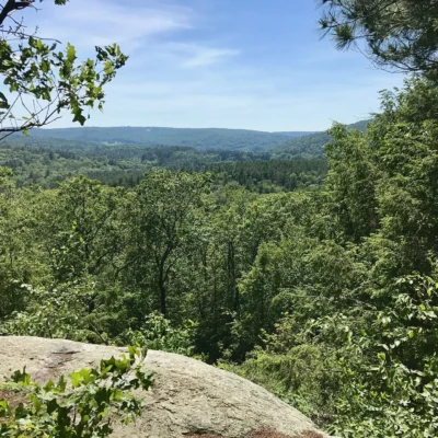
Tunxis State Forest is Connecticut’s largest state forest — over 14,000 acres spanning six towns in the western highlands. The forest is traversed by the Tunxis Trail, part of Connecticut’s famous Blue-Blazed Hiking Trail system. The dramatic Indian Council Caves and the panoramic views from Bald Mountain are highlights. Named for the Tunxis tribe of the Algonquin nation, the forest includes some of the most remote and wild terrain in the state — a remarkable achievement in the nation’s third-smallest and fourth-most-densely-populated state.
Visitor Information
| Detail | Information |
|---|---|
| Location | 6 towns in western CT |
| Size | 14,000+ acres — CT’S LARGEST! |
| Entry Fee | Free |
| Trail | Tunxis Blue-Blazed Trail |
| Highlights | Indian Council Caves, Bald Mountain |
Frequently Asked Questions
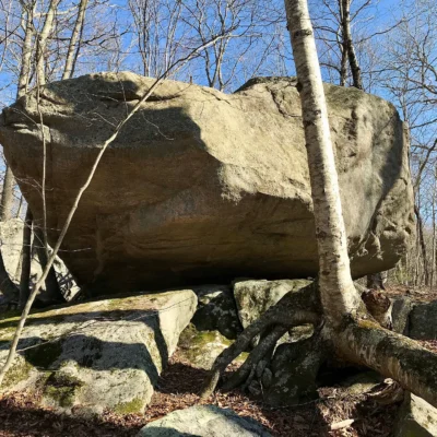
What are the Indian Council Caves?
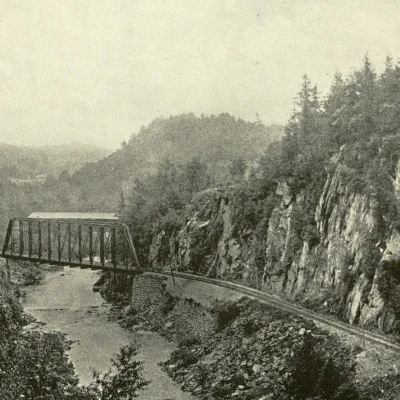
A dramatic series of rock overhangs and shallow caves formed by glacial activity and erosion in the volcanic traprock ridge. These sheltered spots were used by the Tunxis people for thousands of years.
About Tunxis State Forest
Tunxis State Forest covers over 7,000 acres across multiple parcels in the western Connecticut highlands — one of the state’s largest forests. Named for the Tunxis people, the forest straddles the scenic Litchfield Hills with dramatic terrain including Pine Mountain (1,391 feet). The Tunxis Trail — a long-distance hiking trail — traverses the forest from south to north.
Things to Do
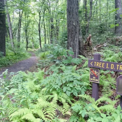
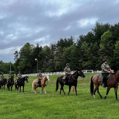
Hiking the Tunxis Trail (long-distance blue-blazed trail), mountain biking, hunting (deer, turkey, bear), horseback riding, fishing in forest streams, and cross-country skiing. The forest’s size offers genuine backcountry experiences.
Nearby state parks: If you have extra time, Satan’s Kingdom State Recreation Area is a short drive away, and Nepaug State Forest is a short drive away.
🏔️ Visit Tunxis State Forest
CT’s largest — 14,000 acres, Indian Council Caves, Blue-Blazed paradise.
Wildlife & Nature
Tunxis SF — 8,684 acres in multiple parcels. The forest’s hardwood forest, rocky ridges, and streams support black bears, wild turkeys, and timber rattlesnakes. The Tunxis Trail traverses the forest.
Nearby Attractions
Barkhamsted — adjacent. Litchfield County — surrounding. Barkhamsted Reservoir — nearby.