
Overview: A Rural Rail-Trail Through Michigan’s Fruit Belt
Stretching approximately 14 miles through the rolling agricultural heartland of Van Buren County in southwestern Michigan, the Van Buren Trail State Park offers a distinctly quiet, unhurried trail experience through one of the most productive fruit-growing regions in the Midwest. Converted from an abandoned railroad right-of-way, this linear trail connects the small inland city of Hartford—known as the self-proclaimed “Blueberry Capital of the World”—to the charming Lake Michigan resort community of South Haven, passing through mile after mile of commercial blueberry fields, vineyards, open farmland, and scattered woodlots along the way.
Managed by the Michigan Department of Natural Resources, the Van Buren Trail is not designed to be a dramatic wilderness experience. It does not feature towering waterfalls, rugged canyon descents, or breathtaking alpine vistas. Instead, its appeal lies in its gentle, pastoral simplicity: the flat, easy grade makes it accessible to cyclists of nearly all fitness levels, the rural landscape provides a meditative escape from urban congestion, and the trail’s western terminus in South Haven delivers riders directly to one of the most popular beach towns on Michigan’s southwestern coast. For families, casual cyclists, and anyone seeking a peaceful day outdoors between the orchards and the lake, the Van Buren Trail is an exceptional, low-key Michigan gem.
History of the Railroad Corridor
Like countless rail-trails across the American Midwest, the Van Buren Trail owes its existence to the vast railroad network that once connected every small farming community to the broader national market. During the late 19th and early 20th centuries, the railroad corridor that would become this trail was an essential economic artery, transporting fresh fruit—particularly blueberries, peaches, and grapes—from the fertile farms of Van Buren County to processing plants and urban markets throughout the region.
As automobile and truck transportation rendered many rural rail lines obsolete during the mid-20th century, the corridor was abandoned. Recognizing the recreational potential of the flat, cleared right-of-way, the State of Michigan eventually acquired the land and designated it as a state park trail. The conversion preserved the gentle railroad grade and the mature tree lines that had grown up along the abandoned tracks, creating a ready-made pathway through the agricultural landscape.
Trail Surface and Conditions
One of the most important things any prospective visitor must understand about the Van Buren Trail is that its surface is not uniformly paved. The trail’s condition varies significantly depending on the section.
The Paved Section: South Haven to 16th Avenue
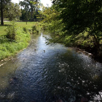
The western portion of the trail, running from the South Haven trailhead eastward for several miles to approximately 16th Avenue, features a smooth, paved asphalt surface suitable for road bikes, inline skates, strollers, and wheelchairs. This section is well-maintained, clearly marked, and receives the highest volume of use, particularly during the summer tourist season when visitors combine a trail ride with a trip to South Haven’s famous beaches.
The Unpaved Section: 16th Avenue to Hartford
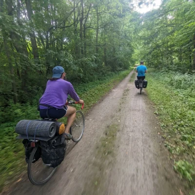
East of 16th Avenue, the trail surface transitions dramatically to a mix of hard-packed dirt, loose gravel, sand patches, grassy two-track, and sections of rough, original railroad ballast stone. This portion of the trail is significantly more challenging and is generally unsuitable for road bikes, strollers, or wheelchair users. Mountain bikes, hybrid bikes with wider tires, and horseback riders will find this section more manageable, though conditions can deteriorate noticeably after heavy rain, creating muddy stretches and standing-water puddles that may persist for days.
What You’ll See Along the Way
The Van Buren Trail is a living agricultural museum in motion. Depending on the season, riders will pass within arm’s reach of some of Michigan’s most iconic crops.
Blueberry Country
Van Buren County is one of the largest blueberry-producing counties in the entire United States. During the late June through August harvest season, the trail passes directly adjacent to massive commercial blueberry fields with row upon row of heavily laden bushes stretching to the horizon. The sight—and the sweet, unmistakable fragrance during peak ripeness—is genuinely remarkable. Several local farms near the trail offer U-pick experiences; watching for roadside signs is well worthwhile.
Vineyards and Orchards
The Lake Michigan “fruit belt” climate that supports the blueberry industry also nurtures a thriving wine industry. Riders will observe established vineyards, particularly in the western half of the trail near South Haven. Additionally, peach orchards, apple orchards, and asparagus fields line sections of the corridor, each offering a different visual character depending on the season.
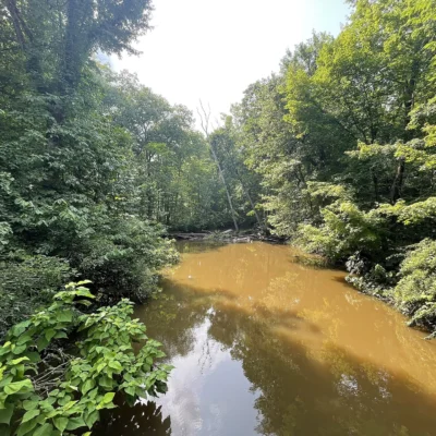
Wildlife and Natural Areas
Despite the heavily agricultural landscape, the trail corridor itself—with its mature tree lines and undisturbed drainage ditches—functions as a linear wildlife corridor. White-tailed deer regularly cross the trail at dawn and dusk. Red-tailed hawks and American kestrels hunt the open fields from fence posts along the route. During spring and fall migrations, birders may spot a surprising diversity of songbirds sheltering in the wooded strips between the fields.
Connecting to the Broader Trail Network
One of the Van Buren Trail’s most significant strengths is its connectivity to a broader network of southwestern Michigan trails.
- Kal-Haven Trail: At its western end in South Haven, the Van Buren Trail connects directly to the Kal-Haven Trail Sesquicentennial State Park, a 33-mile crushed limestone trail running east to Kalamazoo. Combined, these two trails create a roughly 47-mile continuous riding corridor spanning from Hartford through South Haven to Kalamazoo.
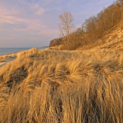
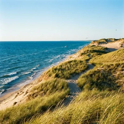
- Van Buren State Park: A spur trail provides access to Van Buren State Park, which features a sandy Lake Michigan beach, wooded campsites, and excellent dune habitat.
- South Haven Beach Trail: Once in South Haven, the local trail system connects riders to the town’s iconic South Beach, lighthouse, and downtown shopping district.
Seasonal Considerations
Spring (April–May)
The fruit trees begin blossoming, creating scenic canopies of white and pink alongside the trail. However, the unpaved sections can be extremely muddy and soft during the spring thaw. Mosquitoes and blackflies emerge as temperatures warm.
Summer (June–August)
Peak season. The blueberry fields are in full production, South Haven’s beaches are packed, and trail use is at its highest. Early morning rides (before 9 AM) are recommended to avoid the heat and the afternoon crowds on the paved western section.
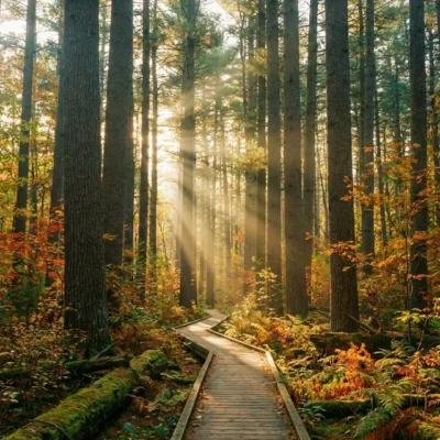
Autumn (September–October)
Many experienced trail users consider fall the finest season on the Van Buren Trail. The vineyards and hardwoods display vivid autumn colors, the summer crowds thin dramatically, and the temperatures are ideal for extended riding. The grape and apple harvest creates a wonderfully fragrant riding experience.
Winter (November–March)
The trail is open year-round, but winter conditions vary dramatically. Sections of the trail are designated for snowmobile use from December 1 through March 31. Cross-country skiing is possible but trails are not groomed. The paved section may be plowed in certain areas; the unpaved section is generally inaccessible during deep snow.
Practical Information
Trailheads
- South Haven Trailhead: Located near the intersection of Kalamazoo Street and Lovejoy Avenue. Parking, restrooms, and information signage available. Easy walking distance to downtown South Haven restaurants and shops.
- Hartford Trailhead: Located near Prospect Street, north of the I-94 exit. Parking available. Fewer amenities than the South Haven end.
Vehicle Pass
A Michigan Recreation Passport ($14 residents, $36 non-residents) or daily vehicle pass is required for parking at the designated trailheads. This pass also grants access to all Michigan state parks for the calendar year.
Frequently Asked Questions
Can I ride the entire trail on a road bike? No. Only the western section (South Haven to approximately 16th Avenue) is paved. The eastern portion is rough, unpaved, and includes loose gravel, sand, and railroad ballast that is unsuitable for narrow road bike tires. A mountain bike or hybrid with wider tires is strongly recommended for the full trail.
Are there any places to eat or drink along the trail? The trail itself passes through rural farmland with very limited commercial services between the two endpoints. South Haven, at the western end, has a full range of restaurants, cafes, and shops. Hartford, at the eastern end, has a few local options. Plan to carry water and snacks for the ride.
Can I ride horses on the Van Buren Trail? Yes. Horseback riding is permitted on the unpaved sections of the trail. Riders should stay to the designated side and yield to pedestrians. Horses are not permitted on the paved section near South Haven.
Is the trail safe for young children? The paved western section is excellent for families with young cyclists. It is flat, smooth, and relatively short. The unpaved eastern section is more challenging and may not be suitable for very young or inexperienced riders due to rough surfaces and occasional road crossings.
Is the Van Buren Trail the same as Van Buren State Park? No. Van Buren State Park is a separate traditional state park located on the Lake Michigan shoreline south of South Haven, featuring a beach, campground, and dune ecosystem. However, a spur trail connects the Van Buren Trail to Van Buren State Park, making it easy to visit both in a single trip.
More parks nearby: Van Buren State Park is a short drive away, while Kal-Haven Trail lies a short drive away.

Park Location
Plan your gear for Van Buren Trail State Park
From our editorial guides, matched to this park’s activities:

Top Tours & Activities Near Kalamazoo
 from $15
 from $29
 from $50