🌤 Weather at Wye Island Natural Resources Management Area by season
| Spring | Summer | Fall | Winter |
|---|---|---|---|
| 36–73 °F | 66–87 °F | 41–78 °F | 29–46 °F |
Each range runs from the coldest monthly average low to the warmest monthly average high in that season (1991-2020 climate normals), measured at Stevensville 2SW, 12 mi away, elevation 10 ft. Conditions at the park can differ from the station, especially where elevation differs — check a forecast before you go.

Wye Island Natural Resources Management Area — 2,450 of the island’s 2,800 acres, managed by the Maryland Park Service on the Chesapeake Bay between the Wye River and the Wye East River, Queen Anne’s County, MD
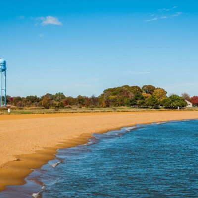
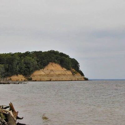
Wye Island Natural Resources Management Area (NRMA) is run by the Maryland Park Service, part of the Maryland Department of Natural Resources (DNR), in Queen Anne’s County. It is not a state park. Of the island’s 2,800 acres, 2,450 acres are managed by the Maryland Park Service for resource management, recreation and agriculture. The island lies in the tidal recesses of the Chesapeake Bay between the Wye River and the Wye East River.
You reach the NRMA at 632 Wye Island Road, Queenstown, MD 21658. It is open from sunrise to sunset (as of October 2026). For questions, call 410-827-7577 or email [email protected]. A major emphasis of the DNR’s work here is habitat for wintering waterfowl, and a primary goal is stabilizing the island’s 30 miles of eroding shoreline.
Trails
Wye Island has six miles of trails, and wildlife viewing and hiking are the most popular activities on them. The island is relatively flat, and you reach the trails easily from the main park road. Horseback riding and bicycling are popular too, but horses and bikes may be off limits in some areas at certain times of year because of trail conditions, so call ahead.
| Trail | What the DNR says |
|---|---|
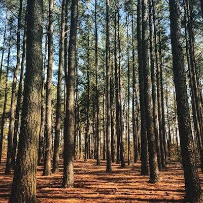
| School House Woods Nature Trail | Leads through a mature hardwood forest. No horses. |
| Ferry Landing Trail | Leads beneath a canopy of Osage orange trees |
| Ferry Point Trail | No horses, because the area is sensitive |
The DNR offers a free Wye Island NRMA trail map as a PDF on its website. The Maryland Park Service does not rent horses. Bring insect repellent, sunscreen and drinking water, watch for poison ivy and check yourself for ticks after your hike.
Wildlife & Birding
The DNR lists ducks, geese, wading birds, bald eagles, the endangered Delmarva fox squirrel and white-tailed deer among the wildlife you can see. Habitat for wintering waterfowl is a major focus of the area’s management.
Kayaking
You can paddle from a soft launch at the Granary Creek Picnic Area, for non-motorized boats only. Parking there is limited, with some extra parking at a small lot about a quarter mile away, and parking along the road is prohibited. Canoes and kayaks are available for rent; call 410-827-7577 for availability. For motorized boats, use the public launches of Queen Anne’s County (Parks Department, 410-758-0835) or Talbot County (Parks and Recreation, 410-770-8050). Boaters anchor in Granary Creek and Dividing Creek off the Wye East River or near Drum Point on the Wye River, and you may come ashore to explore; pick a gently sloped spot to limit damage to the shoreline.
Fishing: Fishing is permitted from the shoreline, and the Wye River is popular with boaters for fishing and crabbing. Anglers 16 and older need a Maryland Chesapeake Bay Sport Fishing License (as of October 2026).
History
For more than 300 years Wye Island was privately owned and farmed, for tobacco and wheat. William Paca, the third governor of Maryland and a signer of the Declaration of Independence, owned the half north of Dividing Creek; the lawyer and jurist John Beale Bordley owned the southern half. In the 1770s Bordley gave up law to farm, experiment and write, and he tried to make the island self-sufficient with orchards, a vineyard, workshops, a large windmill and even a brewery.
Later the island was sold off as separate farms. Glenn and Jacqueline Stewart came to own most of the land, ran it as a cattle ranch and built the hunting lodge known as the Duck House, which still stands on Granary Creek. In the mid-1970s the threat of residential development led the State of Maryland to buy the island to ensure its preservation. For the full story, the DNR points to the book Wye Island by Boyd Gibbons.
Best Time to Visit
The NRMA is open from sunrise to sunset (as of October 2026). The DNR names no best season, but a major emphasis of its management is habitat for wintering waterfowl.
Frequently Asked Questions
Can I camp on Wye Island?
Only as a youth group. The DNR lists youth group camping on two primitive sites, Dividing Creek and Solo Cove, each for up to 40 people, with pit toilets. Reserve at 1-888-432-2267 or parkreservations.maryland.gov. You may not bring your own firewood onto DNR property because of the emerald ash borer; firewood is sold on site (410-827-7577).
What birds will I see?
The DNR lists ducks, geese, wading birds and bald eagles. You may also see the endangered Delmarva fox squirrel and white-tailed deer.
Can I ride horses?
Yes, with limits. Horseback riding is popular, but riders are prohibited on the Schoolhouse Woods Nature Trail and the Ferry Point Trail, and horses may be off limits in some areas at certain times of year because of trail conditions. Call 410-827-7577 before you go. The Maryland Park Service does not rent horses.
Why is it called a “Natural Resources Management Area”?
The Maryland Park Service manages 2,450 of the island’s 2,800 acres for resource management, recreation and agriculture. A major emphasis is habitat for wintering waterfowl, and a primary goal is stabilizing 30 miles of eroding shoreline, together with partners such as the Chesapeake Bay Trust, schools and scout groups.
How was the island saved from development?
In the mid-1970s the encroaching threat of residential development led the State of Maryland to buy the island to ensure its preservation.
More parks in Maryland: Wye Oak State Park and Tuckahoe State Park. See the full Maryland state parks guide.
Reservations: Youth group campsites are booked at 1-888-432-2267 or parkreservations.maryland.gov. The DNR is moving the Duck House Lodge and Pavilion to the same statewide reservation system (as of October 2026).
Plan your visit to Wye Island
Hours, the trail map, youth group camping and the Duck House Lodge: check the Maryland DNR page before you go.

🐾 Dogs & Pets at Wye Island Natural Resources Management Area
Park policy: Wye Island Natural Resources Management Area is run by the Maryland Park Service, and the Maryland Park Service Pet Policy (May 2024) lists it with pets allowed in the day-use area and on the trails.
- Pets allowed?
- Pets are allowed in the day-use area and on the trails
- Leash rule statewide rule
- 6 ft maximum in designated pet areas and 10 ft in undeveloped areas; off-leash under voice control only while swimming in designated areas
- Beaches & swim areas statewide rule
- At most parks pets are barred from sandy swim beaches from Memorial Day weekend through Labor Day; many parks allow shoreline swimming outside the swim beach
- Cabins & lodging statewide rule
- Most cabins are pet-free, but select parks designate pet-friendly cabins (e.g. Herrington Manor cabins 1-10, New Germany cabins 3-7)
- Statewide exceptions statewide rule
- Pets not allowed in park buildings or playgrounds; pets must be licensed and vaccinated
Are dogs allowed at Wye Island Natural Resources Management Area?
Pets are allowed in the day-use area and on the trails.
Beyond that, Maryland’s statewide rules apply.
Rules verified July 2026 via dnr.maryland.gov. More: Maryland state parks guide · Dog rules in all 50 states compared
Park Location
Plan your gear for Wye Island Natural Resources Management Area
From our editorial guides, matched to this park’s activities: