
🌤 Weather at Limekiln State Park by season
| Spring | Summer | Fall | Winter |
|---|---|---|---|
| 43–70 °F | 48–77 °F | 45–77 °F | 42–61 °F |
Each range runs from the coldest monthly average low to the warmest monthly average high in that season (1991-2020 climate normals), measured at Big Sur Stn, 22 mi away, elevation 200 ft. Conditions at the park can differ from the station, especially where elevation differs — check a forecast before you go.

🌲 Big Sur’s Hidden Gem — 100-Foot Waterfall, 19th Century Lime Kilns, Redwood Camping, and a Secret Beach on the Pacific — 710 acres of old-growth redwoods, historic industrial ruins, and coastal bluffs along Highway 1 — Reopened April 2026 after Highway 1 storm repairs — Monterey County, California
Limekiln State Park is the Big Sur experience distilled into 710 acres: a 100-foot waterfall cascading through a redwood canyon, four massive 19th-century lime kilns being slowly reclaimed by the forest, a campground beneath towering coast redwoods, and a rocky Pacific beach — all accessed from a single parking area off Highway 1. While neighboring parks like Pfeiffer Big Sur and Julia Pfeiffer Burns draw the crowds, Limekiln rewards visitors who venture to the southern end of Big Sur with a more intimate, less crowded encounter with everything that makes this coastline legendary.
The park reopened for camping on April 1, 2026, following years of limited access due to Highway 1 landslides and storm damage. This makes it one of the freshest camping options on the Big Sur coast — but availability is extremely competitive. Read the camping section carefully before planning your trip.
⚠️ 2026 Trail Alert: The Hare Creek and Falls Trail remain CLOSED as of April 2026. The Limekiln Trail to the kilns and the coastal access are open. Check the official California State Parks website for current trail status before visiting.
Limekiln Falls — 100 Feet Through the Redwoods
Limekiln Falls drops approximately 100 feet over a limestone face, with water cascading through a narrow canyon of moss-covered rock and towering redwoods. The hike to the falls is short — about 0.5 miles from the trailhead — but involves several creek crossings that can be tricky in spring when water levels are higher. The trail forks early: left leads to both the falls and the kilns, then another fork sends you right to the falls. Even during low-water periods, the falls are a stunning sight — the narrow cascade framed by ferns, fallen logs, and the cathedral-like canopy of the redwood forest above. After heavy rain, the falls become a roaring curtain of whitewater.
Historic Lime Kilns — 1887 Industrial Ruins
From 1887 to 1890, the Rockland Lime and Lumber Company operated four massive lime kilns here, harvesting limestone from the surrounding hills and using the redwood forest for fuel. The kilns are enormous — approximately 100 feet tall — cone-shaped brick and stone structures that tower above the creekbed. Within just three years, Rockland had exhausted both the accessible limestone and the old-growth redwoods needed to fire the kilns, and the operation was abandoned. Today, the four kilns stand as some of the most remarkable and photogenic industrial ruins in California — slowly being consumed by ferns, moss, and the encroaching forest. Reaching the kilns requires about a 0.25-mile walk from the fork along a creek trail.
Camping: 29 Sites in Two Loops
| Loop | Sites | Setting | Best For |
|---|---|---|---|
| Redwood Loop (Sites 13–29) | 17 | Inland, along Limekiln Creek, redwood canopy | Privacy, shade, nature immersion, tent camping |
| Ocean Loop (Sites 1–12) | 12 | Coastal side, closer to beach trail | Ocean proximity, sunset access |
Campground Details
- Reservations: All 29 sites by reservation only via ReserveCalifornia.com or 800-444-7275. Book months in advance for summer.
- Amenities: Flush toilets, potable water, coin-operated showers. No hookups.
- Vehicle Limits: RVs max 24 feet, trailers max 15 feet. Strictly enforced — the access road and sites are small.
- No dogs allowed.
- No cell service in the park — plan accordingly.
- Cash only at the entrance kiosk.
- Rate: $35/night (as of 2026)
Best Campsites
The Redwood Loop (13–29) is generally preferred by experienced campers — the sites sit directly along Limekiln Creek beneath massive coast redwoods, creating a cathedral-forest atmosphere that’s hard to match anywhere on the Big Sur coast. Note that RVs and trailers are typically not permitted in the Redwood Loop. The Ocean Loop sites offer easier beach access but are closer to Highway 1.
The Beach
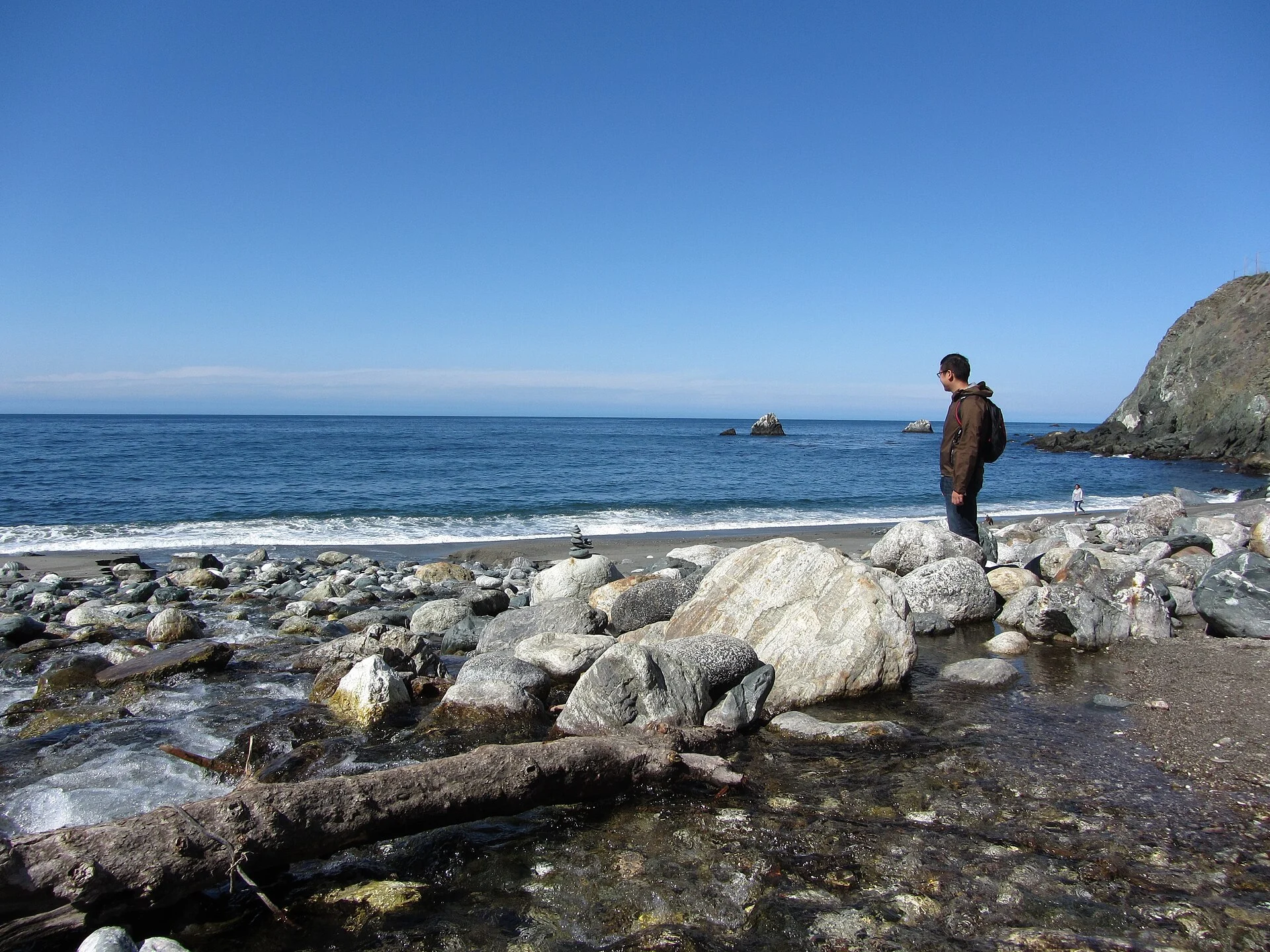
A short trail from the parking area leads under the Highway 1 bridge to a small, rocky cove beach on the Pacific. It’s not a swimming beach — the water is cold and the surf can be rough — but it’s a stunning place to watch the sunset, explore tidepools, or simply sit on the rocks and listen to the ocean. The beach is accessible year-round during park hours.
Trail Guide
| Trail | Distance | Difficulty | Status (2026) |
|---|---|---|---|
| Limekiln Falls Trail | 0.5 mi OW | Easy-Moderate | ✅ OPEN |
| Lime Kilns Trail | 0.25 mi OW | Easy | ✅ OPEN |
| Beach Trail | 0.1 mi | Easy | ✅ OPEN |
| Hare Creek Trail | 0.5 mi | Moderate | ❌ CLOSED |
Best Time to Visit
| Season | Weather | Crowds | Best For |
|---|---|---|---|
| Spring (Mar–May) | 50–65°F, rain possible | Low-Moderate | Maximum waterfall flow, wildflowers, green forest |
| Summer (Jun–Aug) | 55–72°F, fog | High | Camping, beach, dry trails (book months ahead) |
| Fall (Sep–Nov) | 55–75°F | Moderate | Warmest, clearest weather, fewer crowds than summer |
| Winter (Dec–Feb) | 45–58°F, heavy rain | Very Low | Dramatic waterfall, mushrooms, solitude |
💰 Trip Cost Estimator
| Expense | Day Trip | Weekend Camping | Notes |
|---|---|---|---|
| Day-Use Parking | $10 | — | Extremely limited spots |
| Campsite (per night) | — | $70 (2 nights) | $35/night, reservation required |
| Reservation Fee | — | $8 | ReserveCalifornia processing |
| Gas (from SF, ~150 mi) | $40–$60 | $40–$60 | Monterey County |
| Total | $10 | $78–$138 | CASH ONLY at park |
⚠️ Safety & Practical Information
| Issue | Details | Action |
|---|---|---|
| 💳 Cash Only | No card payments at entrance | Bring cash for day-use fee |
| 📵 No Cell Service | Zero reception in park | Download maps, inform contacts |
| 🐕 No Dogs | Dogs prohibited parkwide | Leave pets elsewhere |
| ☠️ Poison Oak | Abundant along all trails | “Leaves of three, let it be” — stay on trail |
| 🌊 Dangerous Surf | Cold water, unpredictable waves | No swimming, never turn back to ocean |
| 🚗 Highway 1 Closures | Landslides can close road | Check Caltrans before driving |
📸 Photography Guide: Best Shots at Limekiln
• Limekiln Falls: Tripod essential. Long exposure (1–4 sec) with ND filter to soften the 100-foot cascade. Best light: overcast days when the redwood canopy diffuses the light evenly. Spring for max flow.
• Historic Kilns: Wide-angle (14-24mm) to capture the 100-foot structures with the ferns and moss growing over them. The kilns photograph best on foggy mornings when mist threads through the ruins.
• Redwood Canopy: Lie on your back and shoot straight up — the converging trunks of the coast redwoods against the sky create dramatic vertical compositions.
• Beach at Sunset: Walk through the Highway 1 underpass to the cove for sunset compositions. The rocky foreground and crashing waves with the bluff backdrop is pure Big Sur.
Nearby Big Sur Attractions
Limekiln sits at the southern end of Big Sur, making it an ideal base for exploring:
- Julia Pfeiffer Burns State Park — McWay Falls (the iconic ocean waterfall) is 25 minutes north
- Pfeiffer Big Sur State Park — Largest Big Sur campground, Big Sur Lodge, 35 minutes north
- Sand Dollar Beach — Big Sur’s largest sandy beach, 10 minutes south
- Nacimiento-Fergusson Road — Mountain road with panoramic coastal views, 5 minutes north
- Partington Cove — Hidden cove with historic tunnel, 20 minutes north
Frequently Asked Questions
Is Limekiln State Park open in 2026?
Yes. The park reopened for camping on April 1, 2026, and day use is available 8 AM to sunset. However, the Hare Creek and Falls Trail remain closed. Check the official California State Parks website for current trail status.
How do I get a campsite at Limekiln?
All 29 sites are reservation-only through ReserveCalifornia.com. Summer weekends book months in advance. Set alerts and be ready when reservations open. There are no first-come, first-served sites.
Which are the best campsites?
The Redwood Loop (sites 13–29) along Limekiln Creek is the premium experience — old-growth redwood canopy, creek sounds, maximum privacy. The Ocean Loop (1–12) is closer to the beach but also closer to Highway 1 noise.
Can I bring my dog?
No. Dogs are not allowed at Limekiln State Park — not in the campground, not on the trails, not on the beach.
Is there cell service?
No. There is zero cell reception in the park. Download offline maps, inform your contacts of your plans, and embrace the digital detox.
Do I need cash?
Yes. All transactions at the park entrance are cash only as of 2026. Bring exact change ($10 for day use) if possible.
How big can my RV be?
RVs are limited to 24 feet and trailers to 15 feet. These limits are strictly enforced — the access road and campsites are small and narrow.
How far is Limekiln from San Francisco?
Approximately 150 miles (3.5–4 hours) via Highway 1 through Big Sur, or faster via Highway 101 to Paso Robles then west. From Monterey/Carmel, it’s about 60 miles (1.5 hours) south on Highway 1.
Make it a road trip: Pair a visit with Julia Pfeiffer Burns State Park (a short drive away) or John Little State Natural Reserve (a short drive away).
🌲 Ready to Camp at Limekiln?
From a 100-foot waterfall in a redwood canyon to 19th-century industrial ruins and a secret Pacific cove, Limekiln State Park offers Big Sur’s most concentrated outdoor experience. Book your campsite months ahead, bring cash and layers, and leave your phone behind.
Wildlife & Nature
Limekiln SP — in Big Sur — named for the 1880s lime smelting kilns that remain in the redwood canyon. The park’s redwood forest, coastal bluffs, and Limekiln Creek support California condors, steelhead trout, and mountain lions. Limekiln Falls (a 100-foot waterfall) is a highlight.
Nearby Attractions
Big Sur — at the park. Highway 1 — at the park. Los Padres NF — surrounding.

🐾 Dogs & Pets at Limekiln State Park
Park policy: California State Parks' statewide dogs table answers No for Limekiln and adds the boundary in plain words: dogs are not allowed beyond the day-use parking lot. Your dog can ride along and get out at the lot, but that lot is where the visit ends.
- Pets allowed?
- Dogs may go no further than the day-use parking lot, not the campground, trails or beach
- Leash rule statewide rule
- Maximum 6-foot leash at all times; dogs may not be left unattended.
- Beaches & swim areas statewide rule
- Dogs are prohibited on most state beaches; only beaches specifically designated as dog-allowed permit them (varies by park).
- Cabins & lodging statewide rule
- Pets are generally not allowed in buildings or cabins; overnight campers must keep dogs inside a tent or vehicle at night.
- Park-specific rules
- The restriction is drawn as a line on the map rather than an activity ban, so everything past that lot is closed to pets — the reopened campground, the Limekiln Trail to the kilns, the Hare Creek and Falls routes, and the beach.
- Statewide exceptions statewide rule
- Designated dog-friendly trails and beaches vary park by park; misrepresenting a pet as a service animal is a misdemeanor.
Are dogs allowed at Limekiln State Park?
Dogs may go no further than the day-use parking lot, not the campground, trails or beach.
Beyond that, California’s statewide rules apply.
Rules verified July 2026 via parks.ca.gov. More: California state parks guide · Dog rules in all 50 states compared
Park Location
Plan your gear for Limekiln State Park
From our editorial guides, matched to this park’s activities:

Top Tours & Activities Near Monterey & Carmel
 from $225
 from $240
 from $248