
🌤 Weather at Smugglers Notch State Park by season
| Spring | Summer | Fall | Winter |
|---|---|---|---|
| 18–64 °F | 53–75 °F | 27–67 °F | 6–29 °F |
Each range runs from the coldest monthly average low to the warmest monthly average high in that season (1991-2020 climate normals), measured at Eden 2 S, 14 mi away, elevation 1,456 ft. Conditions at the park can differ from the station, especially where elevation differs — check a forecast before you go.

🏆 Smugglers’ Notch State Park — A dramatic mountain pass in Vermont’s Green Mountains with 1,000-foot cliffs, access to Mount Mansfield (Vermont’s highest peak), Sterling Pond Trail, and primitive camping with 20 tent + 14 lean-to sites near Stowe.
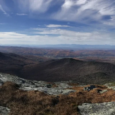
Smugglers’ Notch State Park sits at the base of one of Vermont’s most dramatic mountain passes — a narrow gap between Mount Mansfield (Vermont’s highest peak at 4,393 ft) and Spruce Peak, with towering cliffs rising nearly 1,000 feet on either side. The pass road (Route 108) is a federally designated Scenic Byway, closed in winter due to its extreme narrowness. The park provides a base camp for some of Vermont’s most challenging hiking.
Visitor Information
| Detail | Information |
|---|---|
| Location | Route 108, near Stowe, Lamoille County, VT |
| Season | 3rd weekend of May – 2nd Monday of October |
| Campsites | 20 tent sites + 14 lean-tos (many walk-in) |
| Facilities | Flush toilets, hot showers (token-operated) |
| Pass Road | Closed in winter — too narrow for large RVs |
Hiking
| Trail | Distance | Difficulty | Highlights |
|---|---|---|---|
| Sterling Pond | 2.4 mi RT | Moderate | Scenic alpine pond at 3,000 ft |
| Hell Brook | 1.6 mi to summit | Strenuous | Technical rock scramble to Mt. Mansfield |
| Long Trail | Thru-trail | Moderate–Strenuous | Vermont’s 272-mile trail passes through the Notch |
| Cliff Trail | Variable | Expert | Iron rungs, rock gaps — dry conditions only |
Activities
| Activity | Details |
|---|---|
| Hiking | Sterling Pond, Mt. Mansfield, Long Trail access |
| Camping | 34 sites — tent & lean-to, many walk-in |
| Rock Scrambling | Technical routes on Mt. Mansfield |
| Scenic Driving | Route 108 Scenic Byway (seasonal) |
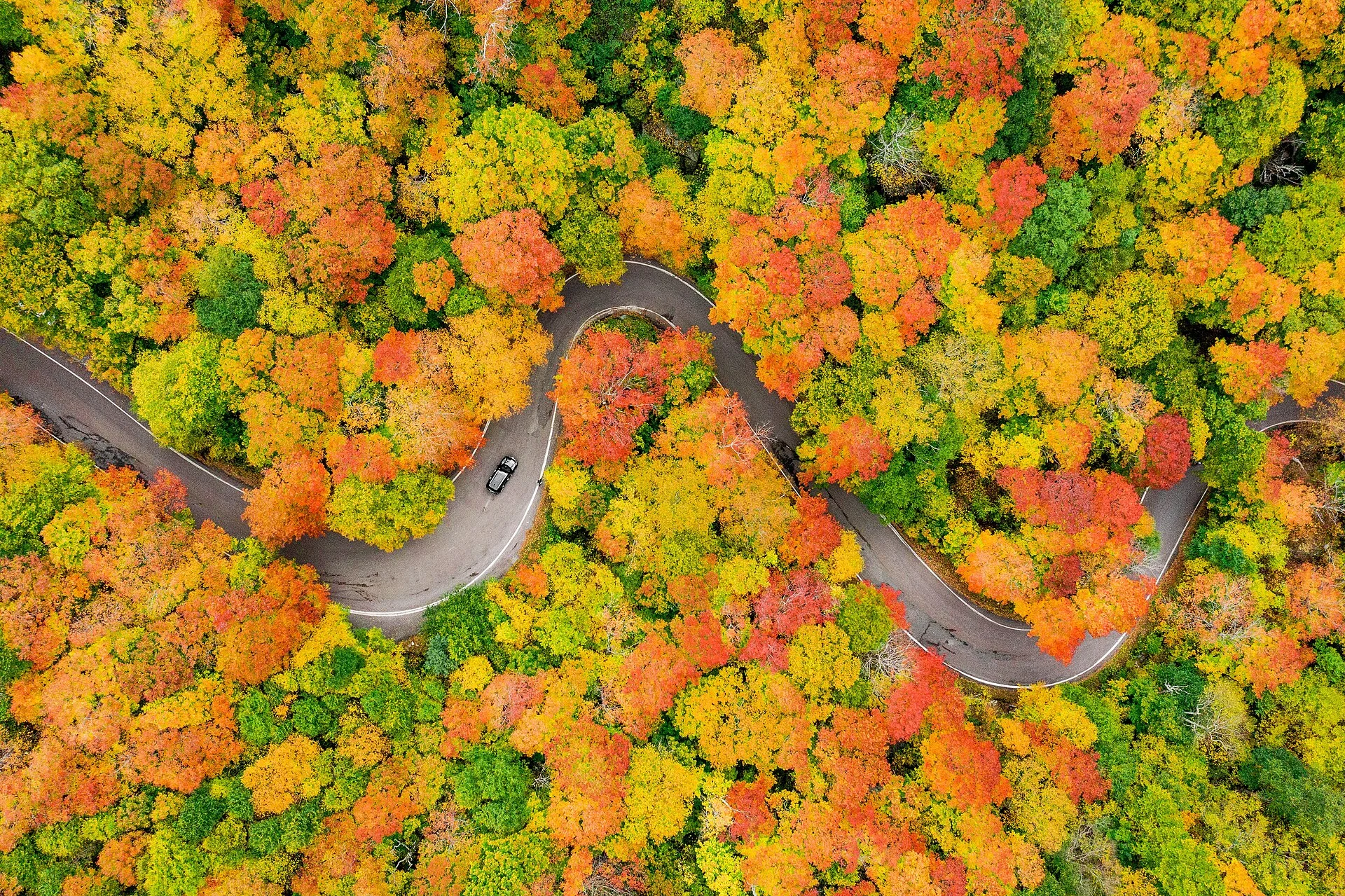
| Fall Foliage | Spectacular October colors in the Notch |
Frequently Asked Questions
Can I drive through Smugglers’ Notch in an RV?
No — Route 108 through the Notch is extremely narrow with tight switchbacks and is not suitable for large RVs, trailers, or buses. The road is closed entirely during winter. Check with the park office about vehicle size limitations before planning your trip.
What is Sterling Pond Trail?
Sterling Pond Trail is a 2.4-mile round-trip moderate hike that climbs to a scenic alpine pond at about 3,000 feet. It’s considered one of the best hikes in the Stowe area and is accessible from the Notch road. Allow about 2 hours for the round trip.
Can I hike Mount Mansfield from here?
Yes — several trails access Mount Mansfield (4,393 ft, Vermont’s highest peak) from Smugglers’ Notch. Hell Brook Trail is the most direct but extremely steep and technical. The Long Trail also passes through the Notch and connects to the ridgeline. All summit routes are strenuous — bring a paper map, layers, and extra water.
More parks nearby: Underhill State Park is a short drive away, while Mt. Mansfield State Forest lies a short drive away.
Camping reservations: Book campsites and cabins for Vermont state parks online at vtstateparks-visit.com.

⛺ Camping at Smugglers Notch State Park: Campgrounds & Cabins
| Campsites | 34 sites — 5 tent/RV sites, 15 tent-only sites, 14 lean-tos. Restrooms with flush toilets, hot/cold water and coin-operated showers. Statewide non-resident rates effective 7/1/2025: $38/night tent/RV, $49/night lean-to, +$8/night per extra person. |
|---|---|
| Pets | Pets permitted throughout the park, on leash. |
| Reservations | (802) 253-4014 or 1-888-409-7579; up to 11 months ahead on a rolling basis. 2-night minimum beyond 7 days out; 1-night stays within 7 days of arrival; all members of the camping party must arrive by 9pm. |
| Special sites | Most sites are walk-in, not vehicle-accessible; very limited RV accommodation due to the narrow, winding road through the Notch; bear activity reported - secure food and trash in a vehicle or bear canister; accessible campsites, trails and facilities available; firewood, ice and dump station on-site; no day-use facilities in the campground itself. |
| Season notes | 2026 season: May 15 - October 11. 2027 season: May 21 - October 10. |
Camping questions about Smugglers Notch State Park
Can you camp at Smugglers Notch State Park?
Yes. Smugglers Notch State Park has 34 campsites. 5 tent/RV sites, 15 tent-only sites, 14 lean-tos. Restrooms with flush toilets, hot/cold water and coin-operated showers. Statewide non-resident rates effective 7/1/2025: $38/night tent/RV, $49/night lean-to, +$8/night per extra person.
How do you reserve a campsite at Smugglers Notch State Park?
(802) 253-4014 or 1-888-409-7579; up to 11 months ahead on a rolling basis. 2-night minimum beyond 7 days out; 1-night stays within 7 days of arrival; all members of the camping party must arrive by 9pm.
Are pets allowed at the Smugglers Notch State Park campground?
Pets permitted throughout the park, on leash.
Source: vtstateparks.com (verified July 2026). Details change seasonally — confirm when booking.
🐾 Dogs & Pets at Smugglers Notch State Park
- Pets allowed? statewide rule
- Pets are allowed at all Vermont State Parks campgrounds and on trails unless otherwise posted, but are not permitted on beaches or in most picnic areas.
- Leash rule statewide rule
- Leash shorter than 10 ft required (or pet safely confined) at all times
- Beaches & swim areas statewide rule
- Pets are not permitted on beaches; limited exceptions let pets use the far side of the beach away from swim areas at Branbury, Lake Shaftsbury and Silver Lake
- Cabins & lodging statewide rule
- Pets are permitted in designated pet-friendly cabins only (full list on the Vermont State Parks cabins page); cottages do not allow pets
- Statewide exceptions statewide rule
- Pets allowed in picnic areas at Allis, Camp Plymouth, Elmore, Kill Kare, Knight Point, Lake Shaftsbury, Mt. Philo, Osmore Pond and Owl's Head; at Camp Plymouth pets may swim only at the cartop boat launch; current rabies vaccination expected
Are dogs allowed at Smugglers Notch State Park?
Pets are allowed at all Vermont State Parks campgrounds and on trails unless otherwise posted, but are not permitted on beaches or in most picnic areas. Individual parks can post stricter rules — check signage on arrival.
Rules verified July 2026 via vtstateparks.com. More: Vermont state parks guide · Dog rules in all 50 states compared
Park Map
Plan your gear for Smugglers Notch State Park
From our editorial guides, matched to this park’s activities:

Top Tours & Activities Near Stowe
 from $359
 from $359
 from $20