The Gateway to Vermont’s Highest Peak — CCC Campground, Sunset Ridge & Alpine Tundra on Mount Mansfield
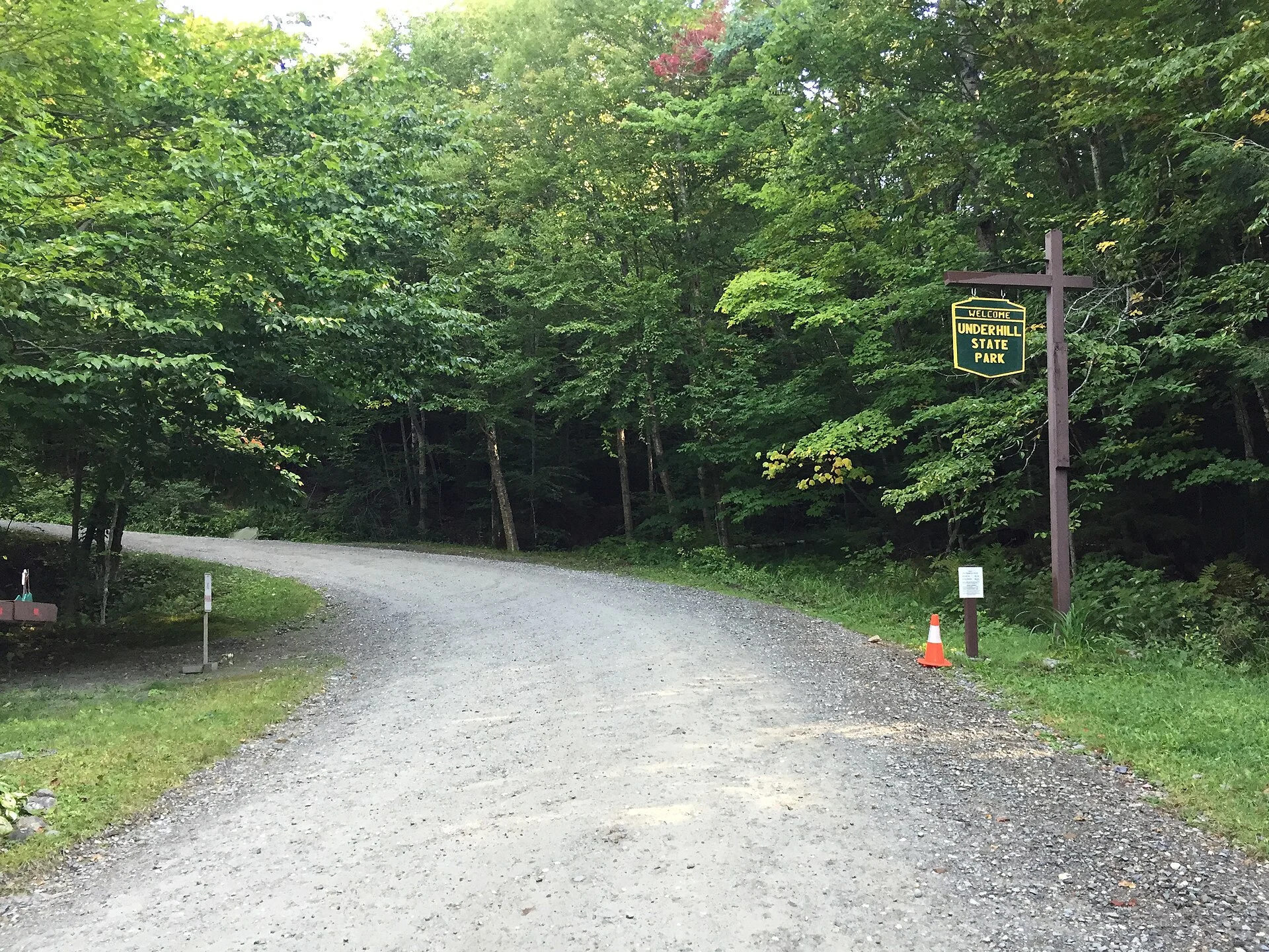
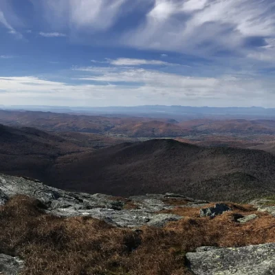
Underhill State Park sits on the western slopes of Mount Mansfield — at 4,395 feet, the highest peak in Vermont and the highest point in the Green Mountains. Located in the town of Underhill, about 20 miles east of Burlington, the park serves as the primary western trailhead for summiting Mansfield via the spectacular Sunset Ridge Trail, widely considered one of the finest hikes in New England.
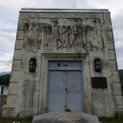
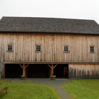
The park itself was developed by the Civilian Conservation Corps (CCC) between 1933 and 1940 — the roads, picnic shelters, and camping structures are listed on the National Register of Historic Places. The campground offers walk-in tent and lean-to sites (no drive-up access) in a forested mountain setting, creating an experience closer to backcountry camping than a typical state park. Above treeline, hikers enter one of the rarest ecosystems in the eastern United States — Mount Mansfield’s arctic-alpine tundra, home to plants that have survived here since the last Ice Age.
Things to Do
Sunset Ridge Trail
The park’s signature hike — and one of Vermont’s most iconic trails:
- Distance: Approximately 6.6 miles round trip to “The Chin” (highest point)
- Difficulty: Strenuous — steep, rocky sections with exposed ridgeline
- Views: Lake Champlain, the Adirondacks, and the Green Mountain spine
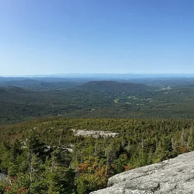
- Above treeline: The trail crosses fragile alpine tundra — stay on marked trails and bare rock only
Mount Mansfield Summit
The summit ridge of Mansfield is shaped like a human face in profile — features are named “The Forehead,” “The Nose,” “The Chin” (highest), and “Adam’s Apple.” The Long Trail traverses the entire ridge, connecting to the Sunset Ridge Trail from Underhill.
Alpine Tundra
Mount Mansfield hosts one of only three arctic-alpine tundra areas in Vermont — a tiny, fragile ecosystem of plants that have survived since the glaciers retreated 12,000 years ago. Species include Bigelow’s sedge, mountain sandwort, and rare moss communities. This is an extremely sensitive habitat — stepping off marked trails can destroy plants that take decades to recover.
CCC Historic Structures
The park’s infrastructure — roads, shelters, and camp structures built by CCC enrollees in the 1930s — is listed on the National Register of Historic Places. The historic character adds a layer of significance beyond the natural landscape.
Trails
| Trail | Distance | Difficulty | Highlights |
|---|---|---|---|
| Sunset Ridge Trail | ~6.6 mi RT | Strenuous | Vermont’s most scenic summit route; exposed ridge; alpine tundra; 360° views |
| CCC Road (approach) | ~1 mi | Easy–Moderate | Historic CCC road to trailhead; forested; connects to Sunset Ridge |
| Long Trail Connection | Varies | Strenuous | Vermont’s iconic end-to-end trail; Mansfield ridge traverse |
Camping
| Area | Sites | Amenities |
|---|---|---|
| Lower Camp | 11 tent / 6 lean-to | Flush toilets; cold water; no showers; walk-in only |
| Upper Camp | 2 tent / 7 lean-to | More secluded; typically for groups; walk-in only |
Important: All campsites are walk-in only — vehicles cannot reach the sites. Carry your gear from the parking area. No showers available.
Best Time to Visit
| Season | Highlights | Considerations |
|---|---|---|
| Summer (Jul–Aug) | ⭐ Best summit conditions; alpine flowers; long days; clear views | Popular trail — start early; afternoon thunderstorms; ridgeline exposed |
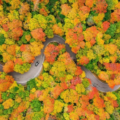
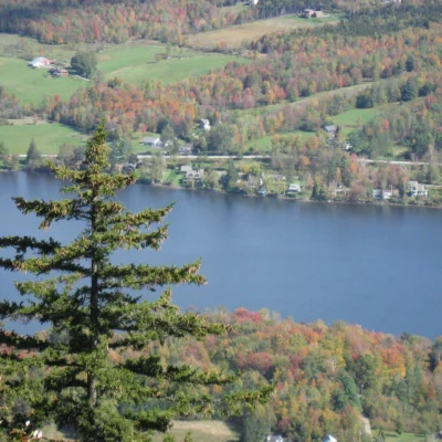
| Fall (Sep–Oct) | ⭐ PEAK FOLIAGE from summit — incomparable; cooler hiking temps | Cold ridgeline; early snow possible; shorter days; campground closing |
| Late Spring (Jun) | Park opening; snowmelt wildflowers; fewer hikers | Trail may still be muddy; alpine areas may have lingering snow/ice |
| Winter | Backcountry skiing access (advanced); ice climbing nearby | Park campground closed; extreme mountain conditions; expert only |
Visitor Tips
- Stay on the trail above treeline: The alpine tundra is irreplaceable. Walk only on marked trails and bare rock. A single footstep can destroy decades of plant growth. This is not a suggestion — it’s an ecological imperative.
- Weather changes fast: The ridgeline is fully exposed. Temperatures can drop 20°F+ from the parking lot to the summit, and fog, rain, or wind can materialize in minutes. Bring layers, rain gear, and extra food regardless of the valley forecast.
- Walk-in camping: All campsites require walking from the parking area. Pack accordingly — this is closer to a backcountry experience than a typical campground.
- Start early: The Sunset Ridge Trail is one of Vermont’s most popular hikes. Begin by 7–8 AM on summer weekends to secure parking and avoid afternoon weather.
- Season: The park is typically open from Memorial Day weekend through the second Monday in October.
Frequently Asked Questions
Wildlife & Nature
Underhill SP — on Mount Mansfield, Vermont’s highest peak. Sunset Ridge Trail provides above-treeline alpine hiking. Bicknell’s thrush nests near the summit.
Nearby Attractions
Underhill Center — adjacent. Stowe — 10 miles east.
How hard is the Sunset Ridge Trail to Mount Mansfield?
The Sunset Ridge Trail is rated strenuous. It’s approximately 6.6 miles round trip from Underhill State Park to “The Chin” (Mount Mansfield’s highest point at 4,395 feet). The trail includes steep, rocky sections and exposed ridgeline hiking above treeline. While it doesn’t require technical climbing skills, hikers should be in good physical condition, prepared for rapidly changing weather, and carry adequate water, food, and layers. It’s widely considered one of the most scenic summit routes in New England.
Is there alpine tundra on Mount Mansfield?
Yes — Mount Mansfield hosts one of only three arctic-alpine tundra areas in Vermont. These fragile plant communities have survived since the last Ice Age (approximately 12,000 years ago) and include rare species like Bigelow’s sedge and mountain sandwort. Hikers must stay strictly on marked trails and bare rock above treeline to protect this irreplaceable ecosystem.
Last updated: April 2026
Make it a road trip: Pair a visit with Mt. Mansfield State Forest (a short drive away) or Smugglers Notch State Park (a short drive away).
Camping reservations: Book campsites and cabins for Vermont state parks online at vtstateparks-visit.com.

Park Location


Top Tours & Activities Near Stowe
 from $359
 from $359
 from $20