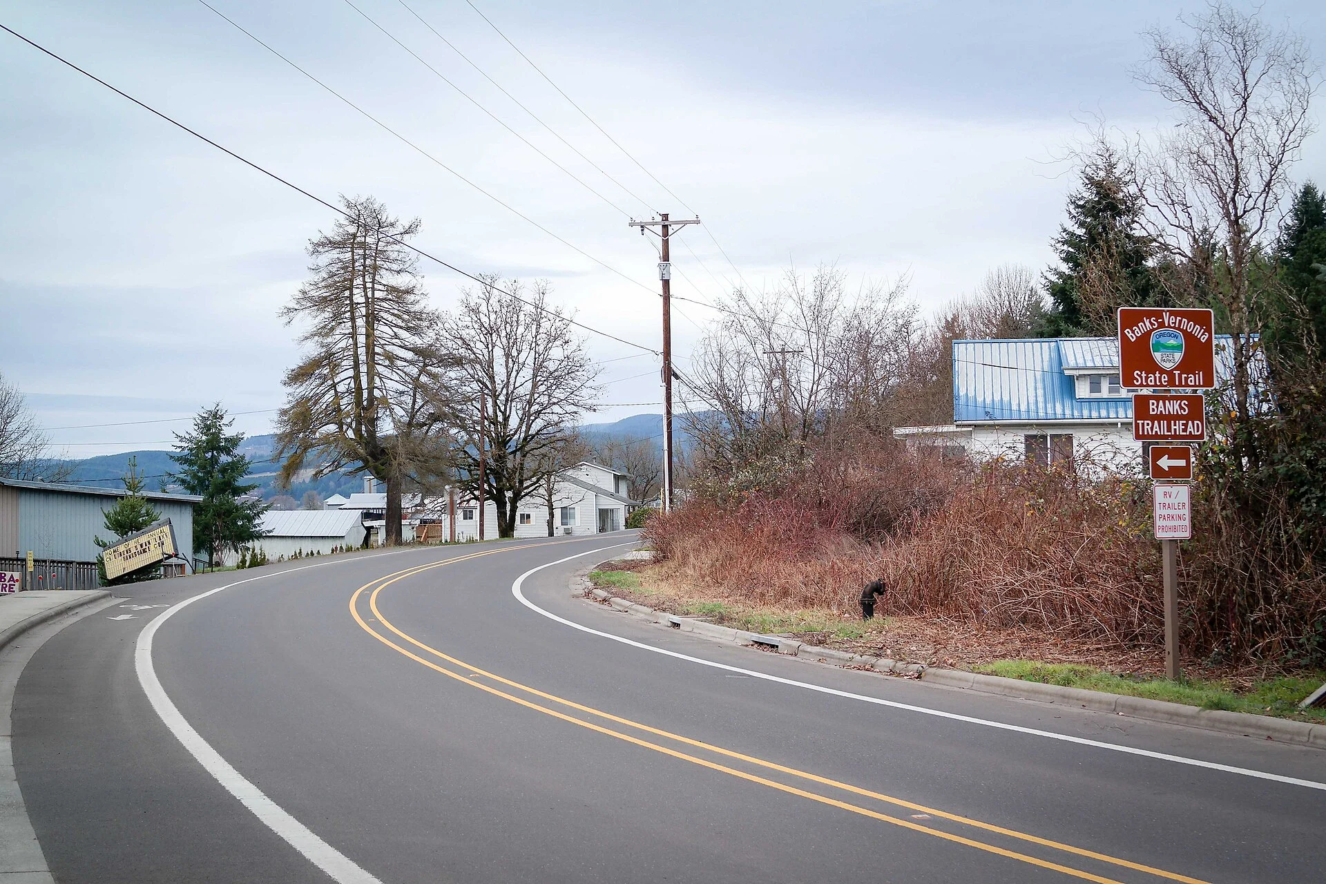
Photo: Geirfuglasker, CC BY-SA 4.0, via Wikimedia Commons
🌤 Weather at Banks–Vernonia State Trail by season
| Spring | Summer | Fall | Winter |
|---|---|---|---|
| 36–68 °F | 50–82 °F | 36–76 °F | 33–49 °F |
Each range runs from the coldest monthly average low to the warmest monthly average high in that season (1991-2020 climate normals), measured at Forest Grove, 7 mi away, elevation 180 ft. Conditions at the park can differ from the station, especially where elevation differs — check a forecast before you go.

Banks–Vernonia State Trail follows a former railroad corridor for 21 miles between Banks and Vernonia in northwest Oregon. The southern section crosses farmland and streamside areas before the route climbs into the wooded Coast Range foothills. Choose your starting point and turnaround before committing to the full distance.
Source check: October 24, 2026 — mapped segments and trailheads, surface and grade notes, parking permits, trestle dimensions, corridor history and regional fire history.
Plan Your Trail Visit
- Choose a segment: use the five-trailhead overview and official elevation profile. The full route is 21 miles one way; returning along it makes 42 miles.
- Match the terrain: the path is paved, but OPRD’s map marks short grades up to 11% near Tophill. Accessible facilities at a trailhead do not establish accessibility of the whole route.
- Plan parking and your return: a day-use parking permit is required and overnight parking at the trailheads is prohibited. Check the official permit information.
- Check notices: OPRD lists a Shoofly Trail southern-bridge closure with a temporary crossing. Check the park’s notices before departure and follow signs at the site.
Trail Details
| Feature | Details |
|---|---|
| Length | 21 miles one-way (42 miles round trip). Banks to Vernonia or reverse. Arrange a shuttle or ride out-and-back |
| Surface | An 8-foot-wide paved hiking and bicycle path, alongside a gravel horse path about 4 feet wide in most sections. Choose a segment using the official map; pavement alone is not an accessibility rating. |
| Elevation | Sustained climbs and descents through the Coast Range foothills. The official elevation profile marks short grades up to 11% near Tophill; it does not give a cumulative climbing total for your ride. |
| Trestles | The trail includes 13 bridges. Buxton Trestle is 733 feet long and 80 feet high, open to hikers and bicyclists; horses use a separate ground-level bypass across Mendenhall Creek. |
| Forest | Farmland and streamside areas near Banks, then wooded Coast Range foothills and private timberland toward Vernonia. Stay on the designated public trail corridor. |
| Uses | Hiking and bicycling on the paved path, with a parallel gravel path for horses in most sections. Check OPRD rules for e-bikes and follow posted restrictions. |
Choose a Trailhead and a Manageable Segment
Oregon State Parks lists five trailheads with parking and restrooms: Banks, Manning, Buxton, Tophill, and Beaver Creek, in that order from south to north. Start with the official trail map and elevation profile to choose a segment. Vernonia is the north end of the 21-mile route; it is not one of the five trailheads listed by OPRD.
| Start | Next point north | What the official map shows |
|---|---|---|
| Banks | Manning: 3.8 miles | Accessible parking and restroom symbols, an interpretive display, bike repair station, and phone charging station. |
| Manning | Buxton: 3.0 miles | Parking, vault restroom, picnic area, and bike repair station. |
| Buxton | Tophill: 5.2 miles | Parking, vault restroom, picnic facilities, stock-trailer parking, and an accessible equestrian loading platform. The map inset marks access to Buxton Trestle and a separate horse bypass; it does not give a parking-to-trestle distance. |
| Tophill | Beaver Creek: 4.8 miles | Parking, vault restroom, picnic area, equestrian loading platform, and hitching posts. Nearby trail sections are marked with grades up to 11%. |
| Beaver Creek | Vernonia: 4.2 miles | Parking, vault restroom, and picnic area. Plan your return from the northern end. |
For a shorter out-and-back, Banks to Manning is 3.8 miles one way, or 7.6 miles if you retrace the same route; it lies on the lower part of OPRD’s elevation profile. Manning to Buxton is 3.0 miles one way, or 6.0 miles out and back, with a climb toward Buxton. If the trestle is your focus, use the Buxton trailhead and its detail inset rather than assuming a specific distance from the parking lot. OPRD marks short grades of up to 11% near Tophill, so a paved surface alone does not tell you whether a segment fits your mobility needs. OPRD lists a day-use parking permit requirement and prohibits overnight parking at the trailheads; check its current park page for notices and permit details before you go.
The History
| Year | Railroad and trail corridor |
|---|---|
| 1920s | The railway carried logs, lumber, freight and passengers. Its owners included the Spokane, Portland and Seattle Railway and Burlington Northern. |
| 1973 | The line was abandoned and its rails salvaged. |
| 1974 | The state purchased the right of way. |
| 1990 | The corridor was transferred to the Oregon Parks and Recreation Department. OPRD identifies Banks–Vernonia as Oregon’s first rails-to-trails state park. |
These corridor dates come from the official park history. The Tillamook Burn is part of the wider region’s forest history; see the regional history question.
Best Time to Visit
| Season | Best For |
|---|---|
| Summer (Jun–Sep) | ☀️ Dry weather. Long days. Coast Range at its best. Wildflowers along the trail. Peak cycling season |
| Fall (Oct–Nov) | 🍂 Big-leaf maple turning gold. Cool riding weather. Fewer cyclists. Morning fog in the valleys |
| Spring (Mar–May) | Trillium and wildflowers. Wet — Oregon spring rain. Muddy on equestrian sections. Beautiful when dry |
| Winter (Dec–Feb) | Expect wet, cold conditions. Check current park notices and bridge conditions before setting out; bring rain gear |
Frequently Asked Questions
Is the trail really 21 miles?
Yes — 21 miles one way between Banks and Vernonia. Retracing the entire route makes a 42-mile round trip. You can choose a shorter out-and-back from one of the five OPRD trailheads; plan your turnaround and return transport before setting out.
What happened in the Tillamook Burns?
The Oregon Department of Forestry describes a series of fires from 1933 through 1951 that burned a combined 355,000 acres in the wider region. Voters authorized rehabilitation funding in 1948, and reforestation eventually included 72 million planted seedlings. Read ODF’s Tillamook State Forest history for this regional background.
Can I ride a road bike?
The hiking and bicycle path is paved and 8 feet wide. Check your planned segment and current notices before riding: OPRD warns that bridge decking can be uneven or slippery, and the map marks steep sections near Tophill. Choose a distance and terrain that suit your equipment and ability.
Nearby parks: explore L.L. Stub Stewart State Park, which connects to the trail, or plan a separate visit to Bald Peak State Scenic Viewpoint.
Plan Your Trail Segment
Use the official map to choose a trailhead, distance and return plan. Check the park page for current notices before you go.
Wildlife & Nature
Banks–Vernonia ST — a 21-mile paved rail-trail — Oregon’s first rails-to-trails state park. The trail’s temperate rainforest, creek crossings, and old railroad trestles support Roosevelt elk, black bears, and pileated woodpeckers. 13 bridges — some up to 80 feet high — are highlights.
Nearby Attractions
Banks — southern trailhead. Vernonia — northern trailhead. Tillamook State Forest — a regional forest destination for a separate visit.

🐾 Dogs & Pets at Banks–Vernonia State Trail
- Pets allowed? statewide rule
- Pets are welcome in Oregon state parks and on most ocean beaches but must be leashed except in designated off-leash areas.
- Leash rule statewide rule
- Leash no longer than 6 feet required in developed park areas
- Beaches & swim areas statewide rule
- Pets are allowed on most ocean beaches under direct control; western snowy plover nesting areas restrict pets March 15 - Sept. 15; leash required on the beach at some parks (e.g. Cape Lookout)
- Cabins & lodging statewide rule
- Designated pet-friendly yurts and cabins at many parks (South Beach has 14 pet-friendly yurts, Tugman 8); maximum two dogs and/or cats; $10 per night pet fee
- Pet fees statewide rule
- $10 per night for pet-friendly yurts/cabins; no pet fee for day use or campsites
- Statewide exceptions statewide rule
- Pets prohibited at Dabney SRA, the Trail of Ten Falls at Silver Falls, and Shore Acres; off-leash areas at Stub Stewart, Willamette Mission, Elijah Bristow, Cottonwood Canyon and LaPine
Are dogs allowed at Banks–Vernonia State Trail?
Pets are welcome in Oregon state parks and on most ocean beaches but must be leashed except in designated off-leash areas. Individual parks can post stricter rules — check signage on arrival.
Rules verified July 2026 via stateparks.oregon.gov. More: Oregon state parks guide · Dog rules in all 50 states compared
Park Map
Plan your gear for Banks–Vernonia State Trail
From our editorial guides, matched to this park’s activities:
Top Tours & Activities Near Portland
 from $128
 from $290
 from $122