😢 Where the Cherokee Crossed the Mississippi — Walking the Ground Where 4,000 People Died During America’s Forced Removal of a Nation — Trail of Tears State Park near Cape Girardeau, Missouri on the Mississippi River with Cherokee removal crossing site (winter 1838–1839), Bushyhead Memorial, certified Trail of Tears National Historic Trail site, 3,400 acres, Mississippi River bluff overlooks, 14.5 miles of trails, Peewah Trail (10-mile backcountry loop), Sheppard Point overlook, Lake Boutin swimming and fishing, two campgrounds, visitor center with Cherokee removal exhibits — Cape Girardeau County, Missouri
In the winter of 1838–1839, nine Cherokee detachments — men, women, children, elderly — arrived at this bend in the Mississippi River. They had already walked hundreds of miles at gunpoint. Their homes had been looted. Families had been separated. People were dying of dysentery, exposure, and starvation.
And then the river was frozen.
They waited. Some for weeks. Camped on the bluffs above the icy Mississippi with little food and no shelter, hoping the ice would break enough to allow a crossing. Many didn’t survive the wait.
Trail of Tears State Park preserves this Mississippi River crossing site — one of the most painful places in American history. It’s a certified site on the Trail of Tears National Historic Trail, and it exists to ensure that what happened here is never forgotten.
The History — What Happened Here
The Indian Removal Act (1830)
President Andrew Jackson signed the Indian Removal Act in 1830, authorizing the U.S. government to negotiate the exchange of Native American lands in the Southeast for territory west of the Mississippi. Although officially “voluntary,” the act was weaponized to force five nations — Cherokee, Chickasaw, Choctaw, Creek, and Seminole — from their ancestral homelands.
The Cherokee Removal Timeline
| Date | Event |
|---|---|
| 1828 | Gold discovered near Dahlonega, Georgia — accelerates pressure to seize Cherokee land |
| 1830 | Indian Removal Act signed by Andrew Jackson |
| 1835 | Treaty of New Echota — signed by unauthorized minority faction, not the Cherokee government. Cedes all Cherokee land east of Mississippi |
| May 1838 | Federal troops and state militia begin rounding up Cherokee at gunpoint. Families confined in stockades. Homes looted and burned |
| Jun–Oct 1838 | ~16,000 Cherokee organized into 13 detachments for 1,200-mile march to Indian Territory (Oklahoma) |
| Winter 1838–39 | Nine detachments reach this Mississippi crossing. River frozen. Weeks of waiting in brutal cold |
| ~4,000 dead | Nearly one-fifth of the Cherokee nation died — from disease, exposure, starvation, and exhaustion |
The Hildebrand Detachment
The largest detachment — 1,766 people under Peter Hildebrand — followed the Northern Route. During the winter of 1838–39, they were trapped at Mantle Rock in Kentucky for 20 days, unable to cross the frozen Ohio River. When they finally reached the Mississippi here in Missouri, they faced the same ordeal again.
Nancy Bushyhead
Nancy Bushyhead Walker Hildebrand died while waiting at this Mississippi crossing. She is believed to be buried within the park’s boundaries. The Bushyhead Memorial — standing in the park today — commemorates her and all those who died at this river.
What to See
| Feature | Details |
|---|---|
| Visitor Center | Cherokee removal exhibits, documentary film, cultural history displays |
| Bushyhead Memorial | Monument honoring those who died during the Mississippi crossing |
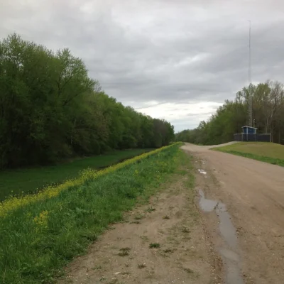
| Historic Route | ~2 miles of park road follow Green’s Ferry Road — the actual route used by Cherokee detachments |
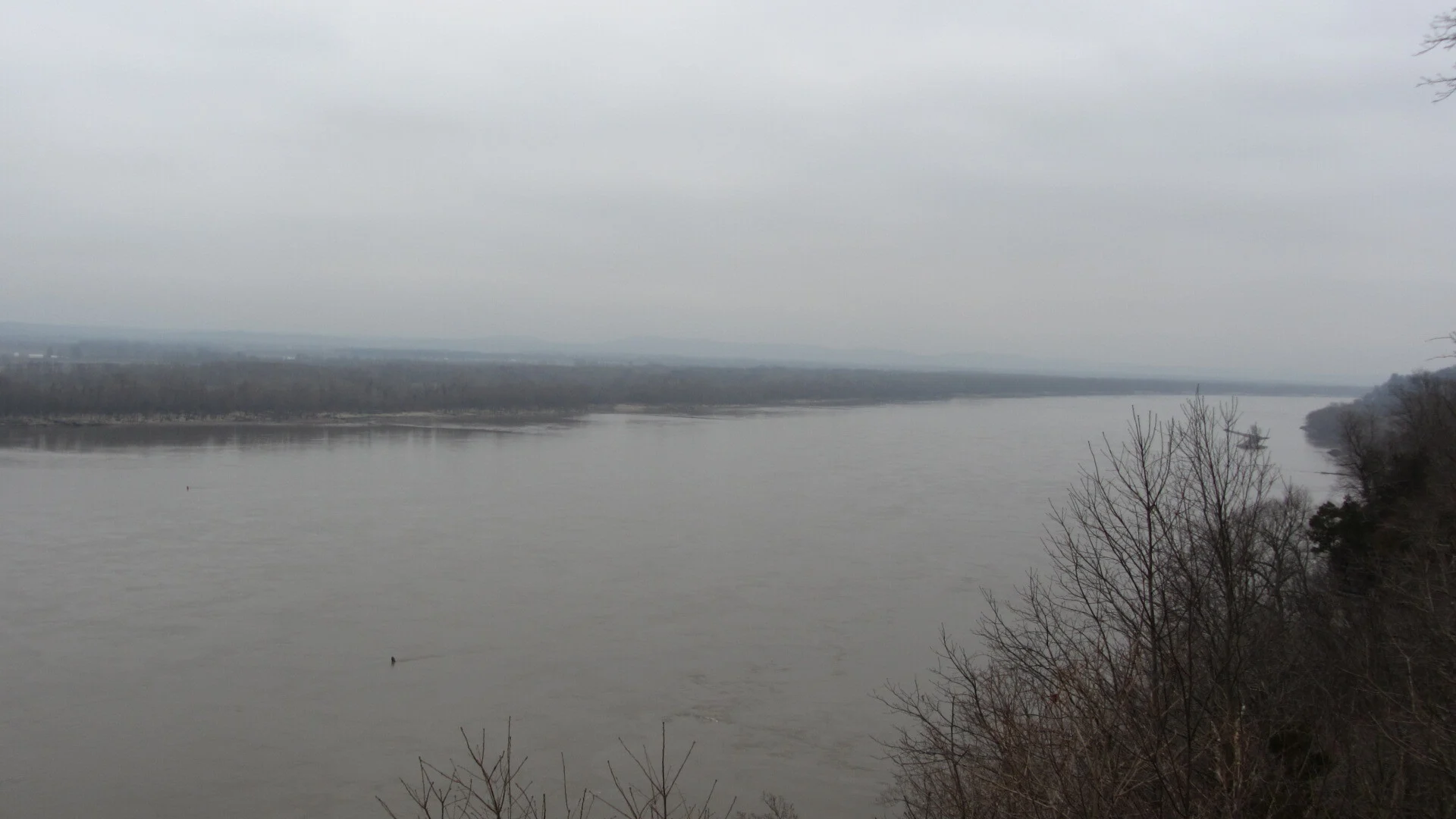
| Mississippi River Overlooks | Bluff-top views of the crossing site — see the river the Cherokee couldn’t cross |
Visitor Center Hours
| Season | Hours |
|---|---|
| Apr–Sep | Mon–Sat 9 AM–5 PM, Sun Noon–5 PM |
| October | Thu–Sat 9 AM–5 PM, Sun Noon–5 PM |
| Nov–Mar | Sat 10 AM–4 PM, Sun Noon–4 PM |
The Trails
Beyond the memorial, Trail of Tears State Park offers 14.5 miles of trails through 3,400 acres of Mississippi River bluffs, hardwood forest, and the Indian Creek Wild Area.
| Trail | Distance | Difficulty | Highlights |
|---|---|---|---|
| Peewah Trail | 10 mi (double loop) | Moderate–Strenuous | Backcountry through Indian Creek Wild Area. Hiking, backpacking, equestrian |
| Sheppard Point Trail | ~1.5 mi loop | Difficult | Rugged terrain with Mississippi River overlooks — most dramatic views |
| Lake Trail | ~2.25 mi loop | Easy | Winds around Lake Boutin, near campground |
| Nature Trail | ~0.5 mi loop | Easy | Near visitor center, interpretive |
Recreation
| Activity | Details |
|---|---|
| Lake Boutin Swimming | Sand beach with restroom/change house |
| Fishing | Lake Boutin (bass, bluegill, catfish) + Mississippi River. MO license required |
| Boating | Concrete ramps on both Lake Boutin (electric motors only) and Mississippi River |
| Equestrian | Horseback riding on Peewah Trail |
Camping
| Campground | Sites | Amenities | Season |
|---|---|---|---|
| Mississippi River Campground | Full hookup + electric sites | Modern restrooms, hot showers, dump station | Year-round (water/showers off Nov–Mar) |
| Lake Boutin Campground | Primitive tent/camper | Restrooms, showers, dump station | May–October |
| Backcountry (Peewah) | Primitive | Pack in/out | Year-round |
Best Time to Visit
| Season | Weather | Best For |
|---|---|---|
| Fall (Sep–Nov) | 45–70°F | Peak foliage on Mississippi bluffs, reflective atmosphere, quiet trails |
| Spring (Apr–May) | 50–75°F | Wildflowers, full visitor center hours, comfortable hiking |
| Summer (Jun–Aug) | 70–90°F | Lake swimming, full camping, long days — humid |
| Winter (Dec–Feb) | 25–42°F | Experience the cold the Cherokee endured. Most emotionally powerful. Limited services |
The Trail of Tears National Historic Trail
This park is one of many certified sites along the 2,200-mile Trail of Tears National Historic Trail, which stretches across nine states from Georgia to Oklahoma. Other key sites include:
| Site | State | Significance |
|---|---|---|
| New Echota | GA | Former Cherokee capital — where the unauthorized Treaty of New Echota was signed |
| Red Clay SP | TN | Last seat of Cherokee government before removal |
| Mantle Rock | KY | 20-day encampment — frozen Ohio River crossing |
| Trail of Tears SP | MO | This park — Mississippi River crossing site |
| Cherokee Heritage Center | OK | Arrival and resettlement — final destination |
💰 Trip Cost Estimator
| Trip Style | Duration | Total Cost | Includes |
|---|---|---|---|
| History Visit | Half day | FREE | Visitor center, memorial, overlooks, historic road |
| Day Hike | Full day | FREE | Sheppard Point overlook + Lake Trail + visitor center |
| Weekend Camping | 2 nights | $30–$60 | Mississippi River campground + trails + swimming + history |
| Backcountry | 1–2 nights | $15–$30 | Peewah Trail 10-mile loop + primitive camping |
| Best Value | Full Day | $0 | History, overlooks, and 14.5 miles of trails — free |
Frequently Asked Questions
What is the Trail of Tears?
The forced removal of ~16,000 Cherokee from their homelands in the southeastern U.S. to Indian Territory (Oklahoma) in 1838–1839. Approximately 4,000 died from disease, exposure, and starvation during the 1,200-mile march. This park preserves one of the Mississippi River crossing sites where Cherokee waited on frozen bluffs.
Who signed the Indian Removal Act?
President Andrew Jackson signed the Indian Removal Act in 1830. It authorized the exchange of Native American lands east of the Mississippi for territory in the west. Although framed as “voluntary,” it was enforced at gunpoint. Five nations were forcibly removed: Cherokee, Chickasaw, Choctaw, Creek, and Seminole.
Who was Nancy Bushyhead?
Nancy Bushyhead Walker Hildebrand was a Cherokee woman who died during the Mississippi crossing in the winter of 1838–39. She is believed to be buried within the park boundaries. The Bushyhead Memorial in the park honors her and all who died here.
What is the Hildebrand Detachment?
The largest Cherokee detachment — 1,766 people — led by Peter Hildebrand. They followed the Northern Route and were trapped at Mantle Rock, Kentucky for 20 days while waiting for the frozen Ohio River to thaw. They eventually crossed and reached this Mississippi site.
Is this a solemn or recreational park?
Both. The park serves as a memorial and educational site, but also offers 3,400 acres of Mississippi River bluffs with 14.5 miles of trails, two campgrounds, a swimming lake, and fishing. Many visitors come for the history and discover the natural beauty of the Mississippi River corridor.
What is the Trail of Tears National Historic Trail?
A 2,200-mile corridor across nine states — from Georgia to Oklahoma — marking the routes of the Cherokee removal. This park is one of many certified sites along the trail. The NPS administers it in partnership with the National Trail of Tears Association.
Can I hike the full 10-mile Peewah Trail?
Yes — the Peewah Trail is a 10-mile double loop through the Indian Creek Wild Area. It’s moderate to strenuous, open to hikers, backpackers, and equestrians. Primitive backcountry camping is available along the route.
When should I visit for the most powerful experience?
Winter. Standing on the bluffs above the frozen Mississippi in December or January — experiencing even a fraction of the cold the Cherokee endured — is the most emotionally powerful way to understand what happened here. Limited services, but the landscape speaks for itself.
Is there camping?
Yes — two campgrounds plus backcountry. Mississippi River Campground (full hookups, year-round), Lake Boutin Campground (primitive, May–Oct), and Peewah Trail backcountry sites.
Is this park free?
Yes — free entry, free visitor center, free trails. Only camping fees apply.
Nearby state parks: If you have extra time, Trails of Tears State Park is a short drive away, and Bollinger Mill State Historic Site is within about an hour’s drive.
😢 Remember the Trail of Tears
Where Cherokee families waited on frozen Mississippi bluffs in the winter of 1838–39, hoping to survive the crossing. 4,000 died. This park exists so we never forget. Free entry, visitor center, 14.5 miles of trails, two campgrounds.
🏛️ Trail of Tears National Historic Trail
2,200 miles across nine states — from Georgia to Oklahoma. Learn the full story of the Cherokee removal and find other certified sites along the trail.
Wildlife & Nature
Trail of Tears SP — 3,415 acres on the Mississippi River — marks the point where 9 of the 13 Cherokee detachments crossed the Mississippi during the forced removal of 1838-39. Thousands of Cherokee died during the march. The park’s river bluffs, forest, and wetlands support bald eagles, wild turkeys, and white-tailed deer.
Nearby Attractions
Cape Girardeau — 10 miles north. Bollinger Mill SHS — 10 miles north. Mississippi River — adjacent. Hawn SP — 20 miles north.

Park Location
Plan your gear for Trail of Tears State Park
From our editorial guides, matched to this park’s activities: