Black Mesa State Park
Black Mesa State Park sits in the far northwestern corner of the Oklahoma Panhandle, where the shortgrass prairie meets the foothills of the Rocky Mountains at the tri-state border of Oklahoma, Colorado, and New Mexico. This remote 349-acre park is the gateway to Oklahoma’s highest point — Black Mesa at 4,973 feet — a dramatic flat-topped mesa capped by 30-million-year-old volcanic lava rock. But elevation is only the beginning: this is a landscape where dinosaur tracks are preserved in Jurassic creek beds, golden eagles soar overhead, and the night sky is so dark it earned official Dark Sky Park designation.
Whether you’re a highpointer ticking off state summits, a stargazer chasing the Milky Way, a paleontology enthusiast, or simply looking for one of Oklahoma’s most unique outdoor experiences, this guide covers everything you need to plan your visit to Black Mesa State Park in 2026.
Quick Facts at a Glance
| Location | Cimarron County, Oklahoma Panhandle |
| Park Size | 349 acres |
| Summit Elevation | 4,973 feet (highest point in Oklahoma) |
| Open | Year-round, dawn to dusk (Nature Preserve) |
| Camping | RV sites (water/electric) + tent sites |
| Key Trails | Black Mesa Summit Trail (8.4 mi RT) + Rock Garden Trail (1.25 mi) |
| Designations | Dark Sky Park, Nature Preserve (TNC) |
| Nearest Town | Kenton (general store) / Boise City (30 mi, full services) |
| Coordinates | 36.9333° N, 102.9981° W |
History & Geology
Born from Fire: 30 Million Years of Geology
Black Mesa’s story begins with volcanic eruptions in southeastern Colorado roughly 30 million years ago. Rivers of basaltic lava flowed eastward across the landscape, hardening into a thick, dark cap of volcanic rock over the softer sedimentary layers below. Over millions of years, wind and water eroded the surrounding terrain, but the resistant basalt cap protected the mesa — creating what geologists call an “inverted valley” where the former valley floor now stands as the highest point in the region.
The exposed rock layers tell an extraordinary story of deep time:
- Jurassic Morrison Formation — home to dinosaur bones and tracks from 150 million years ago
- Cretaceous Dakota Sandstone — ancient shoreline deposits from when a shallow sea covered Oklahoma
- Tertiary Basalt Cap — the black lava rock that gives the mesa its name
This geological diversity makes Black Mesa one of the most scientifically significant sites in Oklahoma and the only place in the state where Triassic and Jurassic rocks are exposed.
Dinosaur Tracks & Fossil Heritage
One of Black Mesa’s most remarkable features is the Jurassic-era dinosaur tracks preserved in a creek bed near the state park. These three-toed footprints were left by theropod dinosaurs — bipedal predators possibly similar to an Allosaurus — walking through mud approximately 150 million years ago. Some tracks even reveal a dinosaur that walked with a limp, offering a poignant glimpse into prehistoric life.
The broader Black Mesa region has produced some of Oklahoma’s most significant paleontological discoveries. Between 1935 and 1942, geologist J. Willis Stovall led excavations funded by the Works Progress Administration (WPA) that unearthed over 18 tons of fossilized dinosaur bones, including:
- Apatosaurus — a massive long-necked sauropod
- Saurophaganax — a giant predator even larger than Allosaurus, among the largest theropods of its era
These fossils are now housed at the Sam Noble Oklahoma Museum of Natural History at the University of Oklahoma in Norman.
Human History: From Clovis Points to Outlaws
The Black Mesa area has been home to humans for millennia. Archaeological evidence — including Folsom and Clovis-style stone points — indicates habitation dating back 25,000 to 4,500 years ago. From 500–800 A.D., Anasazi Indians lived in the region, leaving behind petroglyphs etched into canyon walls that are still visible today.
Later, the area was home to Kiowa, Comanche, Cheyenne, and Arapaho tribes who hunted bison across the high plains. Spanish explorers traversed the region along what became the Cimarron Cutoff of the Santa Fe Trail.
In the late 1800s, the remote canyons and mesas became notorious as outlaw hideouts. Bandits like William Coe and Black Jack Ketchum reportedly built a fort known as “Robbers’ Roost” in the rugged terrain — a perfect place to disappear in a land that even today feels wonderfully removed from civilization.
Wildlife & Ecosystem
Black Mesa sits at a remarkable ecological crossroads where the Rocky Mountain ecosystem meets the Great Plains shortgrass prairie. This convergence creates habitat for species that exist nowhere else in Oklahoma.
The Black Mesa Nature Preserve, managed by The Nature Conservancy, protects 23 rare plant species and 8 rare animal species.
Notable Wildlife
Birds — a highpoint for birders:
- Golden Eagle — nesting on mesa cliffs, Oklahoma’s most majestic raptor
- Scaled Quail — desert-adapted quail found only in the Panhandle region
- Black-billed Magpie — a striking black-and-white corvid, rare in Oklahoma outside the Panhandle
- Pinyon Jay — noisy flocks moving through juniper woodlands
- Mountain Bluebird — electric blue winter visitor
- Lesser Prairie Chicken — endangered grassland grouse, dawn mating dances in spring
- Burrowing Owl — ground-nesting owl living in prairie dog burrows
Mammals:
- Mountain Lion — rare but present in the mesa’s rocky canyons
- Black Bear — occasionally sighted, expanding range from Colorado
- Bighorn Sheep — reintroduced to the region
- Mule Deer — common along the mesa trail, especially at dawn
- Pronghorn Antelope — bounding across the shortgrass prairie
- Black-tailed Prairie Dog — colonial burrowers visible along roadsides
- Bobcat — elusive canyon dweller
Reptiles:
- Texas Horned Lizard — the iconic “horny toad” of the American West
- Various rattlesnake species — watch your step on trails!
Trails & Hiking
Black Mesa Summit Trail — Oklahoma’s Iconic Hike
| Distance | 8.4 miles round trip (4.2 miles one way) |
| Elevation Gain | ~800 feet |
| Difficulty | Moderate to Strenuous |
| Time Required | 4–6 hours |
| Trailhead | Black Mesa Nature Preserve (15 miles north of the state park) |
The summit trail is the pilgrimage for Oklahoma outdoor enthusiasts. The first 3 miles cross mostly level grassland with little shade, followed by a steady 800-foot climb to the mesa top. At the summit, a granite monument marks Oklahoma’s highest point at 4,973 feet — with views stretching into Colorado and New Mexico on clear days.
Essential tips for the summit hike:
- Carry at least 2 liters of water per person — there is no water on the trail
- Start early in the morning, especially in summer — temperatures can exceed 100°F with zero shade
- The Nature Preserve is open dawn to dusk only — no camping on the preserve
- Wear sun protection: hat, sunscreen, sunglasses
- Watch for rattlesnakes, especially on rocky sections near the summit
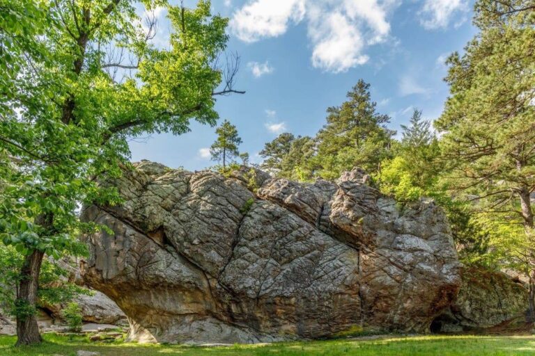
Rock Garden Trail
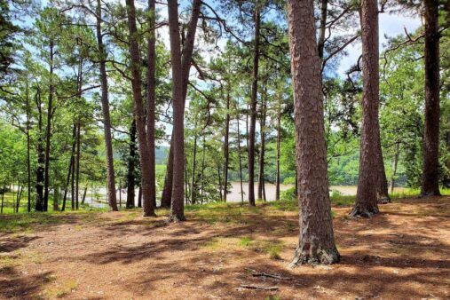
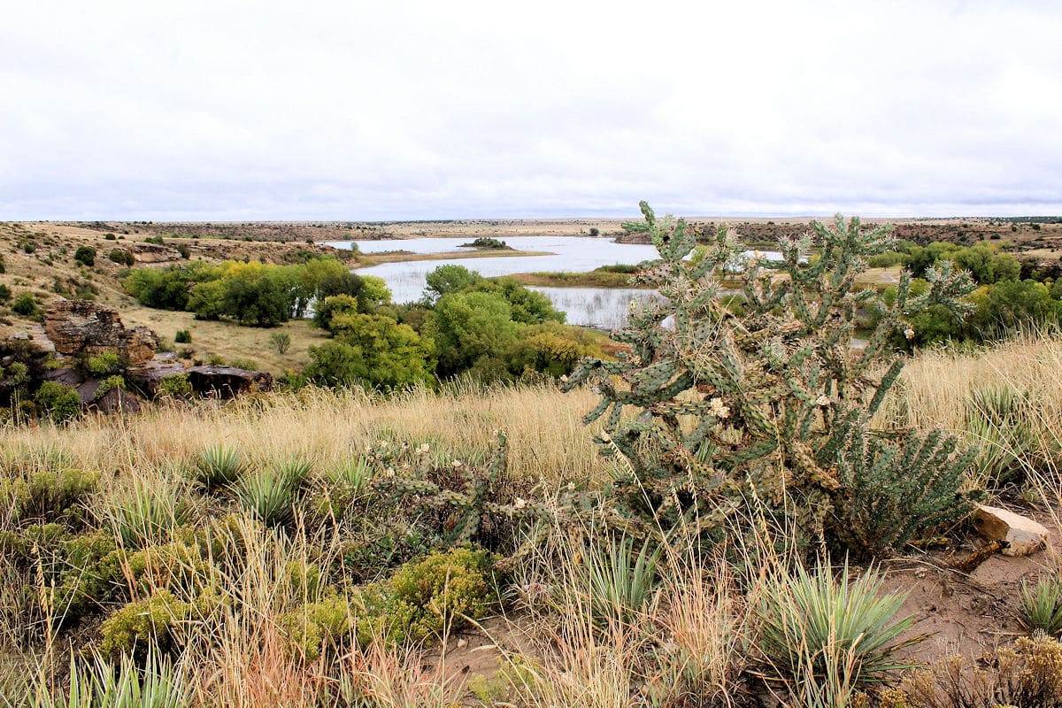
A shorter alternative within the state park itself, the 1.25-mile Rock Garden Trail winds through interesting sandstone formations with views of Lake Carl Etling. Perfect for families or those who want a shorter hike before or after the summit trail.
Dark Sky Stargazing
Black Mesa State Park is an officially designated Dark Sky Park — one of the best stargazing locations in the entire United States. The remote location in the Oklahoma Panhandle, far from any significant light pollution, creates conditions where the Milky Way blazes overhead in stunning detail visible to the naked eye.
What you can see:
- The full arc of the Milky Way from horizon to horizon
- Andromeda Galaxy — visible as a fuzzy smudge to the naked eye
- Meteor showers — Perseids (August) and Geminids (December) are spectacular here
- Planets, star clusters, and nebulae — bring binoculars for breathtaking views
Stargazing tips:
- Time your visit around the new moon for the darkest skies
- Use red-light flashlights to preserve night vision (park rule during quiet hours 11 PM–7 AM)
- Bring a reclining camp chair or blanket for comfortable sky viewing
- Download a stargazing app like Stellarium or SkySafari before you arrive (cell service is spotty)
Camping & Facilities
Campsite Options
The park offers both RV and tent camping around Lake Carl Etling:
- RV Sites: Water and 30-amp electric hookups, mix of concrete pads and gravel. Dump station available near the comfort station.
- Tent Sites: Grassy sites with lake views, some with shade
- Amenities: Picnic table, fire pit, grill, and lantern holder at each site. Restrooms with showers.
Reservations: Book through TravelOK. Three-night minimum may apply during holiday weekends. The park is pet-friendly.
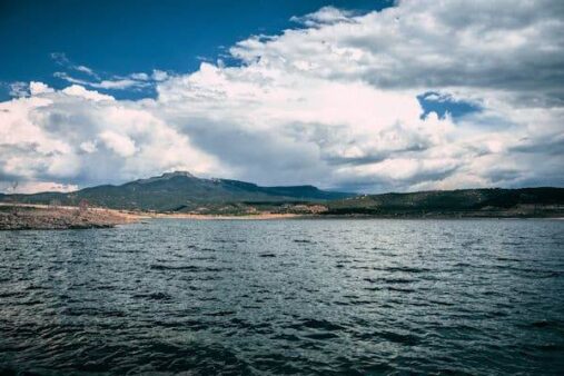
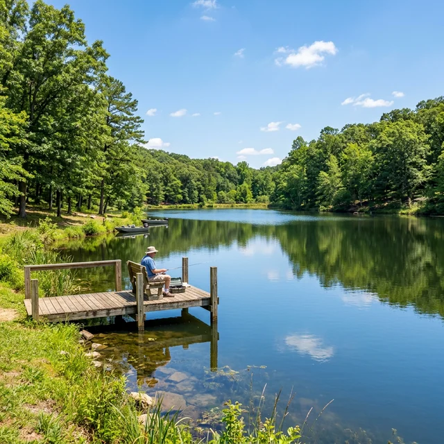
Lake Carl Etling
This small lake within the state park offers:
- Fishing: Catfish, bass, and seasonal trout stocking in cooler months
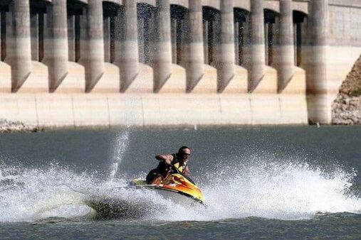
- Boating: Non-motorized and small motorized boats welcome
- No swimming — the lake is designated for fishing and boating only
How to Get There
Let’s be honest: getting to Black Mesa is part of the adventure. This is Oklahoma’s most remote state park, located in the far northwestern corner of the Panhandle.
Driving Directions
- From Oklahoma City (5.5 hours): Take I-40 West to US-270 North to US-64/412 West through the Panhandle to Boise City. From Boise City, take US-325 North to Kenton, then follow signs to the park.
- From Amarillo, TX (3 hours): Take US-54 North to Boise City, then US-325 North to Kenton.
- From Denver, CO (5 hours): Take I-25 South to US-56 East to Boise City, or via Trinidad/Raton on the scenic route.
⚠️ Important logistics:
- Fill your gas tank in Boise City — there are no gas stations between Boise City and the park (30 miles)
- Kenton has a small general store for basic supplies
- Cell service is extremely limited — download maps and trail info before departure
- Roads to the Nature Preserve (summit trailhead) are partly unpaved — a standard vehicle works fine in dry conditions, but check for mud after rain
Insider Tips
- Hike to the summit at sunrise — the early light on the mesa is magical, and you’ll avoid midday heat
- Plan 2 nights minimum — one day for the summit trail, one night for serious stargazing
- Visit in spring (April–May) or fall (September–October) — best temperatures and clearest skies
- Bring everything you need — the nearest full-service town (Boise City) is 30 miles away
- Look for dinosaur tracks — ask park staff for directions to the creek bed tracks near the park
- Combine with a tri-state highpoint tour — New Mexico’s Wheeler Peak and Colorado’s Mount Elbert are both within driving range
- Don’t skip the Rock Garden Trail — it’s short but rewarding, especially at sunset with Lake Carl Etling in view
- Watch for prairie dog towns — black-tailed prairie dogs are entertaining to observe along the road to Kenton
- Summer visitors: start hiking by 6 AM — temperatures regularly exceed 100°F by midday with no shade
- Download offline maps — Google Maps, AllTrails, and Gaia GPS all support offline downloads for the Panhandle area
Best Time to Visit
| Season | Conditions | Best For |
| Spring (Mar–May) | Cool-warm (50–80°F), wildflowers, migrating birds | Summit hike, birding, wildlife |
| Summer (Jun–Aug) | Hot (90–105°F), dry, thunderstorms | Stargazing (long clear nights), early AM hikes |
| Fall (Sep–Nov) | Cool-mild (45–75°F), clear skies | Hiking, stargazing, photography |
| Winter (Dec–Feb) | Cold (20–50°F), possible snow, shortest days | Solitude, trout fishing, dark sky viewing |
Best overall: Late September through October offers ideal hiking temperatures, crystal-clear skies for stargazing, and minimal crowds.
Nearby Attractions
- Kenton, Oklahoma — one of Oklahoma’s smallest towns; the Camp Billy Joe area hosts the annual Okie-Tex Star Party, one of the largest stargazing events in the U.S.
- Cimarron Heritage Center (Boise City) — local history museum covering the Dust Bowl, ranching heritage, and Santa Fe Trail
- Capulin Volcano National Monument (New Mexico, ~90 min) — drive to the rim of a perfectly preserved cinder cone volcano
- Dinosaur Trackway — Jurassic tracks near the park; ask rangers for directions
Frequently Asked Questions
How hard is the Black Mesa summit hike?
The 8.4-mile round trip is rated moderate to strenuous. The first 3 miles are mostly flat, but the final mile involves an 800-foot elevation gain up the mesa. Allow 4–6 hours and carry at least 2 liters of water per person. The biggest challenge is heat and lack of shade in summer.
Is Black Mesa really the highest point in Oklahoma?
Yes! At 4,973 feet (1,516 meters) above sea level, Black Mesa is officially Oklahoma’s highest natural point. A granite monument marks the summit, and you’ll be standing at the tri-state corner where Oklahoma, Colorado, and New Mexico meet nearby.
Can I see the dinosaur tracks?
Yes — Jurassic-era dinosaur tracks are visible in a creek bed near the state park. Ask park staff at the campground for specific directions, as they aren’t formally signed. The tracks are best visible when water levels are low.
Is Black Mesa good for stargazing?
Black Mesa is one of the best stargazing locations in the United States. As an officially designated Dark Sky Park, it offers near-zero light pollution. The Milky Way is clearly visible to the naked eye, and the annual Okie-Tex Star Party draws amateur astronomers from across the country.
Is there cell service at Black Mesa?
Cell service is extremely limited and unreliable throughout the Oklahoma Panhandle. Most carriers have no signal at the park or along the summit trail. Download all maps, trail guides, and stargazing apps before arriving.
Explore More Oklahoma State Parks
Black Mesa State Park is one of Oklahoma’s most unique outdoor destinations. Discover more in our Best State Parks in Oklahoma guide, or use our Park Finder to search by activity, location, or features.