
Allagash Wilderness Waterway
🛶 America’s Premier Wilderness Canoe Trip — A legendary 92-mile paddle through the roadless heart of Northern Maine, passing through pristine lakes, whitewater rapids, and boreal forest where moose outnumber people — the first state-administered river in the National Wild and Scenic River System (1970)
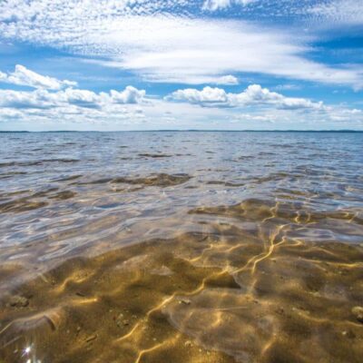
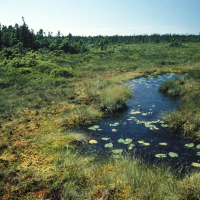
In the vast, roadless interior of Northern Maine — where the nearest paved road is a memory and cell phone signals don’t exist — the Allagash Wilderness Waterway threads 92 miles through a primeval landscape of boreal forest, pristine lakes, whitewater rapids, and bogs that has remained fundamentally unchanged since Henry David Thoreau paddled these waters in the 1850s. This is not a day-trip destination. This is one of the last great wilderness canoe journeys in the eastern United States — a 5-to-10-day expedition through remote country where moose wade chest-deep in morning mist, loons call across mirror-still lakes at dusk, and the only sounds are your paddle breaking water and the wind in the spruce canopy.
Established in 1966 by the Maine Legislature and designated in 1970 as the first state-administered component of the National Wild and Scenic Rivers System, the Allagash is a chain of interconnected lakes, ponds, streams, and river sections stretching from Telos Lake in the south to the confluence with the St. John River near Allagash Village in the north. The waterway passes through country that was once the domain of the Penobscot and Maliseet peoples, then became the center of Maine’s great 19th-century logging drives — an industry whose remnants (old dam sites, log-driving equipment, railroad grades) are woven into the landscape.
The Route — 92 Miles
| Section | Character | Highlights |
|---|---|---|
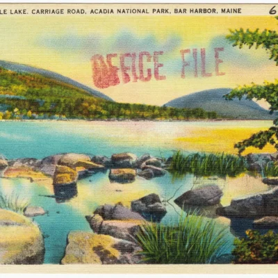
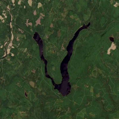
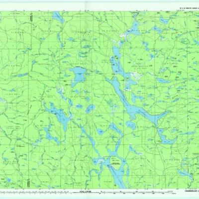
| Telos Lake to Chamberlain Lake | Flatwater lakes | Wide open water, mountain views, historic tramway |
| Chamberlain to Eagle Lake | Lake paddling | Pristine boreal scenery, moose habitat |
| Eagle Lake to Churchill Dam | Lake to river transition | Eagle Lake — largest lake on the waterway |
| Chase Rapids | Class II-III whitewater | 9-mile rapids — portage service available at Churchill Dam |
| Umsaskis to Round Pond | River current | Wilderness camps, wildlife viewing |
| Allagash Falls to St. John River | Final stretch | 40-foot Allagash Falls — must portage |
Trip Planning
| Detail | Information |
|---|---|
| Trip Length | 5–10 days (92 miles) |
| Skill Level | Intermediate — previous canoe/camping experience recommended |
| Season | Mid-May (after ice-out) through October |
| Best Months | June–September |
| Direction | North (downstream) — Telos Lake to Allagash Village |
| Cell Service | NONE — plan accordingly |
Camping — 80+ Wilderness Sites
| Feature | Details |
|---|---|
| Sites | 80+ designated wilderness campsites along 92 miles |
| Availability | First-come, first-served |
| Amenities | Fire ring, picnic table, outhouse at each site |
| Firewood | Maine firewood only (invasive species prevention) |
| Water | Bring filtration — treat all water |
Chase Rapids — The Big Challenge
The 9-mile Chase Rapids section below Churchill Dam is the waterway’s most technical stretch — Class II-III whitewater with ledges, boulders, and standing waves. Options:
- Run it: Experienced whitewater paddlers can navigate with proper skills and equipment
- Portage service: Available at Churchill Dam for a fee — your gear is trucked downstream while you paddle the rapids unloaded
- Full portage: Carry everything around (strenuous but possible)
Wildlife
- Moose: The Allagash corridor has one of the densest moose populations in the Lower 48 — expect daily sightings
- Loons: Nesting pairs on virtually every lake — haunting calls at dusk
- Bald Eagles: Nesting along the waterway
- Black Bears: Present — practice proper food storage (bear hangs)
- Brook Trout: Native — cold, clean water supports wild populations
Access and Permits
| Detail | Information |
|---|---|
| Access | Via private logging roads (North Maine Woods checkpoints) |
| Registration | Required at NMW checkpoint or with first ranger |
| Fees | Access fee + per-night camping fee (ME resident/non-resident rates) |
| Payment | Cash or check at checkpoints |
| Logging Trucks | ALWAYS have right-of-way on access roads |
Essential Gear
- Canoe or kayak suitable for both flatwater and Class II rapids
- Water filter/purifier
- Detailed maps (Maine Atlas — no GPS/cell reliance)
- Bear-resistant food storage
- Rain gear — Maine weather changes fast
- Bug protection — blackflies (May-June) and mosquitoes are legendary
How long does it take to paddle the Allagash?
Most paddlers complete the full 92-mile Allagash Wilderness Waterway in 5 to 10 days, depending on pace, wind conditions, and how much time they spend fishing, photographing wildlife, and exploring side channels. A moderate pace of 10-15 miles per day with rest days is typical. The waterway flows generally north, so you’re paddling downstream on the river sections, but the lake sections require active paddling and can be wind-affected.
Is there cell service on the Allagash?
No. There is zero cell phone service along the entire 92-mile Allagash Wilderness Waterway. This is remote, roadless wilderness in the heart of Northern Maine. Carry detailed paper maps, leave a trip plan with someone at home, and consider a satellite communicator (InReach, SPOT) for emergencies. This is part of the appeal — and the responsibility — of an Allagash trip.
Insider Tips
America’s first wild river: The 92-mile Allagash was the first state-administered waterway in the National Wild and Scenic Rivers System (1970). Pro tip: A full trip takes 7-10 days by canoe through complete wilderness. Moose: You will see moose — densities here are among the highest in North America.
Best Time to Visit
Summer: Prime paddling season (June-September). Fall: Spectacular foliage, few paddlers. Spring: High water — experienced paddlers only. Winter: Accessible only by snowmobile.
Frequently Asked Questions
How long does the Allagash take to paddle?
A full 92-mile Allagash Wilderness Waterway trip typically takes 7-10 days by canoe. The route includes flatwater paddling, lake crossings, and one mandatory portage around Allagash Falls. Designated campsites are spaced along the route. Shuttle services are available. It’s considered one of America’s premier wilderness canoe expeditions.
Keep exploring: The closest neighbors are Round Pond (a short drive away) and Bible Point (within about an hour’s drive).
Camping reservations: Book campsites and cabins for Maine state parks online at campwithme.com.

🐾 Dogs & Pets at Allagash Wilderness Waterway
- Pets allowed? statewide rule
- Pets are allowed at most Maine state parks year-round, including trails, but must be leashed, under the handler's physical control and never left unattended.
- Leash rule statewide rule
- Leash not exceeding 4 feet, under the physical control of the handler
- Beaches & swim areas statewide rule
- Pets are not allowed on state park beaches April 1 through September 30; leashed pets are welcome on beaches October 1 through March 31
- Statewide exceptions statewide rule
- No pets allowed at Sebago Lake State Park campground; park staff may assign pet owners to less congested camping areas
Are dogs allowed at Allagash Wilderness Waterway?
Pets are allowed at most Maine state parks year-round, including trails, but must be leashed, under the handler's physical control and never left unattended. Individual parks can post stricter rules — check signage on arrival.
Rules verified July 2026 via maine.gov. More: Maine state parks guide · Dog rules in all 50 states compared
Park Location
Plan your gear for Allagash Wilderness Waterway
From our editorial guides, matched to this park’s activities:
Top Tours & Activities Near Tadoussac
 from $109
 from $159