
❄️ 135 Miles Through Minnesota’s Iron Range — The North’s Premier Winter Trail — Arrowhead State Trail in St. Louis County, Minnesota, 135-mile multi-use trail from International Falls to Tower, through Kabetogama State Forest and Iron Range country, snowmobiling in winter, ATV and mountain biking in summer, historic iron mining towns, boreal forest, lakes and wetlands, near Voyageurs National Park — St. Louis County, MN
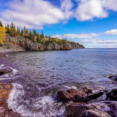
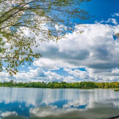
The Arrowhead State Trail runs 135 miles through the coldest, wildest corner of Minnesota — from International Falls on the Canadian border to Tower at the edge of the Boundary Waters. This is the Iron Range, where the earth was ripped open for iron ore and the forest grew back over the scars.
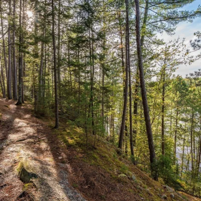
In winter, snowmobiles rule. The trail is groomed and maintained as one of Minnesota’s premier snowmobile corridors. In summer, ATVs and mountain bikers take over — 135 miles of boreal forest, old mining country, and lake-studded wilderness between two of Minnesota’s most remote towns.
Trail Details
| Feature | Details |
|---|---|
| Length | 135 miles one-way — International Falls to Tower. One of the longest state trails in Minnesota |
| Winter Uses | Snowmobiling (primary use). Groomed corridor. Minnesota snowmobile trail sticker required. Connected to the statewide Grant-in-Aid trail system |
| Summer Uses | ATV riding, mountain biking, hiking, and horseback riding. The trail surface varies — gravel, grass, and natural surface |
| Terrain | Rolling boreal forest — spruce, birch, aspen, and pine. Through Kabetogama State Forest. Crosses numerous creeks and wetlands. Gentle grades |
| Towns | International Falls (north terminus), Orr, Cook, Tower (south terminus). Resupply and services in each town |
| Connections | Links to Voyageurs National Park trails, Taconite State Trail, and the statewide snowmobile corridor network |
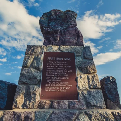
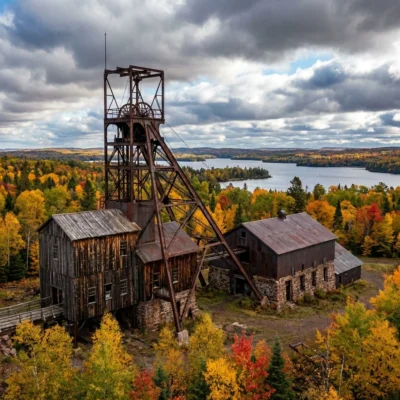
The Iron Range Context
| Era | What Happened |
|---|---|
| 1880s–1960s | The Mesabi and Vermilion Iron Ranges produce the majority of America’s iron ore. Towns like Tower, Ely, and Hibbing boom with mines and immigrants. The Iron Range builds modern America |
| 1960s–1980s | High-grade ore depletes. Mines close. Towns shrink. The landscape — open pit mines, tailings piles, and company towns — begins a slow transformation |
| 1970s–Present | Minnesota converts abandoned rail and mining corridors into recreational trails. The Arrowhead State Trail is built, connecting the Iron Range’s surviving towns through the regrowing boreal forest |
The Arrowhead 135 Ultra
Every January, the Arrowhead 135 — one of the most brutal ultramarathon races in the world — follows this trail from International Falls to Tower. Competitors travel 135 miles on foot, by bike, or on skis in temperatures that regularly drop to -30°F or colder. No support crews. No aid stations. Just the trail, the cold, and 135 miles of Minnesota winter. It’s considered one of the hardest endurance events on Earth.
Best Time to Visit
| Season | Best For |
|---|---|
| Winter (Dec–Mar) | ❄️ Prime snowmobiling. Trail groomed. Deep snow. Northern lights. The trail’s primary season. Dress for -20°F |
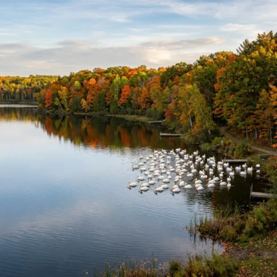
| Fall (Sep–Oct) | 🍂 Birch and aspen turning gold. ATV riding. Grouse hunting. Cool, dry weather. Spectacular boreal fall color |
| Summer (Jun–Aug) | ATV and mountain biking season. Long days. Mosquitoes (bring repellent). Lake swimming nearby. Fishing |
| Spring (Apr–May) | Mud season — trail often closed or very soft. Snowmelt. Not recommended for most uses |
Frequently Asked Questions
Is this primarily a snowmobile trail?
Yes — snowmobiling is the primary winter use and the trail’s main purpose. It’s groomed regularly during the winter season and connects to Minnesota’s extensive statewide snowmobile network. In summer, it converts to ATV and multi-use.
What is the Arrowhead 135?
One of the world’s hardest ultramarathon races. 135 miles from International Falls to Tower in January. On foot, bike, or skis. Temperatures regularly hit -30°F. No support. Competitors carry all their own gear. About half the field drops out each year.
How cold does it get?
International Falls is called “The Icebox of the Nation” for a reason. Winter temperatures regularly reach -20°F to -40°F. If you’re snowmobiling this trail in January, you need serious cold-weather gear. This is not a casual winter destination.
Keep exploring: The closest neighbors are Big Fork State Forest (within about an hour’s drive) and Vermilion Falls Trail (within about an hour’s drive).
❄️ 135 Miles. -30°F. The Icebox of the Nation.
From International Falls to Tower through the Iron Range. Snowmobiles in winter. ATVs in summer. And every January, a race so cold that half the competitors don’t finish.
Wildlife & Nature
Arrowhead State Trail — a 135-mile multi-use trail from International Falls to Tower — traverses the remote boreal forest of northern Minnesota. Moose, gray wolves, and black bears inhabit the corridor. Bald eagles soar above. Common loons call from the lakes. Timber wolves howl at dusk.
Nearby Attractions
International Falls — northern terminus — has Voyageurs NP. Tower — southern terminus — gateway to the BWCAW. Superior National Forest — surrounding.
Park Location
Top Tours & Activities in Minnesota
 from $79
 from $110
 from $195