🚴 30 Miles of Rail-Trail with the Teton Mountains Filling the Horizon — Idaho’s Most Scenic Ride — Ashton to Tetonia Trail in Fremont and Teton Counties, Idaho, 30-mile rail-trail on the old Oregon Short Line Railroad corridor, crushed gravel and paved sections, views of the Grand Teton and Teton Range, gateway to Yellowstone, cycling and walking in summer, groomed snowmobile trail in winter, wildlife including moose and elk — Fremont/Teton Counties, ID
There are rail-trails all over America. Most of them run through suburbs and farmland. This one runs straight toward the Teton Mountains.
The Ashton to Tetonia Trail follows the old Oregon Short Line Railroad bed for 30 miles across the high plateau of eastern Idaho. The Tetons — Grand Teton, Mount Moran, the Cathedral Group — fill the western horizon like a wall of granite and ice. In summer, cyclists and walkers share the trail with moose, elk, and the occasional black bear. In winter, snowmobilers cruise the groomed corridor through a landscape buried in snow.
Trail Details
| Feature | Details |
|---|---|
| Length | 30 miles (one way) from Ashton to Tetonia. 60 miles round trip. Out-and-back or arrange a shuttle |
| Surface | Crushed gravel and paved sections. Suitable for road bikes on paved sections, hybrid/mountain bikes recommended for gravel |
| Elevation | Approximately 5,100–6,200 feet. Gentle railroad grade — never steep. The old railroad was built for trains, so the grade is always manageable |
| The Views | The Grand Teton and the entire Teton Range visible for most of the trail. The mountains grow larger as you ride west toward Tetonia |
| Wildlife | Moose, elk, deer, black bear, sandhill cranes, hawks, and eagles. The trail crosses agricultural land and wild habitat |
Summer vs. Winter
| Season | Use |
|---|---|
| Summer (Jun–Sep) | Cycling, walking, running, horseback riding. The trail is at its best when the Tetons are visible against blue sky. Wildflowers in June–July |
| Winter (Dec–Mar) | Groomed snowmobile trail. Cross-country skiing and fat biking on adjacent areas. The corridor becomes a winter highway through deep snow |
| Spring (Apr–May) | Muddy transition. Snow melting. Trail may be soft. Wildlife active — calving season for elk. Not ideal for cycling |
| Fall (Sep–Oct) | Golden aspens and cottonwoods. Cool riding weather. Elk bugling. The Tetons with early snow. Best photography season |
Best Time to Visit
| Season | Best For |
|---|---|
| Summer (Jul–Aug) | ☀️ Peak cycling. Tetons in full glory. Wildflowers. Long days. Clear skies. Combine with Yellowstone (30 min from Ashton) |
| Fall (Sep–Oct) | 🍂 Golden aspens. Cool air. Elk bugling. Early snow on the Tetons. Best light for photography |
| Winter (Dec–Mar) | Groomed snowmobile corridor. Deep snow. Teton views through winter atmosphere |
| Spring (Apr–May) | Muddy. Trail drying out. Wildlife active but trail conditions challenging |
Frequently Asked Questions
Is the trail paved the whole way?
No — sections are paved, but much of the trail is crushed gravel. Road bikes work on the paved sections. For the full 30-mile ride, a hybrid or mountain bike is recommended. The gravel is generally well-maintained but can be soft in spots.
Can I combine this with Yellowstone?
Absolutely — Ashton is a gateway town to Yellowstone. The west entrance to Yellowstone National Park is about 30 minutes from Ashton via Mesa Falls Scenic Byway. Many visitors combine the rail-trail ride with a Yellowstone trip.
Are there moose on the trail?
Yes — moose sightings are common, especially in the northern sections. Give moose a wide berth (at least 25 yards). They are unpredictable and can be aggressive, especially cows with calves. If a moose blocks the trail, wait for it to move.
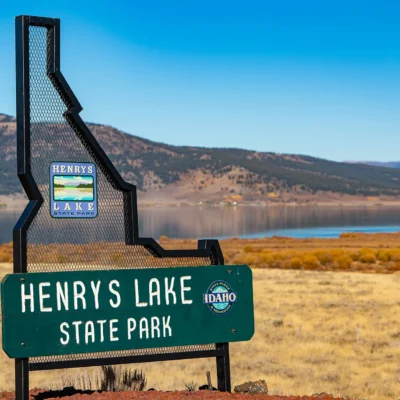
More parks nearby: Harriman State Park is within about an hour’s drive, while Henry Lake State Park lies elsewhere in the state.
🚴 30 Miles Toward the Tetons — On Rails That Once Carried Trains
The old Oregon Short Line is gone. The rails are gone. But the railroad bed remains — 30 miles of gentle grade running straight toward the most dramatic mountain range in America.