D. L. Bliss State Park
🏆 Lake Tahoe’s Most Beautiful State Park — Crystal Water & the Rubicon Trail — Updated for 2026 with full reopening info (May 21, 2026), camping reservations, trail conditions, and beach access
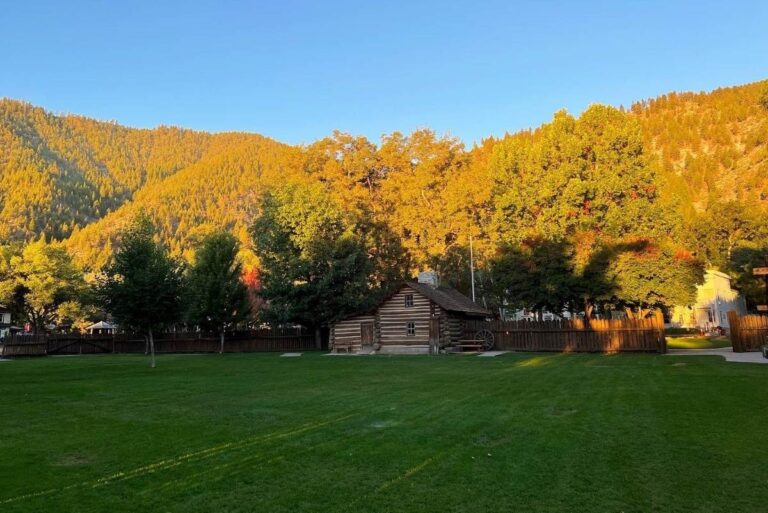
The water is so clear you can see the bottom at 30 feet. Not blue — not green — but a shade of turquoise that defies vocabulary, with granite boulders resting on white sand like they were placed there by a set designer. You’re standing on the shore of Calawee Cove at D.L. Bliss State Park, on the western shore of Lake Tahoe, and the view in front of you is the reason photographers fly across the world to come here. Behind you, 1,830 acres of pristine Sierra Nevada forest rise from the shore, threaded with trails that include one of the most celebrated hikes in California: the Rubicon Trail.
Named for Tahoe-area timber baron Duane LeRoy Bliss — who donated the land to the state — D.L. Bliss State Park sits on Lake Tahoe’s coveted west shore, seamlessly connected to Emerald Bay State Park to the south. The park offers sandy beaches with impossibly clear water, the scenic 5-mile Rubicon Trail along the lakeside cliffs, the historic Rubicon Point Lighthouse (once the highest lighthouse in the U.S. by elevation), the family-friendly Balancing Rock Trail, and 165+ campsites in one of the most sought-after campgrounds in the California State Parks system.
📢 2026 Reopening
D.L. Bliss was closed for all of summer 2025 for waterline replacement. The park fully reopens for camping and day use on May 21, 2026. Camping reservations are available 6 months in advance through ReserveCalifornia.com — these will sell out fast!
What Makes D.L. Bliss Legendary
Crystal-Clear Beaches
Calawee Cove and Lester Beach — some of the clearest water in North America, on sandy shores.
Rubicon Trail
5-mile lakeside trail to Emerald Bay — one of California’s most stunning hikes. Cliff-edge Tahoe views the entire way.
Historic Lighthouse
The Rubicon Point Lighthouse — once the highest lighthouse in the US by elevation, at Lake Tahoe’s deepest point.
Balancing Rock
A 20-foot granite boulder balanced on a narrow pedestal — a short, family-friendly trail.
Beaches & Swimming
Calawee Cove
The park’s crown jewel — a small, protected cove with extraordinarily clear turquoise water and a sandy beach flanked by granite. This is where the Rubicon Trail begins, and it’s the most photographed spot in the park. Limited parking fills early on summer days — arrive before 9 AM on weekends.
Lester Beach
A longer, wider sandy beach ideal for families, sunbathing, and launching kayaks/paddleboards. More space than Calawee Cove. No motorized vessel launching. Kayak and paddleboard access is excellent from this beach.
The Rubicon Trail
The Rubicon Trail is the park’s signature hike — a 5-mile one-way lakeside trail from D.L. Bliss south to Emerald Bay State Park. The trail follows the cliff edge above Lake Tahoe, weaving through pine and fir forest with continuous views of the turquoise lake, the Sierra Nevada crest, and eventually the iconic Emerald Bay with Vikingsholm castle visible below.
| Detail | Info |
|---|---|
| 📏 Distance | 5 miles one-way (10 mi round-trip, or shuttle back) |
| 📐 Difficulty | Moderate — some elevation changes, rocky sections, cliff edges |
| 🕐 Time | 2.5-4 hours one-way (plan half-day for round trip) |
| 🏔️ Highlights | Cliff-top Tahoe views, Vikingsholm overlook, Emerald Bay, Rubicon Point |
| 🐕 Dogs | Not permitted on the Rubicon Trail |
Other Trails
| Trail | Distance | Difficulty | Highlights |
|---|---|---|---|
| 🗼 Lighthouse Trail | 1.5 mi round-trip | Easy | To the historic Rubicon Point Lighthouse with stunning overlooks. Connects to Rubicon Trail |
| 🪨 Balancing Rock Trail | 0.5 mi round-trip | Easy | Short walk to a 20-foot granite boulder balanced on a pedestal. Great for kids |
Photography Guide
📸 Best Photo Spots & Tips
• Calawee Cove (morning): THE Tahoe shot — crystal-clear turquoise water with granite boulders visible beneath. Morning light illuminates the underwater rocks. Use a polarizer to manage glare and enhance the underwater clarity.
• Rubicon Trail (any time): Multiple cliff-edge viewpoints along the trail offer dramatic Tahoe panoramas. The Emerald Bay overlook is the climax. Late afternoon gives warm light on the east shore mountains.
• Lighthouse Point (sunset): The deep blue of Lake Tahoe’s deepest point with sunset colors reflecting. The lighthouse adds a compelling subject.
• Fall (late September): Aspens along the highway and forest edges turn gold against the evergreen backdrop and blue Tahoe water — a color combination unique to the Sierra.
When to Visit: Seasonal Guide
| Season | Months | Weather | Best For |
|---|---|---|---|
| ☀️ Summer | Jun–Aug | 75-85°F | 🏆 Swimming, camping, all trails open, kayaking. Arrives early — lots fill by 9-10 AM on weekends |
| 🍂 Fall | Sep–Oct | 55-70°F | Fewer crowds, fall color, comfortable hiking. Water still swimmable in September |
| 🌸 Spring | May | 50-65°F | Park reopening. Wildflowers, snowmelt, quiet trails. Water too cold for swimming |
| ❄️ Winter | Nov–Apr | 25-40°F | Park closed for camping. Backcountry access by foot from Hwy 89 |
Camping
| Detail | Info |
|---|---|
| 🏕️ Sites | 165-168 campsites. No hookups |
| 🚐 RV | Some sites fit trailers ≤15 ft or motorhomes ≤18 ft |
| 🚿 Amenities | Tables, food lockers (bear country!), restrooms, hot showers |
| ⛵ Boat-In Sites | Primitive boat-access-only sites available |
| 📅 Reservations | ReserveCalifornia.com — 6 months in advance. Book the MOMENT they open |
Budget Calculator
| Expense | Day Trip | Camping Weekend | Notes |
|---|---|---|---|
| Day-Use Parking | $10 | Included w/camping | Lot fills early — arrive before 9 AM summer weekends |
| Camping (2 nights) | — | $70-90 | $35-45/night. No hookups |
| Kayak Rental (nearby) | $40-80 | $40-80 | Multiple outfitters in Tahoe area |
| Total (2 adults) | $50-$90 | $110-$170 | One of Tahoe’s best-value experiences |
Getting There
- 📍 Address: D.L. Bliss State Park, Hwy 89, South Lake Tahoe, CA 96150
- 📍 From South Lake Tahoe: 17 miles north via Hwy 89 (30 min)
- 📍 From Sacramento: 110 miles east via US-50 (2 hours)
- 📍 From Reno: 60 miles southwest via Mt. Rose Hwy and Hwy 28/89 (1.5 hours)
- 📍 From San Francisco: 200 miles east via I-80 and Hwy 89 (3.5 hours)
Frequently Asked Questions
What is the Rubicon Trail?
A 5-mile lakeside trail from D.L. Bliss to Emerald Bay State Park, following cliff edges above Lake Tahoe with continuous turquoise water views. It’s rated moderate and is one of the most scenic hikes in California. Allow 2.5-4 hours one-way.
Is the water really that clear?
Yes — Lake Tahoe’s water clarity is legendary. At Calawee Cove, you can see the bottom at 30+ feet. The granite boulders and white sand beneath the turquoise water create an almost tropical appearance — at 6,225 feet elevation in the Sierra Nevada.
When does the park reopen in 2026?
May 21, 2026 — the park was fully closed for summer 2025 for waterline replacement. It’s now reopening for both camping and day use. Camping reservations are available 6 months ahead via ReserveCalifornia.
How do I get a campsite?
Book via ReserveCalifornia.com, 6 months in advance. D.L. Bliss is one of the most sought-after campgrounds in California — set a reminder and book the instant reservations open. Summer weekends sell out in minutes.
Can I bring my dog?
Dogs are allowed in the campground on a leash but are NOT permitted on trails or beaches. This includes the Rubicon Trail.
What’s the Balancing Rock?
A 20-foot granite boulder balanced on a narrow pedestal — a short, easy, 0.5-mile trail. It’s a great quick stop, especially with kids.
Is there a connection to Emerald Bay?
Yes — D.L. Bliss and Emerald Bay State Park are connected via the Rubicon Trail. You can hike from D.L. Bliss to Emerald Bay (5 miles one-way), then continue to Vikingsholm and Upper Eagle Point.
Can I kayak or paddleboard?
Yes — launching kayaks and paddleboards from Lester Beach is popular. No motorized vessel launching. Rentals are available from nearby Tahoe outfitters.
What’s the lighthouse?
The Rubicon Point Lighthouse — once the highest-elevation lighthouse in the United States (Lake Tahoe sits at 6,225 feet). It’s reached via the 1.5-mile Lighthouse Trail with stunning lake overlooks.
Is swimming safe?
Yes — both Calawee Cove and Lester Beach are popular swimming spots. Lake Tahoe water is cold (rarely above 68°F even in summer) but refreshing. No lifeguards — swim at your own risk.
💎 Tahoe’s Crystal Jewel
Stand on the shore of Calawee Cove and look down at water so clear you can count the granite boulders 30 feet below. Then walk the cliff-edge Rubicon Trail — five miles of the most breathtaking lakeside scenery in the Sierra Nevada, ending at the fairy-tale cove of Emerald Bay. D.L. Bliss is where Lake Tahoe shows you its finest face: crystal water, ancient forest, a lighthouse at the continent’s highest elevation, and sunsets that turn the Sierra pink. Freshly reopened in 2026 after a full renovation, this is the Tahoe experience at its absolute peak. Get your campsite the second reservations open — everyone else will be trying too.
📍 Location: Hwy 89, West Shore Lake Tahoe, CA 96150
📞 Phone: (530) 525-7277