🌤 Weather at Guy W. Talbot State Park by season
| Spring | Summer | Fall | Winter |
|---|---|---|---|
| 35–66 °F | 47–80 °F | 37–74 °F | 33–48 °F |
Each range runs from the coldest monthly average low to the warmest monthly average high in that season (1991-2020 climate normals), measured at Skamania Fish Hatchery, 6 mi away, elevation 435 ft. Conditions at the park can differ from the station, especially where elevation differs — check a forecast before you go.

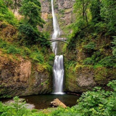
🏆 Guy W. Talbot State Park — Home to the iconic Latourell Falls — a 249-foot plunge waterfall over columnar basalt draped in chartreuse lichen — in the Columbia River Gorge, with a moderate 2.4-mile loop trail to both upper and lower falls.
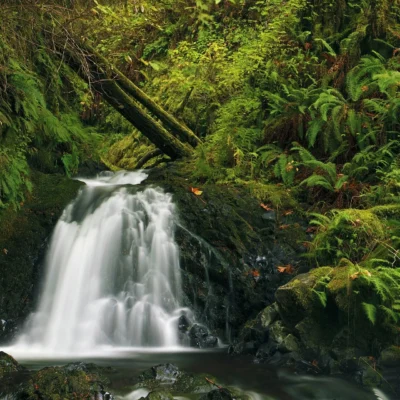
Guy W. Talbot State Park is the gateway to one of Oregon’s most photographed waterfalls — Latourell Falls. Located along the Historic Columbia River Highway, the park protects a section of Henderson Creek as it plunges 249 feet over columnar basalt cliffs famously covered in brilliant chartreuse-green lichen. The loop trail also leads to the lesser-known Upper Latourell Falls, a two-tiered 134-foot cascade.
Visitor Information
| Detail | Information |
|---|---|
| Location | Columbia River Gorge, OR (Historic Highway) |
| Admission | Free — no fees or passes required |
| Lower Falls | 249 ft plunge over columnar basalt |
| Upper Falls | 134 ft, two-tiered cascade |
| Loop Trail | ~2.4 mi — moderate (520–750 ft gain) |
| Dogs | Allowed on-leash |
The Falls
| Falls | Height | Character |
|---|---|---|
| Lower Latourell | 249 ft | Dramatic plunge — chartreuse lichen on basalt |
| Upper Latourell | 134 ft | Two-tiered cascade — quieter, less crowded |
Hiking
| Option | Distance | Difficulty | What You See |
|---|---|---|---|
| Lower Falls Viewpoint | ~100 yards | Easy | Main 249-ft plunge |
| Full Loop | ~2.4 mi | Moderate | Both upper and lower falls, bridges, forest |
Activities
| Activity | Details |
|---|---|
| Waterfall Viewing | 249-ft Latourell Falls — visible from parking area |
| Hiking | Loop trail through moss-covered forest |
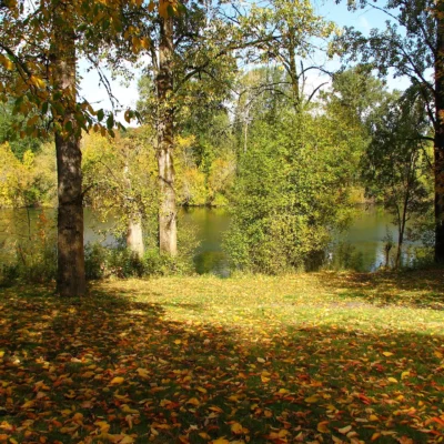
| Picnicking | Grassy picnic area with tables |
| Photography | World-class waterfall + columnar basalt shots |
Frequently Asked Questions
How tall is Latourell Falls?
Lower Latourell Falls is 249 feet — a dramatic plunge over columnar basalt cliffs covered in distinctive chartreuse-green lichen. Upper Latourell Falls is 134 feet with a two-tiered cascade. Both are accessible via the 2.4-mile loop trail.
Do I need to hike to see the waterfall?
No — Lower Latourell Falls is visible from the parking area and reachable via an easy 100-yard walk. However, the full 2.4-mile loop trail to both upper and lower falls is a wonderful moderate hike through moss-draped forest.
Is there a fee to visit?
No — Guy W. Talbot State Park and Latourell Falls are free to visit with no fees or parking passes required. The park includes a picnic area with tables and a grassy hill for relaxation.
Keep exploring: The closest neighbors are Rooster Rock State Park (a short drive away) and Vinzenz Lausmann Memorial State Natural Area (a short drive away).

🐾 Dogs & Pets at Guy W. Talbot State Park
- Pets allowed? statewide rule
- Pets are welcome in Oregon state parks and on most ocean beaches but must be leashed except in designated off-leash areas.
- Leash rule statewide rule
- Leash no longer than 6 feet required in developed park areas
- Beaches & swim areas statewide rule
- Pets are allowed on most ocean beaches under direct control; western snowy plover nesting areas restrict pets March 15 - Sept. 15; leash required on the beach at some parks (e.g. Cape Lookout)
- Cabins & lodging statewide rule
- Designated pet-friendly yurts and cabins at many parks (South Beach has 14 pet-friendly yurts, Tugman 8); maximum two dogs and/or cats; $10 per night pet fee
- Pet fees statewide rule
- $10 per night for pet-friendly yurts/cabins; no pet fee for day use or campsites
- Statewide exceptions statewide rule
- Pets prohibited at Dabney SRA, the Trail of Ten Falls at Silver Falls, and Shore Acres; off-leash areas at Stub Stewart, Willamette Mission, Elijah Bristow, Cottonwood Canyon and LaPine
Are dogs allowed at Guy W. Talbot State Park?
Pets are welcome in Oregon state parks and on most ocean beaches but must be leashed except in designated off-leash areas. Individual parks can post stricter rules — check signage on arrival.
Rules verified July 2026 via stateparks.oregon.gov. More: Oregon state parks guide · Dog rules in all 50 states compared
Park Location
Plan your gear for Guy W. Talbot State Park
From our editorial guides, matched to this park’s activities: