

🌤 Weather at Little Presque Isle by season
| Spring | Summer | Fall | Winter |
|---|---|---|---|
| 21–59 °F | 50–75 °F | 28–67 °F | 12–30 °F |
Each range runs from the coldest monthly average low to the warmest monthly average high in that season (1991-2020 climate normals), measured at Marquette, 7 mi away, elevation 665 ft. Conditions at the park can differ from the station, especially where elevation differs — check a forecast before you go.

Little Presque Isle is a stretch of Lake Superior shoreline 7 miles northwest of Marquette, Michigan, managed by the Michigan Department of Natural Resources (DNR) as part of the Escanaba River State Forest. It is not a state park, even though it is often searched as “Little Presque Isle State Park”. The DNR lists it among its natural areas: 430 acres of natural area plus an 8.6-acre island proposed as a wilderness area.
It is also not Presque Isle Park. That is a City of Marquette park on a 323-acre headland at the northern tip of the city. Little Presque Isle lies 7 miles northwest of Marquette on both sides of Marquette County Road 550 and also takes in Harlow Lake.
Little Presque Isle at a glance
| Managed by | Michigan DNR, Escanaba River State Forest |
| Location | On the shore of Lake Superior, 7 miles northwest of Marquette, along both sides of Marquette County Road 550 |
| Size | Natural area 430 acres; wilderness-area island 8.6 acres |
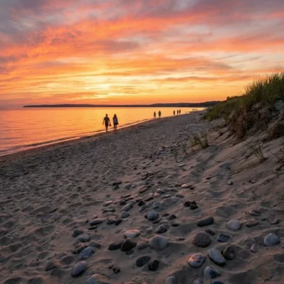
| Shoreline | Four miles of sandy Lake Superior shoreline, plus Harlow Lake |
| Overnight | Six walk-in rustic cabins; no camping |
| Swimming | No designated swim beach |
| Phone (DNR) | 906-339-4461; cabin reservations 800-447-2757 |
| Vehicle pass | The DNR page carries the note “Recreation Passport required” |
Rock, dunes and forest
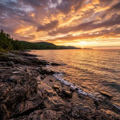
The DNR notes that Little Presque Isle is often called “the crown jewel of Lake Superior” for its sand beaches, rugged shoreline cliffs, heavily timbered forests and scenic views. The natural area lies north and south of Little Presque Point, around the mouth of Harlow Creek.
More than a mile of the shore is bedrock and cliff, including sandstone cliffs nearly 60 feet high toward the base of Sugar Loaf Mountain. Part of the bedrock is granitic, the least common bedrock type along the Great Lakes shoreline, with less than eight miles in total. According to the DNR, this is one of three places in Michigan where you can see these 2.3-billion-year-old formations.
Behind the shore, low sandy beach ridges formed as post-glacial lake levels dropped. The ridges now carry hemlock, red pine, white pine, cedar and balsam fir; the wet swales between them are forested or open wetland. The island was reportedly connected to the mainland before the 1930s and served as a landing place for early explorers and native inhabitants, the DNR notes.
Things to do
- Hiking and biking: Little Presque Isle connects to the Little Presque Isle Multi-Use Pathway, the North Country Trail and the Iron Bell Trail. In 2017 the DNR announced the designation of 17.2 miles of mountain bike trail for the non-winter season and 10.7 miles of winter fat-tire route, open December 1 to May 1. Bikes belong on designated trails, forest roads or the old railroad grade only.
- Paddling: Harlow Lake and Lake Superior are both popular for kayaking, canoeing and stand-up paddleboarding.
- Fishing: Fishing is popular on Harlow Lake. There is a fishing pier near the cabins and a gravel ramp for small fishing boats. On Harlow Lake, only electric motors are allowed.
- Winter: You can cross-country ski on the area trails, but they are not groomed.
- Hunting: The land is open to hunting, but not within 450 feet of an occupied dwelling.
- Picnics and pets: Picnic tables stand along the lakeshore. Pets are allowed along the whole shoreline on a 6-foot leash.
The DNR also asks you not to target shoot, not to drive motor vehicles or snowmobiles off forest roads, to keep fires in fire rings, grills or self-contained cooking units, and to avoid excessive noise. Alcohol is not allowed east of County Road 550, on the Lake Superior side.
The hike-in cabins
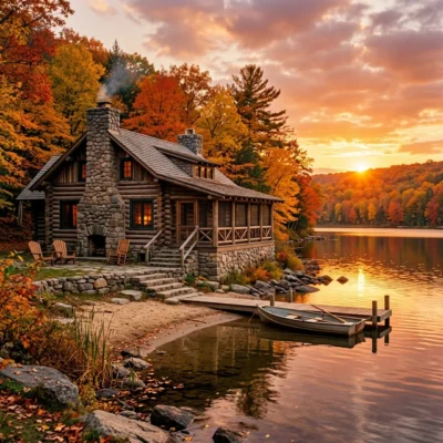
There are six rustic one-room cabins in the birch and pine woods. From the trailhead you walk up to 0.75 miles on a mostly flat, marked trail. Each cabin sleeps up to eight, with two double bunk beds, a wood stove, a table with benches and a fire ring. There is no running water and no electricity, but a hand pump for water is available and a vault toilet is nearby.
Bring your own light, cooking gear, dishes and bedding or sleeping bags. Firewood for indoor use is provided from September 15 to June 1 (DNR, as of June 2026). Cabins 4 and 5 take up to two pets (cats and dogs), for an extra pet fee. Book by calling 800-447-2757 or online through the DNR reservation system, which the DNR page for Little Presque Isle links.
Frequently asked questions
Is Little Presque Isle a state park?
No. It is part of the Escanaba River State Forest, and the DNR lists it as a natural area.
Can you camp at Little Presque Isle?
Not in a tent or RV. The DNR states that there is no camping; you can stay overnight only in the six walk-in cabins.
Is there a swimming beach?
There are sand beaches along the shore, but the DNR notes that there is no designated swim beach.
Is Little Presque Isle the same as Presque Isle Park?
No. Presque Isle Park is a City of Marquette park at the northern tip of the city. Little Presque Isle lies 7 miles northwest of Marquette and is managed by the Michigan DNR.
Explore More Parks in Michigan
Discover more parks in our Best State Parks in Michigan guide, or use our Park Finder to search by activity, location, or features.
Why this page changed
Editor’s note: An earlier version of this page called Little Presque Isle a public state park established in 1921 and filled the rest with general Michigan text about state park beaches, campgrounds, Lake Michigan water temperatures and Recreation Passport prices. The Michigan DNR describes a natural area in the Escanaba River State Forest on Lake Superior, with cabins, no camping and no designated swim beach. We replaced the text in October 2026. The DNR pages were read in archived copies from April and June 2026, because the live site blocked our request.
More parks nearby: Van Riper State Park is within about an hour’s drive, while Laughing Whitefish Falls Scenic Site lies within about an hour’s drive.

Park Map
Plan your gear for Little Presque Isle
From our editorial guides, matched to this park’s activities:
Top Tours & Activities Near Upper Peninsula
 from $89
 from $95
 from $99