Lost Valley State Park

🏆 Arkansas’s Hidden Ozark Canyon — Caves, natural bridges, a disappearing creek, and one of the most magical short hikes in the Ozarks
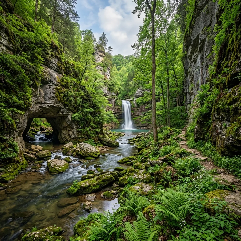
Tucked into a narrow valley in the Buffalo National River region of northwestern Arkansas, Lost Valley is a geological wonderland compressed into a single mile of hiking trail. The valley — formed by Clark Creek cutting through Mississippian-age limestone over millions of years — features a natural bridge, a towering bluff shelter, and the park’s crown jewel: Eden Falls Cave, where the creek disappears underground and a waterfall plunges into a cavern you can walk into.
Lost Valley (also called Lost Valley Trail or Lost Valley Recreation Area) is managed as part of the Buffalo National River by the National Park Service, though it functions like a state park in terms of visitor experience. It’s one of the most popular day hikes in Arkansas, and for good reason — nowhere else in the Ozarks can you experience so much geological drama in such a short distance.
Table of Contents
The Trail
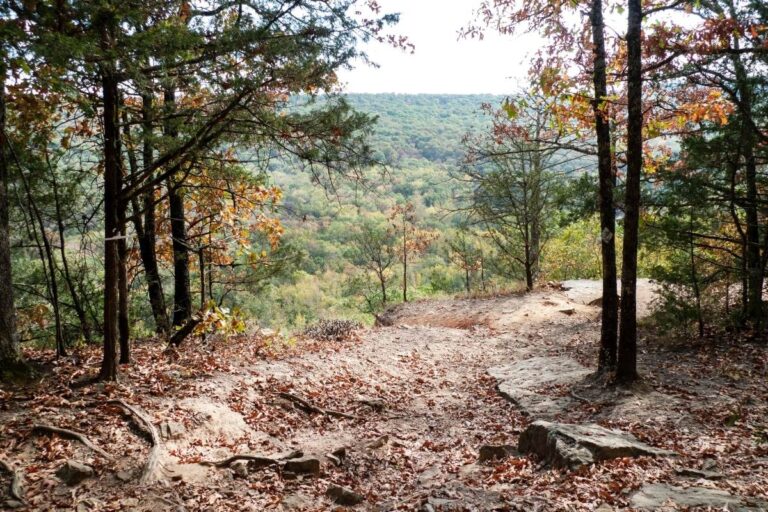
The Lost Valley Trail is a 2.2-mile round trip that follows Clark Creek upstream through a progressively narrowing valley. The trail is well-maintained, mostly flat, and suitable for families with children — though the final section to the cave involves some scrambling over rocks.
| Section | Distance | Highlights |
|---|---|---|
| Trailhead to Cob Cave | 0.5 mi | Creek crossings, forest walk, massive bluff shelter |
| Cob Cave to Natural Bridge | 0.3 mi | Limestone natural bridge spanning the creek |
| Natural Bridge to Eden Falls Cave | 0.3 mi | Narrowing canyon, cave entrance, waterfall |
Eden Falls Cave
Eden Falls Cave is the climax of the Lost Valley hike. Where Clark Creek reaches the head of the valley, it encounters a massive limestone bluff and — rather than flowing over it — the creek disappears underground into the cave system. A 35-foot waterfall cascades into the cave entrance during wet periods, creating a spectacular scene.
🦇 Cave Exploration Tips
• Accessible area: You can walk into the main chamber (no permits needed)
• Bring: A flashlight or headlamp — the cave is dark beyond the entrance
• Floor: Wet, slippery rock — wear shoes with good traction
• Temperature: Cool (~58°F inside) regardless of outside weather
• Bats: Cave is home to several bat species — do not disturb them
• White-Nose Syndrome: Follow posted decontamination guidelines to protect bats
Natural Bridge
About halfway up the valley, a limestone natural bridge spans Clark Creek — formed when the creek carved through a thin wall of rock, leaving an arch overhead. The bridge is visible from the trail and adds to the sense that you’re walking through a geological textbook.
Geology
Lost Valley is carved into Mississippian-age limestone (approximately 340 million years old). The limestone is riddled with karst features — caves, sinkholes, springs, and underground streams created by slightly acidic water dissolving the calcium carbonate rock over millions of years. The Ozarks contain one of the densest concentrations of karst features in North America.
Wildlife
| Category | Species |
|---|---|
| 🦌 Mammals | White-tailed deer, black bear, elk (reintroduced nearby), bobcat |
| 🦇 Cave Life | Indiana bat, tri-colored bat, cave salamanders |
| 🐦 Birds | Pileated woodpecker, Louisiana waterthrush, Acadian flycatcher |
| 🌿 Plants | Ferns, mosses, liverworts in the moist cave-adjacent environment |
Visitor Information
| Detail | Information |
|---|---|
| 📍 Location | Lost Valley Road, Ponca, AR 72670 (Buffalo National River) |
| 📞 Phone | (870) 439-2502 (Buffalo National River HQ) |
| 🕐 Hours | Year-round, dawn to dusk |
| 💰 Entry Fee | Free |
| 🅿️ Parking | Small lot at trailhead (fills early on weekends) |
| 📡 Cell Service | Very limited — remote Ozarks valley |
Best Time to Visit
| Season | Weather | Best For |
|---|---|---|
| 🌸 Spring (Mar–May) | 55–75°F | Best waterfall flow, wildflowers, green canopy |
| ☀️ Summer (Jun–Aug) | 80–90°F | Creek wading, cave cooling, family visits |
| 🍂 Fall (Sep–Nov) | 50–70°F | Fall colors, comfortable hiking, fewer crowds |
| ❄️ Winter (Dec–Feb) | 30–50°F | Ice formations in cave, solitude, elk viewing nearby |
Frequently Asked Questions
How long is the Lost Valley Trail?
2.2 miles round trip. The trail follows Clark Creek upstream through a narrowing canyon to Eden Falls Cave. Allow 1.5–2 hours for a leisurely hike with time to explore the cave.
Can you go inside Eden Falls Cave?
Yes — the main chamber is open to visitors without a permit. Bring a flashlight. The cave is dark, wet, and cool (~58°F). Do not disturb bats, and follow posted decontamination guidelines for White-Nose Syndrome prevention.
Is there a waterfall?
Yes — Eden Falls is a 35-foot waterfall that cascades into the cave entrance during wet periods. Best flow is in spring and after heavy rain. During dry summer months, the falls may be reduced to a trickle.
Is Lost Valley kid-friendly?
Yes — the trail is mostly flat and suitable for children. The final section to the cave involves some rock scrambling. Bring a flashlight for kids to explore the cave entrance safely.
Is there camping?
Not at the Lost Valley trailhead. Nearby options include Lost Valley Campground (NPS), Steel Creek Campground, and Boxley Valley — all within the Buffalo National River corridor. Lost Valley Canoe Campground is nearby and first-come, first-served.
Is this a state park or national park?
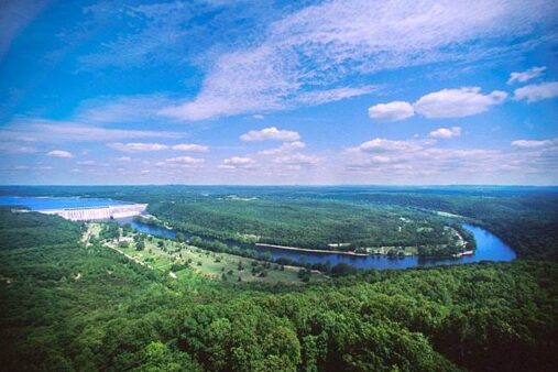
Lost Valley is managed by the National Park Service as part of the Buffalo National River. It functions like a day-use area with free admission. The Buffalo National River was the first national river in the United States (1972).
Can you see elk near Lost Valley?
Yes — elk were reintroduced to the Buffalo River area in 2015 and the population is growing. The Boxley Valley (5 miles from Lost Valley) is one of the best elk-viewing locations in the Ozarks, especially at dawn and dusk in fall and winter.
🦇 Explore Lost Valley
Hike through a narrowing Ozark canyon, cross a natural bridge, and walk into a cave where a waterfall plunges underground — all in one unforgettable 2.2-mile trail.
🗺️ Buffalo National River